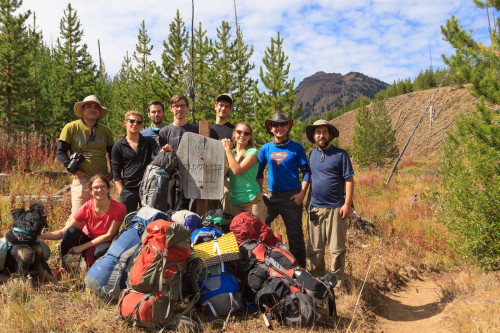
After a long summer with not much exploring, the pace has changed and I’ve had a fairly busy two weeks. The series begins with the return of the Annual Wallowas Weekend. In the six Septembers that I have lived here, I’ve led a backpacking trip to the Eagle Cap Wilderness four of those years, with this year being the fourth. Each time I bring someone new, and each time we explore new trails. This is the first year that we didn’t spend a night at Mirror Lake and the first year that Tyler didn’t join us. Instead, Wesley returns for a second year to help me lead six newcomers to these mountains. Amanda, John, Ian, and Mason are new graduate students to the Biology Department. Josef is a post-doc and his girlfriend Laura also joined us on this hike. Thibault has been to the Wallowas before, but not on one of my Wallowas Weekends. So there we were, a fellowship of nine misfits charged with the task of ensuring that the ring of pow…
Oh right. Sometimes when I’m hiking in the Wallowas, it’s hard not to imagine that we’re crossing the Misty Mountains, and the weather this year just added to that effect.
This year we hiked 11 miles over two days. If that doesn’t sound impressive, it’s because it’s not. I wanted a relatively easy and painless hike to make up for the past few backpacking trips that turned out to be way more strenuous than anticipated. And the weather kinda cut our trip down from three days of hiking to two. In fact, we almost didn’t go to the Wallowas at all. After our hike in the Seven Devils, fire season hit hard and heavy. It was one of the worst seasons on record, which is mostly why the summer has been devoid of travel and exploration. For over a month, the visibility and air quality in Moscow was abysmal, and those conditions extended beyond our region. Much of the smoke had come from some large fires along the northern California coast. But depending on which way the wind was blowing, the smoke could have also come from fires in north-central Washington, or a large fire very nearby to the east in Kamiah. In addition to the smoke, small fires dotted the forest up and down the state, leaving very few places safe for hiking. Once place that was spared the wrath of fires, near and far, was the Sawtooths. So a week before our planned outing, we met and decided that the Sawtooths would be a better alternative for this year’s adventure.
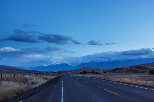
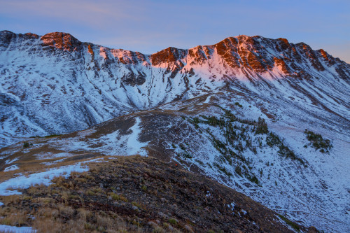
Then the weather changed. Cold fronts blew in and dampened the area. Winds blew the smoke out, temperatures dropped, and the air cleared. For the whole week, the smoke did not return, but we still had our hearts set on the Sawtooths. Despite the longer drive, we picked out a nice 3-day loop to explore some mountains that none of us had been to before. While the smoke conditions had improved, the overall weather had not. Instead of hot and dry conditions, we had cold rain in the forecast. In fact, it was to rain from Friday evening through Saturday night, and in the mountains, that rain was to fall as snow. I’ve camped in the cold and hiked in the rain, but we had no interest in camping and hiking in the cold and the wet. With Saturday’s high predicted to remain under 50º, we decided to cut our hiking down to Sunday and Monday of the holiday weekend. Both days were to be cooler than average, but at least the sun would be out. And since we didn’t feel it was worth driving seven hours to hike two days, we moved the hike back to the Wallowas where we would enjoy an evening of beer and food at Terminal Gravity the night before and camp on their lawn. And so we arrived in Enterprise on Saturday night just in time to see what the passing storm had done to the mountains.
Josef and Laura were to meet us in Enterprise Sunday morning. While we waited, we decided on a trail – a decision between hiking Two Pan to Mirror Lake as I did my first year, or hike into Dollar Lake at the base of Aneroid Mountain from the Tenderfoot trailhead. We eventually settled upon the second choice under the guise that none of us had been on that trail before and therefore we were all experiencing something new together. Josef and Laura were running late, so we agreed to meet them at our campsite at Dollar Lake instead.
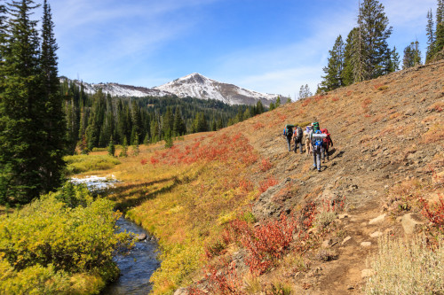
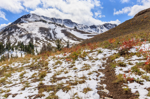
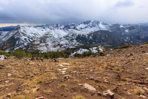
The Tenderfoot trailhead lies at the end of a short rough road along the eastern side of the mountains. At 6500 feet, it’s one of the higher access points to the wilderness area. It’s a 5.5 mile hike to Dollar Lake with a continuous, but gentle climb of 2000 feet. This even grade makes for a nice easy hike. From the beginning, the terrain is gorgeous, but very different from the central valleys that we are used to. For one, the valley is not as deep as the Wallowa, Hurricane, or Lostine valleys, and the mountains are concocted of layers of basalt and shale rather than granite. This difference in underlying terrain meant the floral community was different as well. We passed by some sagebrush communities and aspen groves in the first section of the hike.

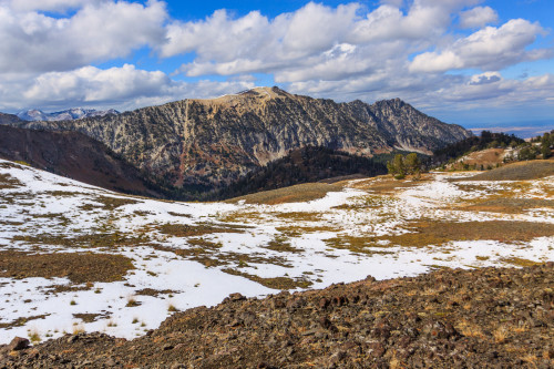
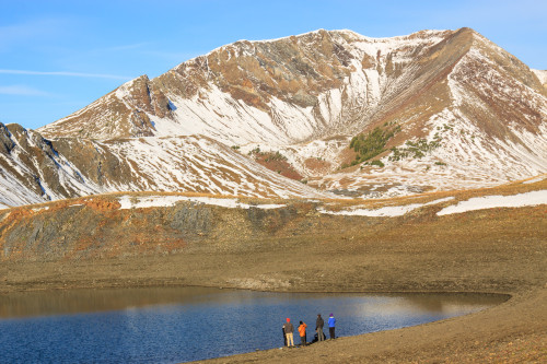
We began on the Tenderfoot Wagon Road for about two miles before turning off onto the Bonny Lakes Trail which passes by the Bonny Lakes and ascends the pass to Dollar Lake. We had a leisurely hike in the sun, stopping frequently to rest and enjoy the view. We ate lunch at one of the Bonny Lakes and then trudged onward, our destination less than a mile ahead. As we neared the top, it became clear that not much snow had fallen, and that it just looked worse from below. Much of the snow had melted through the course of the day. When we made it to Dollar Lake, the sun was still shining down upon us, and we took some time to set up camp and rest a bit.
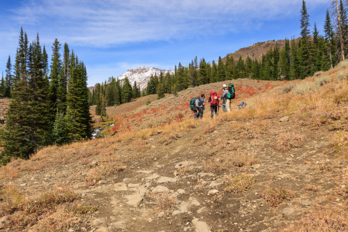
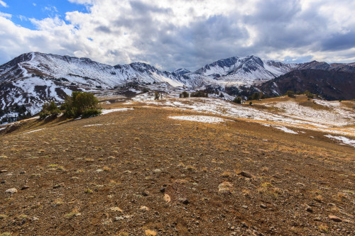
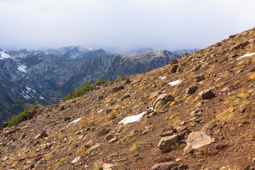
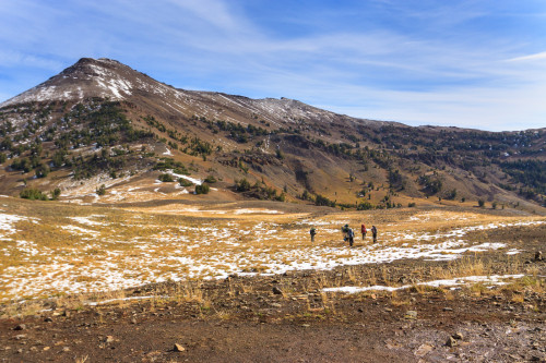
With such a short hike, we had planned to drop our packs and head for the summit of Aneroid Mountain another thousand feet up. Aneroid is not a hard mountain to climb. It’s practically a walk up the slope to the summit with a short rock scramble at the top. Of course, with all mountains, the route looks easier from below than when you’re actually on it. The slope was steep – not as steep as the scree fields at the Seven Devils – but it was still a workout to ascend. When we started our ascent, the sun was still shining. There were clouds amassing over the peaks to the south, but otherwise still looked like a clear day.
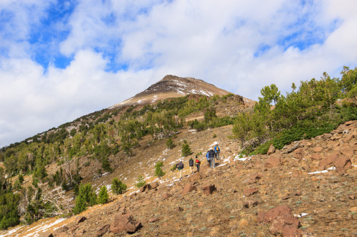
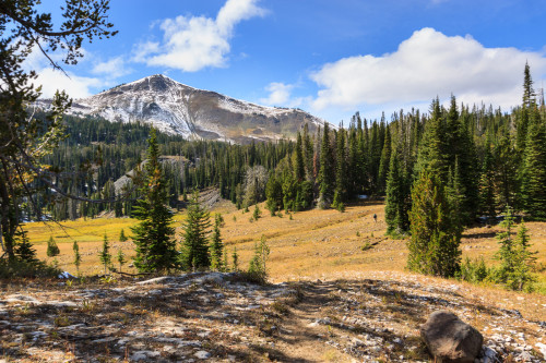
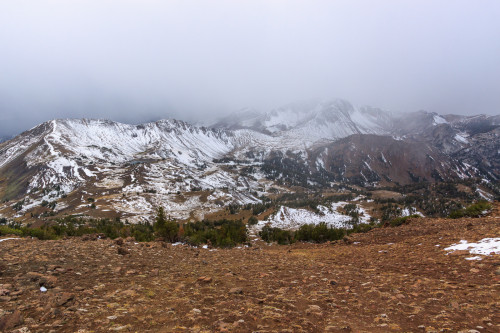
During the first half of the climb, we had an open forest of short trees for support. When we rose above the treeline, we were already above 9000 feet. But by that time, I had noticed the mountains to the west disappearing one by one into a storm. I called out to those ahead of me to reconsider our plan. Finally, when all but the adjacent ridge had disappeared, they decided to turn back. With no way of gauging just how bad this storm could be, I was not going to take any chances with bad weather on a mountain summit. We descended with snowflakes falling upon us.
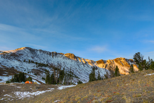
Back at camp, we waited out the storm. Josef and Laura had arrived and were exploring while waiting for our return. It turned out that the storm was small and passed over us rather quickly. But some other hikers coming off the mountain reported some strong gusts that reaffirmed our decision to turn back. Unable to build a fire, we huddled in a small clump of trees for warmth and snacked on cheese and wine before breaking out the stoves for a dinner of mac and cheese. The winds kicked back up and the snow returned as we performed the bare minimum of clean-up and retreated to the shelter of our tents for the evening. The wind gusts blew strong through the night, but our tents held firm. We had the fly tied down to rocks because the ground was too hard to put stakes in. A few times I found myself pulling out the vestibule only to have it blow back into the tent. Luckily the storm was mostly wind and little precipitation. Still, it was cold and I was the most uncomfortable I’ve ever been on a backpacking trip. I think I need a new sleeping bag as mine doesn’t seem to stay as warm as it used to. Also, I might want a new sleeping pad for better cushion.

When I backpack, I tend to bring extra weight. I carry a big DSLR with two lenses and a tripod. This allows me to capture the spectacular images that accompany these posts. The tripod is specifically for sunset and sunrise at the lakes. Without it, I’d get get blurry images due to the long exposures needed at such low light. With the storm Sunday night, I was afraid I had lugged the tripod up for nothing. I awoke Monday morning to calmness. I fixed the vestibule and then unzipped the tent to gauge the conditions: clear blue sky. With that, I got out and prepared to shoot the coming sunrise. Not only that, but others were awake too, and when I summoned them, they came. It was the first time I had company for a sunrise.


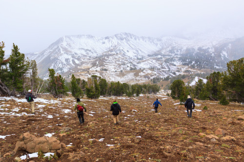
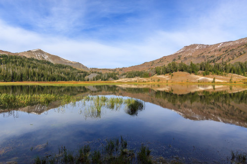
The morning was cold, but worth the effort. Most everyone decided to climb the ridge behind camp to watch the sun rise. I stayed down below mostly because I didn’t feel like exerting the energy to get up there. The light quickly descended and warmed us up as we made breakfast and coffee and packed up our gear. We left at 9:30 and headed back the way we came. Monday was sunnier and warmer than Sunday. The remaining snow was quickly melting away as we hiked down into the valley. I stopped for a couple of reflection shots on the glassy mirror-like surface of Bonny Lake. Otherwise, we made good time, getting back to the car shortly after noon. We finished the weekend with our traditional beer and burger at Terminal Gravity.

[map style=”width: auto; height:400px; margin:20px 0px 20px 0px; border: 1px solid black;” gpx=”http://www.mineral2.com/wp-content/uploads/Wallowas 2015.GPX”]