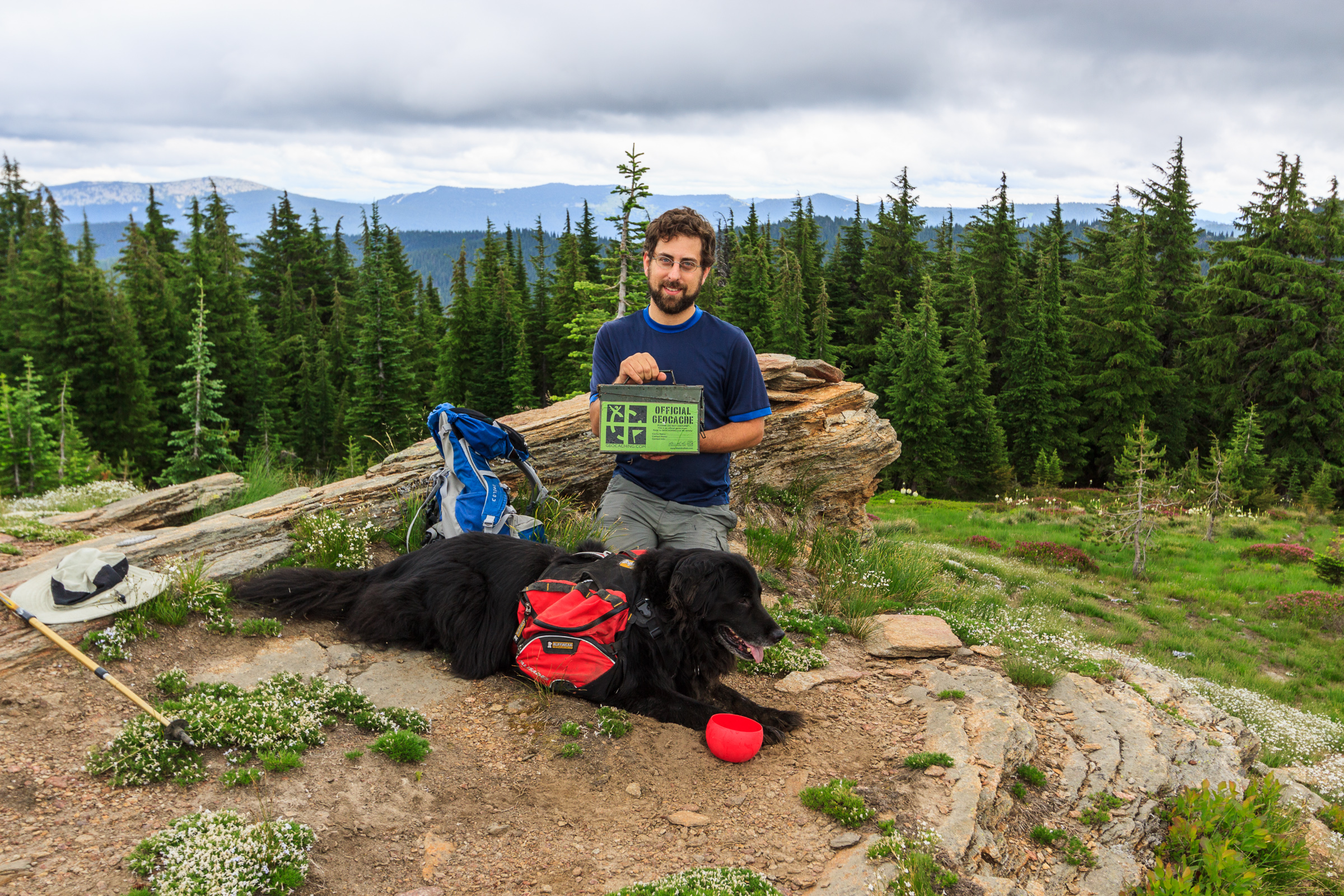
I don’t get out hiking or geocaching often these days. With geocaching, it makes sense. I’ve found nearly all of the geocaches in a close distance to home and town, forcing me to travel farther distances just to make a find. But when it comes to hiking, I have less of an excuse. I don’t live in Moscow. I live near Deary, 25 miles east, which puts me 25 miles closer to the mountains. It puts me at the edge of the mountains, the foothills if you prefer. There are hiking trails all around. The closest is spud hill, from which there is an amazing view from the top. Then there’s the Potlatch River loop with great opportunities for flora and fauna sightings. There are more trails yet back in the Vassar Meadows area and up near Palouse Divide. I don’t have to go very far to get a nature fix. And yet, what keeps me from going out is more of a psychological barrier than a physical or economic one.
Barrier 1: I’ve hiked the trails before. The excuse is rubbish. But deep down, I desire to explore something new. And so I end up passing an opportunity just to get out because I’m hiking the same trails I’ve hiked in the past.
Barrier 2: The trails aren’t that good, or are shared with motorsports. Again, not a good excuse. Yes, many of the trails in the national forest are designed with single track or ATV use in mind. But that doesn’t mean they are terrible for hiking. The White Pine trail is fantastic, even though many people ride it rather than walk it. And yes, many trails don’t lead to a scenic destination – there are no mountain views, no lakes, no waterfalls. But I also enjoy a walk in the woods for its own merit. Yet sometimes these destinations are what bring me to a trail and I forget to just amble for the sake of ambling.
But once in a while, I’ll discover one of these trails through geocaching, and I’ll be quite impressed. Such is the case with the Sand Mountain trail. This trail traverses the ridge of Sand and Mica Mountains, and recently, someone put a geocache along the Sypah Creek. I knew the this trail existed, but ignored it this whole time because it had never shown up on the list of great hikes in the area. But someone recently placed a geocache along this trail, and so I had to find it.
I only hiked a small portion of the trail as it meanders along Sypah Creek for about two and a quarter miles. This section traverses through a lush cedar forest with a carpet of ferns and mosses near the creek. It’s very reminiscent of an inland rainforest, or at least a wet forest. The trail was in good condition, and the climb was gradual – it was 1000 feet up to where I stopped, but I didn’t think we had climbed that high until I looked at the GPS. The trail crosses the creek on a bridge, where we stopped, and then continues up to the ridge and toward the summit of Sand Mountain. I’m not sure if there’s much of a view up there, and I’ll have to return to explore it. But the section I hiked was a beautiful walk in the woods, with a first to find on a geocache as icing on the cake. Watch the video of my hike:
In case you weren’t aware, Geocaching is one of my hobbies turned obsession that fills my life with joy. Geocaching is a game in which people hide containers and post the coordinates on the web for others to enter into a GPS and go out and find. The game began in May of 2000. On May 2, the US Government declassified signals from the GPS satellites making them available to the public. This increased the accuracy of commercial GPS receivers from around 100m down to 10m. The next day, Dave Ulmer hid a stash in the woods outside of Portland, OR and posted the coordinates to a listserv. A few days later, it was found, and it didn’t take long for this idea to catch on. Within that first year, several hundred geocaches had been hidden world-wide with their coordinates posted for others to find. The largest repository of geocaches is hosted at geocaching.com. It’s free to play, and today, the game doesn’t even require that you have a GPS receiver since smartphones are able to communicate with the GPS satellites.
I was formally introduced to the game in 2007 when I created a lesson on GPS orienteering for a summer camp at the Max McGraw Wildlife Foundation. The activities culminated with me hiding containers around the property and having the kids wander around with some GPS receivers to find them. But it wasn’t until 2011, when I was able to buy my own GPS receiver, that I really started geocaching. Since then, I’ve accumulated 1663 finds, mostly around the inland northwest. It’s the perfect hobby, as it pairs well with my love of hiking, travelling. I’ve explored so many unique places that I would have overlooked if geocaching hadn’t brought me there.
A map of my geocache finds in the northwest.
Geocaching is a spatial game that accumulates a lot of data. Geocaching.com aggregates personal statistics for each user – you can see mine here. However, as fun as it is to analyze my own caching behavior, I’m also interested in larger questions about the game. For example, what places are more active in the game than others? While the game isn’t about the numbers, the numbers can tell us a lot about the game. Defining how a place is geocaching-friendly isn’t easy, and there are a lot of variables to consider. Unfortunately, I don’t have access (at least not easily) to the full data hosted at geocaching.com. So I have chosen the number of geocaches as a proxy for how active an area might be. And my definition of area is going to be at the level of state, because I can easily grab the total number of active geocache hides in each state from state regional searches on the website.
What states or regions of the country are most active in geocaching? Here is my data. The number of caches was collected manually using regional searches on the evening of June 12. The state area and population size were gathered from Wikipedia, and population is a 2018 estimate. Perhaps we’ll do this again when the 2020 census numbers get released.
State
sq mi
Geocaches
Cache Density
Population*
Population Density
Alabama
52420.07
14826
0.28
4887871
93.24
Alaska
665384.04
7591
0.01
737438
1.11
Arizona
113990.30
39083
0.34
7171646
62.91
Arkansas
53178.55
12014
0.23
3013825
56.67
California
163696.32
132475
0.81
39557045
241.65
Colorado
104093.67
26075
0.25
5695564
54.72
Connecticut
5543.41
8008
1.44
3572665
644.49
Delaware
2488.72
2890
1.16
967171
388.62
District Of Columbia
68.34
248
3.63
702455
10278.83
Florida
65757.70
41034
0.62
21299325
323.91
Georgia
59425.15
14254
0.24
10519475
177.02
Hawaii
10931.72
2442
0.22
1420491
129.94
Idaho
83568.95
18557
0.22
1754208
20.99
Illinois
57913.55
30905
0.53
12741080
220.00
Indiana
36419.55
21611
0.59
6691878
183.74
Iowa
56272.81
21753
0.39
3156145
56.09
Kansas
82278.36
11676
0.14
2911505
35.39
Kentucky
40407.80
16920
0.42
4468402
110.58
Louisiana
52378.13
5663
0.11
4659978
88.97
Maine
35379.74
9388
0.27
1338404
37.83
Maryland
12405.93
12116
0.98
6042718
487.08
Massachusetts
10554.39
16871
1.60
6902149
653.96
Michigan
96713.51
34800
0.36
9995915
103.36
Minnesota
86935.83
29094
0.33
5611179
64.54
Mississippi
48431.78
7136
0.15
2986530
61.66
Missouri
69706.99
13898
0.20
6126452
87.89
Montana
147039.71
8059
0.05
1062305
7.22
Nebraska
77347.81
9602
0.12
1929268
24.94
Nevada
110571.82
22599
0.20
3034392
27.44
New Hampshire
9349.16
11436
1.22
1356458
145.09
New Jersey
8722.58
14081
1.61
8908520
1021.32
New Mexico
121590.30
17722
0.15
2095428
17.23
New York
54554.98
32343
0.59
19542209
358.21
North Carolina
53819.16
22174
0.41
10383620
192.94
North Dakota
70698.32
3020
0.04
760077
10.75
Ohio
44825.58
28631
0.64
11689442
260.78
Oklahoma
69898.87
14428
0.21
3943079
56.41
Oregon
98378.54
31066
0.32
4190713
42.60
Pennsylvania
46054.35
39347
0.85
12807060
278.09
Rhode Island
1544.89
3613
2.34
1057315
684.40
South Carolina
32020.49
5701
0.18
5084127
158.78
South Dakota
77115.68
9354
0.12
882235
11.44
Tennessee
42144.25
18136
0.43
6770010
160.64
Texas
268596.46
67902
0.25
28701845
106.86
Utah
84896.88
29369
0.35
3161105
37.23
Vermont
9616.36
4988
0.52
626299
65.13
Virginia
42774.93
15162
0.35
8517685
199.13
Washington
71297.95
29634
0.42
7535591
105.69
West Virginia
24230.04
5708
0.24
1805832
74.53
Wisconsin
65496.38
29874
0.46
5813568
88.76
Wyoming
97813.01
5772
0.06
577737
5.91
There is tremendous variation in the number of geocaches hidden in each state. Excluding the District of Columbia, with only 248 active hides, the state with the fewest geocaches is Hawaii at 2442, and on the mainland, it’s Delaware at only 2890. Meanwhile, California leads the way with the most geocaches hidden at 138,475. That’s quite a spread, though the median number of hides per state is 14,826.
The first question that comes to mind is whether the number of hides is limited by the size of the state. After all, California is a huge state. Delaware and Hawaii are pretty small. And given that people who run Geocaching.com have set a rule that geocaches must not be placed within 0.1 mile of another geocache, there is a limit to the number of caches that can be hidden in a finite area.
The number of geocaches in each state as a function of the size of the state. Both axes are log transformed.
There is certainly a trend here. Larger states, on average, have more geocaches. Though the larger the area, the larger the variation in hide count. Without that D.C. outlier, we still have a positive slope, though it’s less steep. To gage just how much area influences the number of caches, we should look at the density, or the number of caches placed per square mile. We are looking for no effect of area on density of hides.
Cache Density as a function of state size. Axes are log transformed.
What we see is a negative association between the density of caches placed and the area of the state. So even though smaller states have fewer caches, overall, they are more densely packed with geocaches. In some ways, this makes sense. The large states of the western half of the country have a lot of open land, public and private. Some of this land, including national parks and designated wilderness areas, is off limits to physical geocaches. Some of this area is just difficult to get to. And some of it is private property – big ranches and farms where the public doesn’t have permission to trespass. When you look at states like Colorado, Montana, California, you’ll notice that geocaches are densely packed into cities with fewer caches in rural areas. Though still, in popular hiking areas, there are still a lot of geocaches hidden along the trails.
But small states have rural places, too. So wouldn’t this affect the density of geocaches? Well, yes. But maybe these small states have less rural land than the larger states. The rural land is broken up into smaller parcels with more public right of ways with which to put a geocache. Or maybe it’s not about the land at all, but about the people living there. Perhaps more people just means more geocachers, which means more geocaches being hidden in a given area.
Cache Density as a function of Population Density by state. Both axes are log transformed.
Here we see our tightest trend. The geocache density appears to be explained rather well by population density. This would also explain why urban areas see so many more caches than rural areas, even within a state. There are still differences among urban centers as to the density of caches, and that may also be explained by population size. Or maybe geocaching is more popular in cities with a higher aptitude for an outdoor lifestyle. Denver, Salt Lake City and Seattle are all some of the densest cities when it comes to geocaches. Perhaps I will find a way to aggregate such data for analysis. But at the state level, the number of people per square mile nicely explains the number caches hidden per square mile.
Let’s look at some maps.
Number of Caches hidden in each state.Density of caches in each state.Population density of each state.
If you’re an avid geocacher, and you want an active geocaching community, where should you live? Well, if we define active geocaching community solely by the number of geocaches placed, it appears that the northeast coast is the place to be. While these states are small and each have a small number of geocaches hidden, collectively, it is the densest area for geocache placement. And this seems to be driven by population density.
Of course, there are more variables to consider. The number of geocaches doesn’t always represent the quality of geocaches. Many people hide film canisters in lamp post skirts in a parking lot. The first time I saw one of these, it was neat. But after a hundred of them, it gets old. Many are placed for the sake of being placed, rather than bringing people to a unique and special area. Judging the quality of hides from numbers is itself a difficult task. Geocaching.com does have a system by which premium members can award favorite points to deserving caches, and this might be one method by which we can estimate the quality of a hide. The number of unique geocachers that are actively hiding and searching in an area will also determine how active a community is with the game. Lewiston and Clarkston once had over 400 hides in a four mile radius. Over half of them were owned by 3 prolific geocachers who have since archived their hides and left the area. Gathering and aggregating data on users is out of my ability at the moment.
And power trails can skew the numbers. These are caches placed 0.1 mile apart along a road or trail for the sole purpose of enhancing find counts. They are typically not quality hides, though a few trails on rural roads do take you into some scenic locations. The famous ET Highway in Nevada boasts over 2000 geocaches. And one prolific hider made power trails all over northern Nevada with over 20,000 hides. They have since been archived, and the state’s hide count dropped considerably.
On the other side of the distribution, South Dakota might be the worst state for a geocacher. With only 3020 caches to find, you’ll quickly be driving long distances if you want to stay active in the game. Montana and Wyoming aren’t much better. Alaska has the lowest density, and rightly so. Of the 7591 caches spread amongst this large state, most are concentrated around Anchorage and the Kenai Peninsula. If you live in this area, there are enough caches to keep you busy for some time. If you live in the small, isolated villages further north, you may quickly find yourself out of a hobby, and even your own hides may only get occasional finds through the years.
This analysis isn’t perfect, but it does give us some insight into where geocaches are hidden in the United States, and what states might be better to live if geocaching is a major part of your life. But don’t read too much into it. Despite Montana’s low ranking on cache density, Missoula, Helena, and Great Falls are all great cities for geocachers, as are Boise, Spokane, and Coeur d’Alene. I wonder, at the city level, how they compare with other comparable cities in other regions, and how they stack up against their larger cousins. That’s a project for another day.