Thanksgiving, Parts II & III
Holy smokes, it’s almost Christmas and I never really finished posting about my Thanksgiving trip to Las Vegas. So, I’m going to give the abbreviated version of the rest of the trip and then move on to some more current events.
When I visit Las Vegas, it’s not for the usual reasons that most people go for. This is the second time I’ve been in the city, and I still haven’t been down to the strip or inside a casino. But it’s the second time I’ve been down there to visit TJ and Clare. TJ is one of my best friends from high school, and when we left for college, he joined the Air Force, so we’ve only seen each other a handful of times since then. It seems to be every two or three years for weddings, but now that our high school posse is nearly all married off, we’re going to have to come up with new reasons to get together.
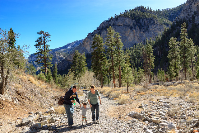
TJ has the distinct advantage of living near the edge of town. That’s really an advantage for me for everything I love about Last Vegas is outside of town. He lives in the northwest corner only a few miles from a little desert oasis called Lone Mountain. This 800-foot hill has a few parks at its base where he and Clare like to bring their daughter to play on the playground equipment. There are actually tons of little city parks like these with picnic pavilions and playgrounds all dispersed throughout the city. But Lone Mountain also has a small piece of desert wilderness. The mountain itself is not technically a city park, but it seems to get quite a bit of recreational use. There is a trail to the summit where the view over the city is actually pretty nice. So on our first morning, we all went to the park. Well, almost everyone. Erin stayed back, not feeling very well. But Sophie and the dogs had fun playing on the jungle gyms.
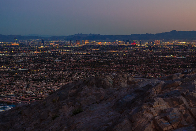
Erin was feeling better later that afternoon, so we took a little drive that led us back to Lone Mountain. We decided to walk around the mountain a bit, and I was surprised when we actually made it all the way to the summit in time to catch the sunset. In hindsight, I would have brought a headlamp, but we managed to make our way back down in the dark just fine.
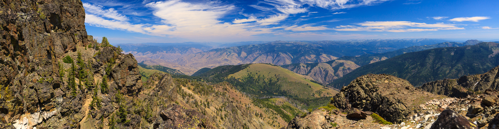
The next day, we headed out to Mt. Charleston to hike further out. Erin and I drove up to the Kyle Canyon trailhead on our previous visit, but that was right before TJ and Clare’s wedding, so we didn’t have much time to hike and explore. This time, we had their 2-year old daughter, so we wouldn’t be going very far, but this trip was more for the enjoyment of being out with friends rather than making miles. We ended up hiking a mile up the trail before turning back. Two miles for a two-year old is pretty good.
Aside from getting out and enjoying the warm sunshine, we had fun catching up while playing board games. I really miss having my game friends readily accessible. We played some Settlers of Catan, Alhambra, Ticket to Ride, Munchkin, and a new one for me: Mystery at the Abbey.
On Thanksgiving, Clare’s parents came over and we had a wonderful meal and too much food to eat. I would go back again just for the food. Sadly, we left Friday morning for the long drive home.
We took the first part of Friday’s drive pretty leisurely. The nice thing about this drive is that we got to see everything that we missed on the drive down. We drove the segment from Ely to Las Vegas in the dark. Once again, we reached Ely just after sunset, but I got to see a different part of the state. About an hour out of town, we stopped at at the Pahrangat National Wildlife Refuge to view some ducks sitting on the water. This is a neat spot where there are several natural lakes in the middle of the desert. It was also warm enough that I would have camped at the campground if I had enough time. We made one other stop just before reaching Caliente. I passed a sign for the Oak Springs Trilobite Area, and as soon as I saw it, I turned around to see what it was. There’s an area where shale containing trilobite fossils is exposed to the surface, and collecting is allowed. So, we took some time to find some trilobites. The majority of the fossils were only of the heads, so I collected no full-body specimines. But, these were my first trilobite finds, so I’m pretty excited.
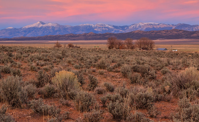
The road beyond Caliente runs behind some of the highest mountains in the state. While we were at 6000 feet in the valley, Wheeler Peak in Great Basin National Park stood towering another 7000 feet above us. It was such a majestic sight, and even better to catch it just as the sun was setting below the horizon.
The drive from Ely to Twin Falls is really long in the dark. The road is very straight and the drive gets old fast when there is nothing to look at. It’s a full two hours to the next town, and when we arrived in Wells, I was really considering stopping for the night. I didn’t help that Erin wasn’t feeling well either, but I knew if I stopped, we’d have an even longer day of driving the next day. So, we continued on through, spending the night in Twin Falls.
It was also nice to see the scenery between Twin Falls and McCall during the daylight. The weather in Idaho wasn’t quite as pleasant as the weather in southern Nevada. It was cold, overcast, and for much of the drive, raining. This resulted in fewer stops which actually got us home at a decent hour.
This short trip has ignited my wanderlust. I really want to load up the car and just see the country with no real time limits and the freedom to just stop and explore on a whim. I also want to head south for the winter, but now that the ski season has arrived, I might just be willing to stay up north.