Month: May 2012

  • Oregon Butte: The Successful Failure


    View Oregon Butte – 5/26-27/2012 in a larger map

    Things don’t always go according to plan. Along the journey, you discover new interests or find obstacles that end up providing you with a totally different experience than originally expected. This lesson was hard hit this weekend as we attempted a backpacking trip in the Blue Mountains of southeastern Washington. The trip was a success, but certainly not what I had expected.

    It’s really a lesson in not getting enough information ahead of time. On paper, it looked like the perfect trip. It’s a 16-mile loop up Panjab Creek to the Mt. Misery Trail on top of the  canyon ridge. The campsite is a place called Table Camp, located on maps with a spring just a mile before Oregon Butte. The return is via Turkey Creek which merges with Panjab Creek to complete the loop. Seems simple.

    View on Oregon Butte

    The weather was already looking sketchy. The forecast called for cloudy skies and 40% chance of snow on Saturday and 30% chance of snow and rain on Sunday. But the highs were in the 50’s and lows right around, but still above freezing. But that had been the weather for the past week, and that generally meant an hour or two of precipitation followed by sunshine. We decided to go for it.

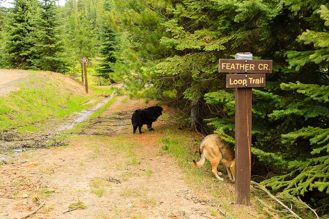
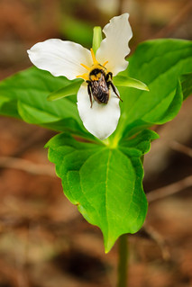
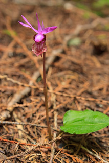
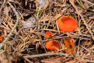
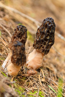
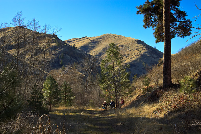
    On Saturday morning, 7 of us left Moscow and headed toward the Blue Mountains. Two more would come later and meet us at the campsite. The drive in was relatively straightforward. The campgrounds along the Tucannon River were packed, but there was plenty of parking at the trailhead. The Panjab Creek trail follows the creek for about 3.5 mile through some beautiful forest. Highlights include a stand of Pacific Yew, tons of wildflowers, and the sound of the rushing creek. The next two miles become a little steeper as the trail switchbacks up the side of the canyon, topping out in a large meadow full of Grass Widow. At this point, we have risen about 2000 feet with only a couple hundred more to go. The last three miles are fairly gentle along the ridge, with fallen trees as the only major obstacle. There is some snow up there, but not so much to make the trip miserable.

    Eight miles and 5 hours later, we reached table camp only to find that there was considerably more snow on the mountain slopes than I had anticipated. The spring that was supoosed to be near the camp was nowhere to be found, either no longer active, or burried deep beneath 3+ feet of snow. We made camp anyway because we were all too tired to move on. There was another spring on the map a half-mile ahead attached to a creek. I had hopes that maybe this one would be more reliable. So I set out with a small search party, but after a painful expedition, we came back without water. We hadn’t planned on dry camping. Luckily there was an abundance of snow surrounding us, and the firewood supply was neverending, so we were able to melt snow without using up our stove fuel.  Melting snow for 9 people is a slow process, but its better than going without water.

    It didn’t rain on us at all on Saturday, though the sky remained overcast. That was alright. We could still see out to the Wallowas and it wasn’t too hot or too cold. In fact, it never really got too cold at night. I suspect there had been an inversion where we had the warmer air on the ridge while all the people car camping along the river had the chill. The wind wasn’t even blowing, so in all, it was a very pleasant evening.

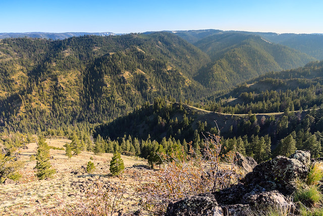
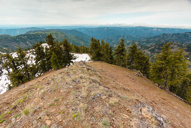
    I’m not sure what time I actually awoke, but I’m told it was before 6:00 am. There was actually blue sky and it looked like the sun might peak through the clouds. Tyler and Genevieve were up shortly after and we started a fire and made ourselves breakfast. There was no sign of movement from any of the other tents. So after waiting, Tyler and I decided we’d make a go for the summit without packs. The worst of the climb was at the beginning. The snow was slick and a few of the slopes were steep. But when we reached the top of the ridge, there was actually a strip of bare rock. From there, we could see up the last ridge to the summit of Oregon Butte where the lookout cabin stood. There was a cornice at least 10 feet high, but again, the ridge back was baren of snow.

    At almost 6400 feet, the view on Oregon Butte is amazing, and the photographs provided don’t even do it justice. The drop down to the rivers below is about 3000 feet. The landscape is bigger and more rugged than it looks on the map (or Google Earth). It’s probably even more impressive on a clear day, though even with the clouds and the haze, we could still make out the high peaks of the Wallowas and the Seven Devils. I imagine that the snow will melt in the next few weeks and the butte will be available as a dayhike from Teepee. I should like to return.

    When we returned to camp, everyone else was up and finishing breakfast. After discussing the prospects of finishing the loop though the high elevation snows, we concluded that it would be best to just turn around and hike back the way we came. As we left camp, the sun came out and remained with us for the rest of the day. When we reached the trailhead, the temperatures had risen to a balmy 65 degrees. I was bushed by the end of the hike. I’ve never come out of a trip that sore before, and I’ve hiked longer trips with longer days. I attribute it to being out of shape from the winter. Nevertheless, I feel that the first backpacking trip of the 2012 season was a success, and I’m already looking forward to the next one.

  • A Tale of Two Hikes

    Feather Creek Trailhead

    I was left home alone this weekend. Erin had gone down to Boise and Ontario, OR for a regional meeting of one of the support groups she attends. She was also taking Lana down to Boise to be transported to her new home with a trainer in Wyoming. So while she was gone for three days, I was in charge of watching the animals. This unfortunately meant I couldn’t go out for any extended trips. No backpacking. No camping.

    So I did what any responsible adult would do when he’s got the house to himself: I threw a party. Well, not a kegger or anything huge. I invited the remaining Biology graduate students out for a cook-out and fire. It was a blast. I’ve got to do this more often. I think everyone enjoyed getting out of Moscow for the evening, too.

    But back to the hikes. Saturday turned into a hike followed by a cook-out and fire. A few people came out early and we headed to Elk Creek Falls. One of the new post-docs and her husband had just arrived and this was their first excursion out of town. It was a nice day to go to the falls. The hill sides were still green and the water was raging. The vegetation in front of the lower falls overlook had been chopped back so there was a clear view. I’ve been to Elk Creek Falls many times now, and yet I don’t have any photos posted online. How can that be?

    Today, I took the dogs on a longer hike. Tyler, Gen, and Matthieu went for a hike on the Feather Creek loop last weekend, and I wanted to check it out for myself. This trail isn’t very well publicized, which might be why I had a hard time figuring out where it was on my own. I heard about it from Mattheiu, who in turn found out about it from the guys at Hyperspud Sports in town. The five-mile loop isn’t very scenic. There are no views and no landmark points of interest. It’s just a trail that follows a creek for two miles, and then returns through the woods.

    What it lacks in major attractions, it makes up for in the little things. At first, it seemed like this was going to be a hike through recently logged / newly regenerating forest. While it’s certainly not old growth or as mature as the forsest surrounding Elk Creek Falls, but it becomes a nice woodland hike. The first thing I noticed were the flowers. Along the creek, there were tons of Western Trillium and Anemones in bloom. As the trail left the creek and ascended the hillside into the woods, the Calypso Orchids became more abundant.

     Bee and Western Trillium Calypso Orchid

    The trail meandered back into a hollow where it crosses a few streams. Here the forest is full of larger trees, mostly cedar with some pines and firs. And then I stumbled upon a strange mushroom that looked like coral. Suddenly, I began to see it growing everywhere. A few steps farther down the trail, I noticed another mushroom, this one bright orange and shaped like a bowl. The final fungal find of the day were morrells, five in total. This was my first ever sighting of morrells in the wild. I’ve marked the spot on the GPS in hopes that I can return and collect some for cooking with.

    Fungus Orange Fungus Morrells

    Feather Creek is a five-mile loop through a nice mix of riparian and forest habitats. Though there are no major destinations along the trail, it provides a nice escape from the developed world and provides a couple hours of relaxation and feeling of solitude. Because its not well publicized, you’re likely to have this trail to yourself. This appears to be a promising wildflower and flora hike, but also seems like a promising place for wildlife sightings. There was plenty of bird activity, though I admit to not taking the time to try and identify everything I heard and saw. The trail is fairly new and appears to be well maintained. It’s not very steep and there’s not much elevation change, making it an easy hike for a family. There is a longer loop that takes off up the ridge, though the sign at the beginning claims this trail hasn’t been completed yet.

    Feather Creek is located a few miles north of Bovill. To get there, travel north on Rt. 3 about 4 miles from Bovill. Turn left onto Talapus Creek Road. There will be a sign for the Feather Creek trail. Continue for a mile and turn right onto Feather Creek Road. The trailhead has a sign about 1.7 miles up.

    Map and Elevation Information

  • Asotin Creek… sort of.

    Asotin Creek Canyon

    The photo above was taken in February of 2010, my first visit to Asotin Creek. I’ve been back a couple of times as it is usually a reliable winter hike that is free of snow. I had never gone down in the spring when everything is green, and certainly not in the summer when temperatures can reach the 100 degree mark. So it was that Erin and I decided to spend a day down at Asotin Creek. The local wildflowers should be in bloom, and the hills might show hints of colors other than the drab brown of dried grass. We would also take the GPS and search for geocaches hidden along the trail. There are many.

    So, we set out for the canyon, stopping in Clarkston to grab some food for Erin. We pulled off at the Headgate County Park to grab a few caches and let the dogs out to stretch their legs. As we approached the wildlife management area, I saw signs that a Discovery Pass was required in order to park. Washington has recently begun charging for vehicle access to its state recreation lands, and the Asotin Creek trailhead falls under this juisdiction. A day pass is $10, and an annual pass is $30. I certainly wasn’t going to pay that much for a day trip, and I don’t visit the state lands enough to justify a $30 pass.

    During the winter, there is a gate across the road just before the trailhead, kept closed to keep cars out during the mating season. The gate is opened in the spring and summer, which allowed us to drive past the trailhead, through the state land, and into the national forest. Here the road climbs out of the canyons and into the high country (5000 ft.) where there are more trees and more green grass, and subsequently more wildflowers. The meadows were full of Grass Widow, Yellow Bells, Mountain Bluebell, and even the occasional paintbrush had started to bloom. As much as I like the desert-like habitat down in the canyons, the upper elevations are really my favorite place to be. Of course, the the best part of being up top is the view.

    Views from Pinkham Ridge

    When we reached the top, I pulled off the road onto a flat clearing with a view over the Asotin Creek canyon. Nearby, someone was burning and that had produced a thick haze over the mountains, but the view was still magnificent. I thought that this would make for a great campsite, and then I found a fire ring from someone else’s previous visit. We explored the meadow, looking at the wildflowers and then ate lunch.

    We were really after a trail that traversed Pinkham Ridge. If we weren’t going to hike in Asotin Creek, we might as well hike above it. The Pinkham Ridge trail is really the top of the Asotin Creek trail, for after the trail heads upstream about 10 miles, it turns and heads up the steep canyon walls to Pinkham Ridge where it ends at a Forest Service road where we had parked. This last portion of the trail hasn’t been hiked very much and it certainly hasn’t been maintained. There’s no signs at the trailhead, and the trail itself seemed to have blended back in with the scenery. However, the brush and forest isn’t very thick and the grasses are short, so walking in this area isn’t too difficult, especially since the trail follows a narrow ridge. However if you were to come up this way, be sure to at least carry a map, but a GPS might be useful too.

    We hiked just under 2 miles down the ridge to a little shelf and clearing, and there we laid out a blanket and napped in the tranquility above the canyon. We saw Mountain Bluebird and Stellar’s Jays and listened to the songs of the Chipping Sparrow, Chickadees, and nuthatches. So, what began as a disappointment turned out to be an awesome adventure. Next time, we can prepare for a full day in the Blue Mountains and just skip Asotin Creek altogether.

  • The Last One

    Pink Girl

    Since last week, we had been down to three puppies. Three is much more manageable than seven, but still a crowd. In fact, having two out at a time was still a handful. Tuesday, I made up posters advertising the rest of the pups, and in less than 24 hours, we had two more sold. This left us with one Pink Girl to care for.

    Having one puppy isn’t so bad. They’re a lot more mellow by themselves, they don’t eat as much, and most importantly, there’s not as much pee and poop to clean up. Of the three that were left were all the lighter dogs. It seems that the darker color is more popular. But the lighter dogs had the better personalities. Green Girl and Brown Boy were so mellow and laid back. And Pink Girl just wanted love and snuggles. If we were to have kept one, Erin would have kept Brown Boy. I think I would have chosen Pink Girl.

    Pink Girl was very much like Greta in some ways. Her number one goal was to snuggle up to you an give and get love.  It turns out, she really likes to nap in someone’s arms. She really liked Greta and looked up to her so much, but Greta would grumble and put up with it. I think she was just jealous that the puppy was getting attention instead of her.

    A day went by and there were no more calls. I thought that maybe we would actually keep Pink Girl because nobody seemed to want her. Then we got three inquiries on Friday. Erin really wanted to keep a puppy, and I’ll admit that I was attached to the idea myself, but the reality is that we can barely afford the animals we have, and until our financial situation improves, we really should not be adding to our collection. So, we loaded the puppy into the car and brought her into Moscow with us where she met her new family. And with that, we are now puppyless.

    We still have Lana, the mother. While she’s calmed down a little, she can’t stay with us forever, and she’s going to have to go sooner than later. Erin has been looking into rescue centers because she’s not likely to find a home going to one of the humane society shelters, even though the local shelters are no-kill.

    So in a few days, we should hopefuly be back to our normal life with only two dogs…

    … and four cats, four horses, three birds, a goat, a hedgehog, a fock of chickens, and a tank full of fish. Did I miss any?