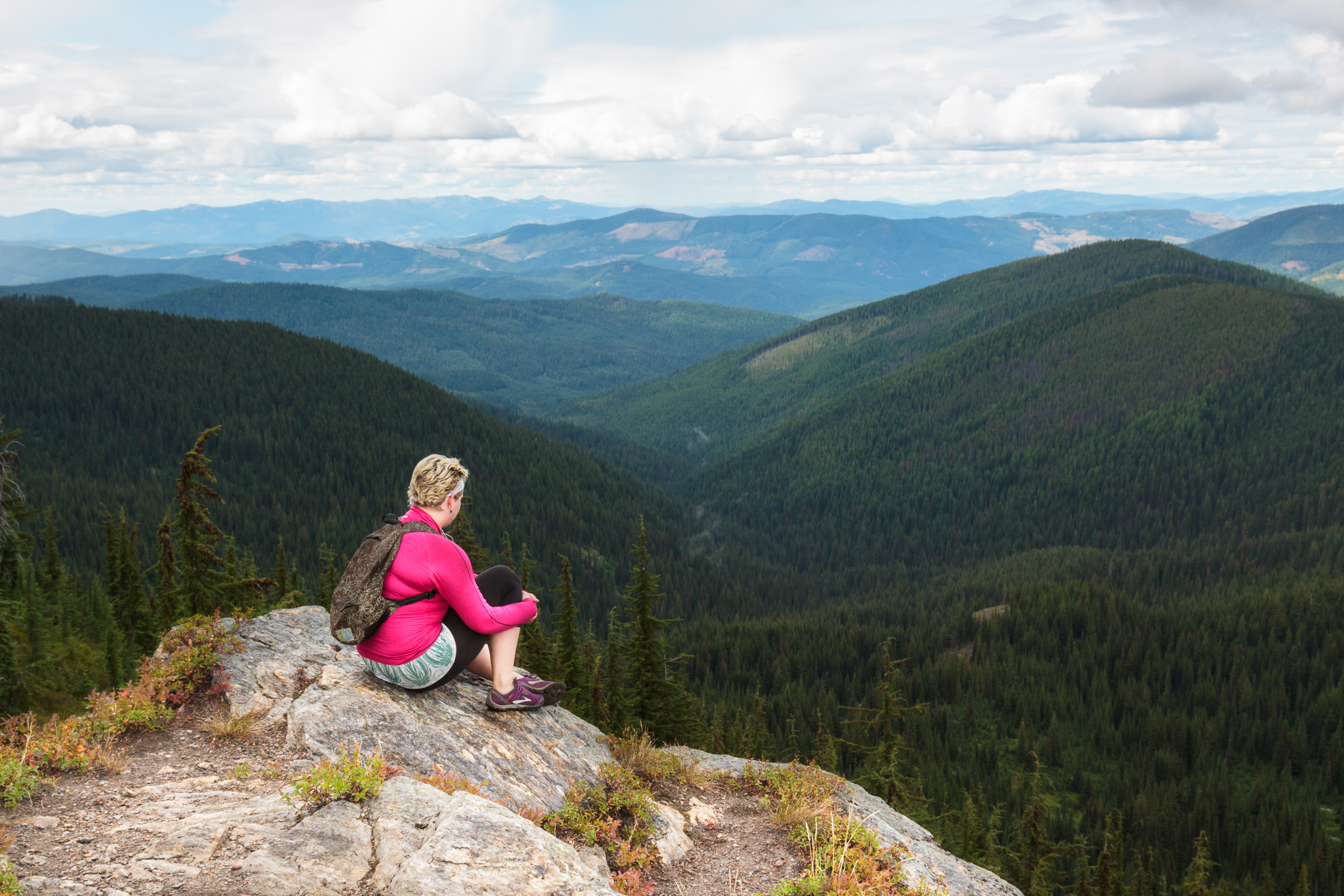
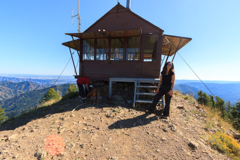
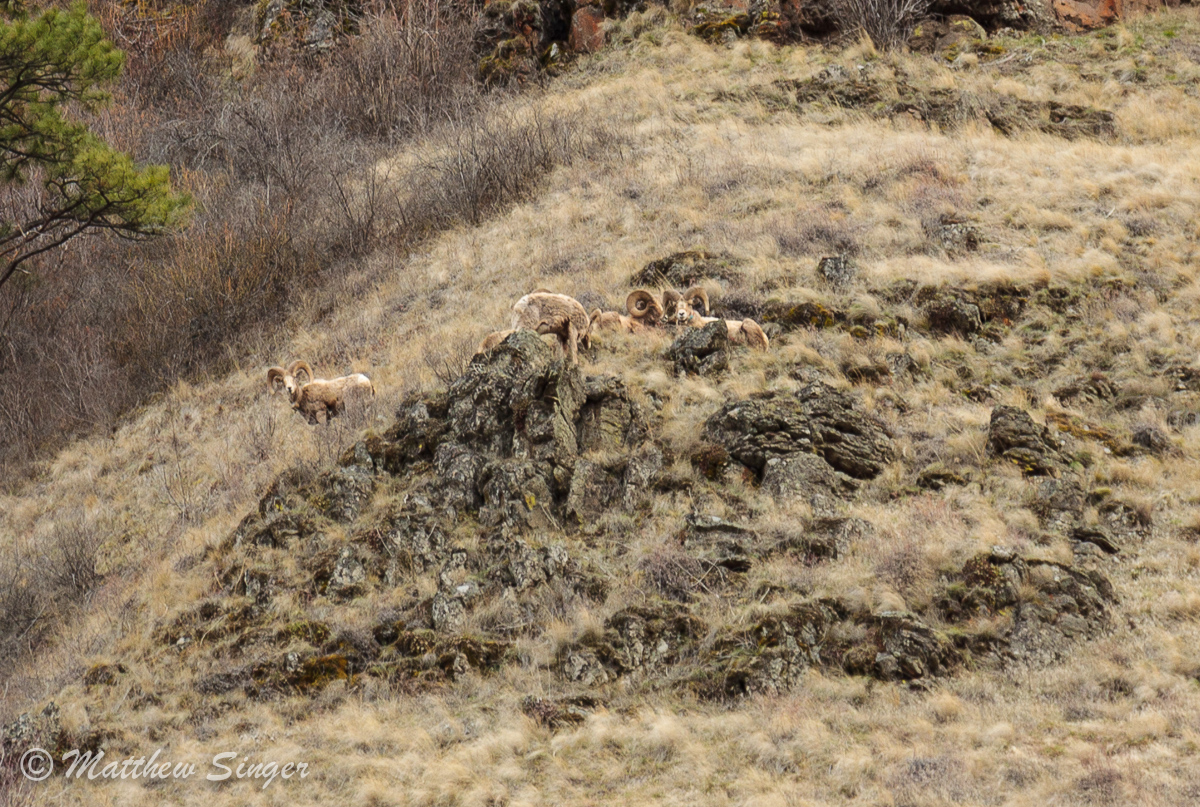
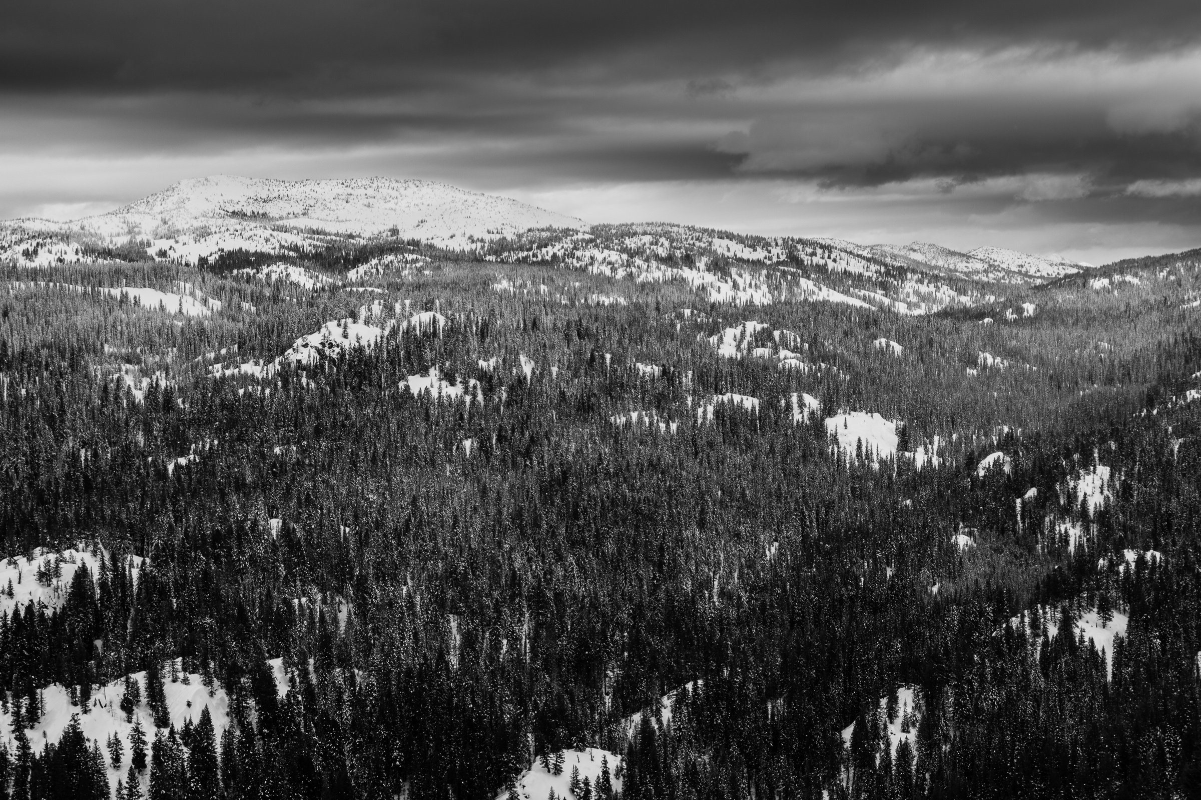
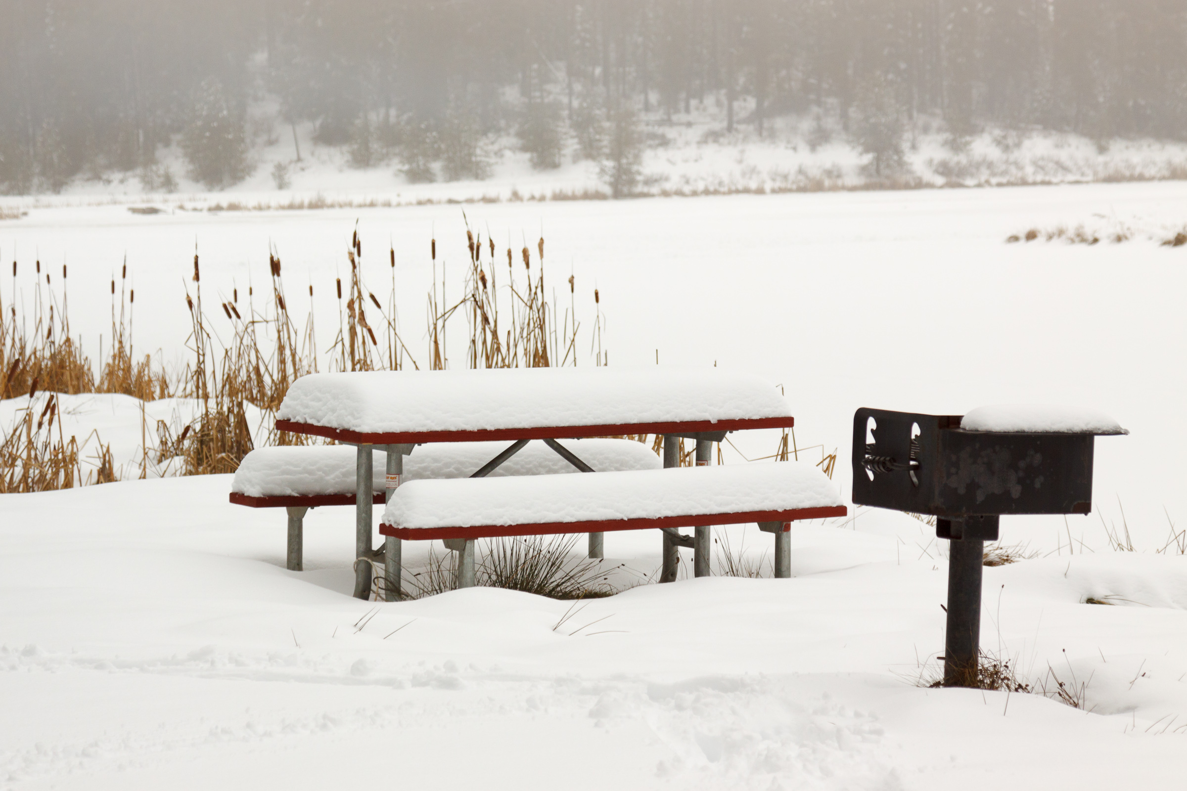
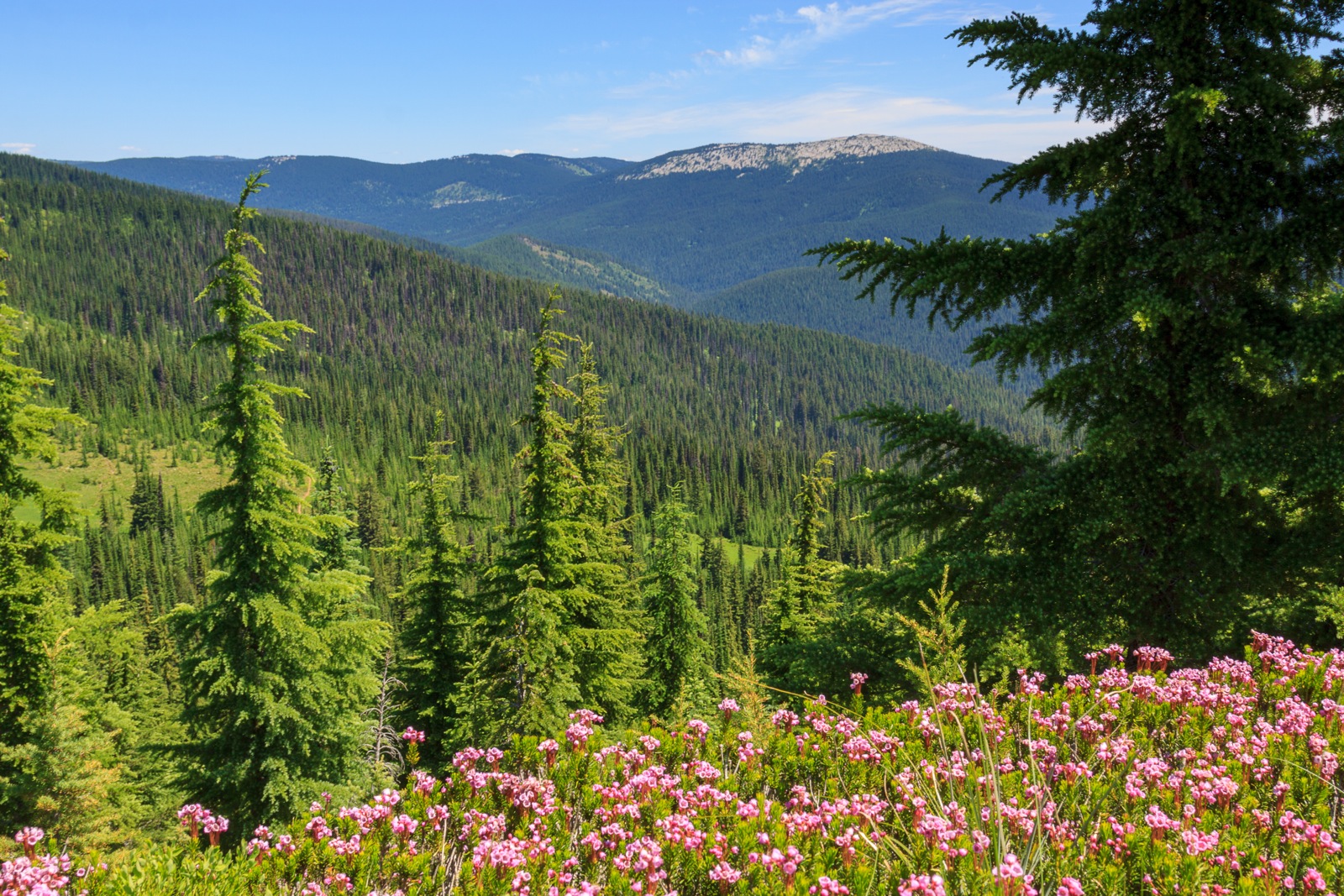
Category: Travel Stories

  • Fly Fishing on the St. Joe

    There’s nothing quite like the feeling of getting that perfect cast with your fly rod, landing the fly perfectly on the water exactly where you intended it to land, and having a fish jump for it seconds later. I was in that groove Sunday afternoon where the fish were chasing after my fly, but only one actually hooked. But the thrill of fly fishing isn’t so much the catch as it is the pursuit. There’s something theraputic about standing thigh deep in running water while throwing the line back and forth, even if nothing is biting. Then again, it’s just theraputic being in the middle of nowhere away from the hustle and bustle of modern life.

    After last week’s trip to the North Fork of the Clearwater, I had been itching to go back out and spend more time on the water with my rod and reel. When Tyler suggested we do another trip, I jumped at the chance and suggested we try the St. Joe river. Like the North Fork, the St. Joe winds through a narrow valley for over 100 miles from its source along the Bitterroot Divide to its end in Lake Coeur D’Alene in the town of St. Maries. In fact, one of the things that makes the St. Joe more attractable is that it sees fewer people than the North Fork, despite an easier drive. The entire road back as far as Spruce Tree campground, the end of the road, is paved. It was an unexpected surprise after spending several hours on forest service roads trying to find our way down to the river.

    Normally, we’d drive to St. Maries and pick up the St. Joe River Road, but in good Idaho DOT fashion, there was road work on Friday afternoon causing a massive delay only a few miles out from St. Maries. There is a “short cut” not too far back that the GPS originally tried to route us on, but I suggested we skip because I had no idea what the condition of the roads would be like. After waiting for 20 minutes with no sign of movement, we turned around to try the path through the forest. Somewhere, we took a wrong turn because instead of travelling straight across as the map suggested we would, we ended up winding our way south back to Clarkia where we had to cross over Hobo Pass and along Marble Creek. In hindsight, we should have just taken that shortcut in the first place. So we were quite relieved to make it back to paved road and find a smooth drive back to our destination at Fly Flat campground.

    The St. Joe is a smaller river than the North Fork, at least half the width and most of it fairly flat and shallow, but there are some deep canyons with deep pools and lots of fish. Unfortunately, they weren’t biting much. I think Dan and Tyler each caught about 5 fish on Saturday, most of which were in the 6-inch range. I caught none. We returned to camp and then headed upstream for an evening catch where Dan pulled in two nice sized cutthroat right away with his spinner, but Tyler and I weren’t getting any bites with flies.

    Part of my problem is that I spent a good chunk of the day tying tippet. Several times, I got my line tangled or snagged and lost my fly or part of my leader. So finally, on Sunday, I cut off a twisted portion of my leader and tied on a fresh length of tippet and was having much better luck. I still lost a few more flies, one to grass, and another to a fish. We first started Sunday by heading into a deep gorge full of deep pools. Since it was too deep to wade, we had to fish from the bank, and in such a confined space, I was having trouble getting good casts. So after losing a fly to the grasses, I called it quits and headed upstream where the river was more open. This is where I caught my one and only fish of the trip, and upon releasing it, lost the fly after another cast. I suspect that the fish had chomped on the line by the hook, creating a weak spot in the knot. After that, I was getting bites, but no catches.

    The St. Joe is beautiful country with great seclusion, scenery, and fishing. I can’t say whether I like it over the North Fork because both rivers offer a spectacular experience. I’m glad that I have such terrain close by and I’m looking forward to more visits in the future. One of these trips, I’ll actually take some time to photograph the area as well.

  • Fishing on the North Fork

    Tyler and the Whitefish

    I went fishing along the North Fork of the Clearwater with Tyler and Dan, two graduate students in the department. Unfortunately, it was a short trip, leaving Thursday morning and returning late Friday afternoon, but that’s just how the timing worked, and it was a much needed getaway for all of us.

    We camped at Kelly Forks campground, luckily snagging a spot along the river. The campground is located at the confluence of Kelly Creek and the North Fork of the Clearwater which has some added benefits. Kelly Creek has an amazing fishery, but it is catch-an- release only. At one time, Kelly Creek barely had any fish left due to over fishing and habitat degredation. Thanks to recovery efforts started in the 60’s and a no-harvest rule, Kelly Creek is one of the best fishing grounds in the state. The North Fork, on the other hand, has a trout limit of 2 per person per day, which meant we could potentially bring some home to cook up.

    We must have been on some pretty popular spots on Kelly Creek. The fish were biting, though they were pretty small. We each caught at least one, though all were 8 inches or less. My first catch was a fluke. I was showing Tyler how to cast a fly rod and during the demonstration, I had a bite that hooked. Tyler and Dan were having more luck with their spinners, but I was having more fun casting flies.

    We moved to a spot along the North Fork before dinner to try and catch something to bring back to camp. Tyler caught a sizeable mystery fish, so ultimately we let it go. We went back to camp and decided to try our luck along the confluence. I caught a small  cutthroat, but it was nowhere near the 14 inch limit. We made spaghetti, lit a fire, and relaxed before bed.

    Friday morning, we tried a spot two miles downstream from camp at a place called Cold Springs. It turned out to be a good spot. Almost immediately, Tyler brought back a nice Mountain Whitefish which we promptly threw into the bag for keeping. Soon after, Daniel reeled in a nice Cutthroat, but it wasn’t quite big enough to keep. I was getting some bites, but eventually realized that my leader was too short and should be extended, so I headed back to the car to add a bit of tippet to my line. While I was trying to figure out the surgeon’s knot, I heard a big splash in the pond beside me. I looked over and saw that a moose had just jumped in and was swimming for the other side. I dropped what I was doing, grabbed my camera, and ran, hoping to intercept it as it climbed out onto the bank. I didn’t run fast enough for it was long down the dike and there was no way I was going to get a decent shot. I went back and finally figured out my knot when Dan and Tyler returned to tear down camp and move on.

    Pond at Cold Springs

    We intended to hit up Weitas Creek on the way out. The bridge over the North Fork to the campground has been closed on account of structural unsoundness. When we got there, it was completely gated off and closed to pedestrian traffic as well.  We found a trail down to the river and waded across. Here, the water was relatively shallow: waste deep but fast flowing. Add some slippery rocks and it was quite a challenge to cross, but we made it to the other side and to the confluence with Weitas Creek. There was a nice rapid below the confluence and that’s where we all headed. I found a set of rocks that Tyler had been fishing, but decided to leave, so I gave it a chance. I landed my fly right beside the rock in a small pool of calm water and immediately, a fish jumped after it. Unfortunately, it did not hook. So I re-casted a few times and then waited a bit, threw the fly in again and got another bite, but no hook. I threw it in a third time and again, got a bite. This one held on for a few seconds, but ultimately I could not get him hooked. Of course, I was excited that I was actually getting bites. However, I kept casting and noticed that my fly wasn’t very far away from the line. The leader had gotten incredibly tangled. I tried to untie it, but the mess was too much for me to handle while standing in the middle of fast flowing water. Frustrated and hungry, I headed back upstream to cut off the knot and tie on a new piece of tippet. At that time, I also noticed Dan was heading back. It was about that time that we needed to head home anyway. So there’s my story about the one that got away.

    Of course, I learned a valuable lesson from this experience:
    1. Always bring all of my equipment with me onto the stream, especially if it’s going to take considerable effort to get back to the car.
    2. Bring a snack.

    The North Fork of the Clearwater is beautiful country. Like the Clearwater/Lochsa river that flows along Rt. 12 from Lolo Pass, the North Fork winds through a deep V-shaped valley flanked by peaks that reach 7000 feet. It’s a beautiful drive that is more remote and slower paced than Rt. 12, only because the roads aren’t major highways. The North Fork still sees a lot of visitors, but as many people as there are back there, there still seemd to be room for that feeling of isolation. I’m so glad I finally got down there and I’m looking forward to planning my next trip, hopefully spending more than one night out in paradise.

    Powered by Qumana

  • Float Trip 2012


    View Float Trip 2012 in a larger map

    Every year, the graduate students from the University of Idaho’s biology department embarks on a float trip on the Snake River. It’s an annual tradion that carrys on well before my time. Actually, I’m not sure when the tradition began. In 2010, the float trip was held shortly after I arrived in Idaho. By that time, the daytime temperatures had cooled and I was not feeling up to floating in the river. In retrospect, I wish I had gone my first year. I made up for it by going last year. Actually, we held two trips last year, but I was only able to go on one of them. It was a blast, but Erin was working and couldn’t come.

    So this year, we set out to continue the tradition of floating 6-10 miles down the Snake River on a hot and gorgous day. We put in about a mile downstream of the confluence with the Grand Rhonde and floated for 7.7 miles, taking out at Bufalo Eddy. We had never started this high up, but decided to do so because Bufalo Eddy creates a challenge when floating in tubes. Essentially, a small rapid propels you around a turn on river right and shoots you into an eddy on river left which is nearly impossible to get out of. Last year, we got stuck in the eddy for about an hour, each time thinking we  were in the current only to be routed back toward shore and up river. We finally had someone on a jetski tow us out so we could finish the float.

    So to avoid that fiasco again, we decided to just end at the eddy where there is also a nice beach and a parking area. The advantage of starting farther upstream is that we got to ride Captain Lewis Rapids. When I saw these waves from the road, I was quite excited that we’d get to float through some “major” rapids for tubing. When it came time to hit the rapid, we actually missed the big waves, and it’s probably a good thing. From the water’s surface, they looked to be 3-4 feet from crest to trough and could have easily caused some problems since we weren’t wearing PFDs. The rest of the ride was pretty smooth. Any rapids downstream of Capitan Lewis were ripples barely big enough to splash us on the tubes.

    The float trip is a great bonding experience. We sit there, tied together as a great floatilla, hanging out and drinking beer. Erin came along and actually had a good time. I’m kind of hoping that we do another one before the season ends, but with the semester starting up in two weeks, I don’t think it will actually happen. Still, one can dream.

    So until next year, I’d say we had a pretty successful float trip.

  • East Peak

    Summit view 1:

    There are many peaks in the Wallowas that top 9000 feet, so East Peak might go unnoticed if it weren’t so easily accessible. It turns out that I’m not the only one who thought to use the Wallowa Lake Tramway to cover the first 3700 feet of elevation, reducing the climb to the peak to 1300 feet. This hike is featured in the book, and while I was’t expecting a crowd, we did pass three other hikers along the way, two of which are local to the area and hike to the peak regularly.

    The Wallowa Lake Tramway brings you to the summit of Mt. Howard. At 8200 feet, the views are incredible, but they also leave something to be desired. For one, you can only look across the Wallowa River valley, and not back into the huge, glacially carved terrain. And as you climb higher, every view always becomes more impressive. Finally, the crowds of tourists stick to the nature trails at the top of the tram, leaving you with an alpine experience that the masses don’t get.

    The trail begins on the backside of the nature trails on Mt. Howard where a faint trail takes off down the east side of the mountain. It can be easy to miss if you’re not looking for it. Despite there not being an official trail, the path is well worn and easy to follow all the way to the summit. At one time, this must have been a popular destination because the forest service had a set of privies in the first saddle below the summit of Mt. Howard. The privies are no longer maintained. Neither have seats on the toilet and one is missing a door. After the saddle, there is a short, but steep climb that quickly levels off for a nice walk to the next saddle. You’re now in fairly treeless terrain so the trail is marked by a series of cairns that switchback up the slope and route you around the next false summit toward the next saddle. Here, the trail branches. To the right, you’ll ascend to the ridge where you make your way to the summit of East Peak. To the left, you can skirt around the summit to a spring and continue to the back side where you can summit East Peak or the next peak, Hidden Peak. Or you can continue to Aneroid Mountain, but that might be getting far for a day hike. Remember, the first tram is at 10:00, and if you’re lucky to be the first one, you’ll hit Mt. Howard at 10:15. The last tram down is at 4:45 pm, so timing is important.

    Summit View 5:The book describes the hike up East Peak as having a scramble. It’s true that there are some rocks along the ridge to the summit, but nothing that really requires any climbing skills. The ridge top is neat, though. There are points where it is only a couple feet wide with steep dropoffs on both sides. The rock scramble does end and the ridge widens a bit for the final approach to the summit.

    From the summit, you can look up the U-shaped valley to see Aneroid Lake and the mountains surrounding it. Some of the prominent peaks you can see include Aneroid Mountain, Sentinal Peak, Red Mountain, Eagle Cap, Sacajawea, Matterhorn, and Chief Joseph. To the east, you can look over the Imnaha canyon and Hells Canyon and see the Seven Devils rising into the sky. To the north, you can see Wallowa Lake, Joseph, and Enterprise over a mile below while looking out over the Wallowa valley to the Blue Mountains in the distance. It’s such an amazing place to be.

    Map and Trip Stats

    More Photos

  • Lookout Mountain

    View North

    Everytime I’m up on Grandmother Mountain, I look to the east and see the bald dome of Lookout Mountain rising over the Marble Creek drainage and I long to stand on top and look down from the other side. Finally, with my parents and sister visiting, I decided this would be the perfect opportunity to try out this trail.

    There are several mountains in northern Idaho named Lookout. This is not the ski area on the Idaho-Montana border off of I-90. This is not the peak in the Selkirks north of Sandpoint of the same name. This is in the St. Joe National Forest, accessed from FS-301, the same road that leads to Freezeout Saddle and the Grandmother Mountain trail outside of Clarkia.

    Lookout Mountain is unique for this area because its summit is completely bald, offering spectacular views in 360 degrees. The summit stands at 6789 feet above sea level and overlooks Lost Lake, the nearest glacial tarn of considerable size to the Moscow Area. This trail is absolutely beautiful and probably seldom used compared to the neighboring Grandmother Mountain trail. The trailhead is only 7 miles farther down the road, but due to the rough road conditions, it took an extra hour of driving to get there. Despite its apparent remoteness, the trail and trailhead are in great condition. The trailhead features several developed campsites with picnic tables and fire rings along with a well-maintained privy. There are also two other small campgrounds nearby. Next time I hike this trail, I may have to spend the night.

    From the trailhead at Orphan Saddle, it’s a 4-mile walk to the summit of Lookout Mountain. The trip isn’t very difficult, though you’ll begin your journey with a 600 foot ascent in just under a mile. By the time you start getting tired, you reach the ridge at 6500 feet and the journey becomes a relaxing meander through a mixture of hemlock forest and grassy field. The next two miles are gentle, holding elevation until the Widow Peak trial splits off, and then gently descending into the saddle above Lost Lake. The last mile is a 700 foot ascent to the summit, and though it may seem steep, you’re on the spine of the ridge with views that get better with every step you take. Take as much time as you need and eventually, you’ll find you can’t go any higher.

    The return journey isn’t too bad. The descent on the way out was gradual and not very noticeable, but you may notice the uphill on the return. However, it’s still gentle compared to the two ascents (now descents) on the way out. In short, this may have become my new favorite local hike. Unfortunately, it is such a pain in the butt to get to that I’ll probably still stick to Grandmother Mountain as my go-to escape to higher elevations.

    Map and elevation statistics

    More Photos

  • Wallowas

    Looking across the Lostine River Valley

    The final chapter in the visit of the in-laws consits of a visit to one of my favorite mountain ranges. There are many spectacular mountain ranges in the country, but I happen to have a fondness for the Wallowas in northeastern Oregon. Perhaps its because they’re the closest mountains of their kind, or because they truely are a spectacular gem. I’ve always wanted to bring people to the Wallowas, but there aren’t really a whole lot of day hiking opportunities. All of the lakes and the peaks are just far enough away that the trips would be better done as an overnight trip. There is one exception. Mt. Howard is accessible by a gondola that rises 3700 feet into the mountains. And so when I mentioned that this might be a good place to come on their next visit, the plans quickly changed to seeing these mountains before they left for Pennsylvania.

    We were originally going to go camping along the North Fork of the Clearwater to go fishing and explore the bit of inland rainforest at the base of the Mallard-Larkins area. We were going to leave Sunday and come back Monday, but Sunday morning, nobody was motivated to pack. Steve and I were still recovering from our backpacking trip, which although was short and sweet, was also tiring. Once noon had passed and we still hadn’t packed, we decided that Sunday would be a more relaxing day with a trip to Elk River and Freezeout Saddle (see previous post). So we moved the camping to leave Monday and return Tuesday. Those days had better weather reports anyway. However, once we were up at 6000 feet, Retta had decided she wanted more high elevation experience, and when she heard that we could get her to 8000 feet without any hiking effort, she had made up her mind.

    Of course, I didn’t really mind either. I love the Wallowas and any chance to bring new people there is a chance for me to see these wonderful mountains. I also love the drive out. On this trip, they got to experience the Lewiston Grade and the deep canyon of Rattlesnake Grade which also blew their minds. It’s one of the most scenic drives we can take in this area, though doing it twice in one day does wear you out.

    So there we were, riding the Wallowa Lake Tramway. Retta did well with her height issues and once we were on top, it was nothing but sheer enjoyment. 8000 feet can take your breath away, litterally. The air is thinner so less oxygen gets to your lungs per breath, and while most people don’t notice it until exceeding 10,000 feet, first-timers will feel the effects on Mt. howard. But no worries. The paths atop the tramway are very easy and short, only 2.5 miles in total, so there is no rush.

    Now that I’ve finally been up the tramway, I don’t really feel the need to do it again, but I think I may bring my parents up there next week with the intent of following the ridge to East Peak above 9000 feet for better views of the Wallowas and Hells Canyon. And then I’ll be back once more for our 3rd annual backpacking trip in the Eagle Cap Wilderness. I never get tired of this place.

  • Return to Freezeout

    Sunset on Freezeout Ridge

    Any time someone visits us, their stay would not be complete without a trip to Elk River and Freezeout Saddle. We were limited in our acitivites because one of our guests were not fit for any major hiking, but luckily, we have options for that. So Sunday, we took an easy morning and headed out mid-afternoon for some local adventure. In Elk River, we stopped at the general store for huckleberry ice cream and then headed out to see the giant cedar, which always amazes anyone who has never seen big trees.*

    The allure of Freezeout Saddle is that it’s the closest place to exceed 6000 feet, and it’s also the closest place to find alpine flora. Retta had never been this high up before, so this was certainly a novelty. We also found out the hard way that she has a fear of heights. Since we weren’t going to hike to Grandmother Mountain, we decided to drive past the trailhead out on Freezeout Ridge. Last year at this time, the road was blocked by a patch of snow after leaving the open slopes and reentering the forest. This year it was wide open. Unfortunately, the road is quite bumpy with a steep drop on one side, so I can see how anyone with an issue with heights might be nervous.

    Freezeout Ridge is nice. There used to be a fire lookout, but the tower is now gone. The area where it stood is still bald of trees and provides a 360-degree view of the clearwater mountains. We spent some time enjoying the cool air and the awesome views and then I realized that we might as well just stay up there for the sun set, which looked like it may turn the sky a fiery pink. Unfortunately, there were clouds on the horizon that blocked the light, but it was a nice sunset anyway. We headed down in the dark hoping to see an Elk, but no such luck this time.

  • Backpacking: Seven Devils’ Lower Cannon Lake

    Sunrise at Lower Cannon Lake

    My father-in-law and his wife have been visiting us since last Wednesday. Before coming out, he had asked if we could go on a little male bonding trip into the backcountry for a night. So, I set about looking for a short and easy hike to a spectacular place. I figured he had probably never spent the night under the rocky peaks next to a glacial tarn, and the high lakes are also one of my favorite places to spend a night, but most of the lakes around here are either fairly strenuous hikes, long hikes, or take nearly all day to get to the trailhead. Stevens lake originally came to mind, but Erin thought that might be too steep, despite the short 2.5 mile hike in. So I kept looking around and found Loon Lake out of McCall, which isn’t really a high mountain tarn but a morain lake at the base of a glacially carved valley.

    I was all set to go to McCall when the heat wave hit Idaho. It was over 90-degrees in Moscow, and not much cooler in McCall. So I thought about some place that was a bit higher up: the Seven Devils. The loop trail around the seven devils is on the easy side of moderate, and Cannon Lake is only 4 miles in from the trailhead. At 7000 feet, the temperatures were much cooler than anywhere else. Then I checked the weather and noticed a good chance of rain in the McCall area, but less of a chance at the Seven Devils.

    Garden Paradise
    The trail to Cannon Lakes is short and sweet. It’s not difficult at all except for a few downed trees to navigate around. This is a beautiful walk around the east side of the Devils, descending through a lush forest of Mountain Hemlock and then traversing the mountainside through the burned forest, now on its way to recovery, but for now lined with lupine, paintbrush, and a variety of other wildflowers. The trail crosses a few creeks and at about 3 miles, meets up with the Cannon Lakes trail. From there, you ascend back up to 7000 feet over the next mile, traversing through beautiful flower-laden alpine meadows. The toughest part of the hike was the return trip, where we had to ascend about 1000 feet over the course of 1.5 miles back to the trailhead.

    Seven Devils Loop approaching Cannon Lakes
    Cannon Lake sits in a basin between She Devil and Tower of Babel, both of which are visible from the trail, but disappear behind some closer formations as you approach the lake. The peaks tower over 2000 feet and really instill a sense of awe. Because we were on the west side of the range, the sunset was fairly lackluster, but sunrise was spectacular. The high peaks receive the first light of the day and are quickly bathed in the pink alpenglow of the sun emerging from the horizon. Normally, I’d be up to witness the first light on the peaks, but on this trip, I slept in, woken up only by my father-in-law who beat me to the morning view. Luckily, I rushed out of the tent just in time to catch the whole face bathed in pink before the color completely faded.

    Friday’s hike in was on a very hazy and muggy day. The air was cooler up on the mountain, but the view was almost nonexistent. You could barely make out the mountain peaks across the Salmon River canyon. Despite the threat of thunderstorms, we had a clear night with blue skies and sunshine the next morning. The haze had thinned out on Saturday and the temperatures dropped a bit never exceeding 70. It was the perfect hiking condition.

    Mountain Goat
    When we returned to the car, I decided to show him the campground, and it’s a good thing we did. A mountain goat was hanging around one of the campsites. I then took him up to the Heaven’s Gate Lookout to get him over 8000 feet and get a view of Hells Canyon. Our stay at the tower was cut short by an approaching thunder storm that we watched approch over the high peaks. I’d say we timed this trip perfectly. The rain hit as we started our descent back into Riggins.

    There’s one precaution to take when hiking into the high country this time of year. I had underestimated the course of mosquito season, and it seems we had hit the motherload. I also made the mistake of dismissing the need for bug spray. I generally don’t use it because I hate putting chemicals on me and introducing them into the environment. But given how bad the mosquitoes were, I’m willing to reconsider.

  • Freezeout

    FS-257

    The heatwave has hit the northwest. Today’s temperatures on the Palouse rose into the high 90’s, and tomorrow it may break 100. I wanted to hike so I can get in shape for backpacking next month, so I thought I’d take the dogs up to Freezeout Saddle and hike to Grandmother Mountain. But when I got up there, it was also hot and somewhat muggy, so we didn’t make it very far. I brought the camera, but got no pictures on this trip. The summer wildflowers are starting to bloom: beargrass was in its early stages, and the lupine had buds, but no open flowers yet. Plox was open, creating a colorful ground cover in places. The glacier lilies had already gone to seed. But overall, we should see the full color in the next week or two. Already, there is less snow on the trail than there was when I brought my parents up at the end of July last year. This holds good promise that the high country is now open for business.

    The best part about today’s excursion was the wildlife sightings, nearly all of them from the car as we were headed down. The only wildlife I spotted from the trail was a fesh pile of bear scat. But on the way down, I came across a very colorful Western Tanager, an elk on the road, a family of skunks (mom and 3 juveniles, I believe), and what I believe to be a wolf. As I came to the bottom of the incine where the road meets the creek, I saw a large dog standing in the intersection. It looked like a husky, definitely bigger than a coyote, but I was also far away so it’s hard to tell. It ran off, and I kept driving, but then I saw it again in the road, running away. I tried to catch up to it to get a better look, but it darted off to the side and then I lost it. I’m not absolutely positive it was a wolf. Coyotes are much more common and more likely, but this was bigger than any coyote I’ve seen, though smaller than a wolf should be. It was more grey and white, rather than the brownish-grey that the coyotes are. It could be a feral dog. Either way, it surely wasn’t tame as it spooked at the first sight of the car. So, it could be a wolf, but I’m not positive, and I hesitate to call it as such. It’s exciting, nonetheless.

  • Elk Butte

    Elk Butte

    Ever since I first visited Elk River during my interview trip in February 2010, I had a desire to get to the top of Elk Butte. After all, who could resist a lookout tower boasting 3000 foot views? The only problem was finding a suitable way to get up there. While the maps show a road to the summit, descriptions also warn that the summit is not accessible by car. Most people reach the summit by four-wheelers in the summer and snowmobiles in the winter. I had read that it was a 7-mile one-way trip, which ruled out a day trip for my hiking abilities.

    Two weekends ago, during a scouting mission to the Morris Creek Cedar Grove, I decided to drive the roads on the mountain to see just how far I could get. It turns out, you can drive to within 3 miles of the summit. Running low on time, I decided to come back to explore this hike and bring some friends along. That’s what I did this past weekend.

    Many of my friends have been out to the falls, but have never gone into the town of Elk River, let alone ventured back to the grove of big trees. So I took them back to see the Giant Cedar where they were amazed at the size of the tree. We also had some fun identifying wildflowers in bloom. Since we got a late start, we skipped the Morris Cedar Grove and headed straight to the mountain.

    Elk Butte, the summit

    The hike is 2.8 miles one-way on a gated road, thus the terrain is open on a well-defined path. The first half of the hike is completely open though a clear-cut. This patch is recovering with a nice cover of bushes and small trees creating a great habitat for birds. It also opens up the slopes to views of surrounding mountains. About a mile in, we reach a spot where we can see the summit. It’s tempting to hike stright up, but it’s certainly easier to walk the extra distance around to the other side. After this point, we re-enter the national forest and into a nice forested patch of hemlock and spruce with a dense understory of huckleberry. Based on the number of flowers on the huckleberry bushes, I think we may have a good year this year. During the last mile, the incline steepens as you gain about 500 feet to reach the tower.

    An 80-foot fire tower stands on the summit of Elk Butte, however the cabin at the top is not accessible to the general public. A lower cabin at 30 feet is accessible by a stairway. Though the interior is locked, visitors can stand on the deck and look down at the town of Elk River 3000 feet below. There are theoretically veiws in all directions, but this requires you to lean around the cabin to see what is toward the north.

    Elk River

    Elk Butte sits in an ideal location, central to viewing some prominent landmarks around north-central Idaho. To the north, you’ll view the meadow-covered slopes of Freezeout Saddle. To the east, you’ll notice some high peaks beyond Dworshak Reservoir. These belong to the Mallard-Larkins area. Some of the other high landmarks require a clear day. To the southeast, you might see some snow-covered peaks on the horizon belonging to the Bitterroot mountains. To the south, behind the camas prairie is the snow-capped Gospel Hump. A little bit further west, the Seven Devils rise above the horizon, and beyond that, the Wallowas may be visible on a really clear day. To the West, you’ll gaze over the Palouse with Moscow Mountain as the first major feature on the north end.

    View to the West: Mallard-Larkins

    Elk Butte sits among active logging territory, so the scenery is dotted with patches of mature and cut forest. This can detract from the overall beauty, but remember, the logging operations sustain the economy of the region and also help in the conservation of some other special places. If you can look past the massive deforestation, you can get lost in the sheer number and size of the mountains. You’re truely at the edge of civilization.

    View North, Freezeout Saddle

    If hiking to the summit, the trail is accessible by car on well-maintained logging roads. If four-wheeling to the summit, there are trails that take off from the base of the mountain. This can easily be combined with a trip to the cedar groves and the falls for a full-day or weekend visit at Elk River. Be sure to stop at the general store for some huckleberry ice cream. We unfortunately got there too late on this trip. For a map and directions to the trailhead, view my trip report here.

  • Perkins (Morris) Cedar Grove

    Perkins Cedar Grove


    I think I’ve mentioned before that there are a number of cedar groves, stands of old-growth Western Red Cedar, nearby. I’ve already posted about the Hobo Cedar Grove out near Clarkia and Grandfather Mountains. Several times I’ve been to the Giant Cedar out near Elk River. On our way into Idaho when I moved out here, Erin and I stopped at the DeVoto Cedar Grove along Rt. 12. There is a cedar grove on Moscow Mountain, but I haven’t been up there to explore it yet. The last one that I know of in the immediate area is also near Elk River on the way to the Giant Tree. Its the Morris Creek Cedar Grove, recently renamed the Perkins Cedar Grove.

    To get there, follow the North Basin road out of Elk River as if you were going to the Giant Tree. There will be a left turn with a sign for the Perkins Cedar Grove a few miles up. Turn here and follow this road, keeping right at all intersections. You will rise above 4000 feet to a parking area along Morris Creek. The trail through the cedar grove is short, only a half mile, but it looks as though it sees far fewer people than either the Giant Tree or the Hobo Cedar Grove.

    My first impression was that this is a nice patch of forest, but the trees aren’t nearly as large as the Hobo Grove, but as I got further into the loop, I rescinded my thoughts. There are a number of impressive trees up here along with an understory of ferns, trillium, and calypso orchid. It’s a very nice stroll through the woods, but nothing challenging. I would pair this with the Giant Tree and the falls for a complete day in Elk River.

    Old growth forests are rare to come by these days. If they haven’t been logged by the lumber companies, many stands have burned due to years of fire suppression causing massive wildfires to erupt. It’s really nice to walk through stands of trees so old, they were standing long before Europeans came to America. There are four such stands that I know of within two hours of Moscow. There are a few more farther afield. I had been meaning to check out this grove since we arrived in Idaho almost two years ago. We’d always time our trips to the big tree such that we’d be hungry right after, so we had always passed up the extra trip to the Morris grove. Last year, the road was closed for construction, so we were unable to get to the grove. Finally, I made it a point to go up there and check it out. I’m glad I did.

  • Oregon Butte: The Successful Failure


    View Oregon Butte – 5/26-27/2012 in a larger map

    Things don’t always go according to plan. Along the journey, you discover new interests or find obstacles that end up providing you with a totally different experience than originally expected. This lesson was hard hit this weekend as we attempted a backpacking trip in the Blue Mountains of southeastern Washington. The trip was a success, but certainly not what I had expected.

    It’s really a lesson in not getting enough information ahead of time. On paper, it looked like the perfect trip. It’s a 16-mile loop up Panjab Creek to the Mt. Misery Trail on top of the  canyon ridge. The campsite is a place called Table Camp, located on maps with a spring just a mile before Oregon Butte. The return is via Turkey Creek which merges with Panjab Creek to complete the loop. Seems simple.

    View on Oregon Butte

    The weather was already looking sketchy. The forecast called for cloudy skies and 40% chance of snow on Saturday and 30% chance of snow and rain on Sunday. But the highs were in the 50’s and lows right around, but still above freezing. But that had been the weather for the past week, and that generally meant an hour or two of precipitation followed by sunshine. We decided to go for it.

    On Saturday morning, 7 of us left Moscow and headed toward the Blue Mountains. Two more would come later and meet us at the campsite. The drive in was relatively straightforward. The campgrounds along the Tucannon River were packed, but there was plenty of parking at the trailhead. The Panjab Creek trail follows the creek for about 3.5 mile through some beautiful forest. Highlights include a stand of Pacific Yew, tons of wildflowers, and the sound of the rushing creek. The next two miles become a little steeper as the trail switchbacks up the side of the canyon, topping out in a large meadow full of Grass Widow. At this point, we have risen about 2000 feet with only a couple hundred more to go. The last three miles are fairly gentle along the ridge, with fallen trees as the only major obstacle. There is some snow up there, but not so much to make the trip miserable.

    Eight miles and 5 hours later, we reached table camp only to find that there was considerably more snow on the mountain slopes than I had anticipated. The spring that was supoosed to be near the camp was nowhere to be found, either no longer active, or burried deep beneath 3+ feet of snow. We made camp anyway because we were all too tired to move on. There was another spring on the map a half-mile ahead attached to a creek. I had hopes that maybe this one would be more reliable. So I set out with a small search party, but after a painful expedition, we came back without water. We hadn’t planned on dry camping. Luckily there was an abundance of snow surrounding us, and the firewood supply was neverending, so we were able to melt snow without using up our stove fuel.  Melting snow for 9 people is a slow process, but its better than going without water.

    It didn’t rain on us at all on Saturday, though the sky remained overcast. That was alright. We could still see out to the Wallowas and it wasn’t too hot or too cold. In fact, it never really got too cold at night. I suspect there had been an inversion where we had the warmer air on the ridge while all the people car camping along the river had the chill. The wind wasn’t even blowing, so in all, it was a very pleasant evening.

    I’m not sure what time I actually awoke, but I’m told it was before 6:00 am. There was actually blue sky and it looked like the sun might peak through the clouds. Tyler and Genevieve were up shortly after and we started a fire and made ourselves breakfast. There was no sign of movement from any of the other tents. So after waiting, Tyler and I decided we’d make a go for the summit without packs. The worst of the climb was at the beginning. The snow was slick and a few of the slopes were steep. But when we reached the top of the ridge, there was actually a strip of bare rock. From there, we could see up the last ridge to the summit of Oregon Butte where the lookout cabin stood. There was a cornice at least 10 feet high, but again, the ridge back was baren of snow.

    At almost 6400 feet, the view on Oregon Butte is amazing, and the photographs provided don’t even do it justice. The drop down to the rivers below is about 3000 feet. The landscape is bigger and more rugged than it looks on the map (or Google Earth). It’s probably even more impressive on a clear day, though even with the clouds and the haze, we could still make out the high peaks of the Wallowas and the Seven Devils. I imagine that the snow will melt in the next few weeks and the butte will be available as a dayhike from Teepee. I should like to return.

    When we returned to camp, everyone else was up and finishing breakfast. After discussing the prospects of finishing the loop though the high elevation snows, we concluded that it would be best to just turn around and hike back the way we came. As we left camp, the sun came out and remained with us for the rest of the day. When we reached the trailhead, the temperatures had risen to a balmy 65 degrees. I was bushed by the end of the hike. I’ve never come out of a trip that sore before, and I’ve hiked longer trips with longer days. I attribute it to being out of shape from the winter. Nevertheless, I feel that the first backpacking trip of the 2012 season was a success, and I’m already looking forward to the next one.

  • A Tale of Two Hikes

    Feather Creek Trailhead

    I was left home alone this weekend. Erin had gone down to Boise and Ontario, OR for a regional meeting of one of the support groups she attends. She was also taking Lana down to Boise to be transported to her new home with a trainer in Wyoming. So while she was gone for three days, I was in charge of watching the animals. This unfortunately meant I couldn’t go out for any extended trips. No backpacking. No camping.

    So I did what any responsible adult would do when he’s got the house to himself: I threw a party. Well, not a kegger or anything huge. I invited the remaining Biology graduate students out for a cook-out and fire. It was a blast. I’ve got to do this more often. I think everyone enjoyed getting out of Moscow for the evening, too.

    But back to the hikes. Saturday turned into a hike followed by a cook-out and fire. A few people came out early and we headed to Elk Creek Falls. One of the new post-docs and her husband had just arrived and this was their first excursion out of town. It was a nice day to go to the falls. The hill sides were still green and the water was raging. The vegetation in front of the lower falls overlook had been chopped back so there was a clear view. I’ve been to Elk Creek Falls many times now, and yet I don’t have any photos posted online. How can that be?

    Today, I took the dogs on a longer hike. Tyler, Gen, and Matthieu went for a hike on the Feather Creek loop last weekend, and I wanted to check it out for myself. This trail isn’t very well publicized, which might be why I had a hard time figuring out where it was on my own. I heard about it from Mattheiu, who in turn found out about it from the guys at Hyperspud Sports in town. The five-mile loop isn’t very scenic. There are no views and no landmark points of interest. It’s just a trail that follows a creek for two miles, and then returns through the woods.

    What it lacks in major attractions, it makes up for in the little things. At first, it seemed like this was going to be a hike through recently logged / newly regenerating forest. While it’s certainly not old growth or as mature as the forsest surrounding Elk Creek Falls, but it becomes a nice woodland hike. The first thing I noticed were the flowers. Along the creek, there were tons of Western Trillium and Anemones in bloom. As the trail left the creek and ascended the hillside into the woods, the Calypso Orchids became more abundant.

     Bee and Western Trillium Calypso Orchid

    The trail meandered back into a hollow where it crosses a few streams. Here the forest is full of larger trees, mostly cedar with some pines and firs. And then I stumbled upon a strange mushroom that looked like coral. Suddenly, I began to see it growing everywhere. A few steps farther down the trail, I noticed another mushroom, this one bright orange and shaped like a bowl. The final fungal find of the day were morrells, five in total. This was my first ever sighting of morrells in the wild. I’ve marked the spot on the GPS in hopes that I can return and collect some for cooking with.

    Fungus Orange Fungus Morrells

    Feather Creek is a five-mile loop through a nice mix of riparian and forest habitats. Though there are no major destinations along the trail, it provides a nice escape from the developed world and provides a couple hours of relaxation and feeling of solitude. Because its not well publicized, you’re likely to have this trail to yourself. This appears to be a promising wildflower and flora hike, but also seems like a promising place for wildlife sightings. There was plenty of bird activity, though I admit to not taking the time to try and identify everything I heard and saw. The trail is fairly new and appears to be well maintained. It’s not very steep and there’s not much elevation change, making it an easy hike for a family. There is a longer loop that takes off up the ridge, though the sign at the beginning claims this trail hasn’t been completed yet.

    Feather Creek is located a few miles north of Bovill. To get there, travel north on Rt. 3 about 4 miles from Bovill. Turn left onto Talapus Creek Road. There will be a sign for the Feather Creek trail. Continue for a mile and turn right onto Feather Creek Road. The trailhead has a sign about 1.7 miles up.

    Map and Elevation Information

  • Asotin Creek… sort of.

    Asotin Creek Canyon

    The photo above was taken in February of 2010, my first visit to Asotin Creek. I’ve been back a couple of times as it is usually a reliable winter hike that is free of snow. I had never gone down in the spring when everything is green, and certainly not in the summer when temperatures can reach the 100 degree mark. So it was that Erin and I decided to spend a day down at Asotin Creek. The local wildflowers should be in bloom, and the hills might show hints of colors other than the drab brown of dried grass. We would also take the GPS and search for geocaches hidden along the trail. There are many.

    So, we set out for the canyon, stopping in Clarkston to grab some food for Erin. We pulled off at the Headgate County Park to grab a few caches and let the dogs out to stretch their legs. As we approached the wildlife management area, I saw signs that a Discovery Pass was required in order to park. Washington has recently begun charging for vehicle access to its state recreation lands, and the Asotin Creek trailhead falls under this juisdiction. A day pass is $10, and an annual pass is $30. I certainly wasn’t going to pay that much for a day trip, and I don’t visit the state lands enough to justify a $30 pass.

    During the winter, there is a gate across the road just before the trailhead, kept closed to keep cars out during the mating season. The gate is opened in the spring and summer, which allowed us to drive past the trailhead, through the state land, and into the national forest. Here the road climbs out of the canyons and into the high country (5000 ft.) where there are more trees and more green grass, and subsequently more wildflowers. The meadows were full of Grass Widow, Yellow Bells, Mountain Bluebell, and even the occasional paintbrush had started to bloom. As much as I like the desert-like habitat down in the canyons, the upper elevations are really my favorite place to be. Of course, the the best part of being up top is the view.

    Views from Pinkham Ridge

    When we reached the top, I pulled off the road onto a flat clearing with a view over the Asotin Creek canyon. Nearby, someone was burning and that had produced a thick haze over the mountains, but the view was still magnificent. I thought that this would make for a great campsite, and then I found a fire ring from someone else’s previous visit. We explored the meadow, looking at the wildflowers and then ate lunch.

    We were really after a trail that traversed Pinkham Ridge. If we weren’t going to hike in Asotin Creek, we might as well hike above it. The Pinkham Ridge trail is really the top of the Asotin Creek trail, for after the trail heads upstream about 10 miles, it turns and heads up the steep canyon walls to Pinkham Ridge where it ends at a Forest Service road where we had parked. This last portion of the trail hasn’t been hiked very much and it certainly hasn’t been maintained. There’s no signs at the trailhead, and the trail itself seemed to have blended back in with the scenery. However, the brush and forest isn’t very thick and the grasses are short, so walking in this area isn’t too difficult, especially since the trail follows a narrow ridge. However if you were to come up this way, be sure to at least carry a map, but a GPS might be useful too.

    We hiked just under 2 miles down the ridge to a little shelf and clearing, and there we laid out a blanket and napped in the tranquility above the canyon. We saw Mountain Bluebird and Stellar’s Jays and listened to the songs of the Chipping Sparrow, Chickadees, and nuthatches. So, what began as a disappointment turned out to be an awesome adventure. Next time, we can prepare for a full day in the Blue Mountains and just skip Asotin Creek altogether.

  • Evo-WIBO weekend recap

    Seattle Skyline

    This past weekend, I was in Port Townsend, WA for the bi-annual Evo-WIBO meeting. Evo-WIBO is a small, regional gathering of someo of the biggest names in evolutionary biology in the Pacific northwest. Its only a day and a half long and very informal. Yet, because of its size and intimacy, I got more out of this meeting than I did when I presented at the much larger SICB meeting in January. I met and hung out with more people than I would have, which made it a lot of fun. The only downside is that it was so nice out that I felt bad spending the day inside instead of being out exploring a new place.

    My talk went well. I presented the results from our selection experiments, but dropped the open field data due to time constraints. Instead, I added the little bit about the dimensionality of the G-matrix that we estimated. My talk was near the end of the day, and I was the first person to mention the G-matrix all day, which I heard got a nod from Steve Arnold.

    Fort Worden is a decomissioned WWII fort on the corner of the Olympic Peninsula. There are gun batteries positioned throughout the grounds, but much of the land is forest or beach. The barracks have been converted into a convention center, which is how we got to have our conference at the park. This is great birding habitat, and wouldn’t you know it? I left my binoculars at home. On a clear day, there are spectacular views of the Mt. Baker and the northern Cascades across the water, and from the right vantage point, you can even see Mt. Rainier to the south.

    Port Townsend is a nice little town. It’s definitely built for the summer tourist season, but it seems like a place worth coming back to explore. The little downtown area is packed with shops and restaurants. I figured that since I was on the coast, I’d get seafood for dinner, and I had the best crab riggatoni ever. Unfortunately, I didn’t get to spend much time in town beyond dinner, so perhaps I’ll return when I get a chance to explore the Olympic Peninsula. The next meeting will be in two years, so I’m hoping I’ll be in a position to take some time off while I’m out there. It’s such a long trip for only a day and a half. From Moscow, the trip can be made in 6.5 hours, but it generally takes longer with meal and bathroom breaks. The bulk of the drive isn’t very scenic either. There’s a good two-hour stretch on open, flat land through central Washington that just seems to go on forever. It’s apparently faster to drive down to Tacoma and around the Puget Sound, but the ferry ride from Seattle to Bainbridge Island gives a much needed break from driving and a chance to enjoy the Seattle skyline and the mountains. Despite the clear blue skies, it was too cloudy to see the mountains on the way out, but on the way back, Mt. Rainier stood majestically above the landscape. It was an awesome sight.

    So to recap, Evo-WIBO is awesome, fun, and a great place to network and meet other people nearby in evolutionary biology.

  • Attempting to Snowshoe

    Gold Center Trail

    This past weekend, we had a nice day on my day off for once. So I took advantage of the sunshine and warm weather to get out and hike. Or so I thought.

    I’ve been waiting to take my snowshoes out for a real winter trek, and the timing has been bad. I set my sights on the Gold Center trail, which leaves at the base of the mountains behind Clarkia and climbs its way up to the ridge just below Grandmother Mountain. I’ve always wanted to hike this trail, and winter seems like the best time to do this since the trailhead at Freezout Saddle is inaccessible.

    The road out was rough as the snow was wet and almost slushy, but my Subaru made it with no trouble. Due to the past few days being so warm, I was expecting some dense, heavy snow that is fairly easy to walk on. But I found that while the snow was heavy, it was still very much unpacked, and even in snow shoes, I was having a tough time walking. Perhaps I should have brought the extra flotation tails with me after all, or perhaps I’m just woefully out of shape.

    Deary has almost no snow left. Moscow and Pullman are dry. But Clarkia still has 2-3 feet, and the mountain elevations were getting fresh snow when we had rain at the bottom. That seemed promising. But I didn’t get out until after 1:00, so I had given up on making it to the ridge on this trip. I hadn’t expected the walk to be so difficult that it took me an our to go one mile on flat terrain.

    Nevertheless, the snowy forest was beautiful, and my tracks were the first on this trail. Even the snowmobiles hadn’t gone this far in. The idea of getting to the summit of Grandmother Mountain in winter is somehow in reach, aided by the longer days. Still, it’s a 5+ mile, 3000 ft. ascent, so we’ll see. If I can float better on the snow, I may be able to endure the full 10 miles in one day. Otherwise, it may be summer challenge.

    Gold Center Creek Grandmother Mountain

  • Grandfather Mountain: A pre-winter hike

    On Grandfather Mountain
    Looking back (south) on Grandfather Mountain


    I’ve been very busy with graduate school, and that has put hiking and exploring on hold, but that also has me itching to get out, especially as my days of decent hiking weather grow shorter and shorter. I’ve been trying to get up to Sandpoint to get in one last snow-free summit for the season, but time just hasn’t been on my side. So this weekend, I headed up to Grandfather Mountain with Erin for what might be our last chance to get up there this year.

    I’ve been to Grandmother Mountain many times since moving out here, but each time, we get started late or take too much time exploring the trail to make it all the way to Grandfather. This time, we skipped Grandmother altogether and set Grandfather Mountain as our goal. Grandfather is exactly 4 miles from the trailhead (according to the GPS), and the first half of the hike covers the same familiar ground that we’ve hiked time after time. Regardless, I never tire of the scenery along the trail. At 6000 feet, the views are incredible, and even though the mountains aren’t that big for this area, they’re still impressive. And then there’s the thrill of seeing it differently every time. For example, when we first discovered this trail last September, summer was ending and fall was just staring so we had a hike full of late-summer flowers and huckleberry bushes turning red. In July, Spring was kicking off with a magnificent show of color and wildflowers. On this hike, a fresh two-inches of snow had fallen the night before and we laid witness to the mountain’s transition from fall to winter. Luckily, we were still able to get to the trailhead.

    So we made it through the first half of the hike as usual, but stopping less often. But at the spur to Grandmother Mountain, we turned left and continued along the ridge. Not long after, we came across a perfect campsite next to a spring under the canopy of the old-growth forest. Then the forest became a bit younger and denser, but nevertheless, it was great to walk through a forest instead of through open fields and patches of trees. Although it had snowed the night before, when the sun came out, the air felt pretty warm and we could feel the snow melting around us. Steam rose up from the ground encasing the ridge top in a thin cloud. When the sun would shine through, we would catch the rays bouncing off the mist.

    Eventually, we ascended out of the forest and into a clearing at the summit of Grandfather Mountain. The views are pretty, but not quite as open as they are on Grandmother Mountain. Still, there’s fewer ridges to block the valley to the north and there’s a different perspective looking back where we came from to the south. So while Grandmother Mountain may be taller and have the better views, it’s still worth making the extra 3-mile (round trip) trek to Grandfather Mountain, if anything for a nice walk through the ridge-top forest.

    View from the Grandfather Mountain trail. The Enchanted Forest

    Romp in the Snow Grandfather Mountain Trail

    See more photos from this hike on Flickr.
  • Eagle Cap Wilderness, Labor Day Weekend

    West Fork Wallowa River Valley
    The West Fork Wallowa River Valley from the Lakes Basin Trail

    A year ago this weekend, I set foot in Oregon for the first time and explored one of its most beautiful and least advertised mountain ranges. Last year, we only got a preview of the Eagle Cap Wilderness in the Wallowa Mountains, only able to stay one night. So this year, I arranged the backpacking trip for Labor Day Weekend, which let us spend 3 nights in the wild and explore more of the area. I rarely return to the same place for a second trip as there is so much around to explore, but then, there is the trade-off. Is it better to see a little bit of everything, or thoroughly explore one place?

    And so it was, I returned to the Eagle Cap Wilderness with Tyler and we brought Tyler’s fiancee, Genevive, and Tom Poorten, two newcomers to this wilderness. Of course, Rusty and Shadow came as well. Since we couldn’t all fit comfortably into one car, we took two and hiked a shuttled one-way route, hiking up Hurricane Creek to Mirror Lake and heading out down the West Fork of the Wallowa River. This route is a much longer way into the lakes basin than last year’s Lostine River trail, but it’s also the easiest way in, especially when the 12 miles to Mirror Lake are broken up into two days. And that’s just what we did.

    Originally, we were to start hiking around 6 or so and hike for about four miles and find camp. But as usual, we were late leaving Moscow and we got into Enterprise at 7. After parking a car at the Wallowa Lake trailhead in Joseph and shuttling over to Hurricane Creek, we got our start on the trail well after dark had fallen. We hiked for an hour, just shy of two miles, before finding a spot in the meadow to make our first camp. Friday night was cold, so cold in fact that we not only had a frost, but I woke up with ice in my water bottle. Temperatures remained near freezing through the morning until the sun had risen high enough to hit the valley floor. We ended up waiting long enough to let the sun warm us up and dry the tents before heading up the valley.

    The Hurricane Creek valley is magnificent. The entire trip is a gentle upward slope, rising about 2000 feet over 10 miles while surrounded by giant peaks rising upwards of 4000 feet into the sky. We woke up with a grand view of Sacajawea, the highest peak in the range. I must say it looks quite different without snow covering its rocky summit. After passing the giant mountain, we’re introduced to the white cliffs of Matterhorn, which due to its more vertical nature, looks even more impressive. The terrain is a mix of open meadow and forest, but nothing nearly as wide open as the upper Lostine River valley. Still, the diversity of terrain and scenery makes this trail almost more scenic than any of the other approaches. After hiking 10 miles in the valley, the trail climbs up one of the back walls via a series of gentle switchbacks and descends into the Lakes Basin area. The summit of Eagle Cap becomes visible and excitement washes over with the prospects of finally getting to the lake. Though the trail was relatively easy, we were quite bushed from hiking 10 miles uphill and quite glad to set up camp on the rocks with a great view of Eagle Cap and Mirror Lake.

    Saturday night was much warmer, as expected. In the fall, mountains experience a temperature inversion from day to night where the cool temperatures fall into the deep vallies and the warm temperatures rise to the high elevations. As a result, we had a very pleasant night by Mirror Lake. In fact, after eating dinner and packing away the food, we sat out on the rocks looking at the stars.

    We spent a relaxed Sunday morning enjoying the area around Mirror Lake. Originally, we had tenative plans to hike up to the summit of Eagle Cap, return and pack up camp and move about 3-4 miles down to Horseshoe Lake and hike out the last 9 miles on Monday. However, we were still tired from our 10 miles of hiking on Saturday, so we decided that a summit of Eagle Cap would have to happen on another trip. Then, pressed with the option of camping at Horseshoe Lake or continuing on into the Valley for a shorter hike out on Monday, we decided it would make more sense for the latter option so that we weren’t getting home super late. Regardless, we left our camp at Mirror Lake around noon and headed down along the lakes, taking short breaks at Moccasin, Douglas, Lee Lakes. We stopped for a long lunch at Horseshoe Lake and found a great jumping rock to plunge into the cold water. Surprisingly, Horseshoe Lake wasn’t too cold and the swim was quite refreshing for a hot day.

    Mirror Lake is definitely the desired destination in the Eagle Cap Wilderness. It’s one of the higher lakes, is centrally located, and sets you up for a nice summit trip to Eagle Cap. But Mirror Lake is also quite popular, and the prime campsites near the water are almost always taken quite early. Despite the popularity, it is easy to find a place that is somewhat secluded and gives the impression that you’re not camping among a crowd. But the other lakes have their advantages too. They are quieter, they have more trees around them, they’re better for fishing, and they have some really awesome campsites. You can be certain to have privacy at these lakes, and still have world class views of the high peaks. The peninsula on Horseshoe Lake offers spectacular views of Pete’s Point and Sentinel Mountain, and from certain angles, you can also glimpse Eagle Cap. Horseshoe is still at 7000 feet, but as the last lake in the chain, it is warmer and more eutrified than the lakes uphill from it. In fact, there are a few nice marshy areas along the trail that look like great amphibian habitat. The water is still clear, and the lake is still deep. But there are likely to be more fish in there than at Mirror Lake.

    After Horseshoe Lake, the trail drops into the valley of the West Fork Wallowa River. This descent, while not strenuous, is about 3 miles that would be a steeper incline in the other direction than any incline on the Hurricane Creek Trail. I’m certainly glad we chose the direction that we did. Shortly after the descent began, we came upon a rocky shelf looking over the valley. Convinced there was a view to be had, I dropped my pack and ran out to the rocks. Sure enough, there was a magnificent view of the back valley. The Wallowa River valley is a classic glacially-carved U-shaped valley about 3000 feet deep and maybe a mile wide at the base. The views we got from this rock were like those you’d get at a national park. It was glorious. The trail opens up again a few more times on the way down before reaching the valley floor at Six Mile Meadow. There is good camping at the meadow, six miles from the trailhead, but it proved to be a popular site, so we pressed on to see if we could find anything else nearby. Turns out, much of the Wallowa River valley is forested, unlike Hurricane Creek, and camp sites are few and far between. We ended up camping three miles farther at the intersection with the Ice Lake trail. This put us at a second 10-mile day, but would afford us the luxury of sleeping in a bit and only hiking out about 3 miles on Monday.

    Sunday night was colder than Saturday night at the lake, but not as cold as Friday with the frost. We built a fire in the fire pit and sat around to keep warm during dinner. The morning was also cold, but not nearly as bitter as our first morning, so we were able to get moving fairly early. We ended up leaving camp around 9 and getting to the car well before noon. We celebrated with a post-hike beer and lunch at the Terminal Gravity Brew Pub in Enterprise, a well deserved treat after two back-to-back 10-mile days of hiking and three nights in the wilderness. Although I was sad to leave such a beautiful landscape, I was glad to be back in the comfort of my bed, take a break from hiking, and have a hot shower.

    The Eagle Cap Wilderness is one of the most beautiful and special places I have been to, and that’s one of the reasons I keep returning. This will certainly not be my last visit or backpacking trip in the Wallowas as there are so many more places within these mountains to see and explore. I hope we can keep up this tradition and next year, I’ll get to report on the third annual Eagle Cap Wilderness backpacking adventure.

  • The Seven Devils


    Sunset at the Seven Devils


    This past weekend, I had the pleasure of spending three nights in Idaho’s Seven Devils. The devils are a series of craggy peaks between the Salmon and Snake river canyons. They rise over 7000 feet above the rivers and offer spectacular views and recreation opportunities, and for about three months of the year, they are accessible to people of all ages and abilities.

    I went camping with seven other graduate students from the department and we had a blast hiking, fishing, enjoying the scenery, and spending time in the outdoors. We left Moscow Thursday afternoon and made it to Riggins by early evening. All descriptions of the road to the Seven Devils campground were way off. We were prepared for narrow, steep, unmaintained driving suitable for high-clearance, four-wheel-drive vehicles. While the first half of the drive was steep, the road was quite wide, enough for two cars to pass each other, and the surface was fairly smooth for a gravel road. I think anyone could make this drive in just about any car. We ascended for 17 miles, and when we popped out of the forest in to the alpine meadow, it became apparent that this place was going to be awesome.

    The first thing I noticed was the carpet of flowers through the grassy field. And then the view; wow, we were high up. We hit Windy Saddle during that golden evening light, but rather than start photographing, we had to secure ourselves a campsite. To our surprise, the trailhead parking was pretty full, and so was the campground just beyond. We found a spot that seemed like it would work, though I don’t think it was an official campsite. So Tim and I drove over to the horse facilities to find several of the sites open. When I went back to inform the rest of the group, they had found an open site, but it wasn’t very optimal. On our way back to get Tim and look at the sites in the horse facilities, we ended up finding two more sites, one of which was tucked away from the road near the lake. That ended up being our site for the three nights. We got camp set up just as darkness fell over the mountain.

    Our campsite was quite optimal. For one, we were away from the main hustle and bustle. Many of the other sites were within visibility of neighboring sites, and we were afraid that we’d be too loud for other campers. Our site was tucked away, next to the trail to Seven Devils Lake. From the site, we could see a giant 1000+ foot cliff towering overhead. The morning sun bathed the rock and made for a most spectacular view to wake up to. Though as much as I tried, I failed to wake in time to catch the pink alpenglow the first two mornings. I did make it to the lake for some fairly early morning shots.

    Friday morning, Tim and I drove out to the Heaven’s Gate Lookout before everyone else had gotten up. Though we missed the early morning light, we had a pretty spectacular view and brought back some good images of the mountains and the canyons.  Later that day, we all packed our day bags and headed over to Sheep Lake. Normally, this would be a 12-mile hike, but the unofficial climber’s route drops the trip down to two. This trail is very steep and very strenuous.  In half a mile, we must have gained nearly 1000 feet to the first pass on a trail made from loose rock and gravel. Once on top, there is a spectacular view of the Tower of Babel and Mirror Lake. Then there’s a fairly steep decline to Sheep Lake. It took us two hours to hike two miles, but it was worth it. Sheep Lake is the largest lake in the Seven Devils and it is surrounded by four of the seven peaks: He Devil, She Devil, Mt. Baal, and the Tower of Babel. A few of us had planned to make the scramble to the top of some of these, but after the strenuous hike over with the return trip looming, we decided it was going to be too much to do in one day. So we spent the afternoon lounging and fishing around Sheep Lake. The hike back isn’t nearly as bad as the hike out since the incline isn’t as high or steep. However, because this is an unmarked trail, it’s easy to follow a false path, and this slowed us down quite a bit. I’m not sure how others make this route with full packs, but I don’t think I want to give it a try.

    Since we were all tired and sore from Friday’s hike, we spent Saturday relaxing at camp. Some of the group spent the day fishing at Seven Devils lake, but there was no major activity. I headed to the Heaven’s Gate Lookout in the afternoon with Tyler and Genevive, and returned again at sunset with everyone else. The hike to Heaven’s Gate is only .3 miles and very easy to a fire tower with a 360-degree view of the surrounding area: Seven Devils to the south, Hells Canyon and the Wallowa Mountains to the west, The Salmon River canyon, Frank Church Wilderness, and the Bitterroot mountains to the East, and the Snake River Canyon and Cottonwood Butte area to the north.  At 8300 feet, I don’t think I could get tired of that view.

    Sunday morning, I finally got up early enough to catch the pink light on the mountain behind Seven Devils Lake. The color was so good that I want to return and capture it from the lookout. In fact, the Seven Devils is quite easy to get to, so I may return for more trips. I certainly would like to return and backpack the devils. There aren’t a lot of day-hiking destinations from Windy Saddle, so an overnight trip would get me to more lakes, more views, and maybe even up one or more of the peaks. However, if you only have a day to kill, it’s worth driving to the top to get the view from Heaven’s Gate.

    See Photos from the Seven Devils.

  • Exploring

    The past week, my parents were in town visiting and we spent the week exploring and showing them our favorite places in the area. We’d usually leave fairly early in the morning and get back kinda late, always exhausted. As a result, I haven’t been able to post some detailed updates on the awesome places that we’ve been. I’ll try to summarize the week here.

    WWII era bomberSaturday, July 23: Picked my parents up from the Lewiston airport. Turns out, there was some kind of airplane festival going on so we decided to have a look. There were planes out on the tarmack for people to check out, mostly navy planes, but still neat to see them up close. It was hot and out in the open, so we didn’t stay long. We had lunch in Lewiston before making the scenic drive back to our house.

    Sunday: We started out the morning hiking the Potlatch River Trail near Little Boulder Creek in Helmer. It’s the little 5.5 mile loop behind us. We did the whole loop and it was much easier than the last time when there was still snow on the trail. We spent the afternoon in Moscow taking care of some shopping  and other errands to prepare for the rest of the week.


    Walking Among Giants. This is a great place to bring the family. It’s a short walk from the parking area to the “mine” where $10 gets you the privilage to sift through dirt and sand looking for the prized star garnet. Emerald Creek is one of two places in the world to find star garnets, the other being a place in India. We came home with some nice garnet pieces and later in the week, took them to the local rock shop to have them looked at. Turns out, we had a couple of star garnets, one of which was nice enough to cut into a pendant. After rock hunting, I took everyone to the Hobo Cedar Grove to walk among the awesome forest and big trees.

    Tuesday: We went to Spokane to shop and explore the city. After dropping a friend off at the airport, we headed to Manito Park where the botanical gardens are and finally got to see them in full bloom. Then we headed ot REI where Erin traded in her hiking boots for another pair that should hopefully be more comfortable. Surprisingly, I was good on this trip and didn’t buy anything. Then we went downtown to check it out. I was interested in Huppins, the local camera and electronics shop. I was disappointed to find they were more of a TV and stereo dealer than a camera shop. Looks like the nearest pro photography store might be in Seattle. We had dinner at Anthony’s, overlooking the falls and finished the evening with a walk through Riverside Park. Did I mention that we saw a moose on the way into the city?

    BeargrassWednesday: We had one “big” hike planned for the week, and for this trip, we kept it local and headed up to Freezeout Saddle. My initial goal was to hike to Lookout Mountain, but we ran into snow on the road that forced us to turn around and hike Grandmother Mountain instead. Last year, we hiked up there in early September and the area was showing signs of Autumn. Now, in late July, the area was showing signs of early Spring with tons of wildflowers in bloom including Beargrass! But what really surprised us was the ammount of snow up there so late in the season. I would expect a few patches here and there in some cool shady areas, but we were climbing over some good-sized mounds on the trail. The last push for the summit was nearly entirely on a snowfield under the trees. As a result, we stopped at Grandmother and did not continue to Grandfather Mountain on this trip. Nevertheless, that area is beautiful and quite awesome and a great place to go to beat the heat. I’m reminded that there’s such a short window to enjoy the high country between the time the snow melts enough to get up there and it becomes blocked off again by the next winter’s arrival.

    Me by the Giant Western Red CedarThursday: We can’t have visitors without taking them to Elk River. It’s such a neat place and so close that it’s impossible to pass up. We started at the Elk River Falls, hiking our usual route backward by starting at the lower falls and ending at the upper, giving the dogs a chance to swim in the pool below the upper falls before hiking back to the car. Then we stopped in the town itself to get some of their famous Huckleberry ice cream. Finally, we headed out to the giant cedar to show my dad… well… the giant cedar. Unfortunately, the road to the Morris Creek Cedar Grove has been closed all season for construction, so it looks like we’ll have to wait until next year to check it out.

    Friday: We took a down day, spent the morning at home, and the afternoon in Moscow walking around town since most of the shops were closed on Sunday when we were in. We had one last nice dinner at Nectar and then headed to Lewiston where my parents were spending the night to catch a 5:30 am flight the next morning. And thus concludes a week of exploring the sights of the Moscow area.