Dolly Sods, Revisited
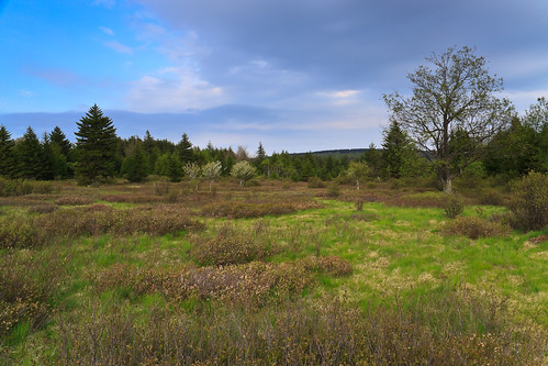
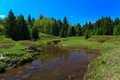
Dolly Sods Meadow, originally uploaded by Matthew Singer.
In the fall, I visited West Virginia’s Dolly Sods with my parents. The foliage on the blueberry bushes was amazing, but the trees had not yet turned. I was planning to return a week later to backpack through the wilderness area during its peak foliage, but my car broke down and I was unable to make the journey. So I decided I’d make a spring visit instead.
So, a week and a half ago, I did just that. I got together with Charlie (uvagolfer), another hiker and photographer I met on Flickr, and we did a one-night backpacking trip into the heart of the Dolly Sods Wilderness. We planned a route to cover all imaginable terrain, the northern high country along Blackbird Knob, the scenic views of Rocky Point, and the waterfalls and river terrain of the bottom of Red Creek.
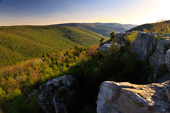
Our initial plan was to hike in from Red Creek Campground along the Blackbird Knob trail, turn down the Red Creek Trail and camp behind the rocks at Rocky Point, then head up Big Stonecoal Creek and return the whole length of the Blackbird Knob Trail. But we had to change our plan when we found no suitable camping at Rocky Point. In fact, when we got to Rocky Point, we couldn’t find the cliffs initially. The trail comes out on a talus slope offering a small view over Stonecoal gorge, but nothing spectacular. On our way out, we found an unofficial side trail blazed with cairns and decided to follow it. Sure enough, it led to the top of an amazing rock outcropping showing off views up and down Red Creek Canyon. We had the evening light to shoot, but had to return to the trail before it got too dark.
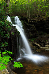
When we reached the intersection of the Rocky Point and Big Stonecoal Run trails and had to make a decision: head upstream a little bit where the terrain flattens out and there might be a campsite at the stream crossing, or head down a steep 1.2 mile trail to Red Creek where we knew there was a campsite. We chose to go up, and it’s a good thing we did. Almost immediately after the intersection, we found the big waterfall on Big Stonecoal Run and had some time to shoot some long exposures in the dark light. We found an awesome campsite among the spruce forest next to the stream.
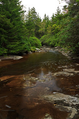
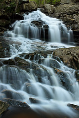
The next morning, we had to decide wither to continue on our planned route, or head down to Red Creek and circle back up the Red Creek Trail. It was a gray and cloudy day, and there were supposed to be more waterfalls below us. Had it been sunny, the scenic views and meadows would have been a better option, but we chose to go down and were not disappointed. We hit two more nice cascades on Big Stonecoal Run before hitting Red Creek. There were two gorgeous waterfalls on some side tributaries on the Red Creek Trail, and two more small, but wide drops on Red Creek itself. So, what should have taken us a few hours to hike ended up taking all day. We returned to the car just as the evening light was fading away.
There are some really awesome campsites in the Dolly Sods, some big enough to be called campgrounds. The first we came to was an island on Red Creek along the Blackbird Knob Trail. The island was mostly flat and grassy with a small patch of hemlock and spruce. Surrounded by water, it would have been a very serene place to stay. The second was at the confluence of Left Fork and Red Creek. Here, and area was cleared and grassy with room for lots of tents. In fact, a big group was using it that night. That site was probably once a homestead or a mining camp as there was once a railroad bed leading to it. The third big site was at the confluence of Big Stonecoal Run and Red Creek, another grassy area with 4 fire pits and lots of space to pitch tents. Of course there were some smaller, more private sites along the trails as well.
The Dolly Sods is possibly one of the most beautiful spot in the mid-atlantic, easily topping anything Virginia has, except maybe Mount Rogers. But the terrain and scenery at the Dolly Sods wouldn’t exist if it weren’t for its land use history. Regardless, the protection of this land as a wilderness area makes it a great reason to visit West Virginia. There are some other spots in the Monongahela that I hope to get to before I leave, but time is limited.