East Moscow Mountain
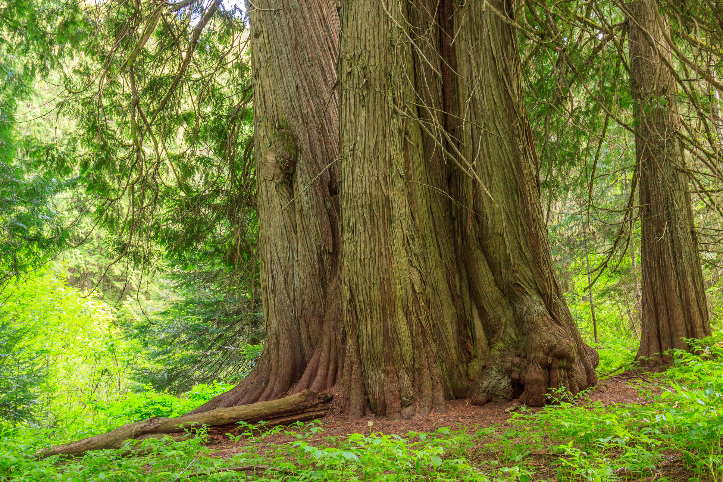
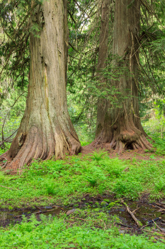
I had heard about the big trees on Moscow Mountain, but I had yet to experience them for myself. I first drove the road along the ridge back in 2010, the year I moved to Idaho. Back then, I passed some fairly large trees along the side of the road, and I assumed those were the trees everyone was talking about. But as I did some more research, I found that there really was a stand of old grown timber remaining on the north side of the mountain. The only problem is that it’s not well documented on the mountain itself. The trees are part of the old East Moscow Mountain park, which may or may not still be owned by the county. It’s clear that the picnic area near the Tamarack lookout is no longer maintained, but trails all along the mountain are maintained by the local mountain biking club. I suspect that they also maintain the picnic table at the cedar grove.
 When I first drove Moscow Mountain, I was able to drive all the way through, descending on Tamarack Road and riding all the way out to Troy. Last summer, the gate at the bottom of Tamarack Road remained closed through the season. So instead of parking on the ridge to walk to the lookout, people had to park at the bottom where the winter lot is generally plowed. That’s not really a big deal, it adds about a mile to the hike each way, and the ascending road is well shaded most of the way. But it does mean that a trip to the cedars and the lookout is going to require a good half-day’s commitment at least.
Both the lookout and the cedars are about 2 miles (give or take) from the lower parking area. When you hit the turn off to go to the lookout, instead continue straight on the road for another half mile until you reach what looks like a pull-off on your right. There you’ll see a trail enter the woods marked by two metal poles. Follow this trail about .2 miles into the heart of the old-growth cedars. There, you’ll find a picnic table surrounded by many impressively sized trees. You won’t find as many large trees as you would at Elk River or the Hobo Cedar Grove, but you’ll find some solitude and awe among some giants that rival the ones at the other groves.
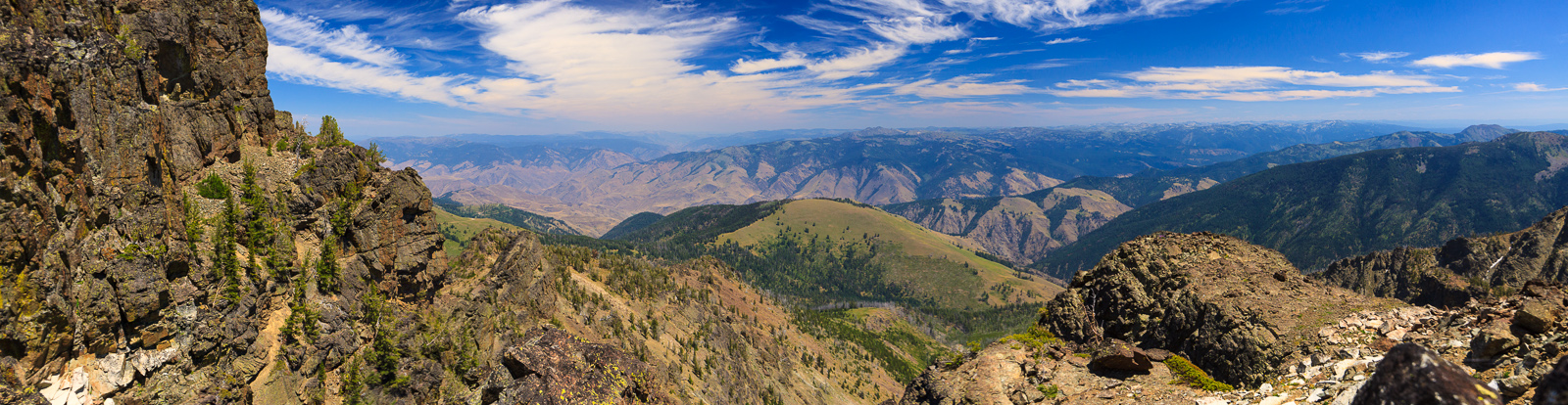
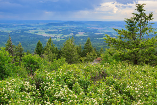
If you combine this with the lookout, as I did on Sunday, the entire trip will reach about 5.6 miles. That’s not bad, considering you get to experience both old-growth forest and a stunning view of the Palouse, all within 15 miles of Moscow.


Sunday began sunny and hot. Temperatures had exceeded 80 degrees when I parked my car at the Tamarack trailhead. I huffed and puffed and sweated my way to the top where I noticed that the temperature and humidity hadn’t really gotten any better, but at least I was in the shade and on relatively flat ground. We’ve had an unusual weather year in north Idaho. It began with a less than stellar winter. That’s not to say it was a dry winter, but it was quite warm, so on the few occasions that we did get snow it melted away pretty quickly. For the most part, it rained in January and February, leaving the burnt of the snowpack to the high elevations. By late April and early May, temperatures had risen into the 80’s at times. This past week, it even got up to 90, which is average for the middle of summer, but not Spring. On top of that, we’ve been experiencing daily thunderstorms each evening for over a week. Spring rains aren’t uncommon here, but thunderstorms are. We get a few each summer, but that’s about it. This year, we’ve gotten more in one week than I remember in some years.
I chose Sunday for my hike because the weather forecast predicted a clear, rain-free day. But the storms were to resume by evening. I started my hike late in the afternoon and enjoyed my walk up to the cedars. There, I took a break and cooled off before setting out for the lookout. I knew my sunshine was limited when I noticed the soft cloudy light in the cedar grove. I didn’t mind, though. Those are the best conditions for photographing the forest. When I finally packed up and headed back, I noticed that the air was heavy. It was humid, like hiking in the east. Of course, the funny thing is that the humidity on a “humid” day is still less than a “dry” day in the southern Appalachians, but when most days are below 20%, a day above 30% feels balmy. As I reached the lookout, I saw storm clouds and rain across the Palouse heading my way. The rain looked to be over Lewiston and Clarkston, but it was moving slowly. I had enough time to enjoy a snack with my view before I raced back down to the car. I did manage to beat the storm, but I think it was also moving in a more easterly direction than north, so it may not have hit the mountain for quite some time.
Now that I know where the cedars are, and how far the hike is, I look forward to returning in the winter on snowshoes.