|

Potlatch River


Potlatch River, originally uploaded by Matthew Singer.

There is a Forest Service hiking trail about 3 miles due north of our house, though it’s about 7 miles to drive there. Still, it’s close for those after-work getaways. The trail is a ~5mi. loop along the Potlatch River that takes you along the river and then up to the “rim” of the canyon. The first half mile or so is paved, but it then becomes a regular old trail through the woods. There are interpretive markers along the entire length.

I have been down on the trail several times, but yesterday was the first time I decided to do the entire loop. It turns out that while we have no snow left at the house, there is still plenty on the ground out there and what should have taken 2 hours to complete ended up taking a good chunk of my day (and energy!). I actually hiked the loop backward going up to the top first and coming back along the river. Had I gone the other direction, I may not have hiked the loop at all. The snow along the river was still 2+ feet deep and not packed down very well. Every other step or so, I’d sink down to my knees, and the dogs weren’t having an easier time.

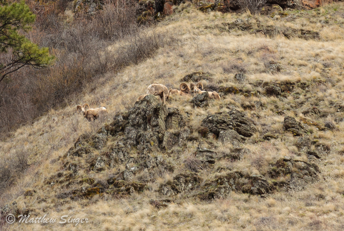
Still, despite the difficulty with the snow, this trail seems promising. It traverses through a diversity of habitats and promises to offer good wildlife. I came across the scat of deer, elk, and moose, but did not see any. It could be the combination of my timing (mid-day) and the fact that I had the dogs with me. I saw and heard tons of birds, but without binoculars, I couldn’t identify all of them. I heard Pileated woodpeckers and came across another unidentified woodpecker. There were chickadees galore, and a wren that flew across the trail. We spooked several grouse and saw a turkey in the big meadow by the river. And on the river, I caught a pair of Common merganser.

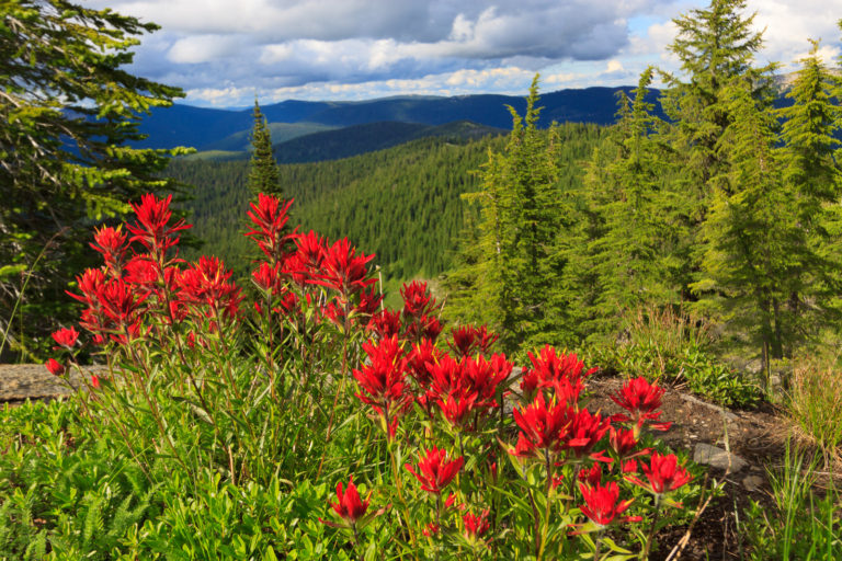
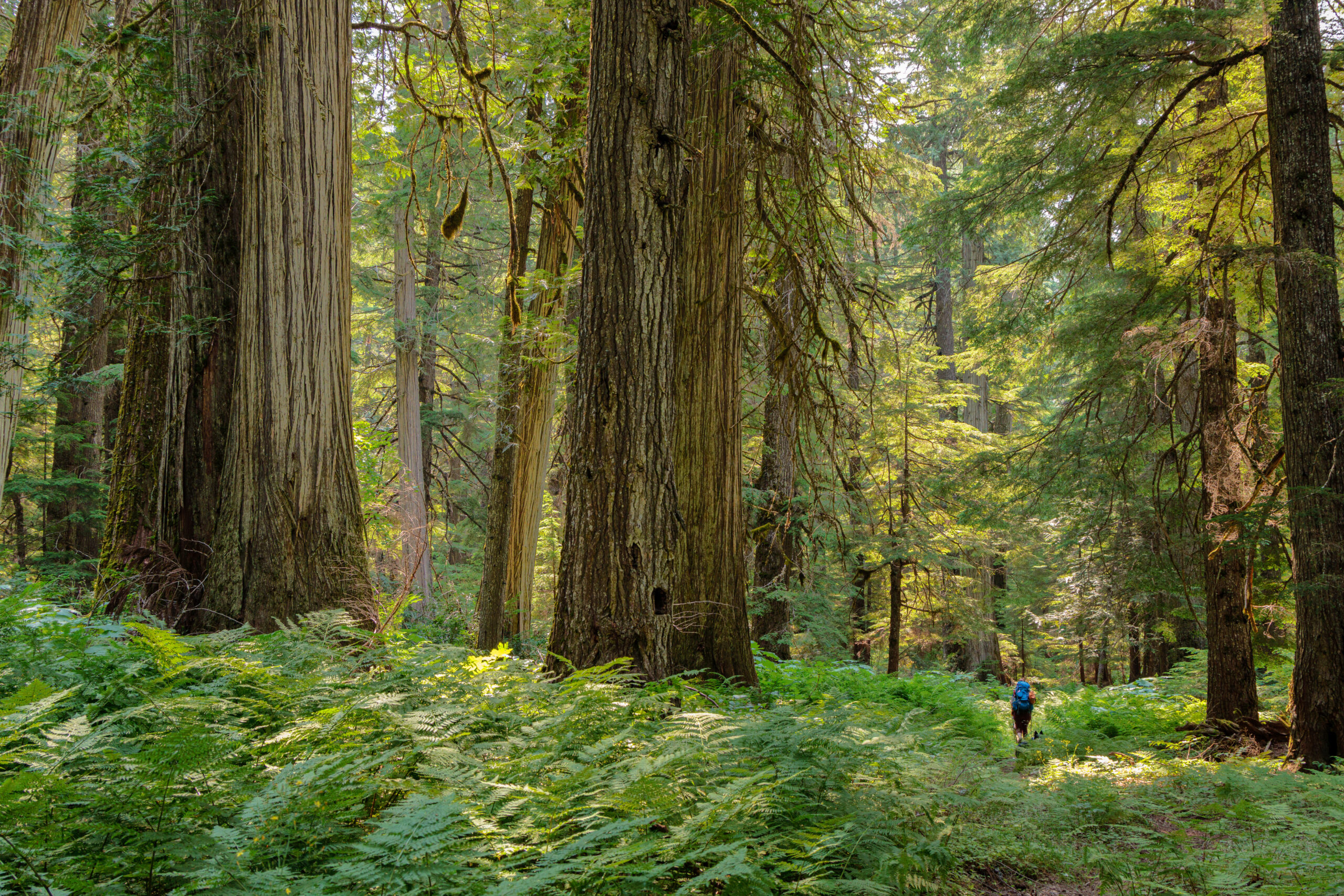
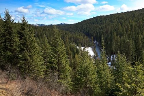
The trail takes you through a variety of habitats including new forest, thinned/open forest, mature forest, river, meadow, upland, lowland. The best surprise was a clearing with a scenic overlook on top of the canyon (pictured above). The view looks down upon the river, across a swatch of forest and out to some higher peaks off in the distance. Despite being so close to farm and logging lands, the trail feels like it’s secluded in its own patch of wilderness.

I think when the snow melts, the trail will be a bit more fun to explore and revisit. It’s nice to have something like this so close to home.

Similar Posts

  • Grandmother Mountain

    I finally got some time to get up to Freezeout to hike Grandmother Mountain. The flowers are out and it’s quite pretty, though it’s not the best year for flowers that I’ve seen. It could be that I got up there a little late. Everything seems to be coming out a little earlier this year than normal. But then, all of the flowers that are out still seem to be in peak bloom. I was especially hoping for a great beargrass year like I got to see three years ago. But even with the lower abundance of flowers, the ones…

  • Asotin Creek

    It’s funny that only two weeks ago, I was clearing snow from my driveway, and now there’s hardly any sign of winter left on the Palouse. Instead of snow, it rained for nearly a week straight. So when we caught a break in the weather on Saturday, I was quite happy to take advantage and begin my spring hiking season. I chose to go to Asotin Creek. The town of Asotin is located five miles south of Clarkston, Washington. It is here that Asotin Creek empties its water into the Snake River. But the hiking begins about 20 miles upstream…

  • Backpacking … for real

    After our jaunt to the fire tower on Shorty Peak, we decided to go out for a more conventional backpacking trip – the kind where we bring everything we need with us, including the shelter. We chose the upper priest river, a relatively mild trail to get us started. This trail goes 8 miles along the upper Priest River through lush old-growth forest, ending at a waterfall just miles from the Canadian border. In many ways, this trip reminded me of backpacking in the eastern US. If you’re looking for grand mountain views and high alpine lakes and meadows, this…

  • |

    Aurora

      This story begins Friday night when I learned that a large coronal mass ejection (CME) sent a burst of solar radiation from the sun headed toward Earth. It was predicted to intercept our atmosphere on the evening of the 8th, producing auroral activity in the high latitudes. Given the size of this solar storm, as described by spaceweather.com, I was a bit suspicious that the auroras migh be big enough to see all the way down here in northern Idaho. So, I kept a watch looking for evidence of such activity. On the evening of the 8th, I checked…

  • Grandmother and Grandfather Mountains

    Since my daughter was born a month ago, I haven’t been able to get out and stretch my legs on the trail. So when an opportunity came along to go hiking, I jumped at it. The past few weeks had been miserably hot, even to the point where escaping into the high elevations wouldn’t provide refuge from the heat. However, since nights were cool, the early morning hours were a pleasant time to be outside. So one morning, CJ and I hit up Spud Hill in Deary and made it down just in time for the heat to make life uncomfortable….

  • Duncan Knob

    View on Duncan Knob, originally uploaded by Matthew Singer. I got up early this morning to hike before the heat of the day. I would have liked to have gotten up earlier to be at the summit for that early light, but I enjoyed what I got. I arrived at my trailhead by 8:00 and reached the summit of Duncan Knob a little after 10 and I had the trail and the rocks to myself. I basked in the sunshine and enjoyed the view for almost an hour before heading back. When I got back on the Gap Creek Trail,…