Road Trip: Elk River Scenic Byway
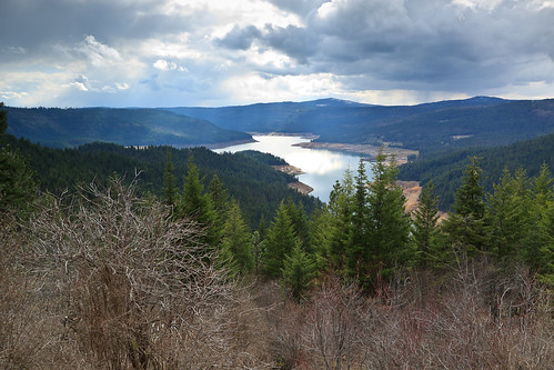
View over the Dworshak Reservoir

Last weekend, we went to Orofino to check out a riding mower that someone was selling. The drive to Orofino is quite scenic, dropping into a canyon, and then climbing back out before reaching Kendrick, passing a few small mountains, and then descending into the big canyon: the Clearwater River. Orofino is kind of neat in its geographic setting, it sits deep in the intersection of the North Fork of the Clearwater River and the Middle Fork (South Fork? ). It almost reminds me of those towns in Europe that are nested between steep mountains and a river, only not quite as elegant.

There is another way to get to Orofino, and that is by way of the Elk River Scenic Byway, which connects Elk River to Orofino. The scenic byway is pretty neat, and mostly scenic. From Orofino, it travels the high country above the Dworshak Reservoir, a lake created from a dam on the North Fork, one of the largest dams in the northwest. The dam created a lake about 50 miles up stream into some pretty and wild country. The reservoir itself is owned and operated by the Army Corps of Engineers, but beyond that, the land is primarily owned by the timber companies. So, in the course of driving through lush woodland and high country wetlands, you do come to some clearings.
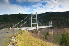
Dent Bridge
Dent Bridge
The road must cross the reservoir at some point, and does so by way of a very scenic and expensive looking suspension bridge. One only wonders how such a fancy structure was placed in the middle of nowhere, a fine use of federal funds no doubt. Nevertheless, it is a sight to see. Once on the north side of the reservoir, the road becomes unpaved and remains that way until reaching the town of Elk River. Since the land is owned by the logging companies, it is not uncommon to drive through an expansive clear-cut. These openings do provide views of the larger mountains, but with a very ugly foreground. Clear-cutting is probably not the best way to manage a forest for timber, and certainly not the best practice when it comes to impacting water quality, but that’ll be a debate for another day.

Once we hit Elk River, we’re back on familiar ground, skirting the still-frozen reservoir with a glimpse of the freshly snow-covered Elk Butte. From there, it’s back home by route 8. There are so many cool places to see around here, even by scenic drives, but as the price of gasoline continues to to rise, I wonder how many of these joy rides I’ll be able to take. But some of them will get me deep into the backcountry where I hope to escape for a few days at a time.

View Larger Map

Similar Posts

  • Moscow Mountain Snowshoe

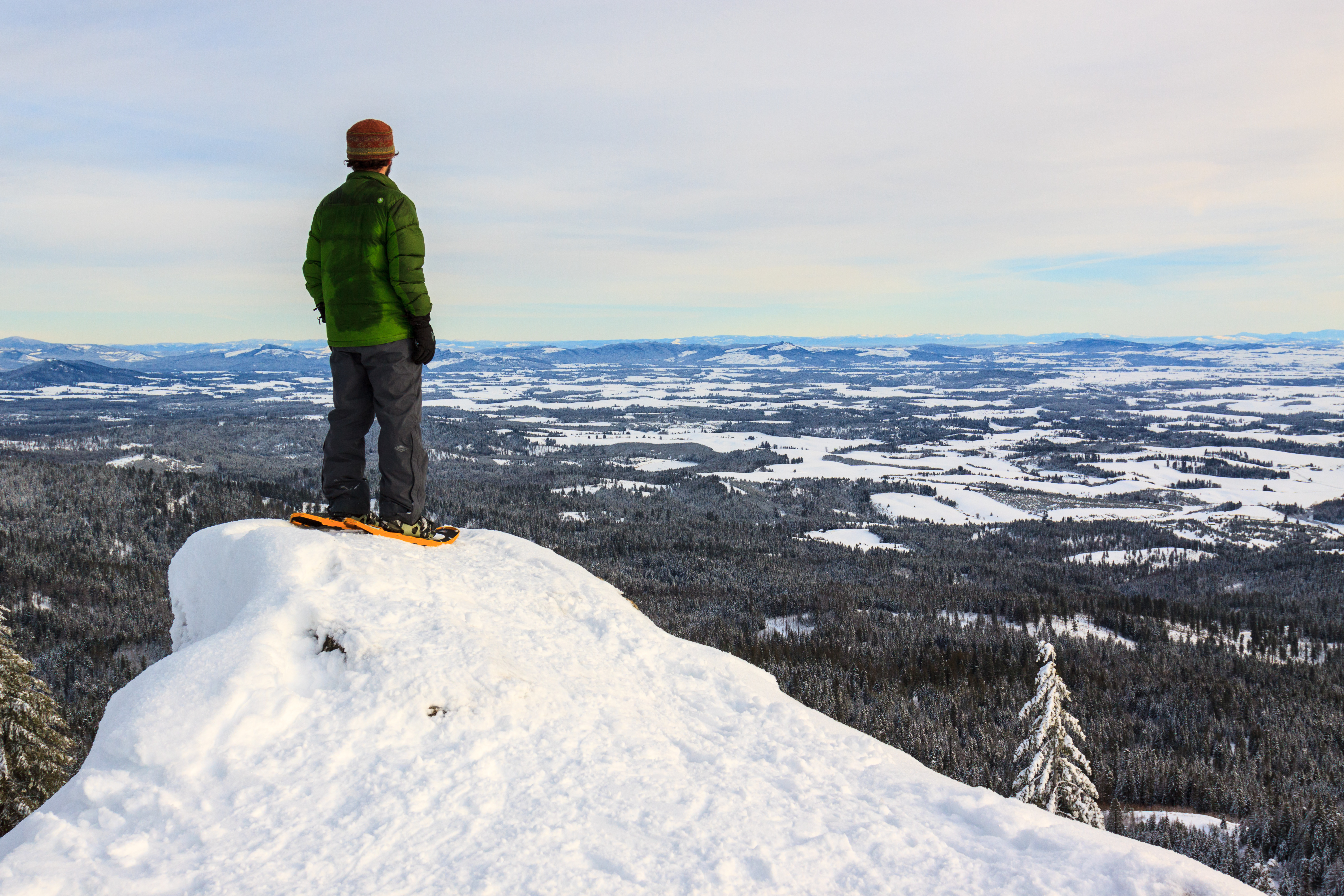
    Saturday, January 14, 2017 It’s not often that I get out to hike these days. But we’ve had a fantastic winter so far, and after a week of insanely cold temperatures and clear weather, I just had to get out and take advantage before the warm weather and rains took over. I’ve always wanted to hike to the lookout on East Moscow Mountain in the winter, but on every attempt, I was thwarted with people who just couldn’t make it all the way up. So on Saturday, I had a nice sunny day and some time to go for a…

  • Elk Butte

    Ever since I first visited Elk River during my interview trip in February 2010, I had a desire to get to the top of Elk Butte. After all, who could resist a lookout tower boasting 3000 foot views? The only problem was finding a suitable way to get up there. While the maps show a road to the summit, descriptions also warn that the summit is not accessible by car. Most people reach the summit by four-wheelers in the summer and snowmobiles in the winter. I had read that it was a 7-mile one-way trip, which ruled out a day…

  • Thanksgiving, Parts II & III

    Holy smokes, it’s almost Christmas and I never really finished posting about my Thanksgiving trip to Las Vegas. So, I’m going to give the abbreviated version of the rest of the trip and then move on to some more current events. When I visit Las Vegas, it’s not for the usual reasons that most people go for. This is the second time I’ve been in the city, and I still haven’t been down to the strip or inside a casino. But it’s the second time I’ve been down there to visit TJ and Clare. TJ is one of my best…

  • East Peak

    There are many peaks in the Wallowas that top 9000 feet, so East Peak might go unnoticed if it weren’t so easily accessible. It turns out that I’m not the only one who thought to use the Wallowa Lake Tramway to cover the first 3700 feet of elevation, reducing the climb to the peak to 1300 feet. This hike is featured in the book, and while I was’t expecting a crowd, we did pass three other hikers along the way, two of which are local to the area and hike to the peak regularly. The Wallowa Lake Tramway brings you…

  • National Aquarium in Baltimore

    National Aquarium in Baltimore Originally uploaded by Matthew Singer Last Saturday, Erin had to go to Towson to take her riding instructor exam. I dropped her off at Goucher College and headed to REI, only to find that they didn’t open for another hour, so I drove down the road to Borders, looked at books I couldn’t afford, and played on the reliable fast internet for a while. It’s funny, when I went into the the store at 9:30, there were barely any cars in the parking lot. When I left at 11:00, the lot was full. I did make…

  • |

    Asotin Creek

    The Deep Gorge Originally uploaded by Matthew Singer While we were out in Idaho, we had the pleasure of taking a day and hiking. While the Moscow area was devoid of any snow this year, the surrounding mountains still had a bit of the white stuff, and forget about trying to get to the big mountains. It was winter, after all. I’m particularly excited about the nearly year-round hiking available out there. In the summer, I can retreat to the high country. In the winter, I can head low into the canyons where it stays pretty warm late into the…