Thanksgiving in Las Vegas, Part 1: The drive down
One of my best friends from high school invited Erin and I down to Las Vegas for Thanksgiving. In fact, we were invited down last year, but we weren’t able to make it. Therefore, I decided that we’d make it work this year. Erin still wanted to host our annual Thanksgiving dinner at our house, so we had one on Saturday before everyone left for their break, and on Sunday, we packed up the car and headed south.
This trip has a lot of firsts in it for me. It was my first time venturing south of McCall, my first time stopping in Boise, my first time driving through Nevada. It wasn’t my first time in Las Vegas, however. If you recall, I had actually been in the city four years earlier for this same friend’s wedding.
I love road trips because it’s a chance to see new places with freedom along the journey. It’s the freedom to stop spontaneously to explore attractions that come up without prior knowledge. It’s the freedom to bring dogs with you, which we did. And in some cases, it’s cheaper than flying. But road tripping in the winter has its downsides, the biggest of which is the short daylight cycle. We spent Sunday morning cleaning up the house and packing, which meant we didn’t get on the road until after noon. This gave us about 4 hours of daylight, so by the time we reached Cascade, it was dark. I enjoy watching the scenery as I drive. It’s what keeps me awake and interested. But the drive from Cascade to Boise, and then Boise to Twin Falls was completed in the dark. A similar situation occured the next day, but resulted from a different cause.
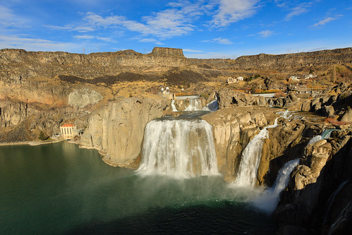
We actually woke up fairly early on Monday, checking out of the hotel a little after 9:00 and grabbed breakfast at the nearby Shari’s. But, Twin Falls had something I wanted to see: the falls. Just north of town, the Snake River cuts a fairly deep slot canyon in the valley, and here, the river tubmles 212 feet down Shoshone Falls. So we drove out to the falls after breakfast and played around for a while, taking the dogs on a walk to one of the overlooks and just enjoying the warm air and sunshine. It was a beautiful sight, but by the time we actually hit the road, it was noon again.
From Twin Falls, it’s about an hour to the Nevada Border where the small casino town of Jackpot lies. It’s about another hour to Wells, where we intersect I-80, but continue through. It’s about 2 more hours to the town of Ely, gateway to the Great Basin. But between Wells and Ely, there is virtually nothing. In fact, there was a sign just out of wells reading “Next Gas 126 Miles.” To add to the nothingness, the road is fairly straight, often continuing for 10 miles without requiring the use of the steering wheel. There is only one major intersection in this stretch, and there used to be a gas station there. Now it sits empty and the residents have an army of peacocks.
As desolate as northern Nevada might be, it’s not all bad. The valleys are wide and flat, but flanked by some rather tall mountain ranges. It’s particularly nice to drive in November because the mountains are snow-capped, though had this been late Spring or early Fall, I would have been tempted to take a side road into the mountains and camp.
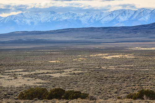
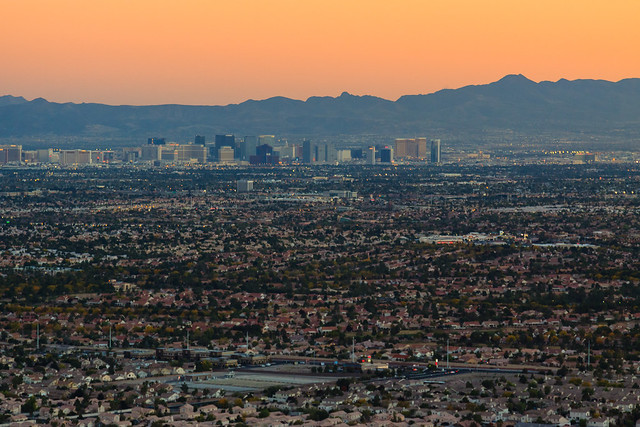
By the time we made it to Ely, it was dark, which meant no more gawking at the awesome landscape. It also meant a 4-hour drive in the dark, which just made the time go by that much slower. Driving through Nevada just makes you aware of how lonely you can be. This landscape is dark at night. If you’ve never driven through these parts of the destert Southwest at night, you have no idea just how dark it is. This is one of the only places in the lower 48 states where the light pollution drops to almost zero. In that regard, Nevada is awesome. I just wish it had been a clear night. As we got closer and closer to the city, I began to notice a faint glow emanating from the southern mountains. It became apparant just how bright civilization can be as we approached our intersection with I-15. The truck stop in the middle of the desert put out more light than the entire town of Deary during a football game. Once on the interstate, we were about 15 miles out of town. As we crested over the final pass, the ocean of light revealed itself. Suddenly, you go from feeling completely alone to wondering if you were going to have any personal space in the valley. In any other metropolitan area, the transition from rural to urban is somewhat gradual. In Las Vegas, it’s as stark as transitioning from dry land to ocean.
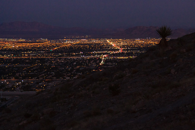
Welcome to suburban sprawl in the southwest.
Coming up…
Part II: Visiting friends and playing in the desert.
Part III: The drive up.