Weekend Getaway, Part III

View at 5-Mile Point
View of the Imnaha River Canyon from 5-Mile Point


Day 3: Canyons

Storm's Approachin'
Storms over the Wallowas

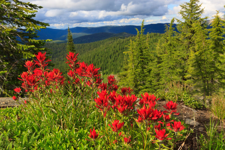
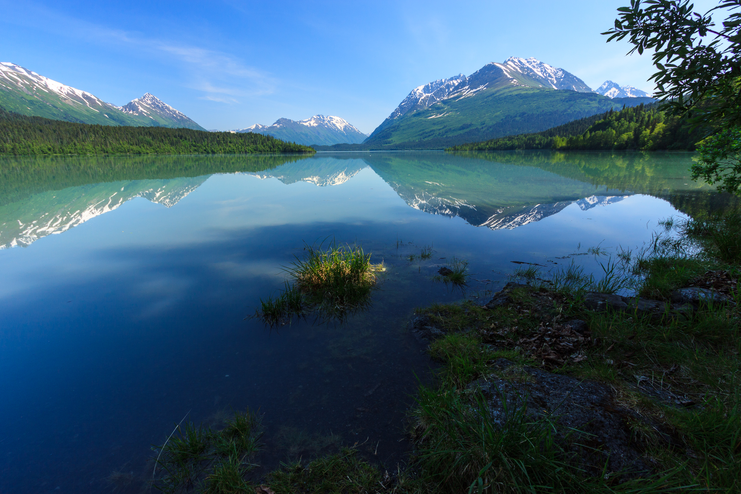
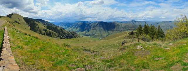
It’s a week later and I’m only now getting to the end of our romantic weekend away to celebrate our anniversary. Saturday was our third and final full day in Oregon. Thursday we had a nice scenic road trip to Enterprise. Friday, we explored the mountains. And Today (a week ago), we explored the canyons. Hells Canyon is a remarkable geologic feature. It’s deeper than the Grand Canyon, and on both sides it’s flanked by two major canyons. On the Idaho side, it’s the Salmon River with the Seven Devils creating the wall between the two. On the Oregon side, it’s the Imnaha river, separated by an extension of the plateau making up the Wallowa Valley. This formation between the two canyons rises up over 6000 feet in elevation and offers spectacular views on both sides. Unfortunately, we were unable to get over to the Snake River side at this time.

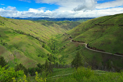
Our morning started out with breakfast outside again. I had a wonderful skillet with eggs and fresh local veggies. The sun was shining and the air was warm, but the forecast wasn’t to be so good for the rest of the day. Despite my best attempts to get out early, we still seemed to get a late start. The goal was to drive down to Imnaha and explore Hells Canyon a bit. Imnaha sits at the bottom of the Imnaha River canyon. At about 2000 feet, it’s often 10-20 degrees warmer and doesn’t get the harsh snows that the higher elevations receive. Thus, Imnaha was the winter refuge of choice for the Nez Perce.

Getting Closer
Storms in the Imnaha Canyon

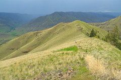
Today, the town of Imnaha is the end of the paved road, 25 miles into the canyon from Joseph. There’s not much to the town: a tiny post office, a general store, and a couple of houses. But it is the gateway into the Hells Canyon National Recreation Area. We headed up the road to Hat Point, though Hat Point wasn’t our destination. My plan was to get up on the rim, hike around and find some views of the Snake River 5000 feet below. But our plan was thwarted 6-7 miles in when, at 5600 feet, we ran into snow blocking the road. The trip wasn’t without its merits. The entire drive up, the view over the Imnaha gorge just gets better and better. While we were up there, we watched as a thunderstorm developed over the Wallowas and were glad we weren’t over there. The rains slowly filled the canyon, but never actually fell upon us. Even as we drove back down into Imnaha, I was sure we’d hit the rains, but they passed before we got there.

We went back to Joseph for a late afternoon snack, and then back to the B&B for a bit. We had made reservations for a nice dinner at a place called Caldera’s in Joseph. Their menu is seasonal and the food made with fresh, local ingredients. The food was to die for.

Day 4: The Return Trip

Rattlesnake Grade
Rattlesnake Grade

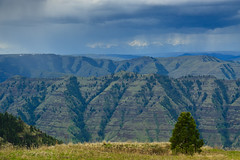
All good things must come to an end. And so, Sunday, we got up early, packed, had breakfast, and headed back for home. Erin had to work, so we couldn’t make an exploratory drive out of it. We stopped at the Joseph Canyon overlook to use the restrooms, and we made one brief stop on the way down rattlesnake grade so that I could take a photo of the canyon.

It’s sad that the trip had to end so soon, but my days in the Wallowas are not over. I plan to make at least one trip there annually to do some hiking and backpacking. The Wallowas are a very awesome mountain range and their relative obscurity makes them that much more special.

Similar Posts

  • Grandmother Mountain

    I finally got some time to get up to Freezeout to hike Grandmother Mountain. The flowers are out and it’s quite pretty, though it’s not the best year for flowers that I’ve seen. It could be that I got up there a little late. Everything seems to be coming out a little earlier this year than normal. But then, all of the flowers that are out still seem to be in peak bloom. I was especially hoping for a great beargrass year like I got to see three years ago. But even with the lower abundance of flowers, the ones…

  • Oregon Butte: The Successful Failure

    View Oregon Butte – 5/26-27/2012 in a larger map Things don’t always go according to plan. Along the journey, you discover new interests or find obstacles that end up providing you with a totally different experience than originally expected. This lesson was hard hit this weekend as we attempted a backpacking trip in the Blue Mountains of southeastern Washington. The trip was a success, but certainly not what I had expected. It’s really a lesson in not getting enough information ahead of time. On paper, it looked like the perfect trip. It’s a 16-mile loop up Panjab Creek to the…

  • Grandfather Mountain: A pre-winter hike

      I’ve been very busy with graduate school, and that has put hiking and exploring on hold, but that also has me itching to get out, especially as my days of decent hiking weather grow shorter and shorter. I’ve been trying to get up to Sandpoint to get in one last snow-free summit for the season, but time just hasn’t been on my side. So this weekend, I headed up to Grandfather Mountain with Erin for what might be our last chance to get up there this year. I’ve been to Grandmother Mountain many times since moving out here, but…

  • Lookout Mountain

    Everytime I’m up on Grandmother Mountain, I look to the east and see the bald dome of Lookout Mountain rising over the Marble Creek drainage and I long to stand on top and look down from the other side. Finally, with my parents and sister visiting, I decided this would be the perfect opportunity to try out this trail. There are several mountains in northern Idaho named Lookout. This is not the ski area on the Idaho-Montana border off of I-90. This is not the peak in the Selkirks north of Sandpoint of the same name. This is in the…

  • Alaska

    I was in Alaska from June 10-17. This trip was mostly about business with a little bit of pleasure while I was out there. I attended the 2015 meeting of the Animal Behavior Society. This wasn’t my first scientific meeting. But it was my first time at ABS and my first meeting where I was alone. I was the only one there from the University of Idaho, and I didn’t know anyone else there. That made it a daunting challenge to socialize from scratch. But then, the one of the purposes of being there was to meet new people in my…

  • |

    Swimming Holes

    The Lower Falls on Overall Run, originally uploaded by Matthew Singer. When the weather turns hot and humid, there’s no better way to stay cool than at your local swimming hole. Swimming holes offer something that your pool does not: privacy, seclusion, crisp cold water, and no chemicals. That icy mountain stream gets the old heart moving at first, but feels refreshing when the air temperature passes 90 degrees. At camp, we have two swimming holes. We frequently take kids to one along Jeremy’s Run because we can walk there. Jeremy’s Run is nice. There’s an upper pool with a…