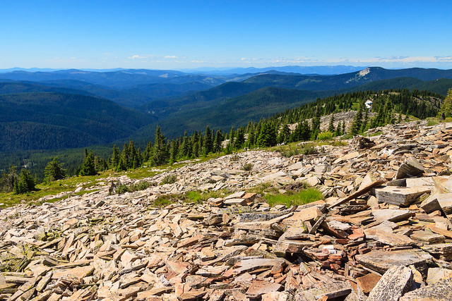
Lookout Mountain

View North

Everytime I’m up on Grandmother Mountain, I look to the east and see the bald dome of Lookout Mountain rising over the Marble Creek drainage and I long to stand on top and look down from the other side. Finally, with my parents and sister visiting, I decided this would be the perfect opportunity to try out this trail.

There are several mountains in northern Idaho named Lookout. This is not the ski area on the Idaho-Montana border off of I-90. This is not the peak in the Selkirks north of Sandpoint of the same name. This is in the St. Joe National Forest, accessed from FS-301, the same road that leads to Freezeout Saddle and the Grandmother Mountain trail outside of Clarkia.

Lookout Mountain is unique for this area because its summit is completely bald, offering spectacular views in 360 degrees. The summit stands at 6789 feet above sea level and overlooks Lost Lake, the nearest glacial tarn of considerable size to the Moscow Area. This trail is absolutely beautiful and probably seldom used compared to the neighboring Grandmother Mountain trail. The trailhead is only 7 miles farther down the road, but due to the rough road conditions, it took an extra hour of driving to get there. Despite its apparent remoteness, the trail and trailhead are in great condition. The trailhead features several developed campsites with picnic tables and fire rings along with a well-maintained privy. There are also two other small campgrounds nearby. Next time I hike this trail, I may have to spend the night.

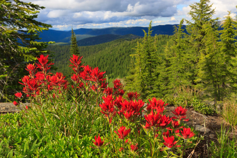
From the trailhead at Orphan Saddle, it’s a 4-mile walk to the summit of Lookout Mountain. The trip isn’t very difficult, though you’ll begin your journey with a 600 foot ascent in just under a mile. By the time you start getting tired, you reach the ridge at 6500 feet and the journey becomes a relaxing meander through a mixture of hemlock forest and grassy field. The next two miles are gentle, holding elevation until the Widow Peak trial splits off, and then gently descending into the saddle above Lost Lake. The last mile is a 700 foot ascent to the summit, and though it may seem steep, you’re on the spine of the ridge with views that get better with every step you take. Take as much time as you need and eventually, you’ll find you can’t go any higher.

The return journey isn’t too bad. The descent on the way out was gradual and not very noticeable, but you may notice the uphill on the return. However, it’s still gentle compared to the two ascents (now descents) on the way out. In short, this may have become my new favorite local hike. Unfortunately, it is such a pain in the butt to get to that I’ll probably still stick to Grandmother Mountain as my go-to escape to higher elevations.
Map and elevation statistics

More Photos

Similar Posts

  • Grandmother Mountain

    I finally got some time to get up to Freezeout to hike Grandmother Mountain. The flowers are out and it’s quite pretty, though it’s not the best year for flowers that I’ve seen. It could be that I got up there a little late. Everything seems to be coming out a little earlier this year than normal. But then, all of the flowers that are out still seem to be in peak bloom. I was especially hoping for a great beargrass year like I got to see three years ago. But even with the lower abundance of flowers, the ones…

  • |

    View from Mount Rogers

    View from Mount Rogers Originally uploaded by mineral2. Oops! I promised a detailed account of my Mount Rogers extravagansa, but forgot to post about it here. So here it is, almost two months late. Of course, you can visit the photo galleries for photos as they are now up there. But here’s my adventure: Sunday: I left Alabama on Sunday. I said my good byes to everyone, including my 5-foot wild gray ratsnake rescue friend (hehehe), and my partings from Jen. We’re still together for now, but time shall tell if the distance thing works out. So anyway, I headed…

  • |

    Potlatch River

    Potlatch River, originally uploaded by Matthew Singer. There is a Forest Service hiking trail about 3 miles due north of our house, though it’s about 7 miles to drive there. Still, it’s close for those after-work getaways. The trail is a ~5mi. loop along the Potlatch River that takes you along the river and then up to the “rim” of the canyon. The first half mile or so is paved, but it then becomes a regular old trail through the woods. There are interpretive markers along the entire length. I have been down on the trail several times, but yesterday…

  • Adventures with Clara: Hobo Cedar Grove

    The Hobo Cedar Grove is a nice easy 1-mile hike through a grove of giant old-growth trees. It is the perfect hike for toddlers to explore nature, which is why we brought Clara up there on Sunday. She enjoyed the large trees, but wasn’t into walking the trail much. Eventually Erin had to carry her for most of the hike. In hindsight, she may not have completely gotten over her illness from Friday and Saturday.

  • Hells Canyon

    Panoramic View from our vantage point, originally uploaded by Matthew Singer. This story begins with Luke and I itching to get out into the backcountry. Although it’s the middle of June, the combination of an unusually cold and wet Spring with the very productive winter has left many of the high country destinations (above 5000 ft.) still buried under 100+ inches of snow in places. And even some of the lower areas are still blocked with impassible snow drifts on the road. This makes our options quite limited. The one place we’re sure to have access is Hells Canyon. With…

  • | |

    Exploring

    The past week, my parents were in town visiting and we spent the week exploring and showing them our favorite places in the area. We’d usually leave fairly early in the morning and get back kinda late, always exhausted. As a result, I haven’t been able to post some detailed updates on the awesome places that we’ve been. I’ll try to summarize the week here. Saturday, July 23: Picked my parents up from the Lewiston airport. Turns out, there was some kind of airplane festival going on so we decided to have a look. There were planes out on the…