Asotin Creek… sort of.
The photo above was taken in February of 2010, my first visit to Asotin Creek. I’ve been back a couple of times as it is usually a reliable winter hike that is free of snow. I had never gone down in the spring when everything is green, and certainly not in the summer when temperatures can reach the 100 degree mark. So it was that Erin and I decided to spend a day down at Asotin Creek. The local wildflowers should be in bloom, and the hills might show hints of colors other than the drab brown of dried grass. We would also take the GPS and search for geocaches hidden along the trail. There are many.
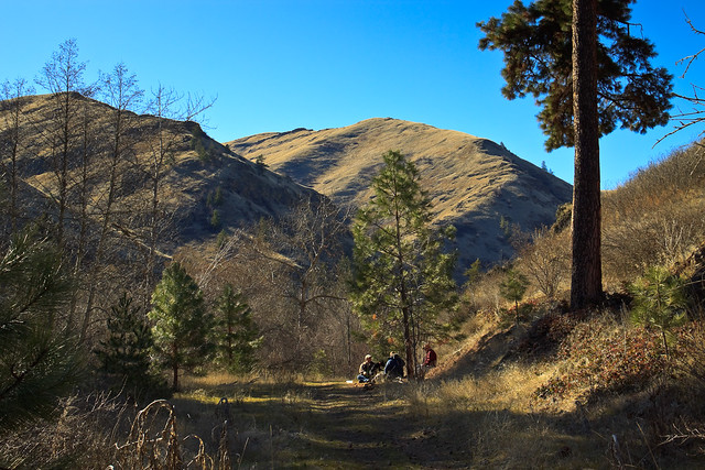
So, we set out for the canyon, stopping in Clarkston to grab some food for Erin. We pulled off at the Headgate County Park to grab a few caches and let the dogs out to stretch their legs. As we approached the wildlife management area, I saw signs that a Discovery Pass was required in order to park. Washington has recently begun charging for vehicle access to its state recreation lands, and the Asotin Creek trailhead falls under this juisdiction. A day pass is $10, and an annual pass is $30. I certainly wasn’t going to pay that much for a day trip, and I don’t visit the state lands enough to justify a $30 pass.
During the winter, there is a gate across the road just before the trailhead, kept closed to keep cars out during the mating season. The gate is opened in the spring and summer, which allowed us to drive past the trailhead, through the state land, and into the national forest. Here the road climbs out of the canyons and into the high country (5000 ft.) where there are more trees and more green grass, and subsequently more wildflowers. The meadows were full of Grass Widow, Yellow Bells, Mountain Bluebell, and even the occasional paintbrush had started to bloom. As much as I like the desert-like habitat down in the canyons, the upper elevations are really my favorite place to be. Of course, the the best part of being up top is the view.
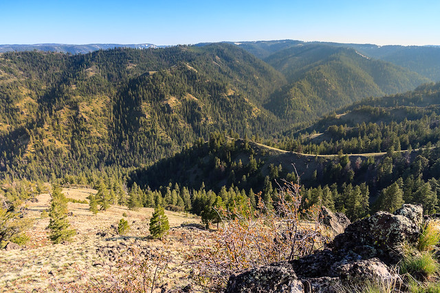
When we reached the top, I pulled off the road onto a flat clearing with a view over the Asotin Creek canyon. Nearby, someone was burning and that had produced a thick haze over the mountains, but the view was still magnificent. I thought that this would make for a great campsite, and then I found a fire ring from someone else’s previous visit. We explored the meadow, looking at the wildflowers and then ate lunch.
We were really after a trail that traversed Pinkham Ridge. If we weren’t going to hike in Asotin Creek, we might as well hike above it. The Pinkham Ridge trail is really the top of the Asotin Creek trail, for after the trail heads upstream about 10 miles, it turns and heads up the steep canyon walls to Pinkham Ridge where it ends at a Forest Service road where we had parked. This last portion of the trail hasn’t been hiked very much and it certainly hasn’t been maintained. There’s no signs at the trailhead, and the trail itself seemed to have blended back in with the scenery. However, the brush and forest isn’t very thick and the grasses are short, so walking in this area isn’t too difficult, especially since the trail follows a narrow ridge. However if you were to come up this way, be sure to at least carry a map, but a GPS might be useful too.
We hiked just under 2 miles down the ridge to a little shelf and clearing, and there we laid out a blanket and napped in the tranquility above the canyon. We saw Mountain Bluebird and Stellar’s Jays and listened to the songs of the Chipping Sparrow, Chickadees, and nuthatches. So, what began as a disappointment turned out to be an awesome adventure. Next time, we can prepare for a full day in the Blue Mountains and just skip Asotin Creek altogether.