A Tale of Two Hikes
I was left home alone this weekend. Erin had gone down to Boise and Ontario, OR for a regional meeting of one of the support groups she attends. She was also taking Lana down to Boise to be transported to her new home with a trainer in Wyoming. So while she was gone for three days, I was in charge of watching the animals. This unfortunately meant I couldn’t go out for any extended trips. No backpacking. No camping.
So I did what any responsible adult would do when he’s got the house to himself: I threw a party. Well, not a kegger or anything huge. I invited the remaining Biology graduate students out for a cook-out and fire. It was a blast. I’ve got to do this more often. I think everyone enjoyed getting out of Moscow for the evening, too.
But back to the hikes. Saturday turned into a hike followed by a cook-out and fire. A few people came out early and we headed to Elk Creek Falls. One of the new post-docs and her husband had just arrived and this was their first excursion out of town. It was a nice day to go to the falls. The hill sides were still green and the water was raging. The vegetation in front of the lower falls overlook had been chopped back so there was a clear view. I’ve been to Elk Creek Falls many times now, and yet I don’t have any photos posted online. How can that be?
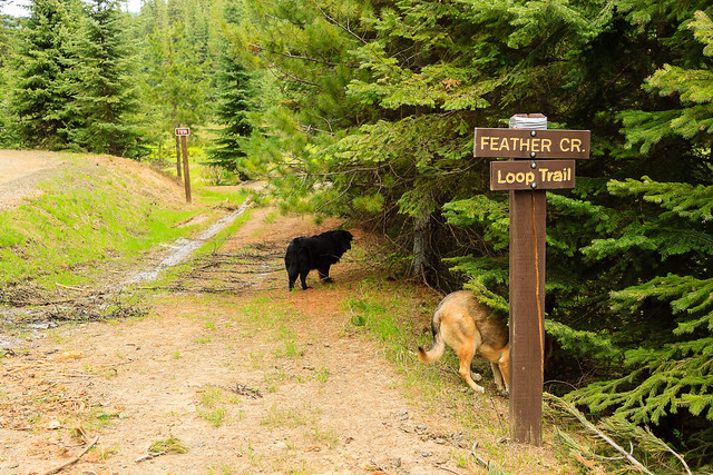
Today, I took the dogs on a longer hike. Tyler, Gen, and Matthieu went for a hike on the Feather Creek loop last weekend, and I wanted to check it out for myself. This trail isn’t very well publicized, which might be why I had a hard time figuring out where it was on my own. I heard about it from Mattheiu, who in turn found out about it from the guys at Hyperspud Sports in town. The five-mile loop isn’t very scenic. There are no views and no landmark points of interest. It’s just a trail that follows a creek for two miles, and then returns through the woods.
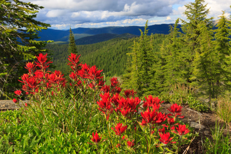
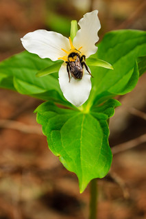
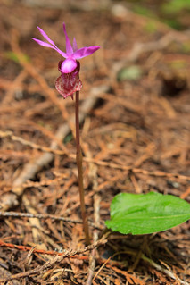
What it lacks in major attractions, it makes up for in the little things. At first, it seemed like this was going to be a hike through recently logged / newly regenerating forest. While it’s certainly not old growth or as mature as the forsest surrounding Elk Creek Falls, but it becomes a nice woodland hike. The first thing I noticed were the flowers. Along the creek, there were tons of Western Trillium and Anemones in bloom. As the trail left the creek and ascended the hillside into the woods, the Calypso Orchids became more abundant.
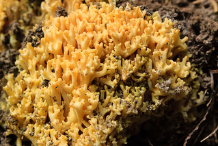
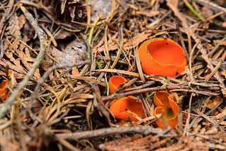
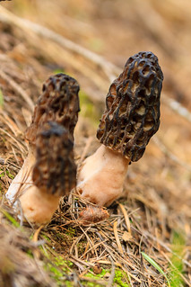
The trail meandered back into a hollow where it crosses a few streams. Here the forest is full of larger trees, mostly cedar with some pines and firs. And then I stumbled upon a strange mushroom that looked like coral. Suddenly, I began to see it growing everywhere. A few steps farther down the trail, I noticed another mushroom, this one bright orange and shaped like a bowl. The final fungal find of the day were morrells, five in total. This was my first ever sighting of morrells in the wild. I’ve marked the spot on the GPS in hopes that I can return and collect some for cooking with.
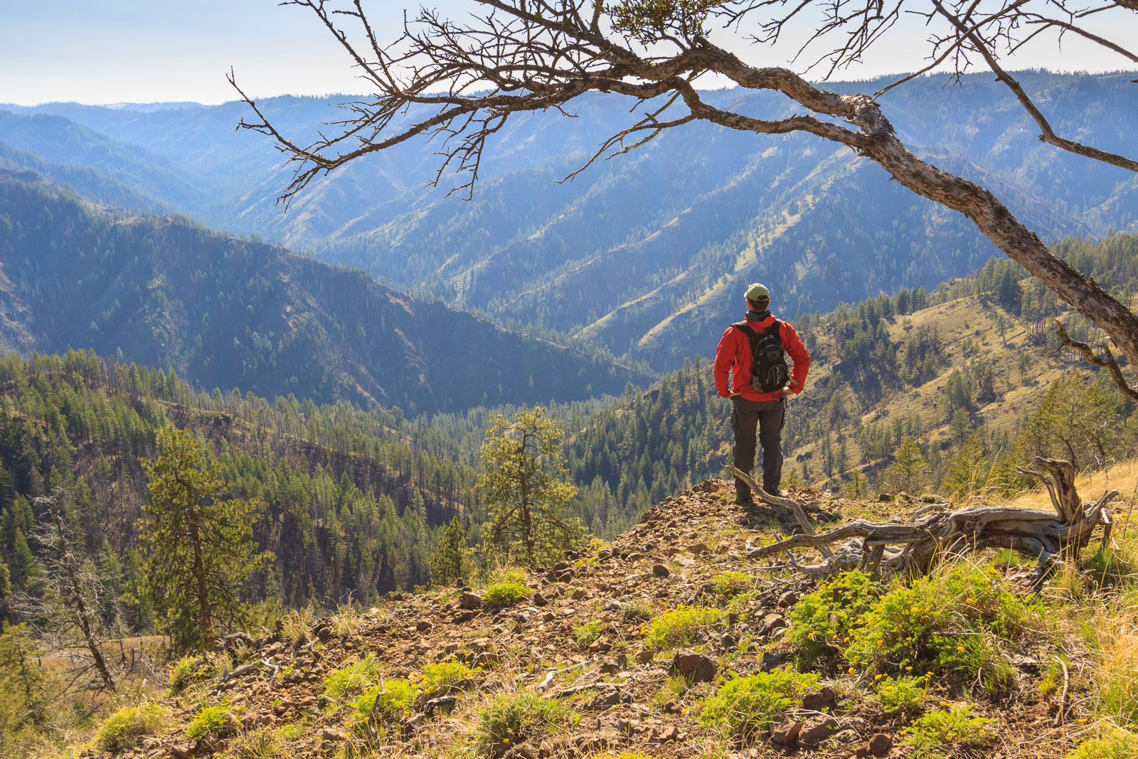
Feather Creek is a five-mile loop through a nice mix of riparian and forest habitats. Though there are no major destinations along the trail, it provides a nice escape from the developed world and provides a couple hours of relaxation and feeling of solitude. Because its not well publicized, you’re likely to have this trail to yourself. This appears to be a promising wildflower and flora hike, but also seems like a promising place for wildlife sightings. There was plenty of bird activity, though I admit to not taking the time to try and identify everything I heard and saw. The trail is fairly new and appears to be well maintained. It’s not very steep and there’s not much elevation change, making it an easy hike for a family. There is a longer loop that takes off up the ridge, though the sign at the beginning claims this trail hasn’t been completed yet.
Feather Creek is located a few miles north of Bovill. To get there, travel north on Rt. 3 about 4 miles from Bovill. Turn left onto Talapus Creek Road. There will be a sign for the Feather Creek trail. Continue for a mile and turn right onto Feather Creek Road. The trailhead has a sign about 1.7 miles up.