Oregon Butte

In a world where there are so many playgrounds at arm’s reach, the Blue Mountains of southeastern Washington are so often overlooked. They’re not as tall as the surrounding mountain ranges – the highest point is just shy of 6400 feet. There are no natural lakes, and the valleys are actually canyons carved into an uplifted basalt lava flow. But while they may not have the grandeur of the nearby glaciated Wallowas, the Blue Mountains are quite beautiful and offer some great hiking experiences. A large portion of the Blue Mountains is protected under the Wenaha-Tucannon Wilderness Area, and a network of trails takes hikers from the scenic ridge tops to the raging rivers for a plethora of panoramic viewpoints and wildlife viewing opportunities.

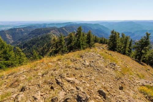
At 6387 feet, Oregon Butte is the highest point in Washington’s Blue Mountains. That puts it on par with other local peaks such as Grandmother Mountain. Temperatures are often 20-30 degrees cooler than the surrounding cities which makes this hike a great place to escape the summer heat. The Blue Mountains are drier than some of the other mountains of comparable height, and that can be reflected in the vegetation. However, there are plenty of reliable springs with great tasting water. While the official government warning states to treat all water in the backcountry, these springs feature pipes coming directly out of the ground and are generally safe for direct consumption.

The summit of Oregon Butte with the fire lookout.

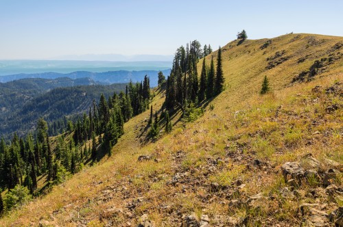
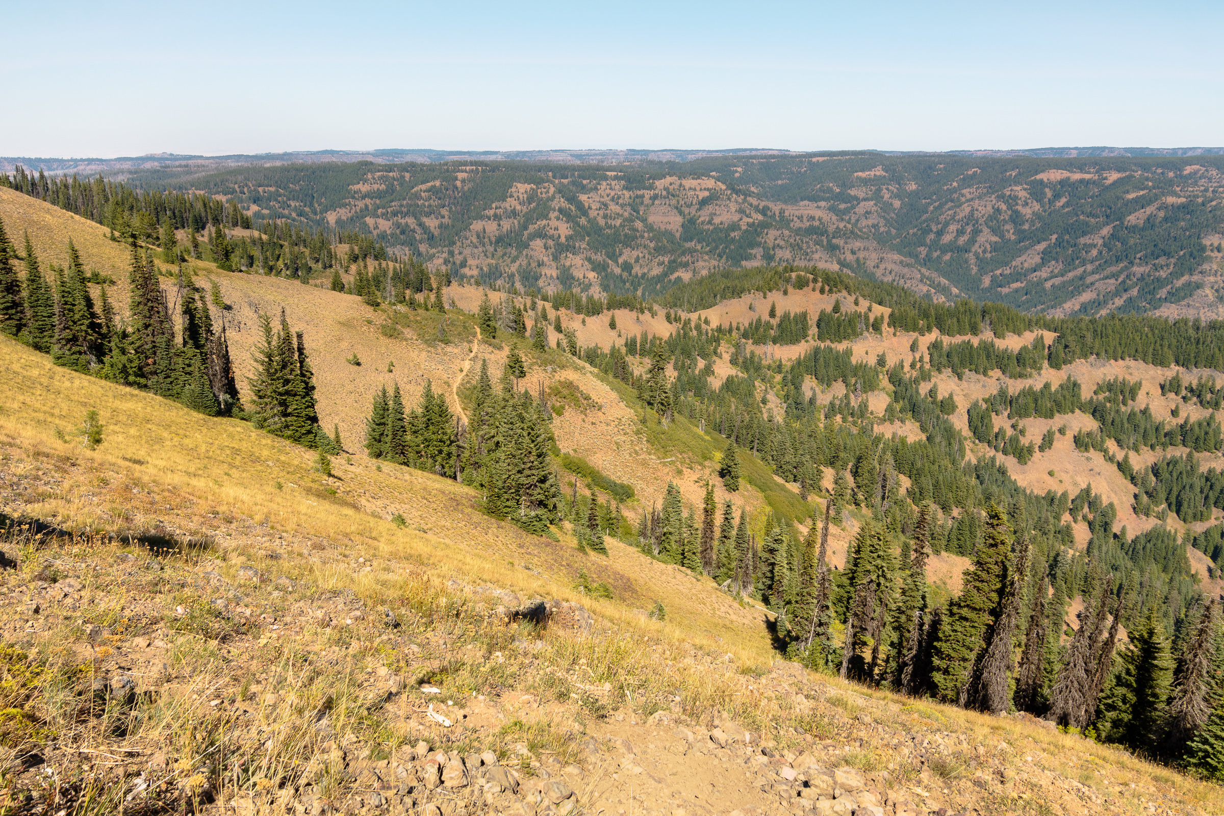
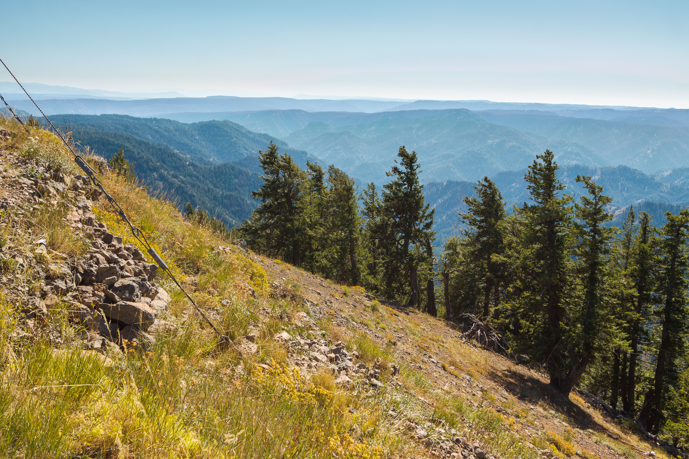
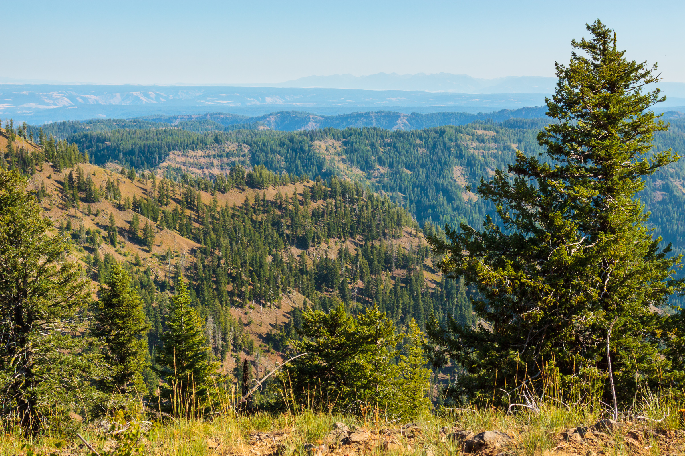
The hike to Oregon Butte is an easy 3-miles from the Teepee trailhead (see map below). You’ll gain about 900 feet in elevation while walking through lush ridge-top forests and mountain meadows. In late spring-early summer, this area is carpeted in wildflowers. In late summer, it’s nice to see that there is still green left on the hills when everything else has turned brown. There are still wildflowers blooming. The fields contain an abundance of western aster, paintbrush, goldenrods, and other late-summer flowers. The huckleberries are also ripe, though not nearly as abundant as they are at Freezeout.

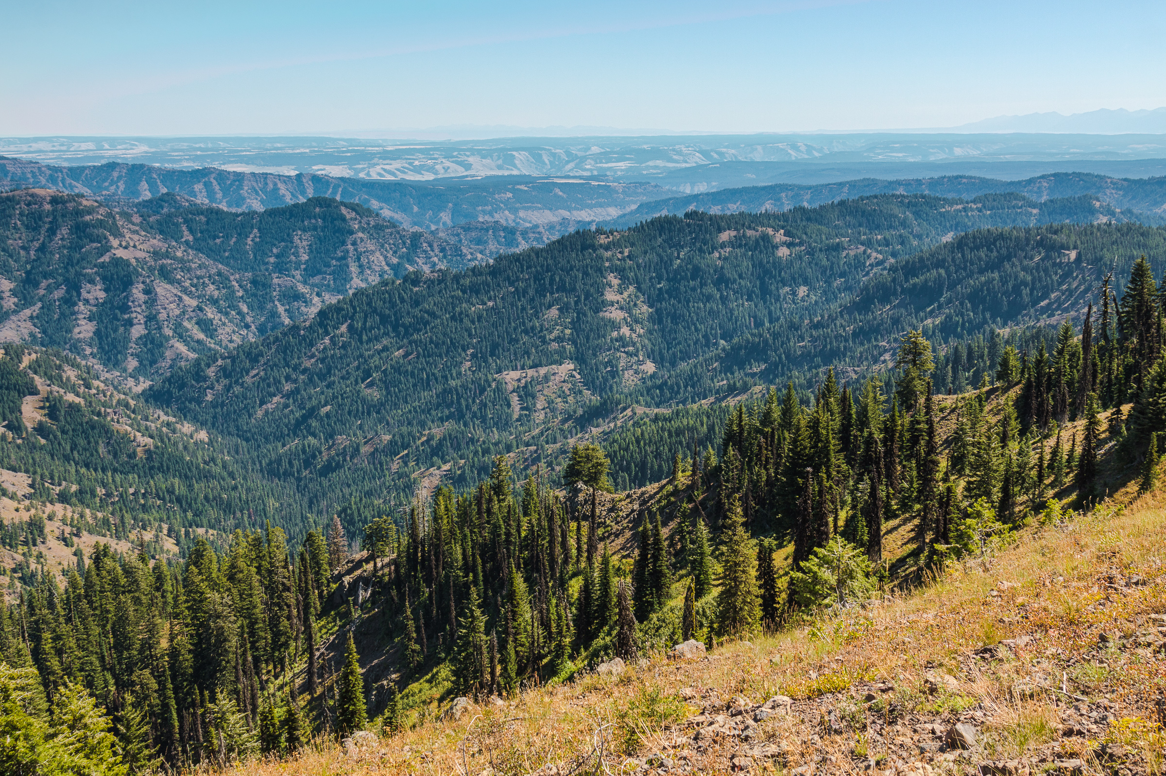
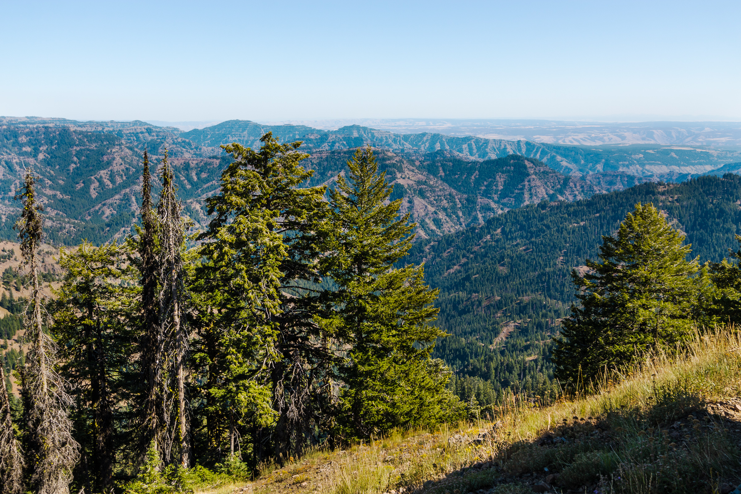
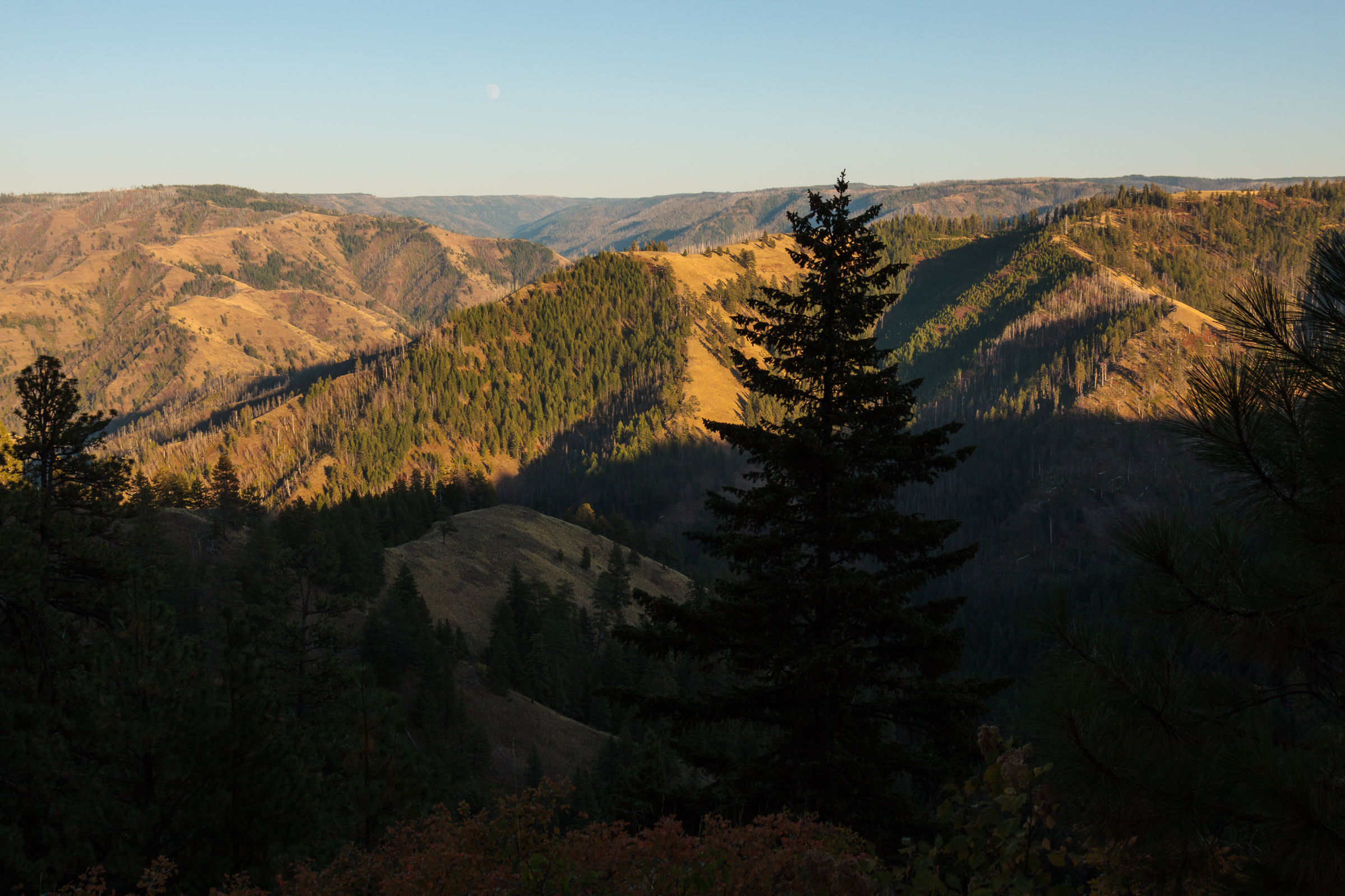
The view on Oregon Butte is nothing short of amazing. On Saturday, I could see 90 miles to the Seven devils. The Wallowas were quite visible as were the Elkhorn Mountains and Moscow Mountain. According to some, that constitutes a clear day. However on a really good day, the view extends to over 200 miles. Spokane Mountain becomes visible to the north, and during the twilight hours, the shadows of Mt. Rainier, Mt. Adams, and Mt. Hood are all visible to the west. That’s not bad for a small mountain range. Of course, in the middle of the summer fire season, visibility might also be limited to just a few miles, so plan your trip accordingly.

View from the lookout on Oregon Butte.
[map style=”width: auto; height:400px; margin:20px 0px 20px 0px; border: 1px solid black;” maptype=”TERRAIN” gpx=”http://www.mineral2.com/wp-content/uploads/Oregon Butte Hike.GPX”]

Similar Posts

  • Grandmother Mountain

    Looking West on Grandmother Mountain, originally uploaded by Matthew Singer. This weekend, Erin and I set out for our first hike together in Idaho and we made our first summit together on Grandmother Mountain. The hike to Grandmother Mountain begins high up in the St. Joe National Forest 12 miles out of Clarkia. The entire hike is above 5500 feet, which was a neat considering all of our hiking in the East (so far) was under 5500 feet.* Grandmother Mountain is an easy two-mile one-way along a high sub-alpine ridge with forest mixed with meadow. The summit stands at 6369…

  • Oregon Butte: The Successful Failure

    View Oregon Butte – 5/26-27/2012 in a larger map Things don’t always go according to plan. Along the journey, you discover new interests or find obstacles that end up providing you with a totally different experience than originally expected. This lesson was hard hit this weekend as we attempted a backpacking trip in the Blue Mountains of southeastern Washington. The trip was a success, but certainly not what I had expected. It’s really a lesson in not getting enough information ahead of time. On paper, it looked like the perfect trip. It’s a 16-mile loop up Panjab Creek to the…

  • Asotin Creek

    It’s funny that only two weeks ago, I was clearing snow from my driveway, and now there’s hardly any sign of winter left on the Palouse. Instead of snow, it rained for nearly a week straight. So when we caught a break in the weather on Saturday, I was quite happy to take advantage and begin my spring hiking season. I chose to go to Asotin Creek. The town of Asotin is located five miles south of Clarkston, Washington. It is here that Asotin Creek empties its water into the Snake River. But the hiking begins about 20 miles upstream…

  • |

    August Update

    I just realized that August has come and gone and I have yet to write about anything that happened during this month. It’s not as though I haven’t done anything. In fact, I was quite busy every weekend. So, let’s see, what happened in August? It got really hot. In fact, it got so hot, that doing things became unpleasant. Nevertheless, we took Clara out to Elk River to beat the heat. At first, she didn’t like sitting in the cool water, but by the end, I got her to tolerate it. We also took Clara up to Kamiak Butte….

  • Backpacking … for real

    After our jaunt to the fire tower on Shorty Peak, we decided to go out for a more conventional backpacking trip – the kind where we bring everything we need with us, including the shelter. We chose the upper priest river, a relatively mild trail to get us started. This trail goes 8 miles along the upper Priest River through lush old-growth forest, ending at a waterfall just miles from the Canadian border. In many ways, this trip reminded me of backpacking in the eastern US. If you’re looking for grand mountain views and high alpine lakes and meadows, this…

  • Snowshoeing Moose Creek

    Last week, winter returned to the Palouse. We got about six inches of snow in Deary, most of which was still around over the weekend. On Sunday, I joined a group of students and post-docs for a snowshoeing trip to Moose Creek. Although it was a foggy and overcast day, we had a great time. I’m always amazed at how much more snow Moose Creek gets, despite its close proximity to home. I estimate the snow was about a foot deep, which is plenty for snowshoeing. We ended up hiking just under 2 miles in before turning around and heading…