Backpacking… sort of

It’s good to be back on the trail. Backpacking has been absent from my life for quite some time, and I am excited to change that. On this trip, I hiked 2.5 miles and 1500 feet up to a forest service fire lookout that has been converted into a cabin for rent.

Shorty Peak tops out at an elevation of around 6500 feet above sea level with a view that is as spectacular as it sounds. The mountain is located in Idaho’s Selkirk Mountains on a ridge adjacent to the ridge that hosts the US-Canadian border. When Heather found that someone was unable to use their reservation, she quickly jumped on the opportunity and we were soon heading up the winding forest service road to the trailhead. On paper, the trail isn’t bad – 2.5 miles to the lookout with an elevation gain of 1300 feet. However, two challenges made this hike feel tougher than it was. First, neither one of us had backpacked in years, and so we were not used to carrying so much weight. Second, There is no available water at the lookout, so our packs were exceptionally heavy having to carry all of our water with us. Now, I have since learned that there is a spring about half a mile and 500 feet down from the lookout, which isn’t much better for collecting water. Either way, it’s not easy. We also happened to go in the prime of mosquito season, and we were surely getting eaten alive on the hike up. But the mosquitoes all but disappeared as we emerged from the forest to the bald summit.

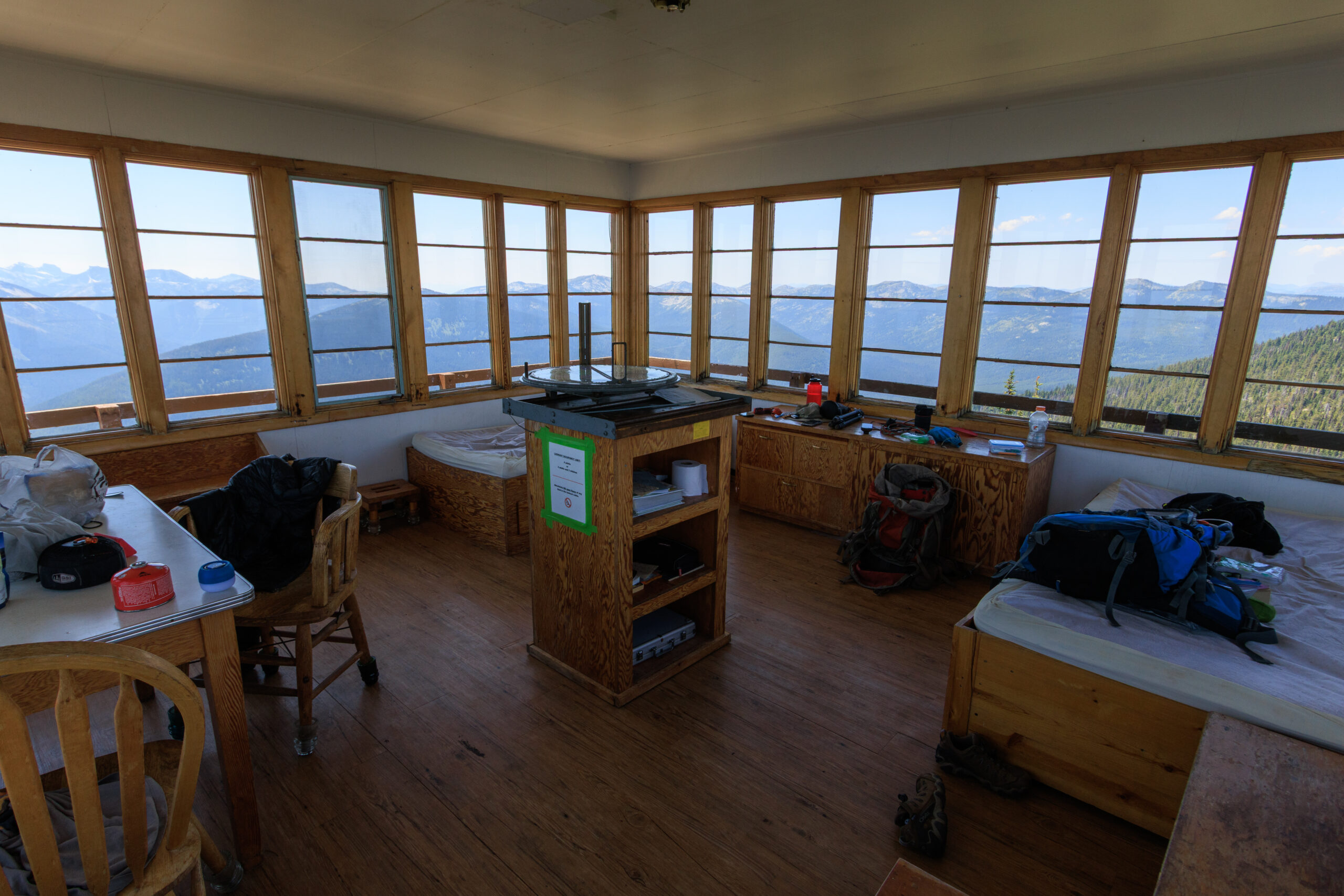
Sleeping in a fire lookout affords some comfort that you don’t get on a conventional backpacking trip. The lookout comes with beds, and while we had to carry our own bedding (we chose sleeping bags), we didn’t have to bring shelter. There are also chairs, a table, and lots of room to spread out. The lookout also provides shelter from the wind. But aside from that, it’s still a primitive camping experience.

The view is worth the pain and effort. There is a 360-degree panorama to enjoy. The view to the west peers into the Selkirk Mountains. To the north, we could look into Canada and the impressive peaks of the Kootenay Mountains. At night, we could see the lights from the town of Creston. To the east, we gaze upon the Cabinet Mountains and into Montana.

This was certainly a unique experience, and I hope I get the chance to do it again.

Similar Posts

  • Asotin Creek… sort of.

    The photo above was taken in February of 2010, my first visit to Asotin Creek. I’ve been back a couple of times as it is usually a reliable winter hike that is free of snow. I had never gone down in the spring when everything is green, and certainly not in the summer when temperatures can reach the 100 degree mark. So it was that Erin and I decided to spend a day down at Asotin Creek. The local wildflowers should be in bloom, and the hills might show hints of colors other than the drab brown of dried grass….

  • Duncan Knob

    View on Duncan Knob, originally uploaded by Matthew Singer. I got up early this morning to hike before the heat of the day. I would have liked to have gotten up earlier to be at the summit for that early light, but I enjoyed what I got. I arrived at my trailhead by 8:00 and reached the summit of Duncan Knob a little after 10 and I had the trail and the rocks to myself. I basked in the sunshine and enjoyed the view for almost an hour before heading back. When I got back on the Gap Creek Trail,…

  • Snowshoeing Moose Creek

    Last week, winter returned to the Palouse. We got about six inches of snow in Deary, most of which was still around over the weekend. On Sunday, I joined a group of students and post-docs for a snowshoeing trip to Moose Creek. Although it was a foggy and overcast day, we had a great time. I’m always amazed at how much more snow Moose Creek gets, despite its close proximity to home. I estimate the snow was about a foot deep, which is plenty for snowshoeing. We ended up hiking just under 2 miles in before turning around and heading…

  • |

    Old Rag

    Spring!, originally uploaded by Matthew Singer. In April, I briefly lost my camera due to a bent pin in the card slot. I sent it to Canon for repair and got the camera back in a week’s time. Unfortunately, during that time, I had scheduled a hike up Old Rag with Jon, my supervisor at the time. So, after a trip to Fed Ex, I stopped at the camera store and bought a couple rolls of film. I’ve finally had the chance to get the old scanner out of the box and get this set of slides scanned and uploaded….

  • Stevens Lakes

        The hike to Stevens Lakes itsn’t particularly hard, but it’s no walk in the park either. It’s about 2.5 miles and 1700 feet of vertical gain to the upper lake on a well-used and well-mantained trail. It starts off relatively steep and continues to climb steadily for the next mile before levelling out briefly as the trail emerges from a beautiful forest into an open basin surrounded by walls several hundred feet high. Just atop the headwall, 350 feet up, is the first lake, and Willow Creek drains from Lower Stevens Lake to drop over this ledge with…

  • Annual Wallowas Weekend 2014

    [map style=”width: auto; height:400px; margin:20px 0px 20px 0px; border: 1px solid black;” gpx=”http://www.mineral2.com/wp-content/uploads/Selected Data from wallowas 2014.GPX”] The annual Wallowas Weekend tradition kinda took a hiatus for a couple of years. In 2012, Tyler had to pull out of the trip, and several other people followed. That left me with one other person who still wanted to hike, but also wanted to fish. So we turned it into a Seven Devils trip. Last year, I was still recovering from my ski accident and was in no shape to go backpacking. But this year, I was determined to get back in…