Grandmother and Grandfather Mountains

Since my daughter was born a month ago, I haven’t been able to get out and stretch my legs on the trail. So when an opportunity came along to go hiking, I jumped at it. The past few weeks had been miserably hot, even to the point where escaping into the high elevations wouldn’t provide refuge from the heat. However, since nights were cool, the early morning hours were a pleasant time to be outside. So one morning, CJ and I hit up Spud Hill in Deary and made it down just in time for the heat to make life uncomfortable. Despite the haze in the air, we could see all the way out to the Wallowas over 100 miles away.

Spud Hill (elevation 4009) overlooks  Deary and the eastern edge of the Palouse.
Spud Hill (elevation 4009) overlooks Deary and the eastern edge of the Palouse.

On Wednesday of last week, temperatures actually broke 100 degrees fahrenheit, making it the hottest day of summer so far. We had to go to Spokane to pick up my mother from the airport, but because it was so hot, we didn’t even take any walks in the city. On Friday, we got a blast of cold air from Canada, but with it came smoke from a massive series of fires burning in the Northwest Territories. The smoke was so bad that even I was having trouble walking around town. Luckily, it moved out of the area over the weekend and yesterday, the air was pretty clear and still cool. There were clouds in the sky, but so far everything seemed dry, so I suggested we take advantage of the “good” conditions and hike up to Grandmother and Grandfather mountain.

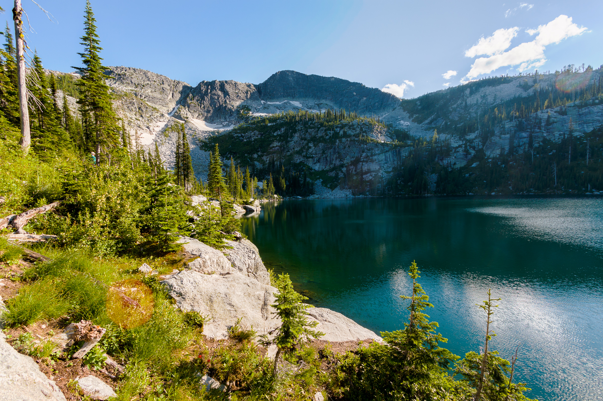
The clouds were thicker over the mountains. On the drive up, I notice that the summits of each of the peaks were cloaked in the cloud, and the dark skies had the possibility of rain. But the clouds were moving quickly, and there was sunshine to the west that had me hopeful that we’d end up with a nice day on the mountain. During the hike, the summit of Grandmother Mountain came in and out of the clouds. We must have timed it just right because when we hit the summit, the low clouds had lifted and moved further out. Since it seemed nice, we decided to continue on to Grandfather Mountain.

For most of the hike, the mountains were cloaked in the clouds.

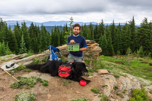
At Grandfather mountain, we noticed that there was some rain to the northeast. The clouds still looked like they were moving from the northwest, but it didn’t take long to feel the raindrops upon us. We ate a quick lunch and I found a geocache on the summit that hadn’t been found since 2005.

We found a geocache at the summit of Grandfather Mountain. This cache hadn't been found since 2005.
We found a geocache at the summit of Grandfather Mountain. This cache hadn’t been found since 2005.

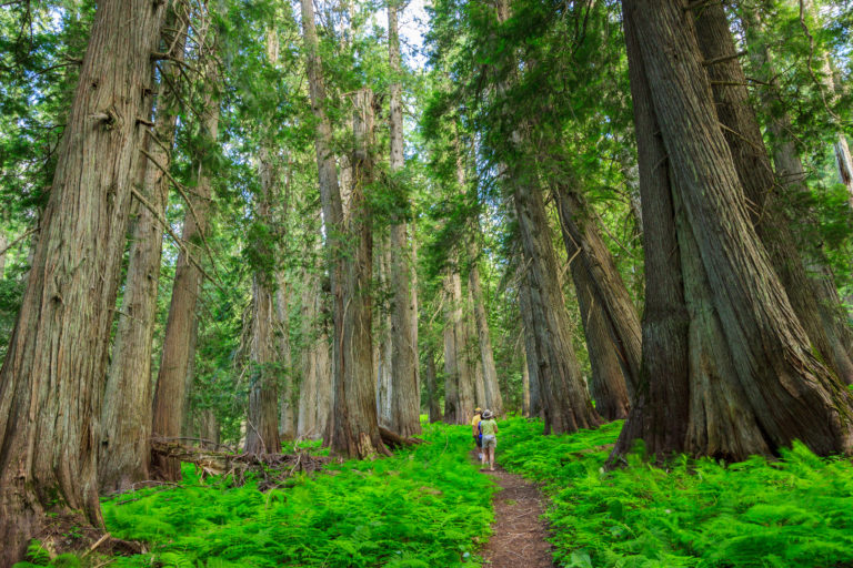
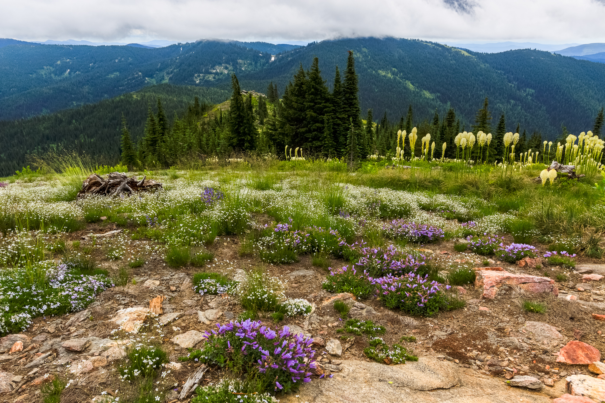
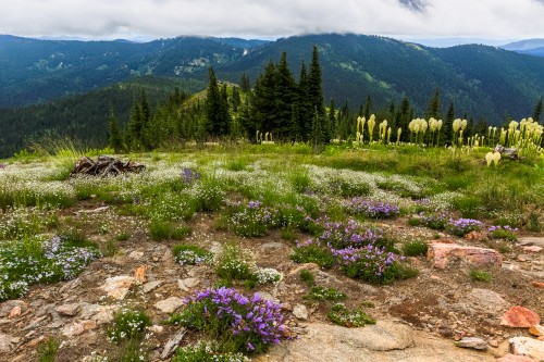
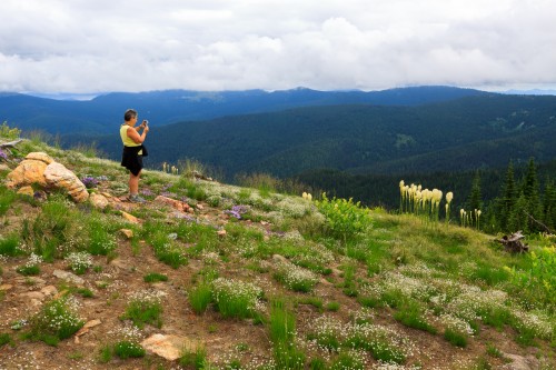
Though the rain never amounted to more than a light sprinkle, we got fairly damp having to hike back in it for four miles. Despite the weather, it was a great hike. The wildflowers were in the peak of their blooms and provided a colorful carpet as we passed by. There were more beargrass flowers than I had ever seen up there before. I have not hiked 8 miles at once in a while, but my leg has healed such that I was pleasantly tired at the end, but not overly sore. In fact, my good leg was aching more than the injured one. I think I might be ready for a good hiking season, that is, if I can get the time to get out.

Wildflowers blooming in the meadow on Grandmother Mountain.
My mom taking photos of the wildflower blooms.

The full trip to Grandfather Mountain is a little over 8 miles with almost 2000 feet of total elevation gain. If you don’t wish to make the full trip to Grandfather, the shorter hike to Grandmother Mountain is just as good since the best views and scenery are found on this section of the hike. Grandmother Mountain is my favorite local hike. I’ve been up here several times each year since I’ve moved out here. It’s even a popular destination for people living farther away. On this hike, we met some hikers who came down from Spokane. That’s impressive considering there are plenty of great places to hike with a shorter driving time from the city.

[map style=”width: auto; height:600px; margin:20px 0px 20px 0px; border: 1px solid black;” gpx=”http://www.mineral2.com/wp-content/uploads/Grandfather Mountain Jul 20 2014.GPX”]

Similar Posts

  • East Peak

    There are many peaks in the Wallowas that top 9000 feet, so East Peak might go unnoticed if it weren’t so easily accessible. It turns out that I’m not the only one who thought to use the Wallowa Lake Tramway to cover the first 3700 feet of elevation, reducing the climb to the peak to 1300 feet. This hike is featured in the book, and while I was’t expecting a crowd, we did pass three other hikers along the way, two of which are local to the area and hike to the peak regularly. The Wallowa Lake Tramway brings you…

  • Dolly Sods, Revisited

    Dolly Sods Meadow, originally uploaded by Matthew Singer. In the fall, I visited West Virginia’s Dolly Sods with my parents. The foliage on the blueberry bushes was amazing, but the trees had not yet turned. I was planning to return a week later to backpack through the wilderness area during its peak foliage, but my car broke down and I was unable to make the journey. So I decided I’d make a spring visit instead. So, a week and a half ago, I did just that. I got together with Charlie (uvagolfer), another hiker and photographer I met on Flickr,…

  • |

    Roman Nose Lakes

    Last year, I tried to take my family up to Harrison Lake to enjoy a true alpine zone. When we got close, we saw that the lake had been closed due to problematic bear activity. I would have still been ok hiking up there, but my parents were wary, so we came up with an alternative: Roman Nose. There used to be a road connecting the Pack River to Roman Nose lakes on the other side of the ridge. That road is no longer passable except by ATV or mountain bike. We found that out the hard way. On the…

  • Adventures with Clara: Hobo Cedar Grove

    The Hobo Cedar Grove is a nice easy 1-mile hike through a grove of giant old-growth trees. It is the perfect hike for toddlers to explore nature, which is why we brought Clara up there on Sunday. She enjoyed the large trees, but wasn’t into walking the trail much. Eventually Erin had to carry her for most of the hike. In hindsight, she may not have completely gotten over her illness from Friday and Saturday.

  • |

    Evo-WIBO and the Olympic Peninsula

    I’m two weeks on this post, but forgive me because the last two weeks of the semester have been insane. The bi-annual northwest evolution conference, Evo-WIBO, occurred the last weekend of April. If you don’t remember, I attended the last meeting two years ago and presented a talk on the results of our selection experiment. This year, I presented a poster (my first) on the use of function-value trait analysis to analyze video tracking data. In short, we can use functions to describe behaviors over time and use more details in the data than if we were to simply distill…

  • Backpacking: Seven Devils’ Lower Cannon Lake

    My father-in-law and his wife have been visiting us since last Wednesday. Before coming out, he had asked if we could go on a little male bonding trip into the backcountry for a night. So, I set about looking for a short and easy hike to a spectacular place. I figured he had probably never spent the night under the rocky peaks next to a glacial tarn, and the high lakes are also one of my favorite places to spend a night, but most of the lakes around here are either fairly strenuous hikes, long hikes, or take nearly all…