Annual Wallowas Weekend 2014
The annual Wallowas Weekend tradition kinda took a hiatus for a couple of years. In 2012, Tyler had to pull out of the trip, and several other people followed. That left me with one other person who still wanted to hike, but also wanted to fish. So we turned it into a Seven Devils trip. Last year, I was still recovering from my ski accident and was in no shape to go backpacking. But this year, I was determined to get back in the game, and I didn’t disappoint. I chose a 24-mile loop to accomplish over three days. We’d climb a total of more than 6000 feet and finally summit the iconic Eagle Cap while exploring a total of four river valleys and a new lake. Tyler and I brought with us four newcomers to the Eagle Cap Wilderness, two of which were new to backpacking. It was a difficult trip, but we had a great time.
Day 0: Getting to Enterprise
The timing of this trip was planned around Tyler’s brother in law. Christian was visiting to drop off his car before heading to Germany for two years. He requested we take him backpacking in the mountains, and thus the annual Wallowas Weekend was reborn. We originally wanted to spend three nights in the backcountry, but none of our schedules meshed to allow that. So the best plan we could come up with would be to drive out there Thursday evening after work and car camp near the trailhead and then hike for three full days. There aren’t very many trail options to satisfy these demands. There are plenty of one-night hikes, and plenty of three-night hikes, but a two-night loop is in short supply, especially when we had to plan a true loop, unsure whether we’d have two cars to shuttle between trailheads. We did end up taking two cars for six people, but stuck to the loop motif anyway.
That’s because Tyler and I had a second mission. Every previous trip, we had stayed at Mirror Lake below the summit of Eagle Cap, and every year we look up at the summit and think that we’ll do it. This time, we wanted to make sure we made the 2000 foot climb. I figured we’d do the classic Mirror-Minam Lakes loop, but modify it to hike over Horton Pass rather than Carper Pass. This way, we’d hit the summit of Eagle Cap and get to experience some more scenery than if we had taken the shorter and more popular route.
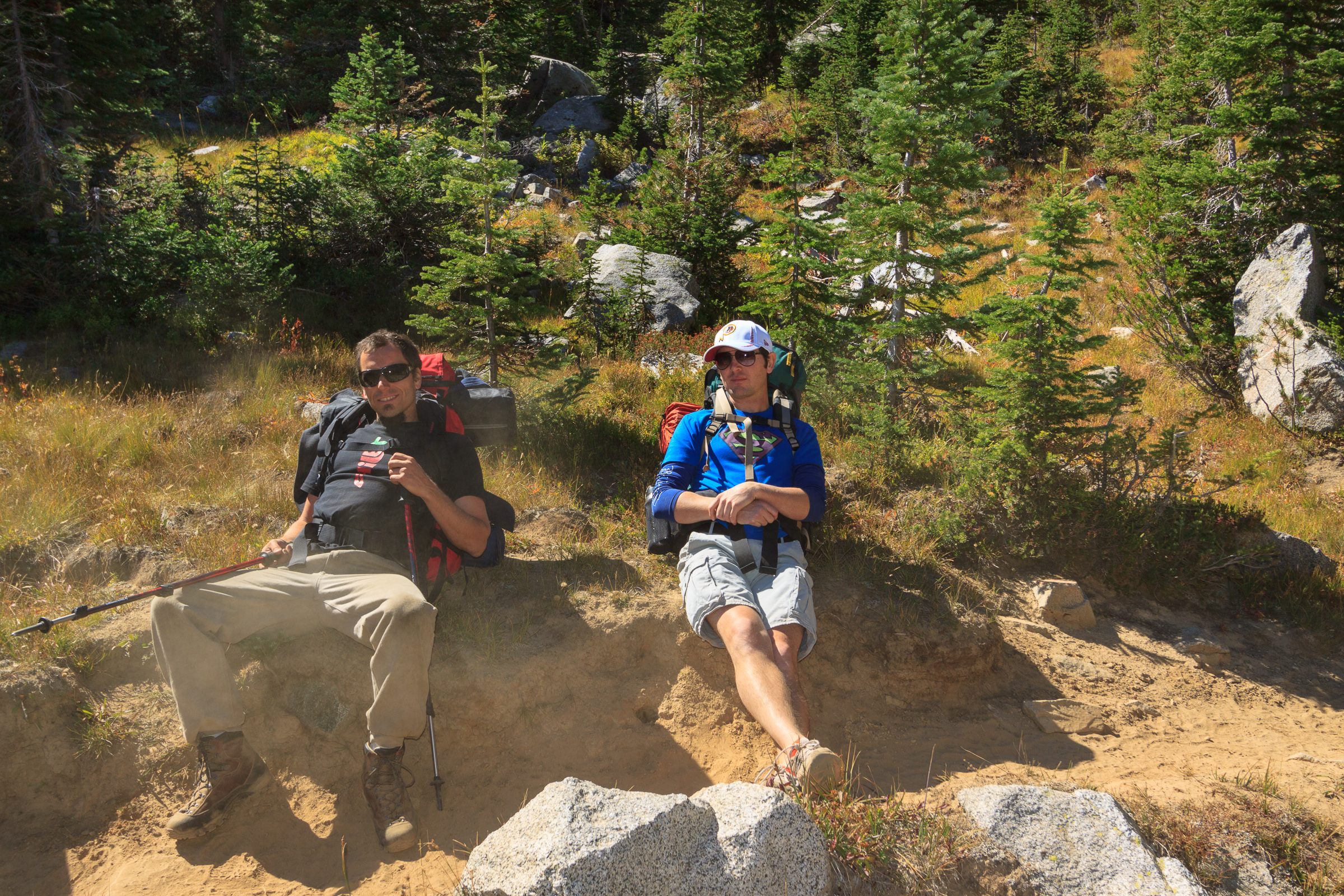
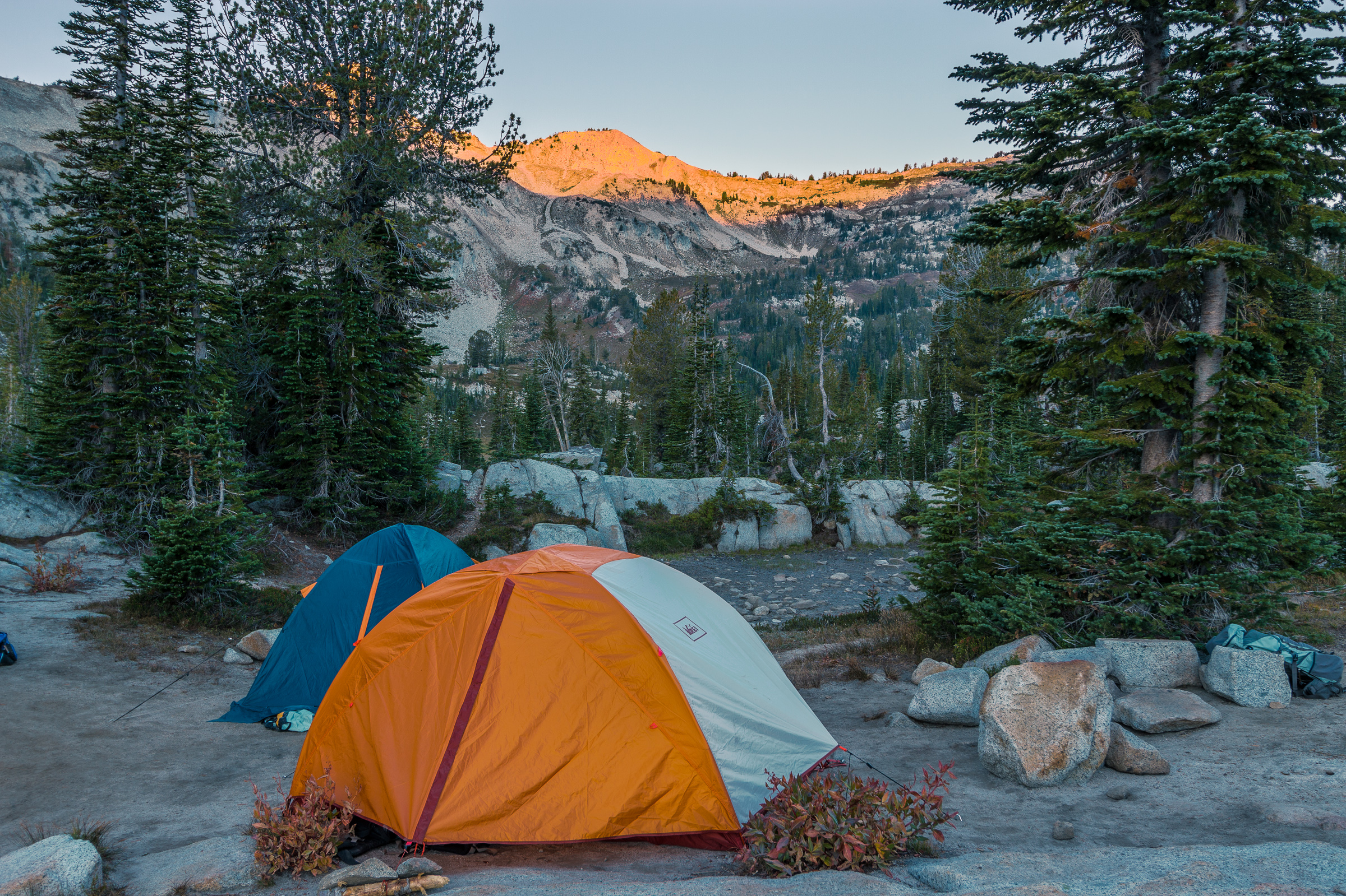
And so came Thursday, September 11. We all left work a tad bit early to pack up the cars and get to Enterprise before dark. For convenience, we planned to eat dinner in town and ended up at the Terminal Gravity brewpub for a pre-hike beer and meal. But that meant we were setting up camp in the dark. We camped at a very nice campground about 1/4 mile before the Two Pan trailhead. The parking lot was pretty crowded, but the campground was relatively empty. We set up our tents, I set up my hammock, and we had a fairly cold night next to the river. At least nobody forgot his sleeping bag this trip, and we were able to pack up and get an “early” start on the trail.
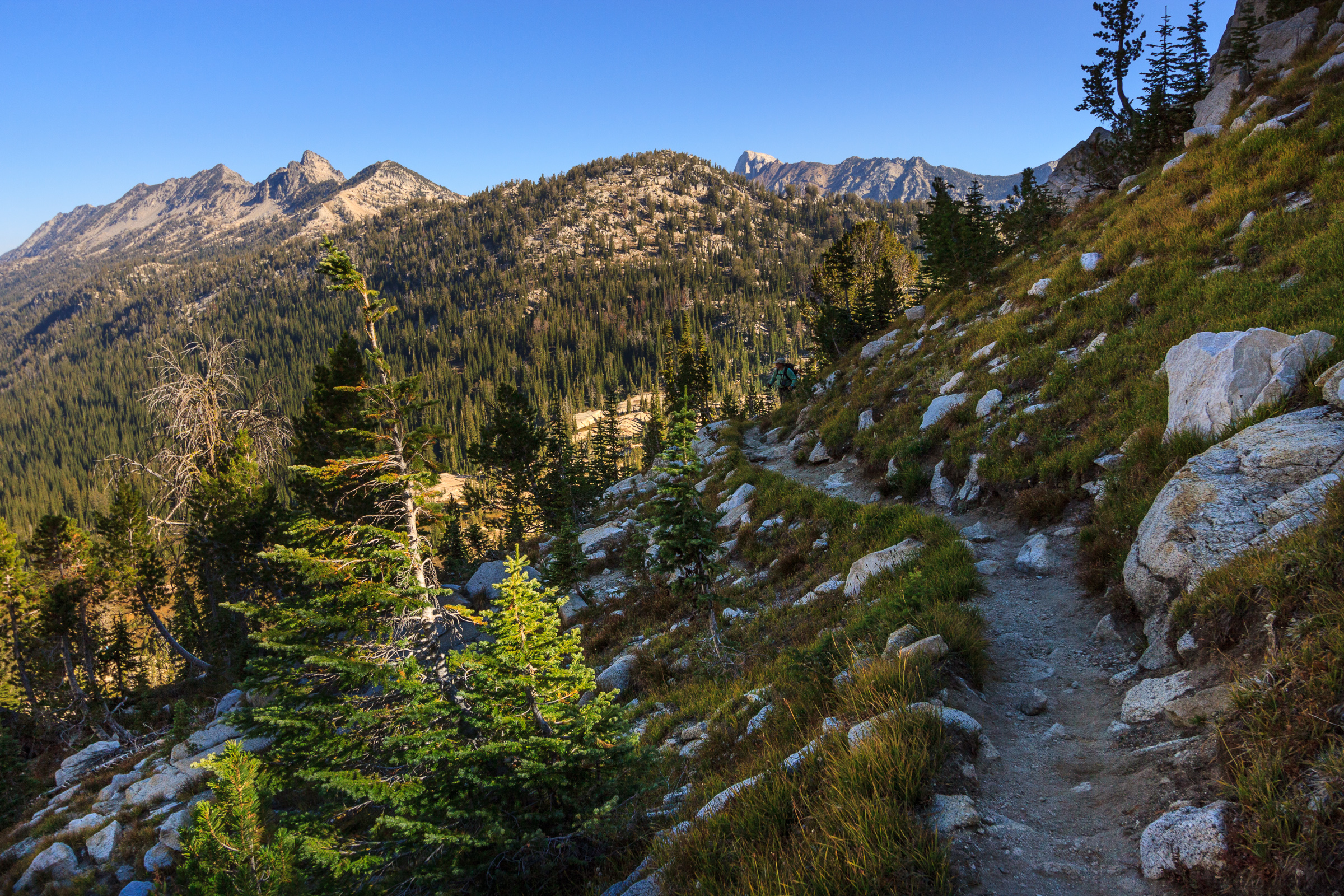
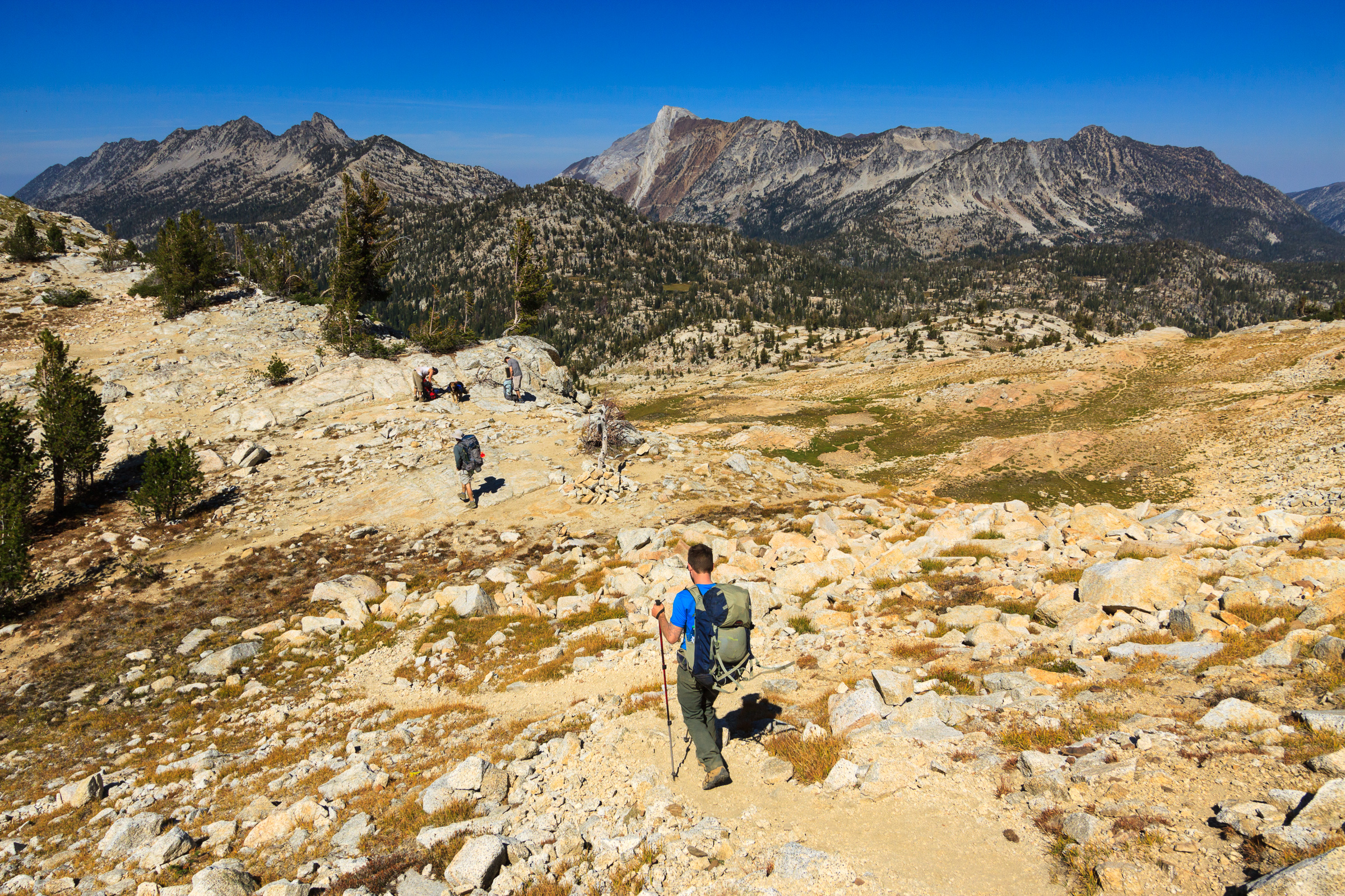
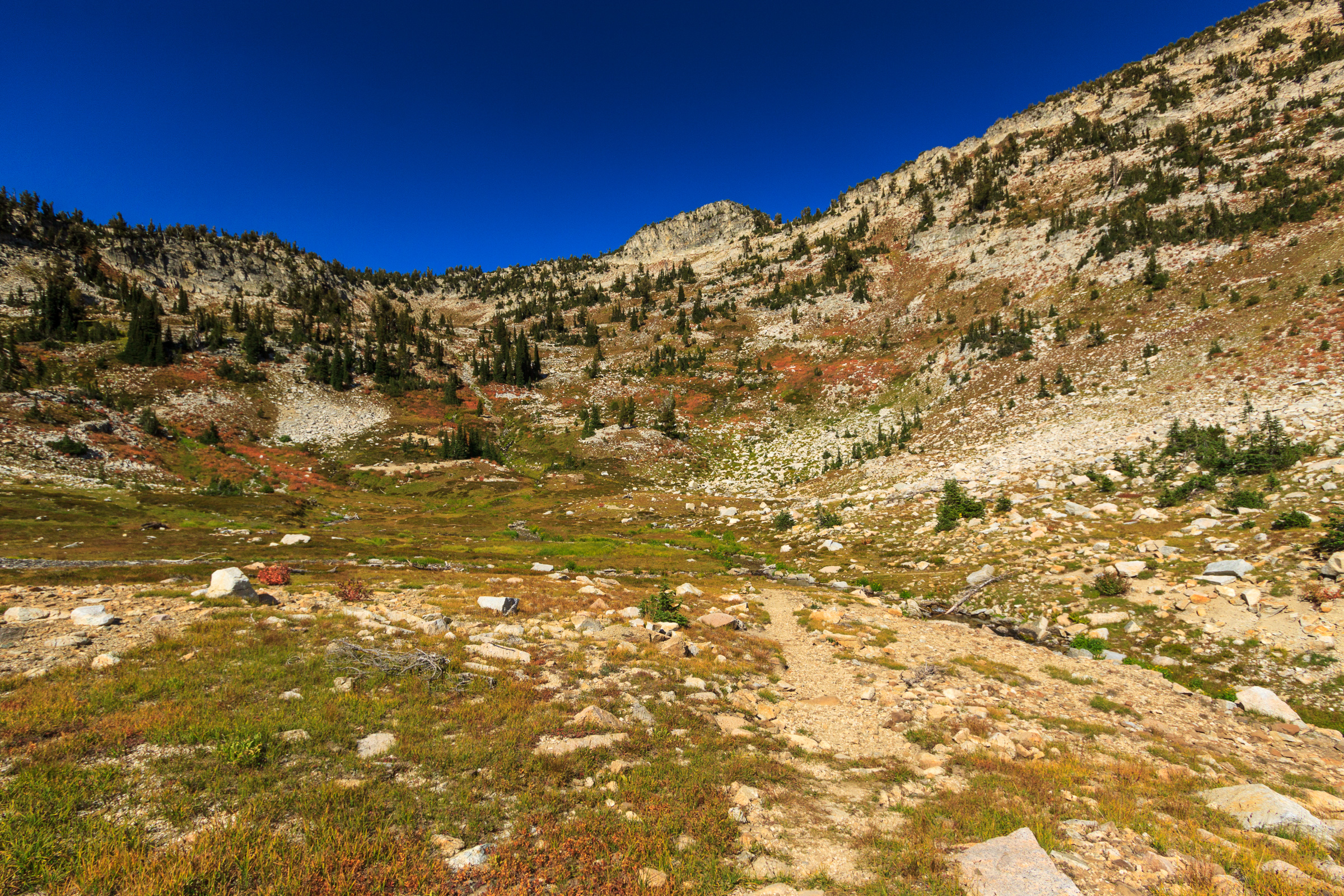
Day 1: Lostine River to Mirror Lake (7.2 mi., approx. 2000 ft. up)
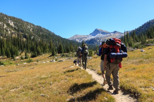
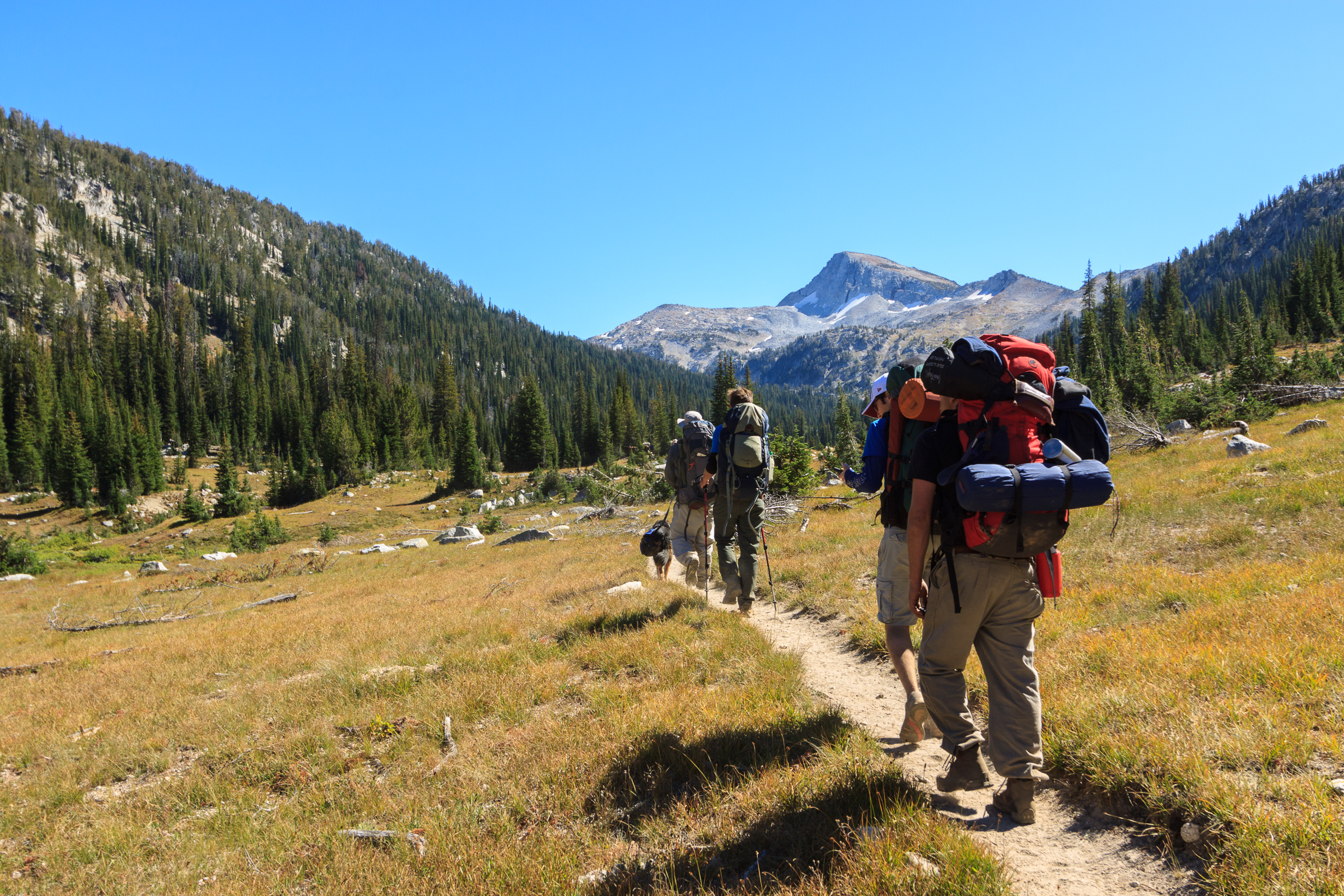
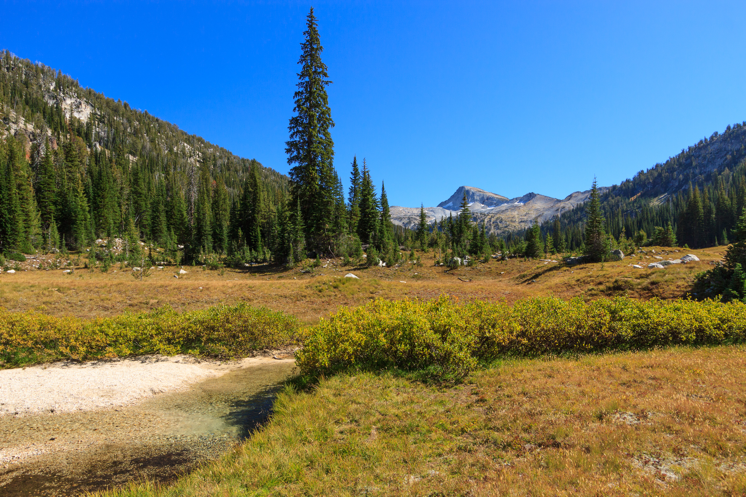
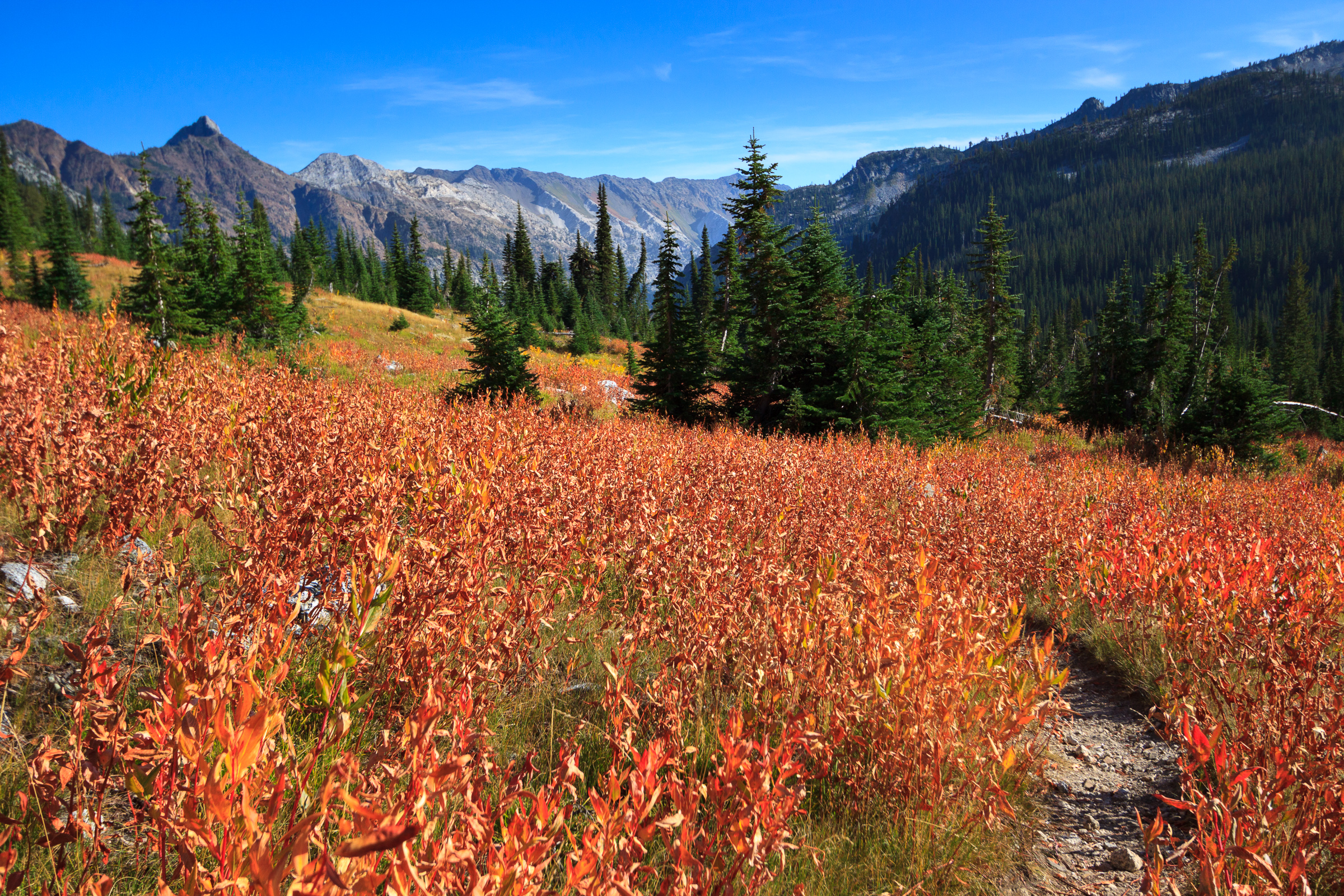
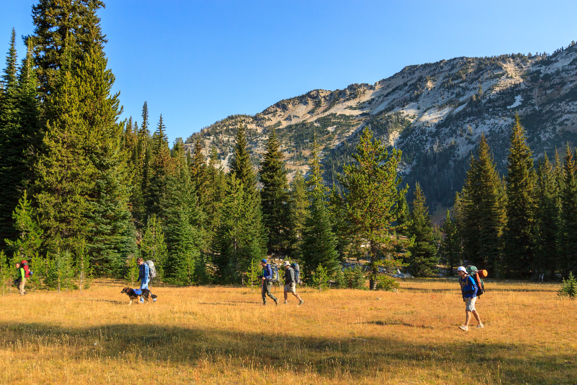
We left the trailhead promptly at 10:00 am. This was the same trail that Tyler, Matt Pennell, and I hiked on our first trip in 2010, so Tyler and I at least knew what to expect from this day. Despite not having hiked with a heavy pack in over a year, I handled the climb much better than I did the first time. We stopped for our first lunch break at the waterfall about 2.5 miles in. We had already climbed about 1300 feet at this point and were making great time. It wasn’t long before we hit the great meadow and the majestic view of Eagle Cap looming in the distance. Here, the trail mellows out, staying relatively flat for the next 3miles. Near the back of the valley, the trail crosses a bridge over the Lostine River. We planned to use this as a great rest stop and photo opportunity, but there had been a group of horse packers hanging out near the bridge, so we ended up stopping for an extended lunch break shortly up the trail.
The weather was perfect – blue skies and moderate temperatures that made a rest in the grass all the more pleasant. Since we were making great time, we could afford to rest in the valley and enjoy the tranquility of the landscape. Some day, we’ll plan a trip where we camp in that meadow. But for now, we had to show everyone the experience of a night at Mirror Lake.
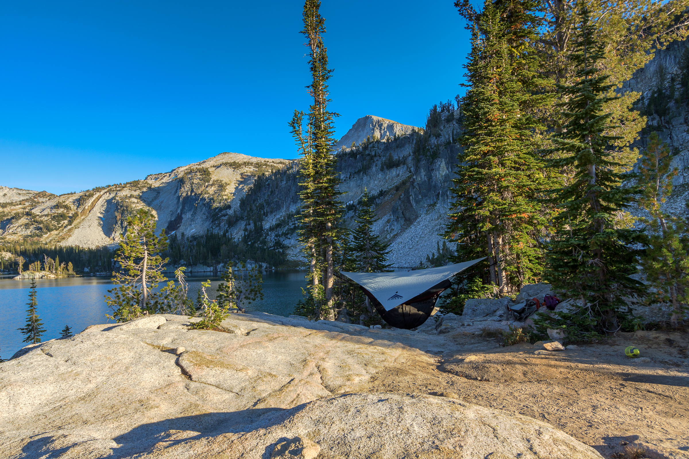
We started moving again after we noticed several groups of hikers heading in our direction. Mirror Lake is typically the most crowded spot in the Eagle Cap Wilderness, and we wanted to be sure we found a good campsite before it was taken. We arrived at the lake at 4:00. Had we not stopped, it would have only taken us four hours. But the breaks were worth it and well earned. Surprisingly, we found a campsite overlooking the lake with no problems. In fact, the ranger came by and said she had only counted about 25 people staying that night. I suppose that’s the result of hiking on a weekday on a non-holiday weekend.
 We set up camp and explored the lake a bit before making dinner. Urs made us some of his alpine pasta, a combination of noodles, potatoes, caramelized onions, and cheese. It hit the spot and warmed the belly as the temperatures dropped. That night was the warmest night that I slept. There’s something about the fall inversion that really brings that cold air down to the river valleys, but leaves the high lakes fairly warm. We finished the day by laying out and looking at the stars. For some, this was the darkest sky they had ever experienced. It really is a marvelous sight.
Day 2: Eagle Cap, Frazier Pass and Minam River (9 mi., 3000 ft. total climb)
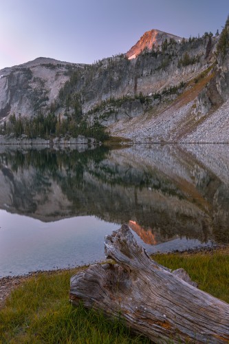
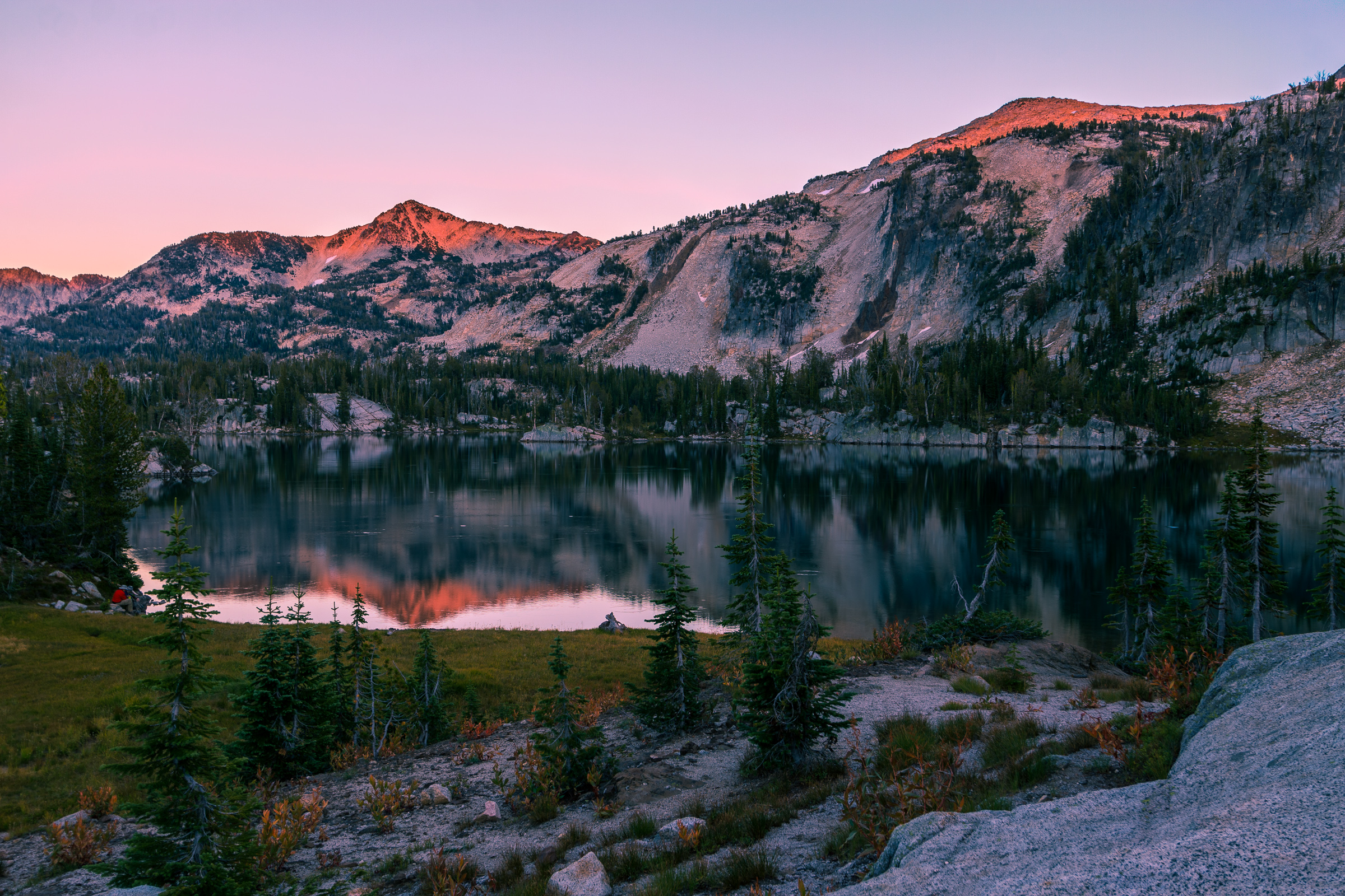
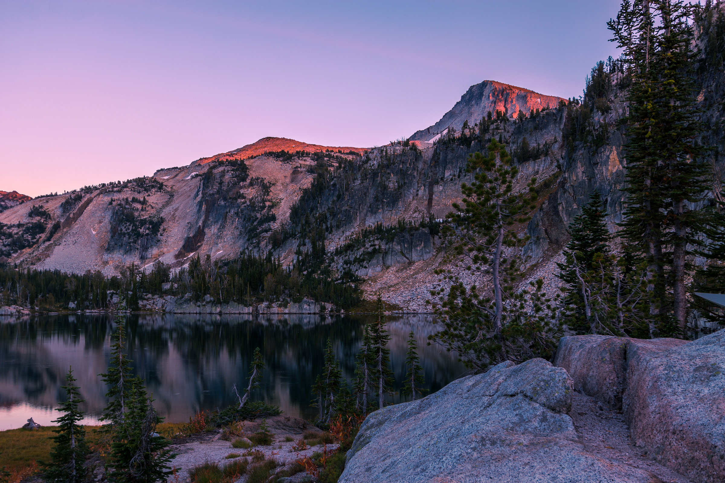
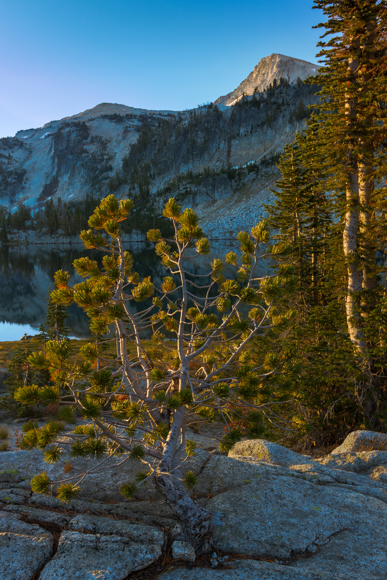
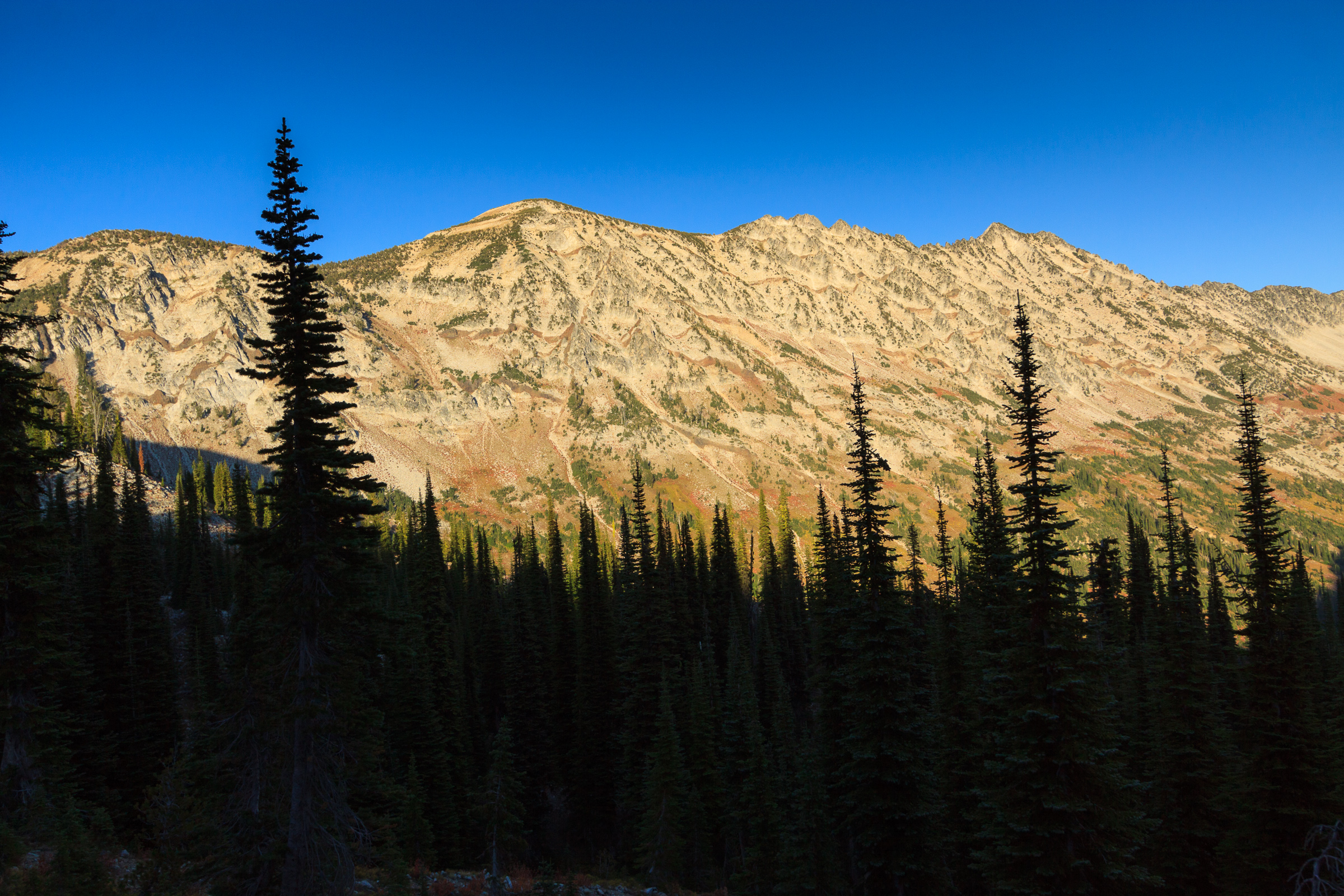
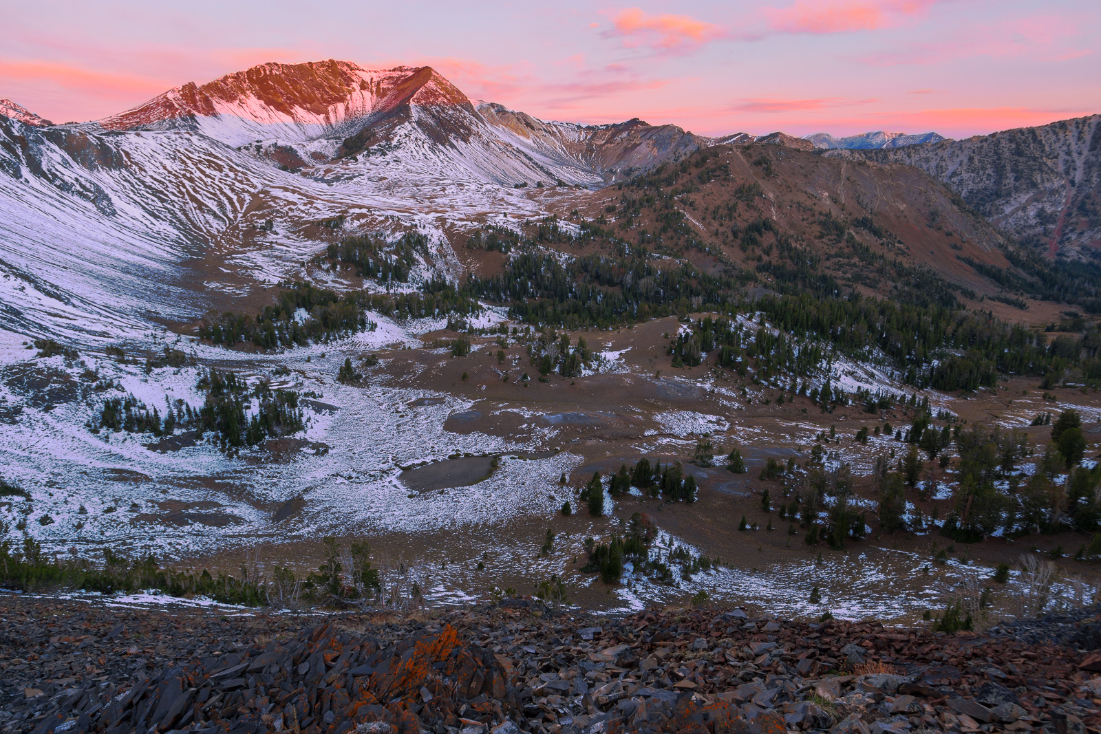
When I’m backpacking, somehow I manage to wake up just before the sun rises. That means I get to make images like the one to the right. It’s that very reason that I’m willing to load up my pack with extra weight and carry a tripod. That first light is the best time of day. It’s cold, but you know that very shortly, the light will bath the campsite and immediately start to warm everything up.
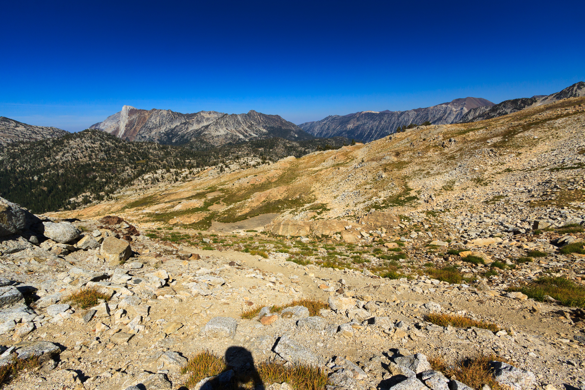
Our second day was to be our hardest and longest day of the trip. We originally planned to hike 11 miles and camp at Minam Lake after climbing to the summit of Eagle Cap. We didn’t quite make it that far, but it turned out to be a blessing that we didn’t.
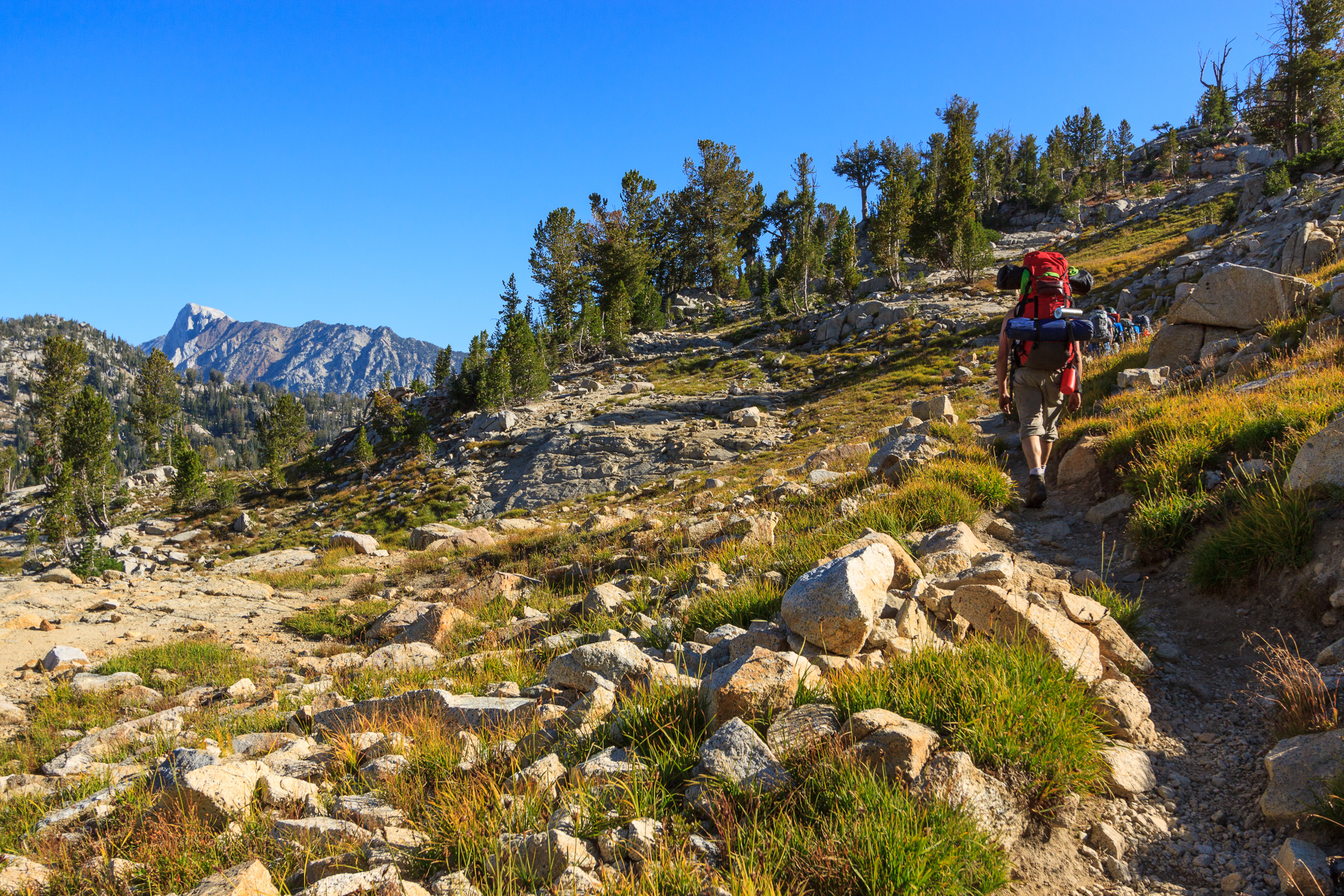
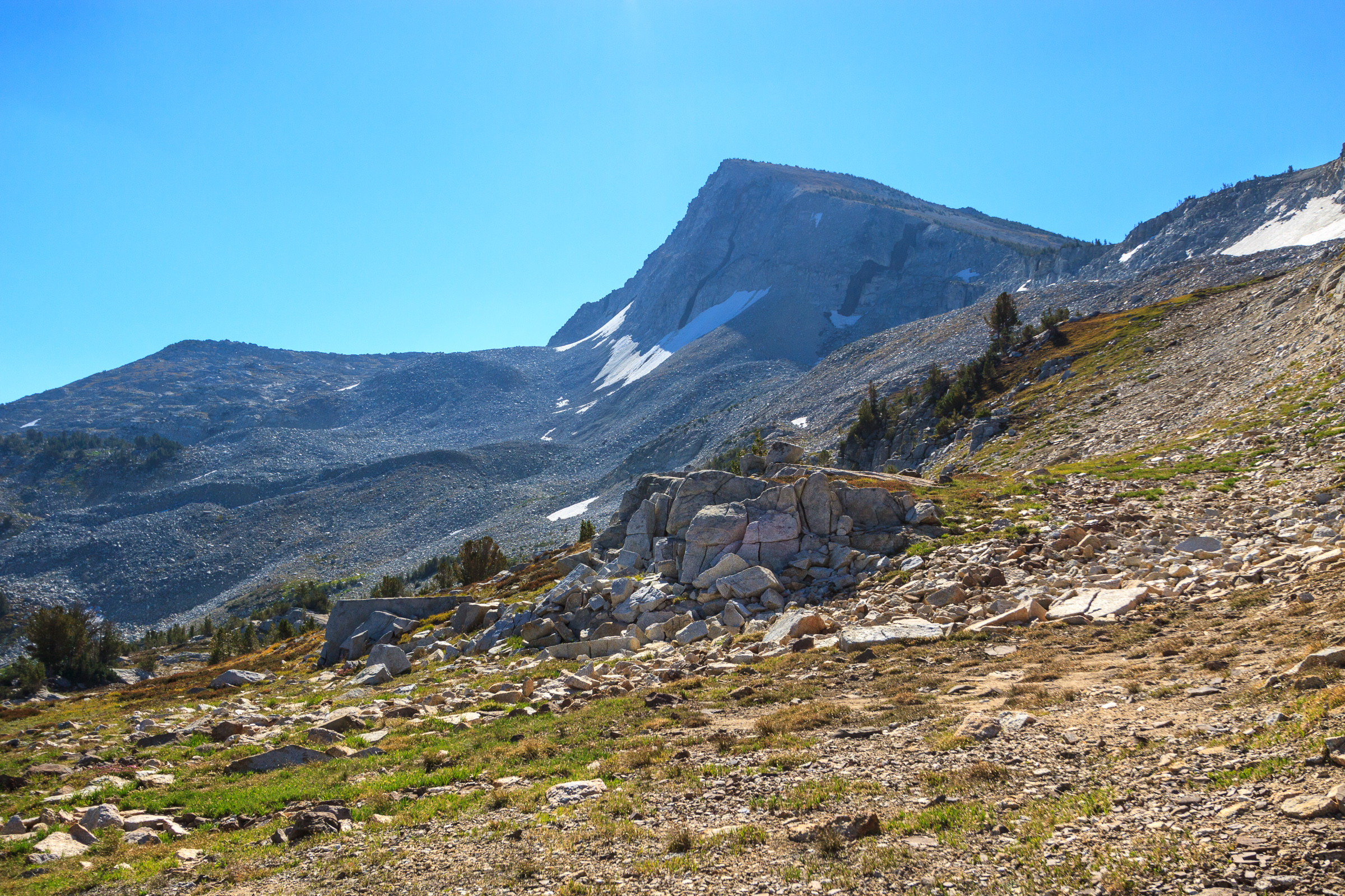
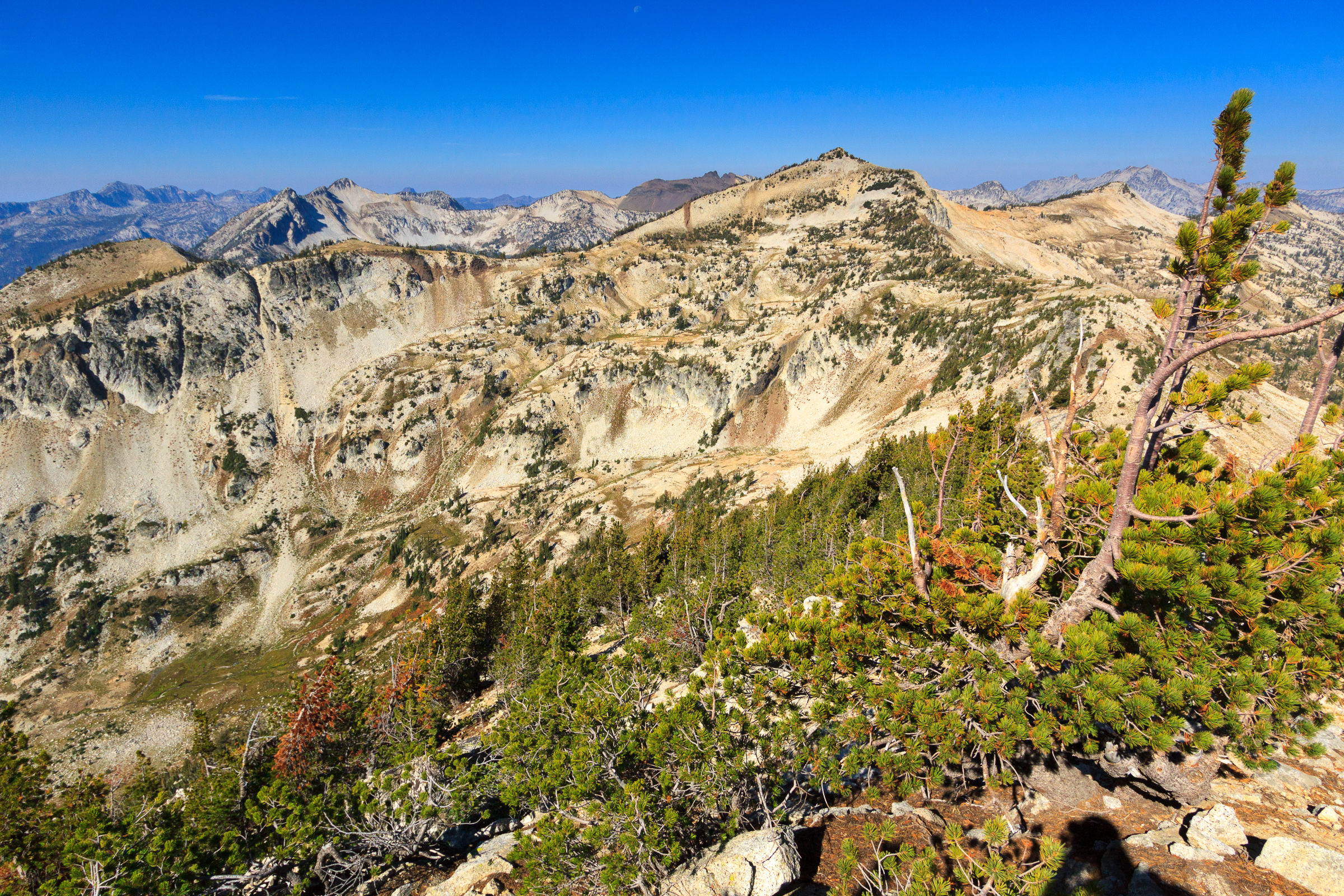
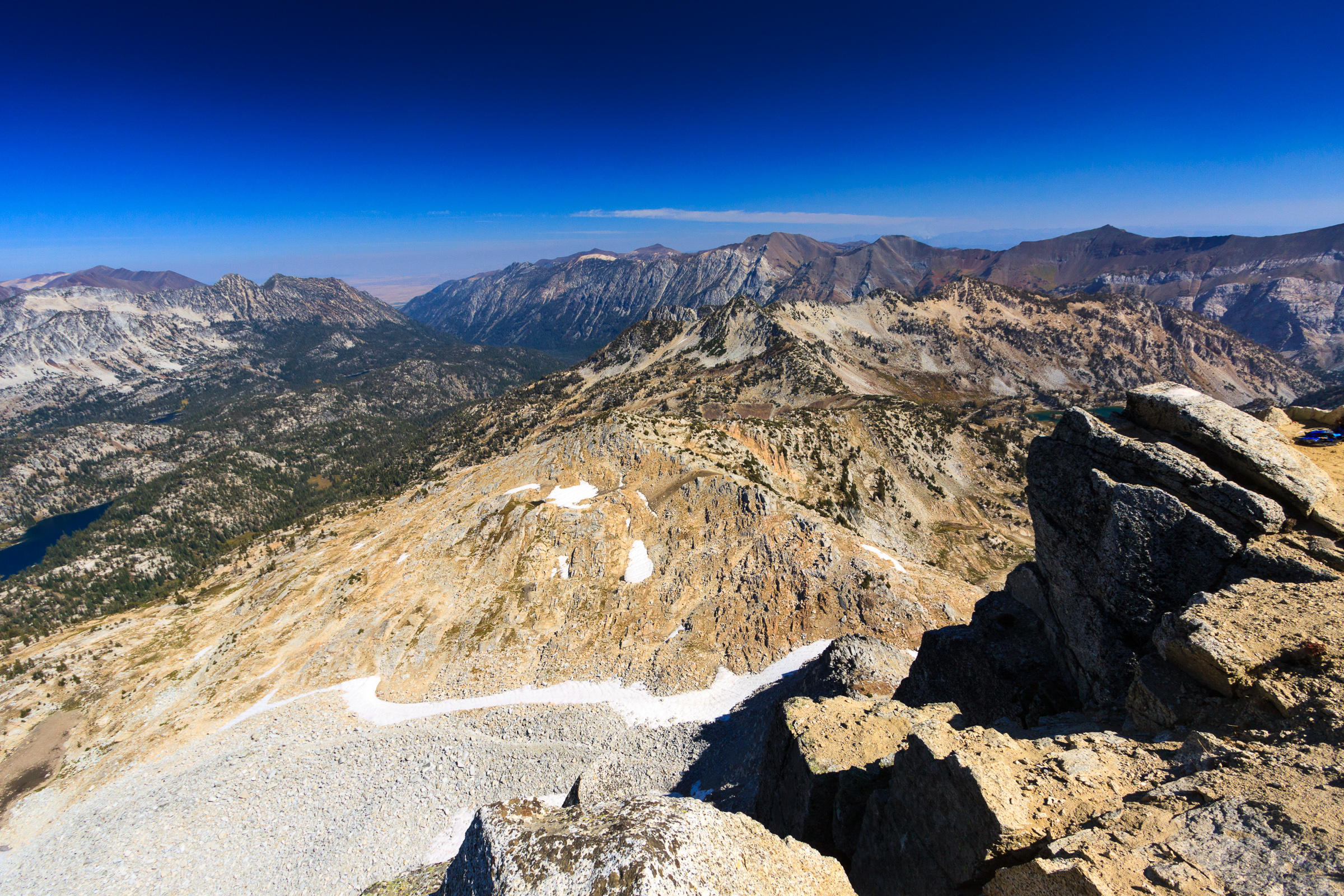
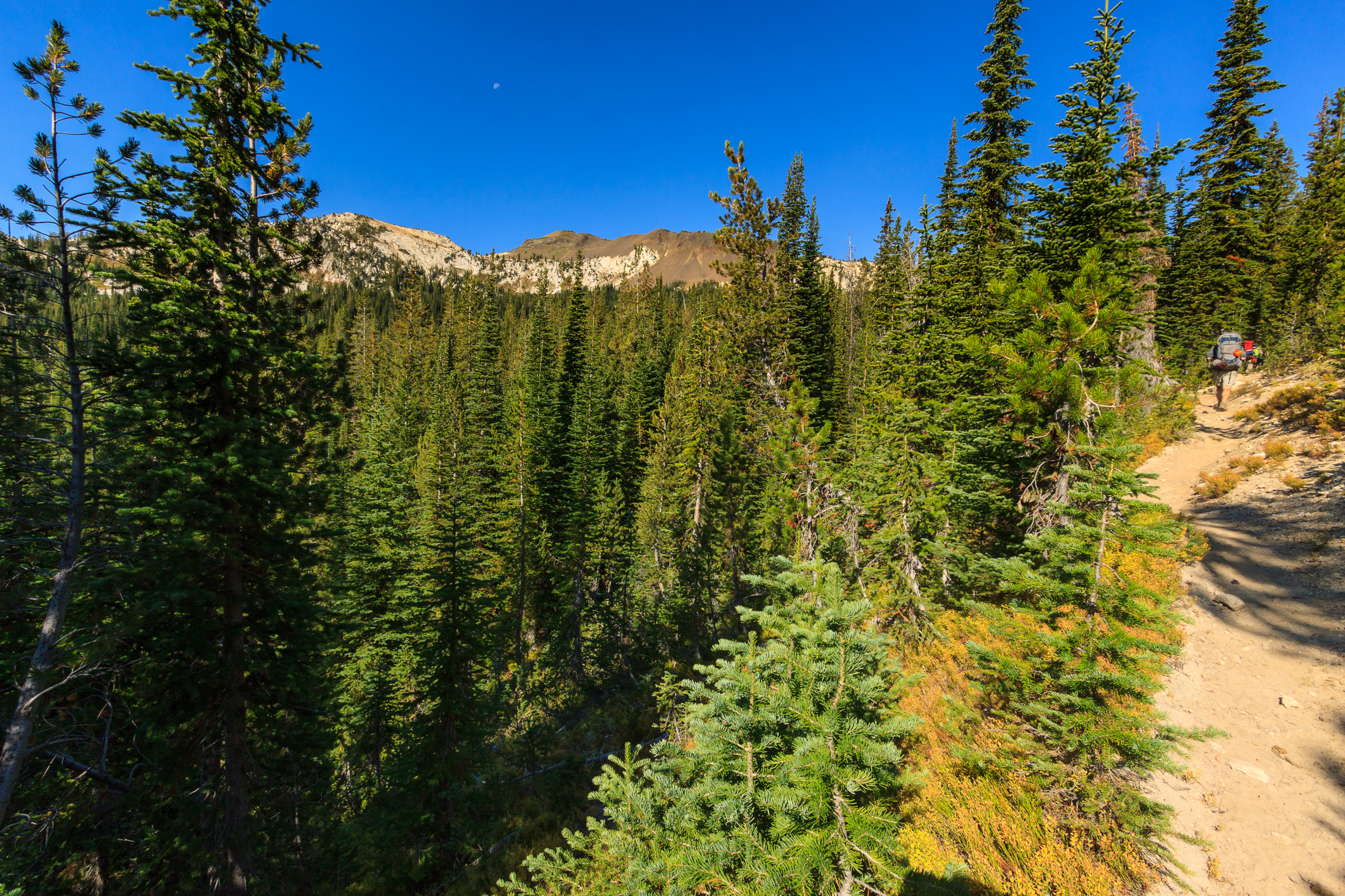
We began our hike on the East Eagle Trail which climbs from the lakes basin up to Horton Pass. This was new terrain for all of us, and so it was quite exciting to photograph some new scenery. After passing Upper Lake, the trail quickly climbs up a series of switchbacks while opening up views of the Lostine River valley that we hiked up the previous day. Then the towering Matterhorn appears over the Hurricane Creek valley. At this point, the trees become dwarf and sparse. At Horton Pass, there are barely any trees at all. Ironically, the other side of the ridge is full of them. In fact, there’s even a sparse forest of dwarf trees at the summit which might provide enough wind shelter to set up a tent up there.
The trail to the summit leaves the East Eagle Trail before Horton Pass. It climbs up a series of switchbacks before reaching the ridge. At this point, we get our first glimpse of the southern half of the Wallowas. It’s quite a sight. It’s a steep drop straight down into the East Eagle River basin. One wrong move and you might slide all the way down to the bottom. But the trail is well maintained and well travelled, and since there are trees surrounding you, there’s no imminent risk.
From the meeting with the ridge, it’s a fairly steep 900 foot climb over the course of a mile. Most of us dropped our packs or the majority of the contents of our packs for the last part of the climb, which helped speed up the ascent. After all, at over 9000 feet, the air starts to get thin and any bit to reduce exertion will save us later on.

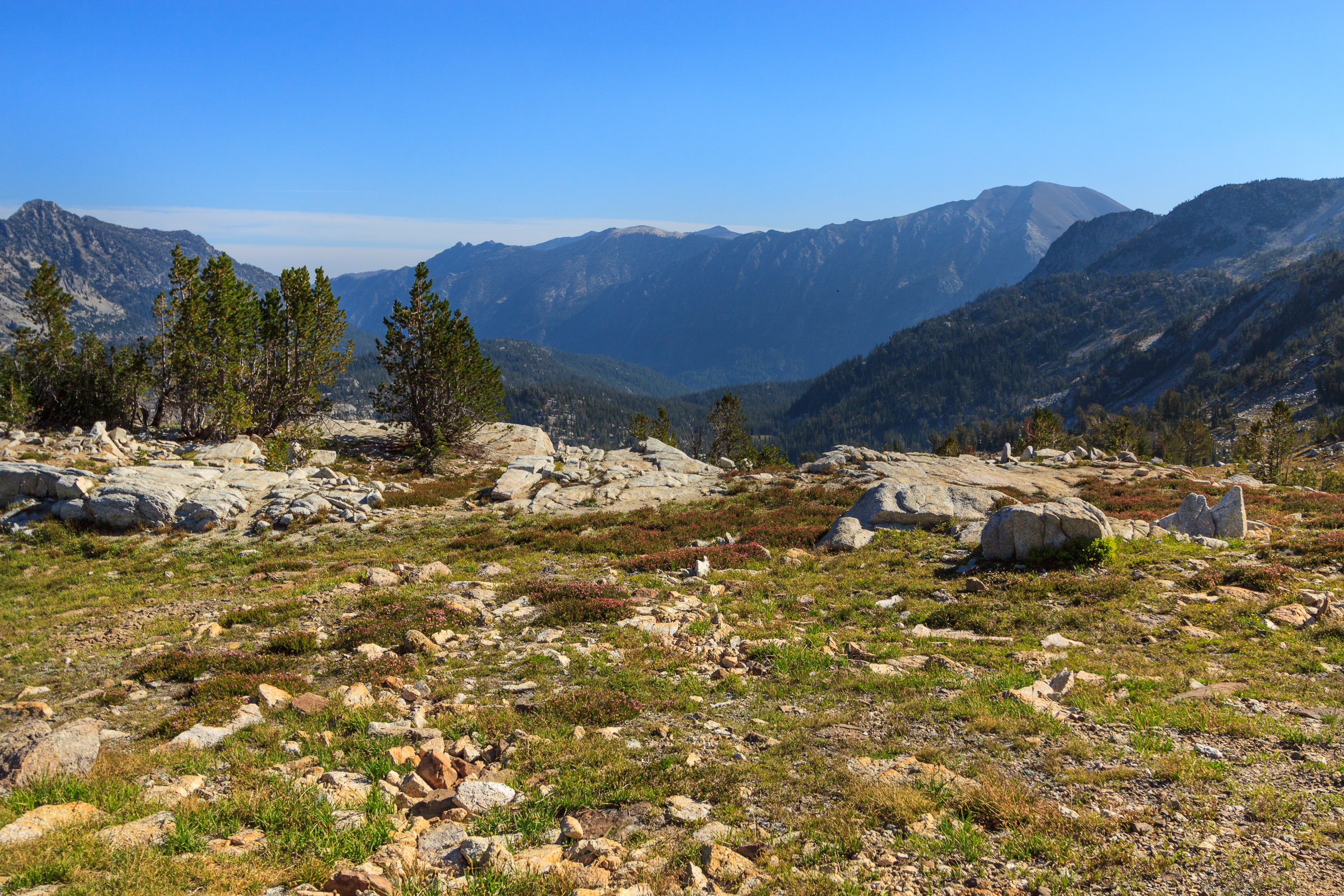
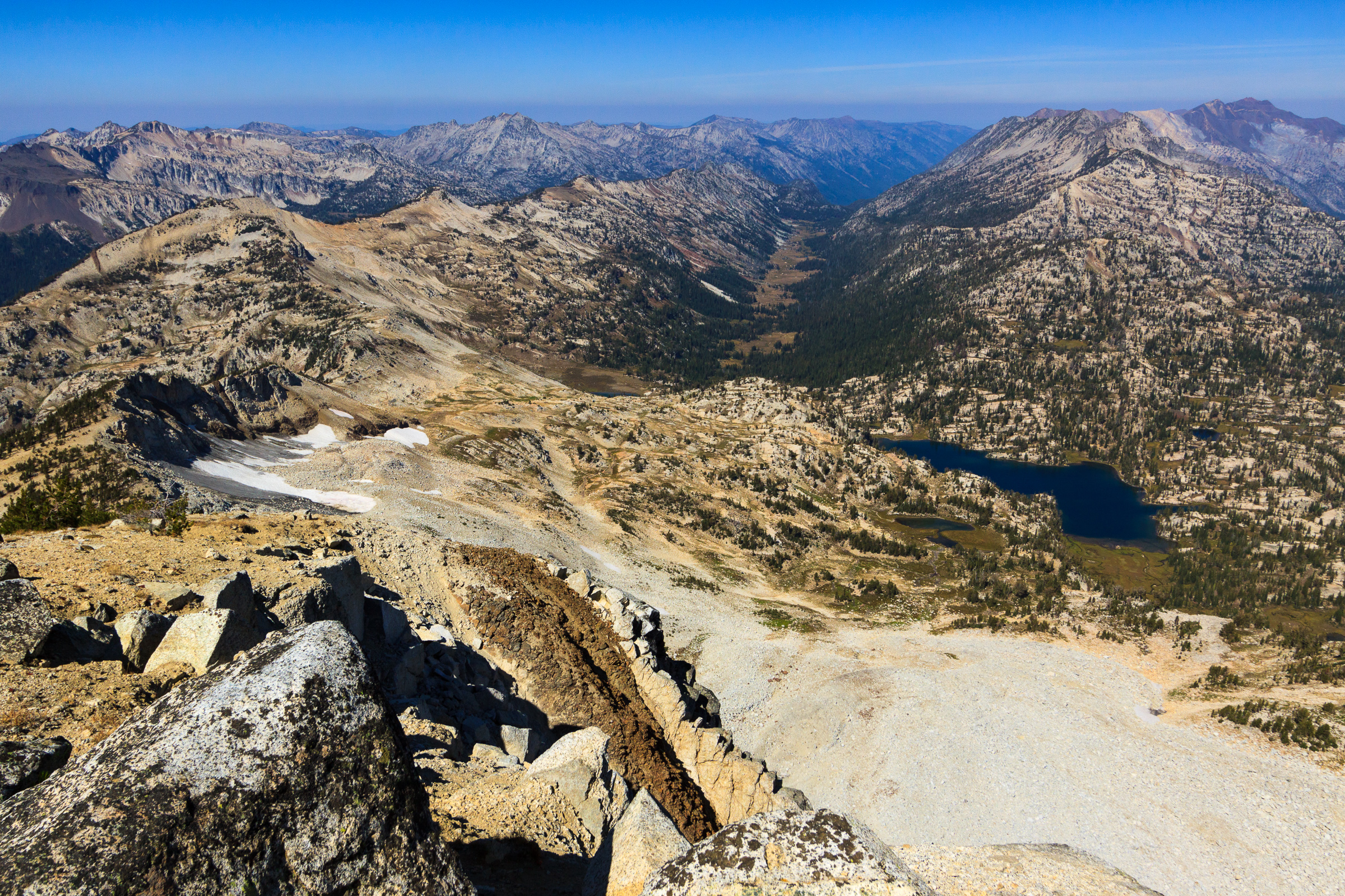
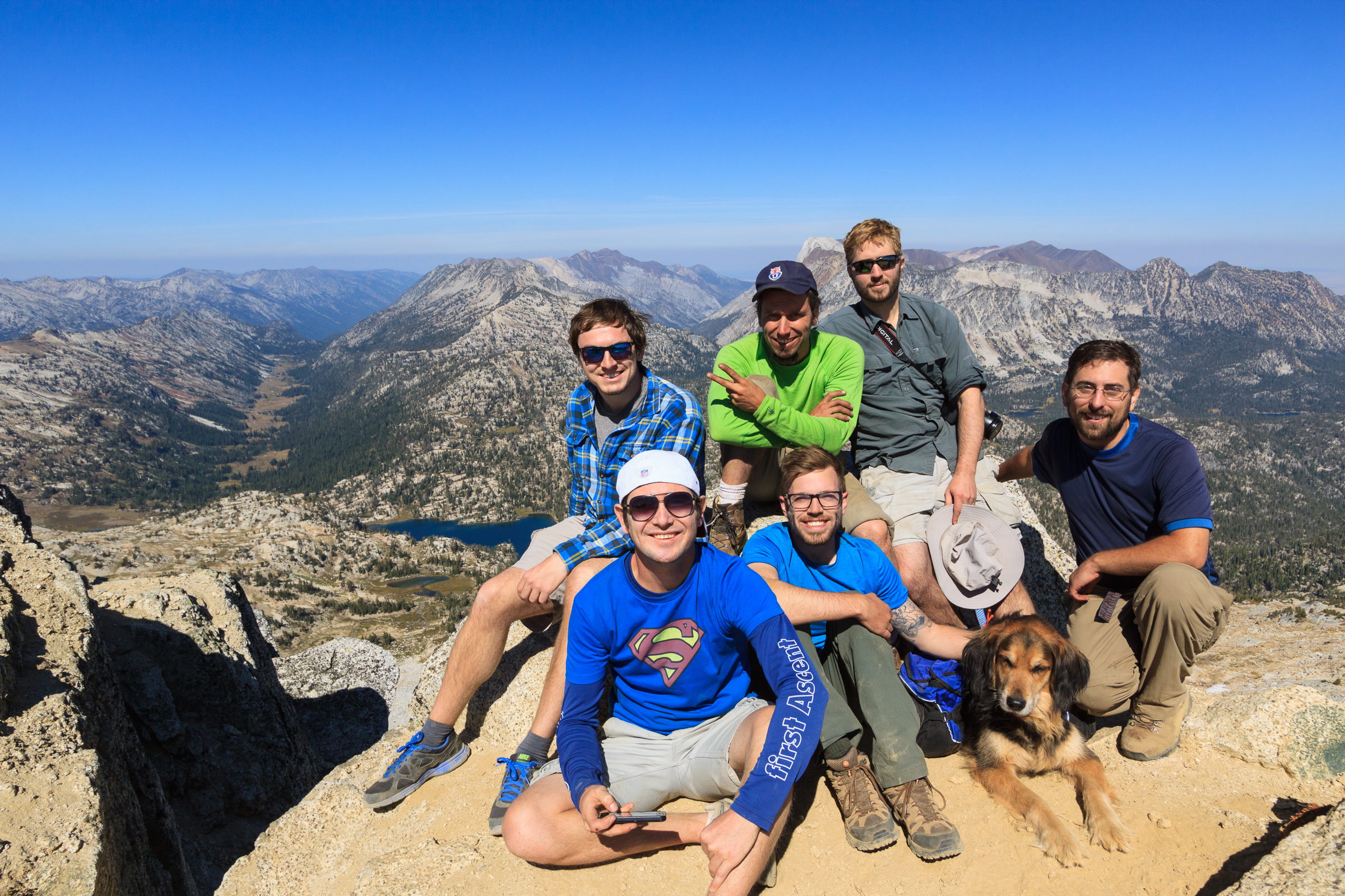
The summit of Eagle Cap is at 9573 feet above sea level, making it the 8th highest peak in the Wallowas. It sits right in the middle of the mountain formation, and as a result, stares at more glacial valleys than any other peak in the range. The views are some of the best around. We could see a fire burning in front of the Seven Devils. Hells Canyon is barely visible beyond the Wallowa River Valley. On a completely clear day, we were told that some of the high volcanoes from the Cascades are visible from the summit. It wasn’t the clearest of days, but it was clear enough to be impressive. It certainly could have been much worse, and after experiencing thick smoke haze in Moscow this week, I’m thankful for the conditions that we did have on the mountain.
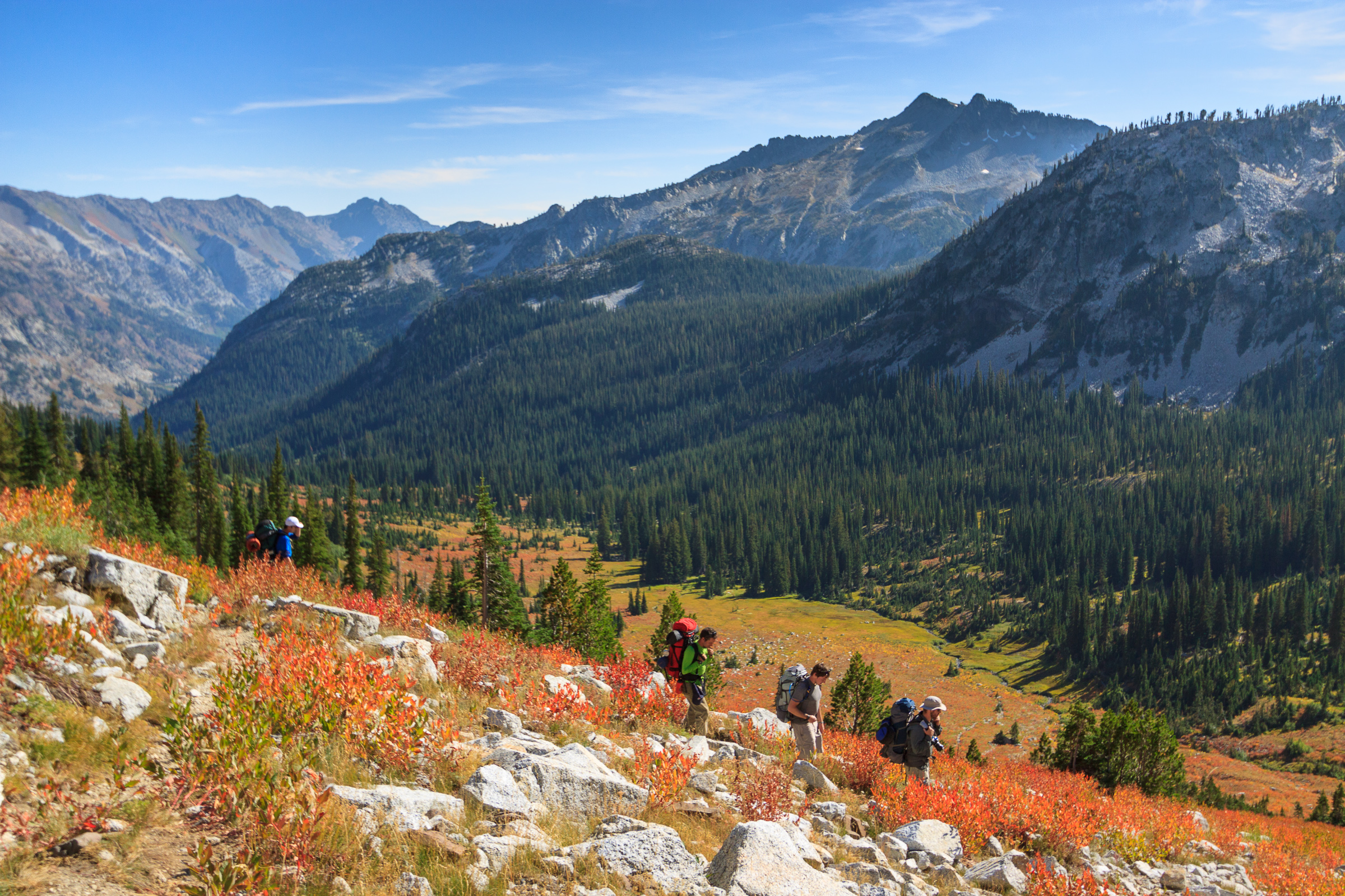
We spent well over an hour on the summit eating lunch, enjoying the views, and resting in the high altitude. It was certainly the high point of our trip. But all good things must come to an end, and eventually we did pack up and head back down the mountain. After all, we had 8 more difficult miles planned and only the afternoon to complete them.
Everyone always dreads hiking uphill, but always underestimates the downhill. The uphill might be more energetically expensive, but downhill is more taxing on your body. Uphill, you’re pushing against gravity. Downhill, you’re fighting gravity for control. That fight wears on your knees and feet. Thus, going down can sometimes hurt more than going up.
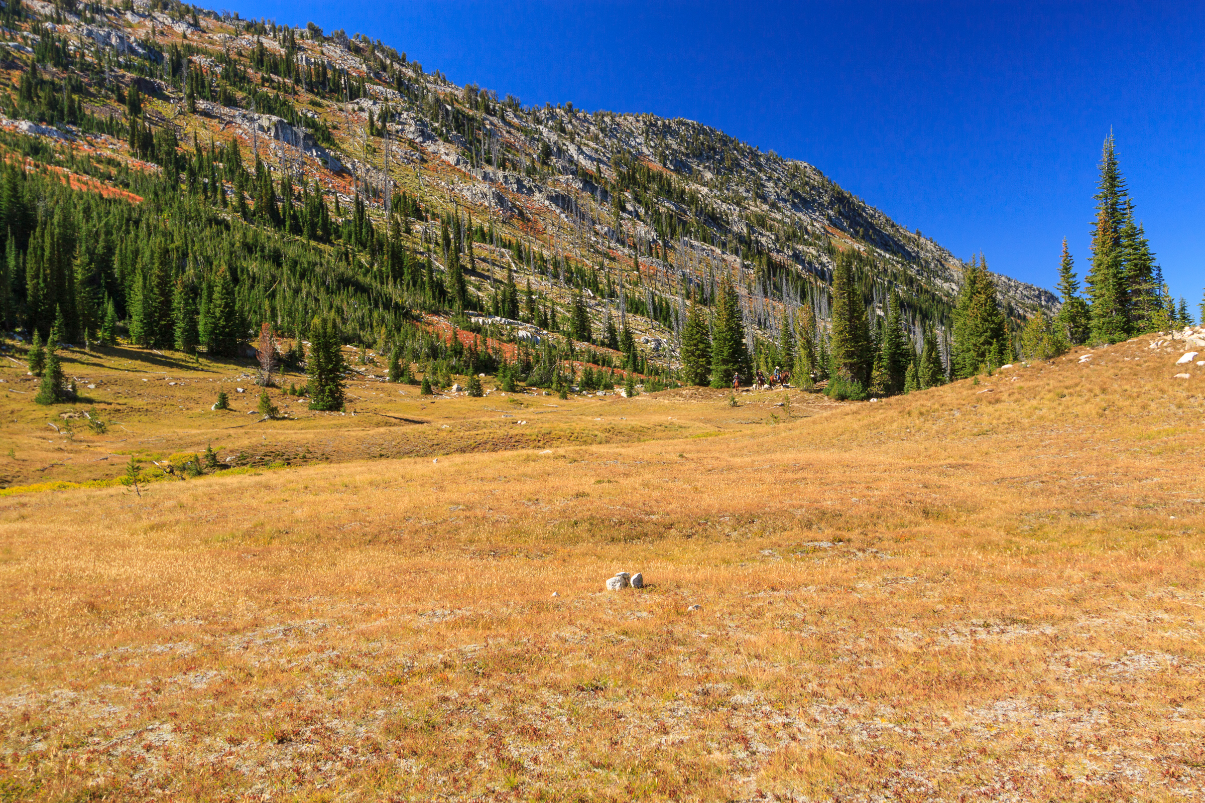
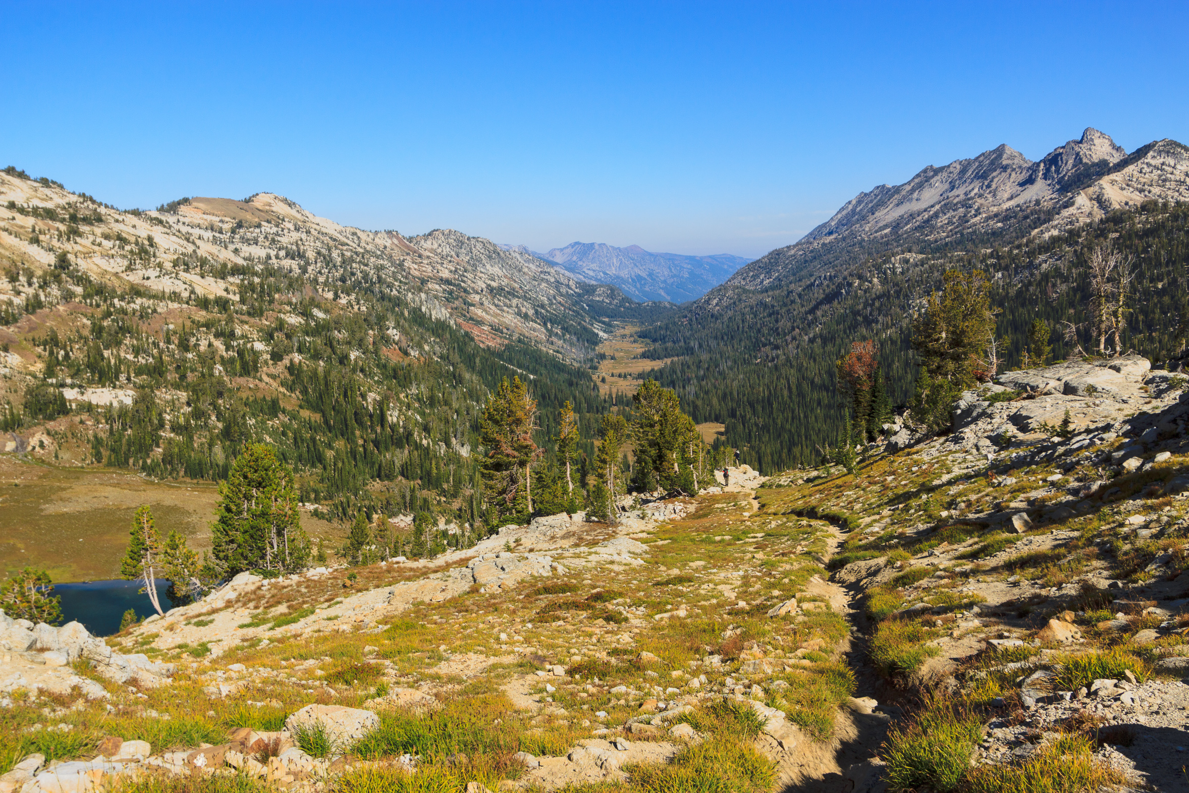
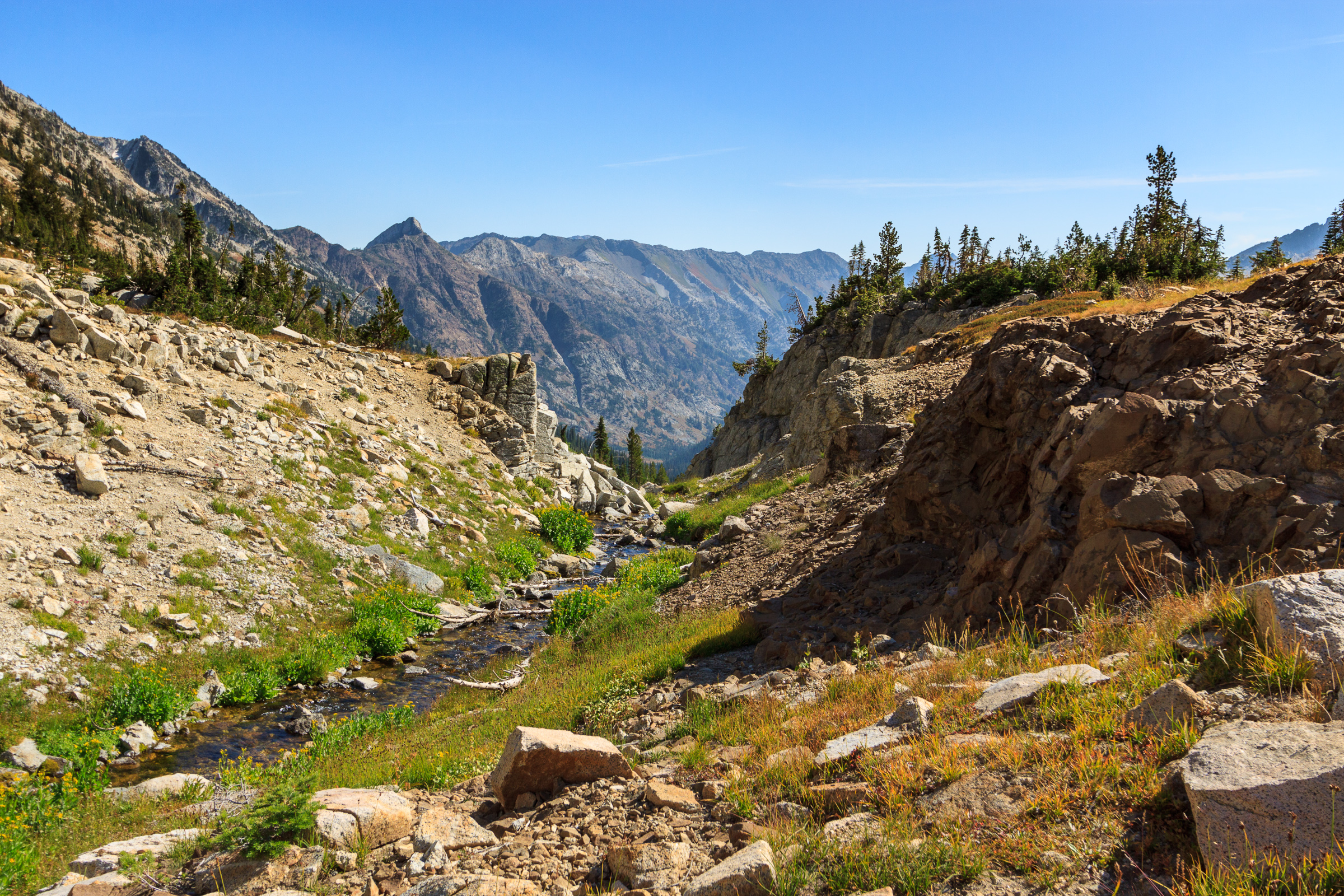
We ascended 2000 feet from Mirror Lake to the summit of Eagle Cap. We descended 3000 feet from the summit to the intersection with the Frazier Pass trail. That initial descent from Horton Pass was steep and rocky. By the time we reached the Frazier Pass trail, we were already exhausted. The campsite by the river looked inviting. But we couldn’t stop there or we’d have a major 10-mile hike out the next day. So, over Frazier Pass it was.
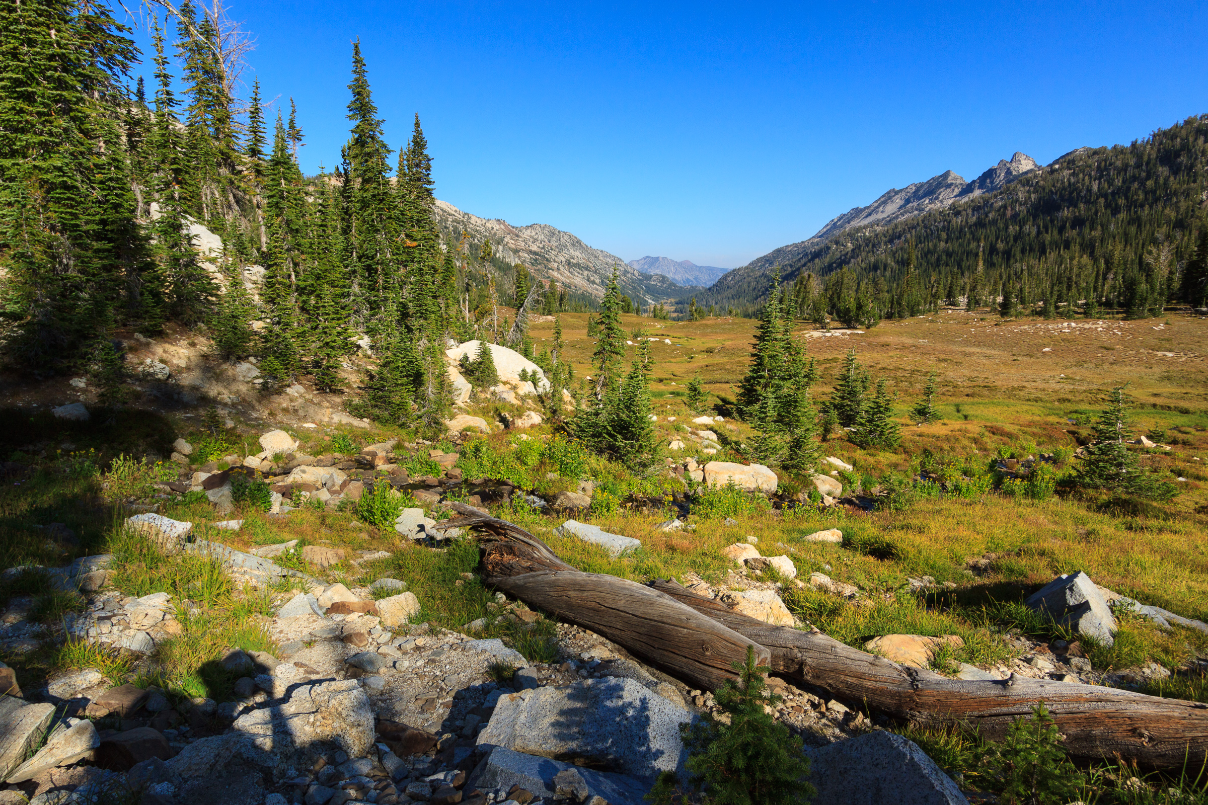
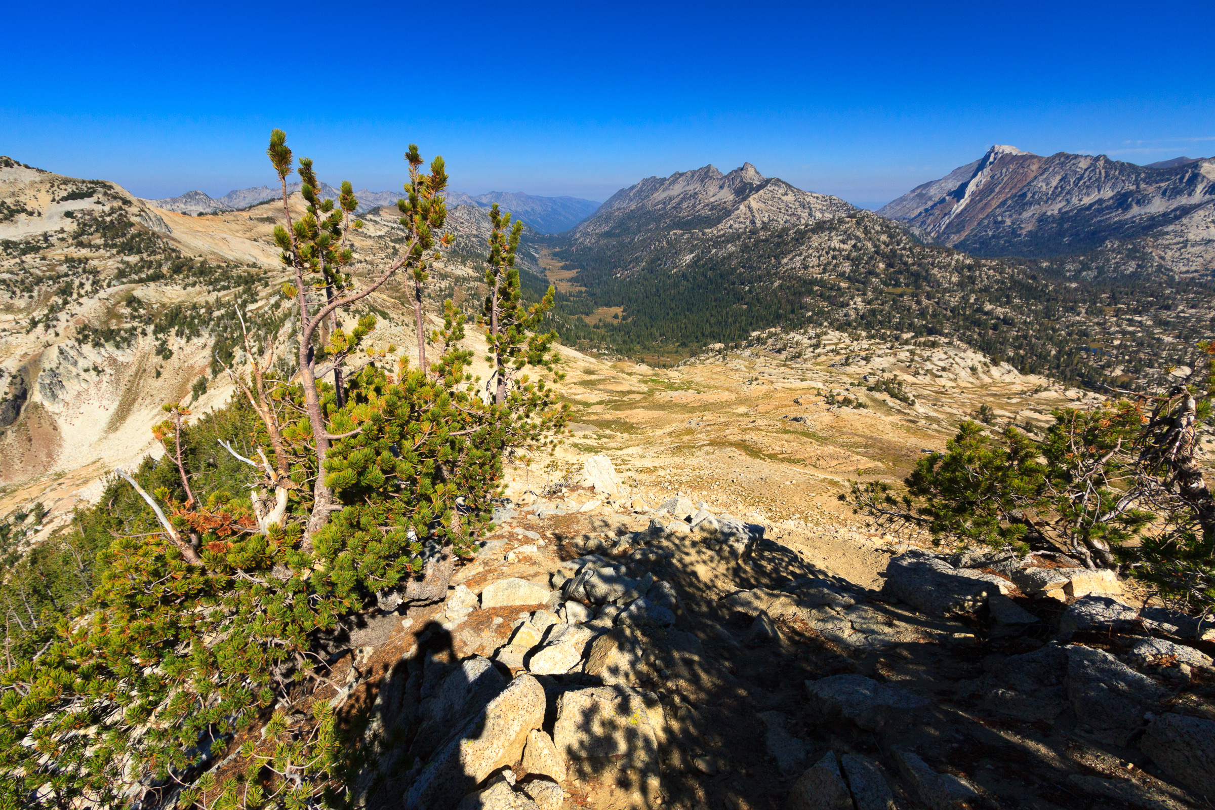
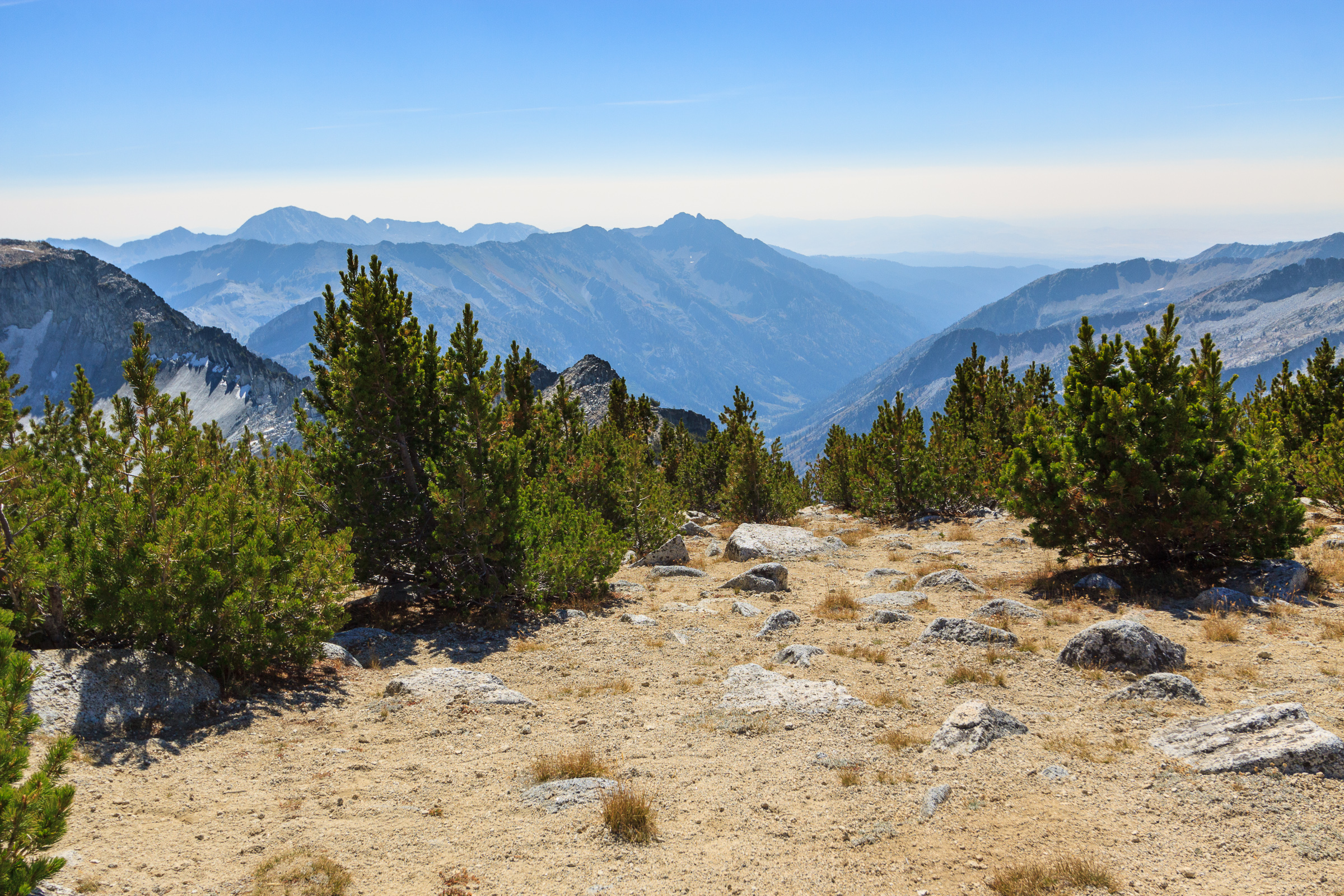
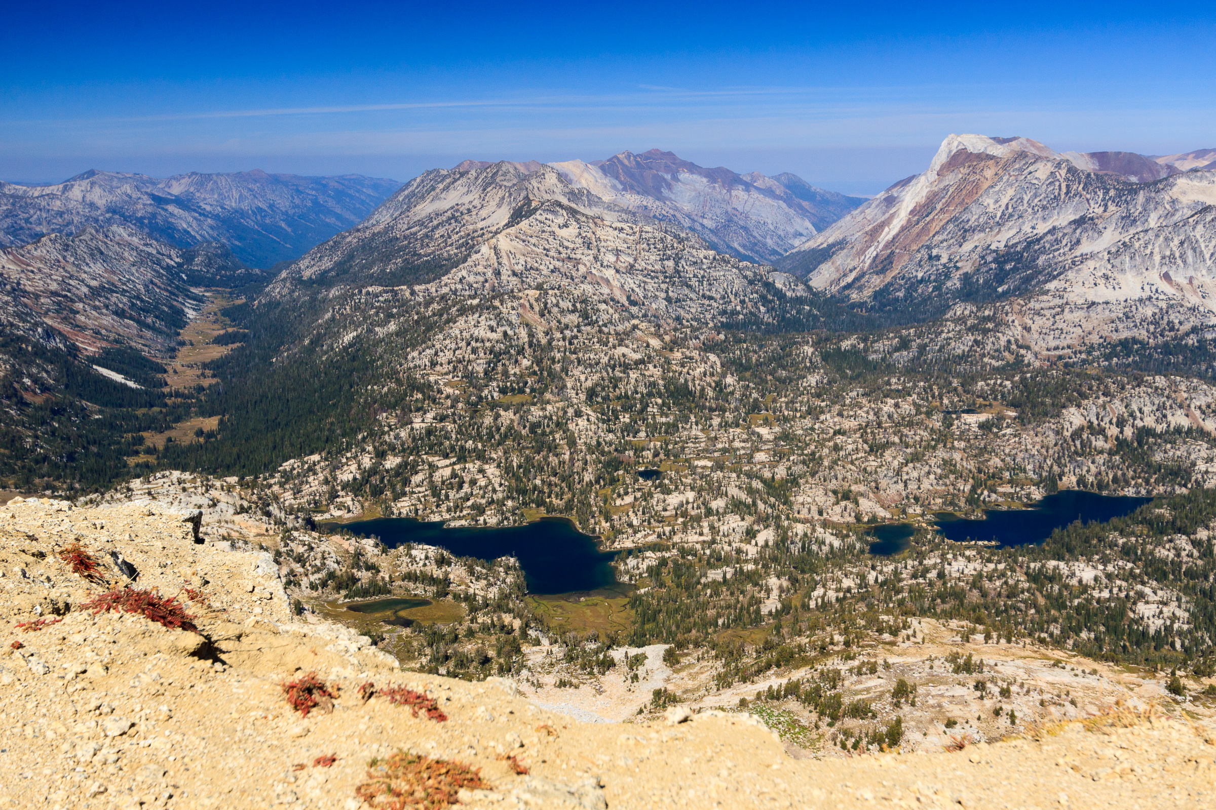
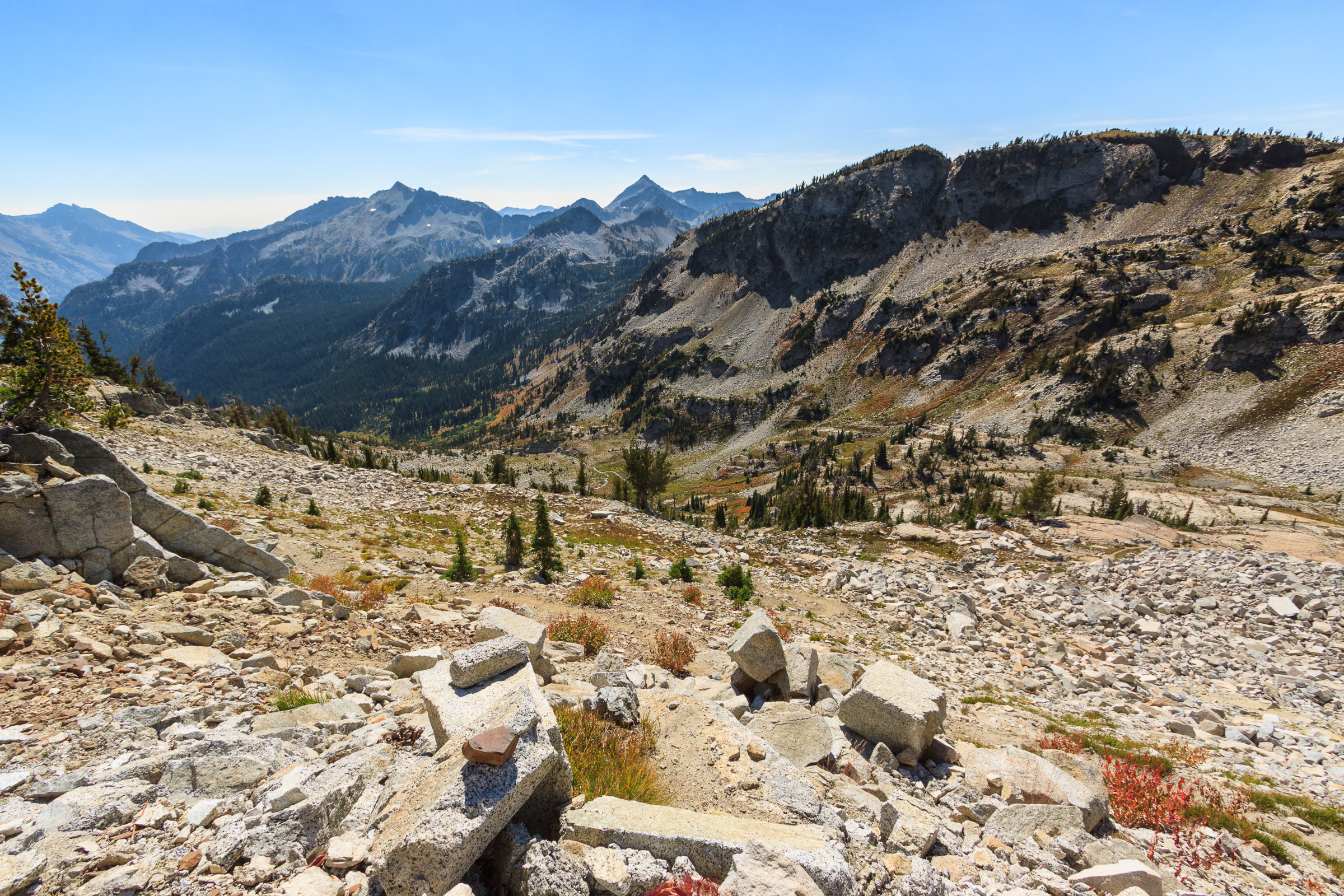
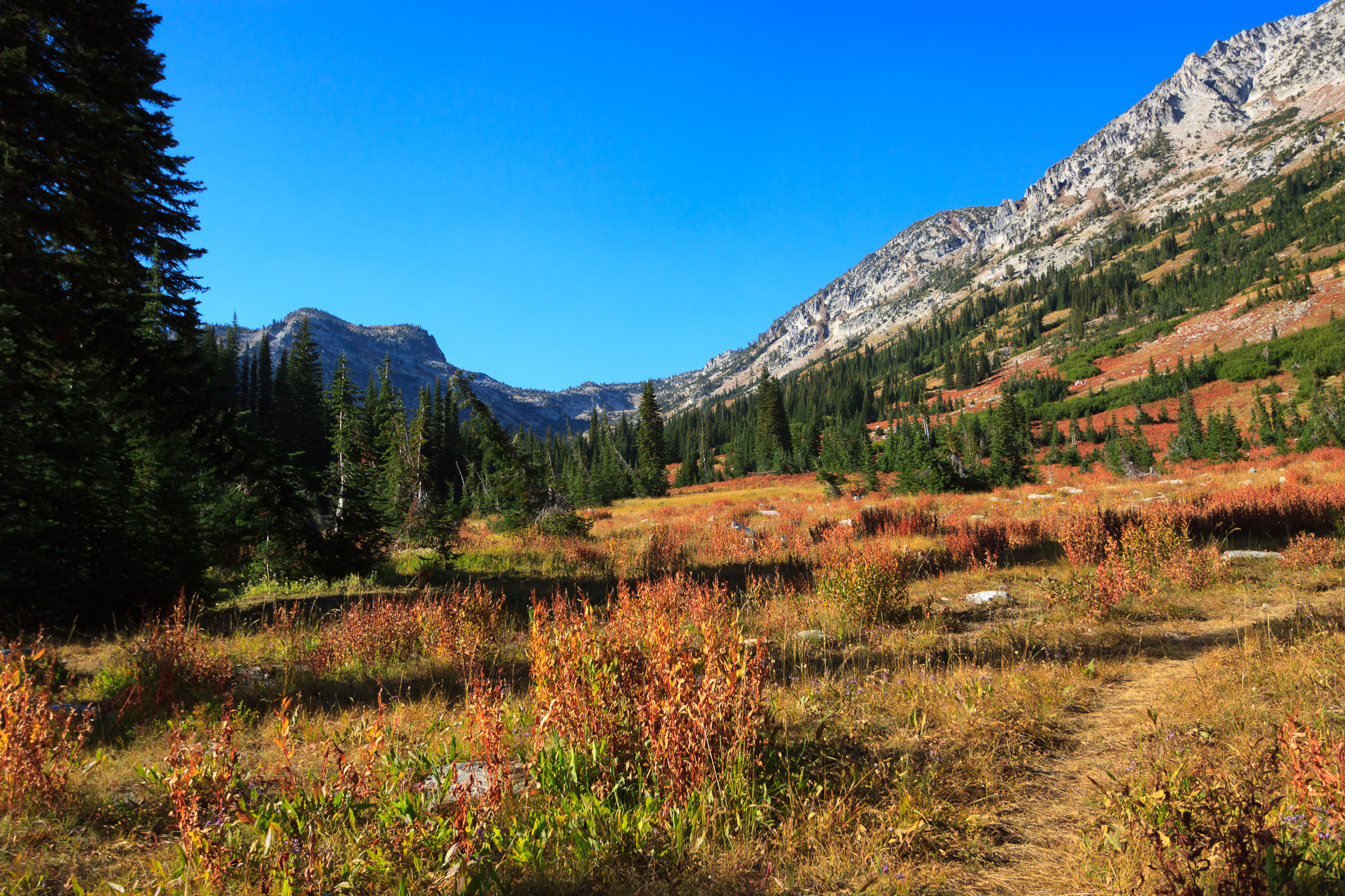
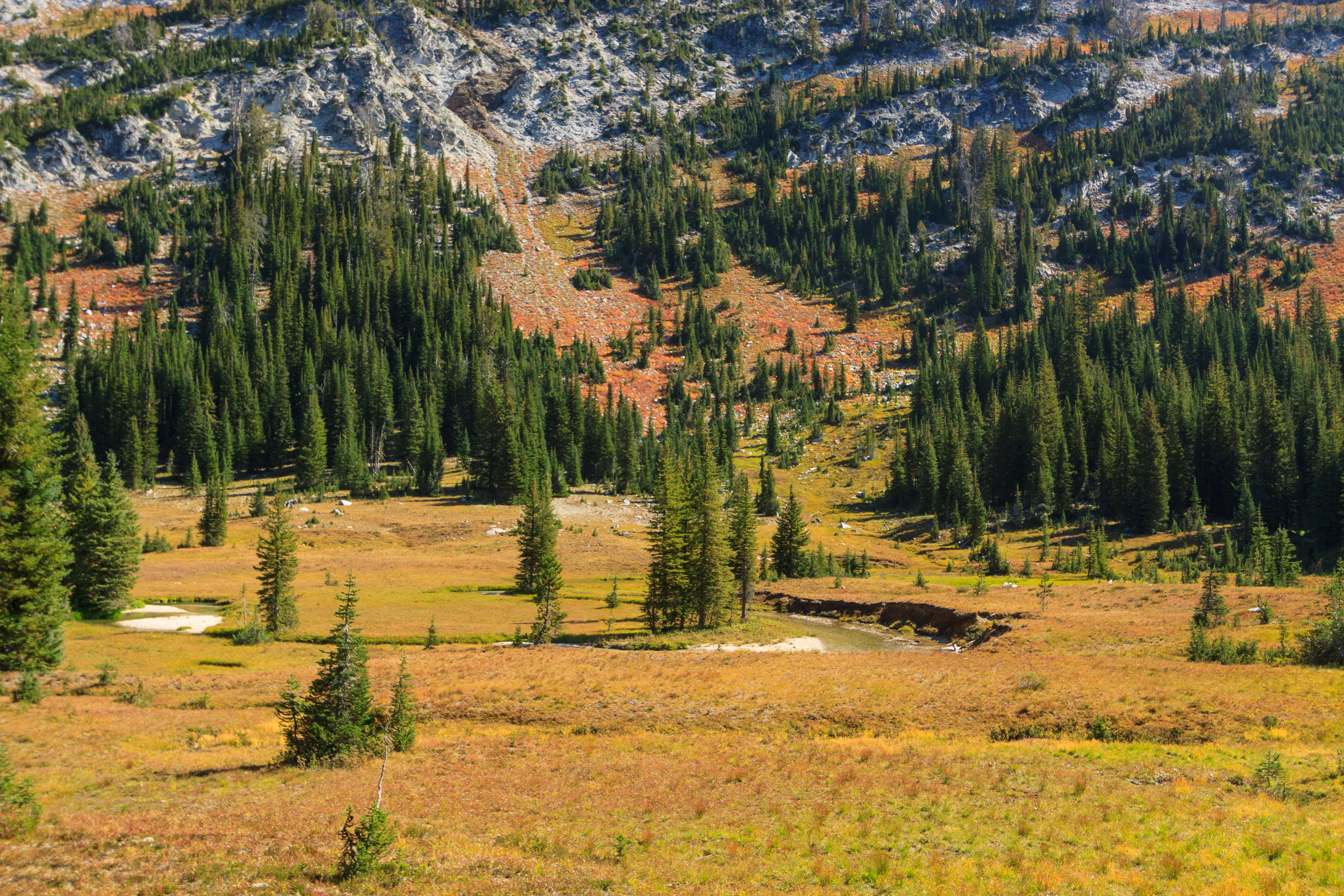
 But before I get to Frazier Pass, let’s talk about the East Eagle River valley. In short: It’s beautiful. But it’s also very different from the Lostine River valley. As we descended Horton Pass, we could see a nice meadow down below. We would end up hiking through it before crossing the river and ascending up the other side of the valley, but the first thing I noticed was that the plant community was very different from the northern valleys. There seem to be fewer flat shelves with meandering streams and more of a deliberate slope to the whole valley floor. It’s not that it’s any better than the north. It’s just different. In fact, each valley seems to have its own unique character, distinct even from the next basin over. No two valleys are alike, which makes the prospect of returning to explore more of the area an enticing possibility.

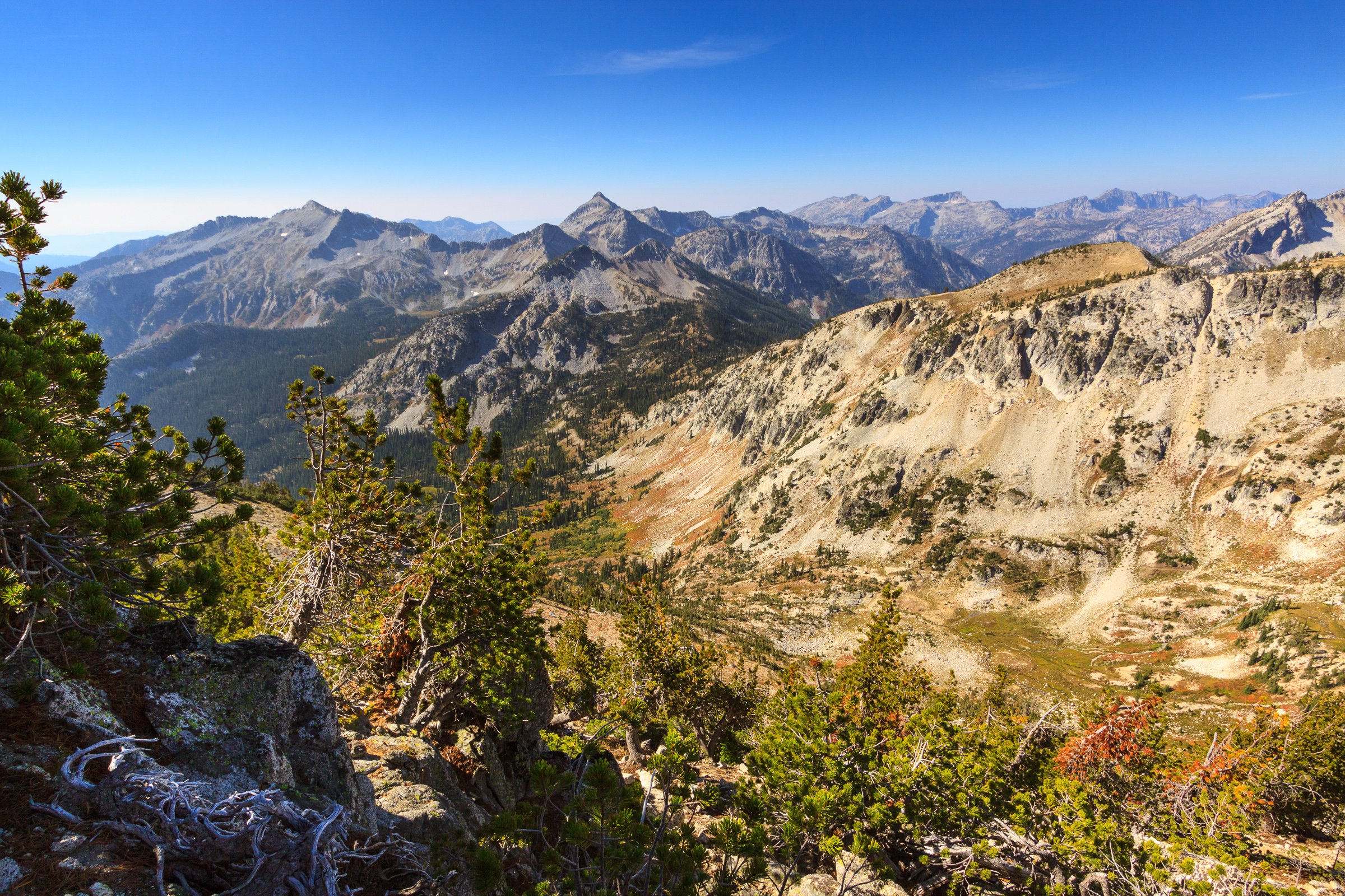
Frazier Pass is a difficult trail, especially after having hiked seven miles with a major elevation gain and loss. We had two more miles to hike before reaching the Minam River where we could have the option to cut the second day short and still have a manageable last day to hike out. This required a steep climb of 1000 feet in one mile, and then a descent of 800 feet for the second mile. My feet were done, so this last stretch was slow and excruciating for me. Yet I pressed on. I made it to the river as the light was fading. Everyone else had already arrived and had chosen a suitable campsite for the night.
The advantage of sleeping in the valley is that we could make a fire. And that’s one of the first things we did. We had a nice fire going to keep ourselves warm while we set up camp and got dinner going. I don’t think we were so grateful to have a fire to relax by than we were this night. It was a chilly night, but nothing we couldn’t deal with. It still wasn’t as cold as our first night car camping by the trailhead.
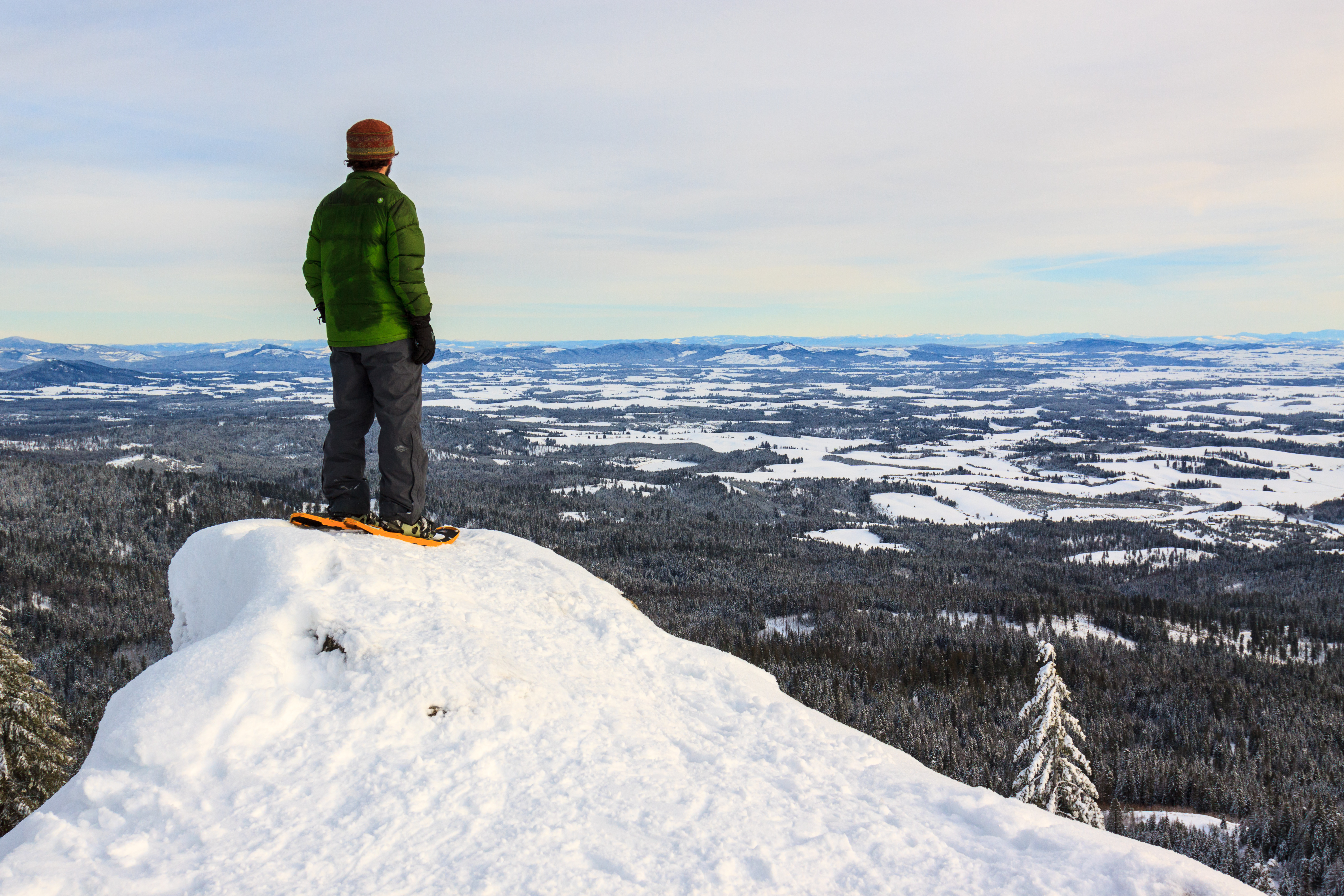
Day 3
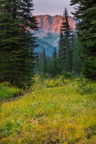
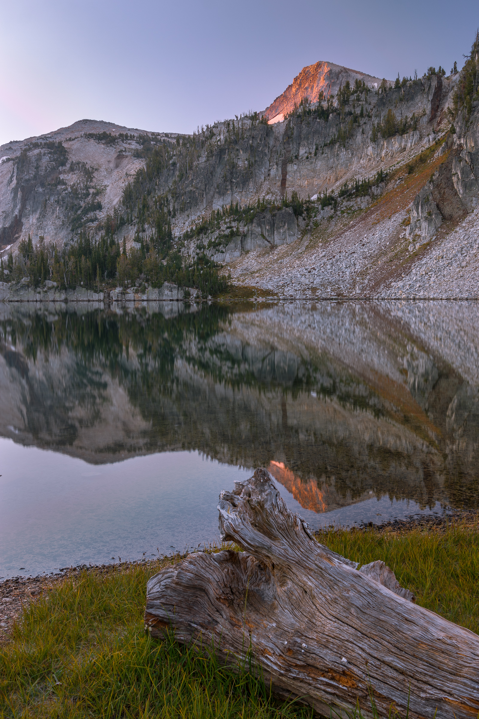
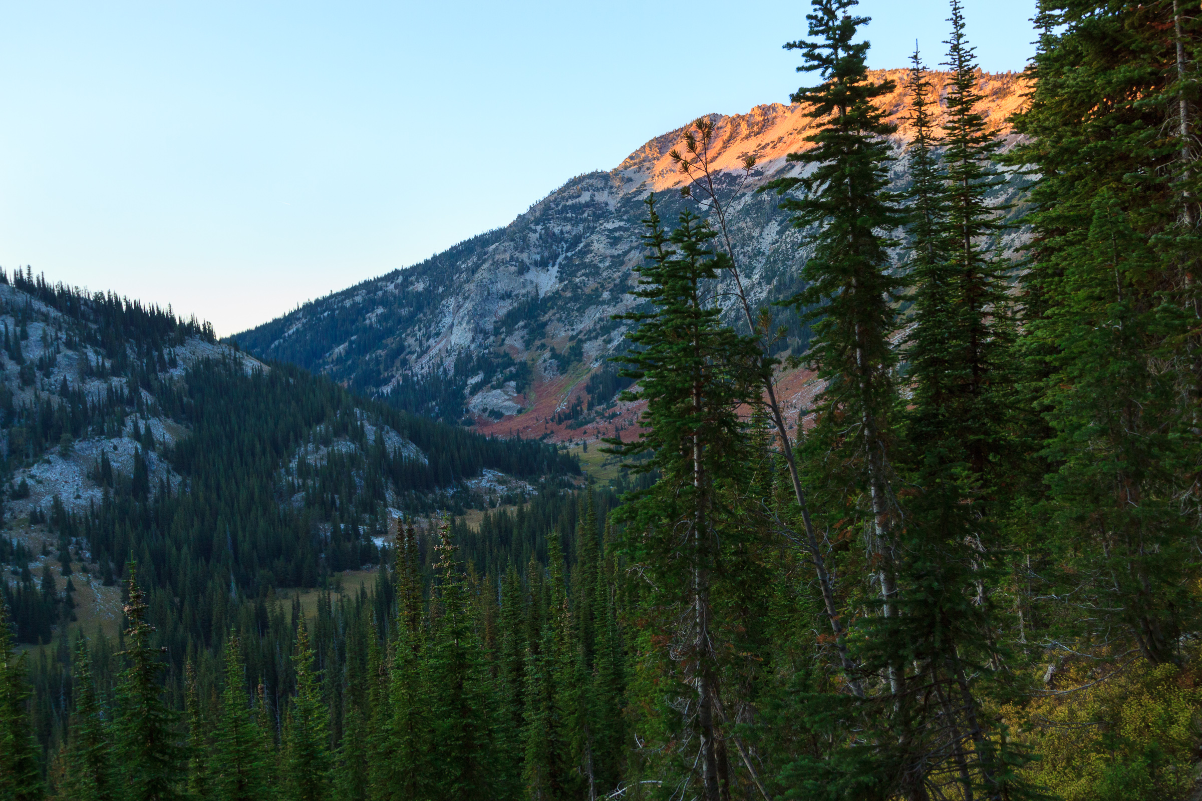
Again, the reason I bring my tripod is to get shots like this.
Throughout the night, I had been hearing the sounds of elk in the valley. So when I was awoken by elk bugles, I looked across the field from my hammock and thought I saw some grazing. That prompted me to preemptively wake everyone up for an elk sighting. I should have fished out my glasses first, because it turns out the dark blobs I thought were moving around were really just trees. Oops!
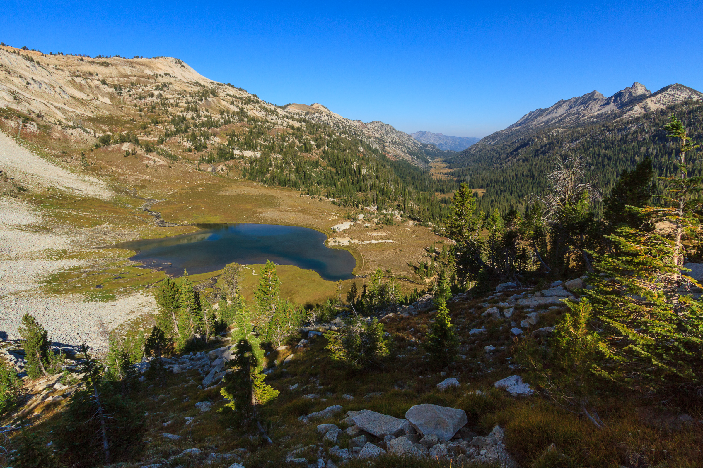
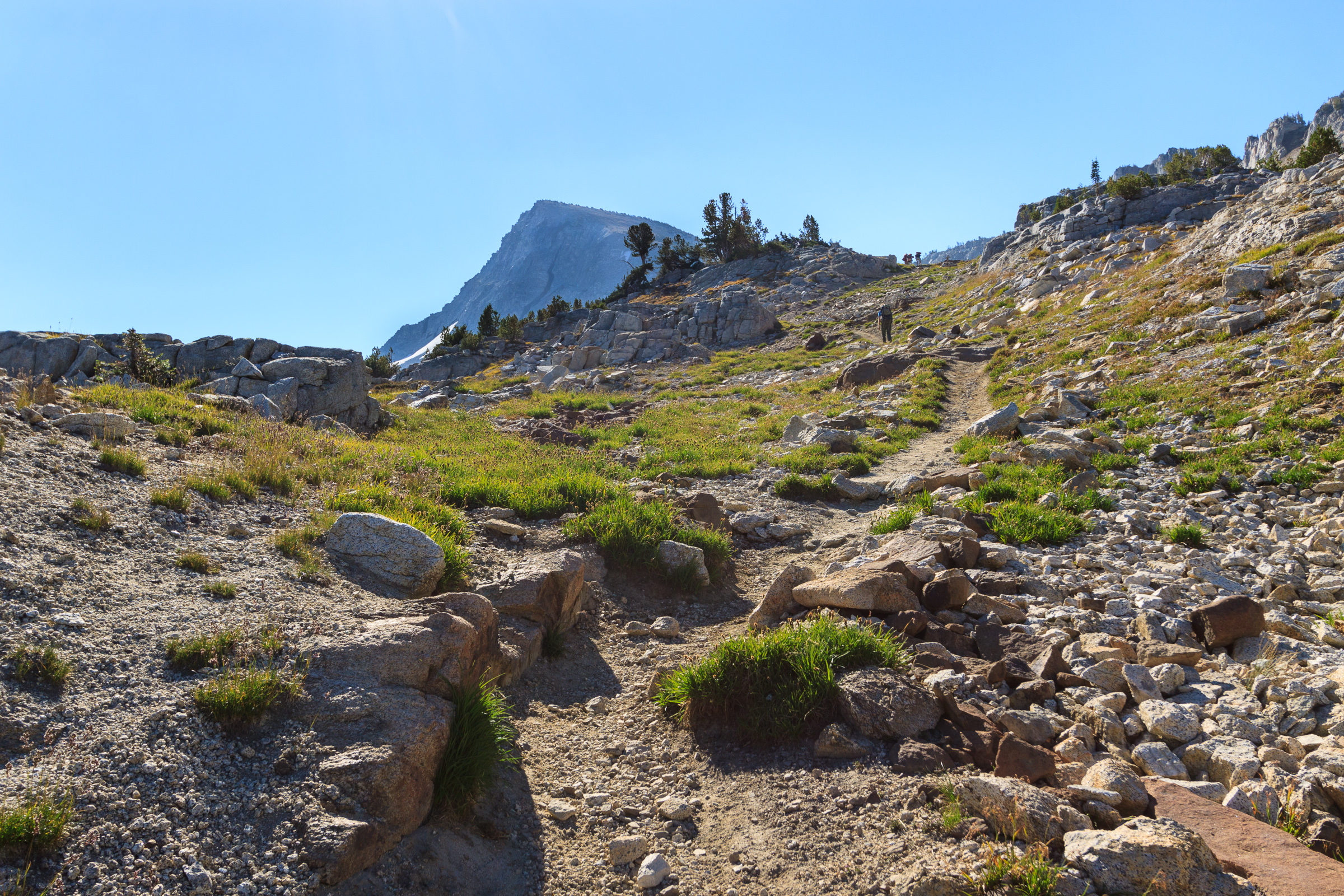
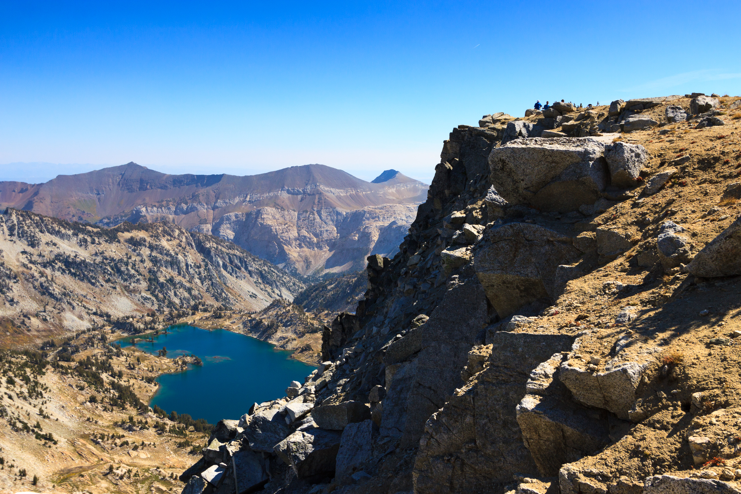
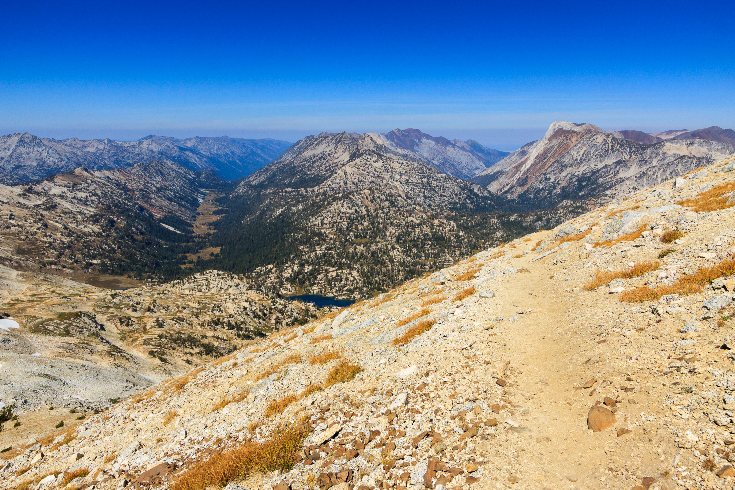
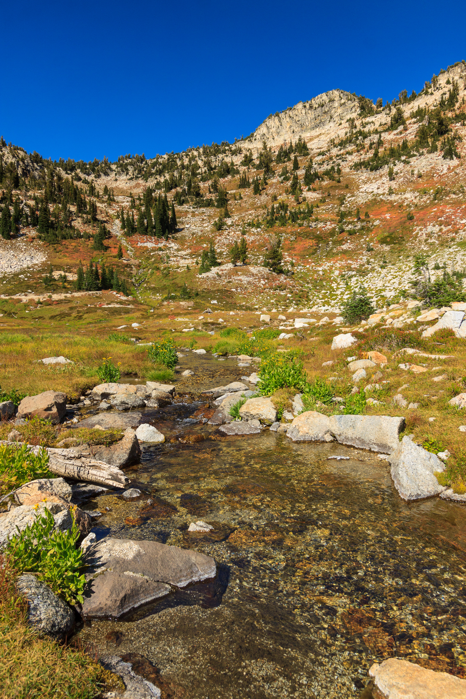
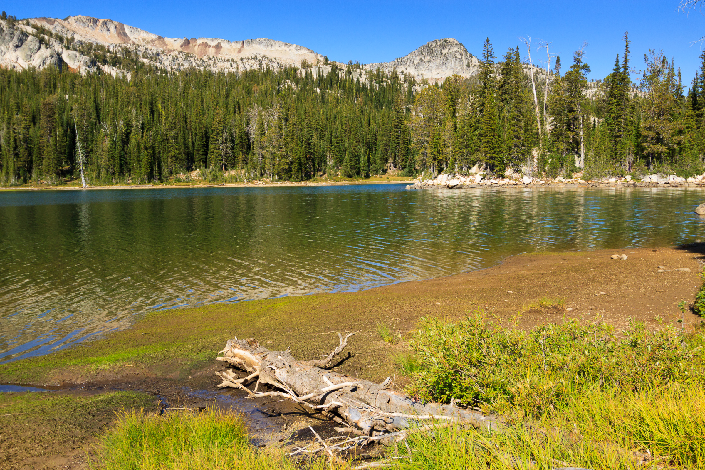
 Well, it’s a good thing I woke everyone up or we would have slept in later than we wanted. We only had an 8-mile hike out to the car which, with short breaks, we estimated would take us 5 hours to complete. We left camp around 9:00 and headed up the trail toward Minam Lake. It was a gentle 700-foot climb over two miles through a combination of beautiful forests and open meadows. It was a much needed reprieve from the strenuous terrain of the day before. We reached the lake and stopped for a quick view, but decided not to take an extended break. We stopped once more near the northern end of the lake for a second view and then headed down into the valley.
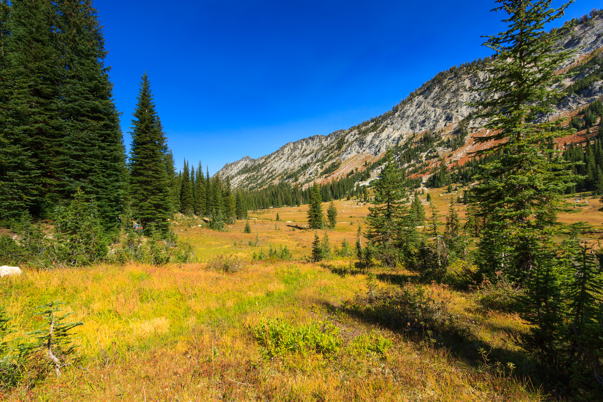
The West Lostine Valley is similar to the East Lostine valley on the other side of the ridge where we hiked in, yet it’s quite different. The grasses are short and the meadows are fla just as its eastern sister. But this fork has more water in it. The meadow isn’t nearly as long, so there’s more time spent in the forest, especially after descending and meeting up with the Copper Creek trail.
Despite the more constant descent on the trail’s elevation profile, there were some steep sections along the trail which made me glad we didn’t go up this one. But overall, it was an easy and scenic 8 miles. As we descended the last switchbacks near the confluence of the east and west forks, we celebrated the end of our hike. As predicted, it took us five hours to reach the trailhead, just in time to pack up and head back to Enterprise for a post-hike beer and burger at Terminal Gravity.
This was my first backpacking trip since injuring my leg skiing last year. Even with an overweight pack and some strenuous terrain, my hip and knee performed like a champ. Yes, I came out sore, but not from my injuries. The worst part was getting out of the car in Enterprise after sitting for an hour. At that point, my calves did not want to support me. I was still hurting a bit Monday morning, but by the end of the day, I was feeling back to normal. It helps to be walking around.
This year’s Wallowa Weekend was a success. I’m already excited to plan next year’s adventure. I’m determined to keep the tradition alive until I leave the area.