Camping at Hazard Lake

In May we bought a new tent to accommodate our growing family on camping trips. I guess the two-person backpacking tent just won’t do it anymore for thee people and two large dogs. So after we bought it, we took it out for its maiden test at a nearby campground. This summer was dubbed the summer of no fun. I was busy writing and Erin was working an internship. To make the summer a bit more bearable, we thought we’d go camping for a night or two once a month just to get out of the house and have some adventure with Clara. June came and I had planned a trip to the Blue Mountains of southeastern Washington. Then Clara got sick and we didn’t go. July came and I had planned a trip down to McCall. Then Clara got sick. And Erin got sick. And we didn’t go. So when Erin finished her internship the first week of August, I put my foot down and said we were going camping.

I’ve always wanted to explore the mountains behind Brundage. In the summer, the road continues past the Brundage Reservoir, Goose Lake with trailhead access to Granite Mountain, and onto Hazard Lake in the alpine valley at 7000 feet. At that elevation, we could escape the heat and dry vegetation on the Palouse. The Hazard Lake campground is remarkably nice for being 20 miles out of civilization on a gravel forest service road. The tent pads are filled with sand which keeps them flat and soft. Every site has a picnic table and a fire pit. The toilets were some of the cleanest I’ve seen at a forest service campground. And there’s potable water available at a central pump. Though the forest service claims the campground doesn’t get heavy use, we were lucky to find an open campsite when we arrived Saturday evening.

Hazard Lake
Bruin Mountain and Hazard Lake

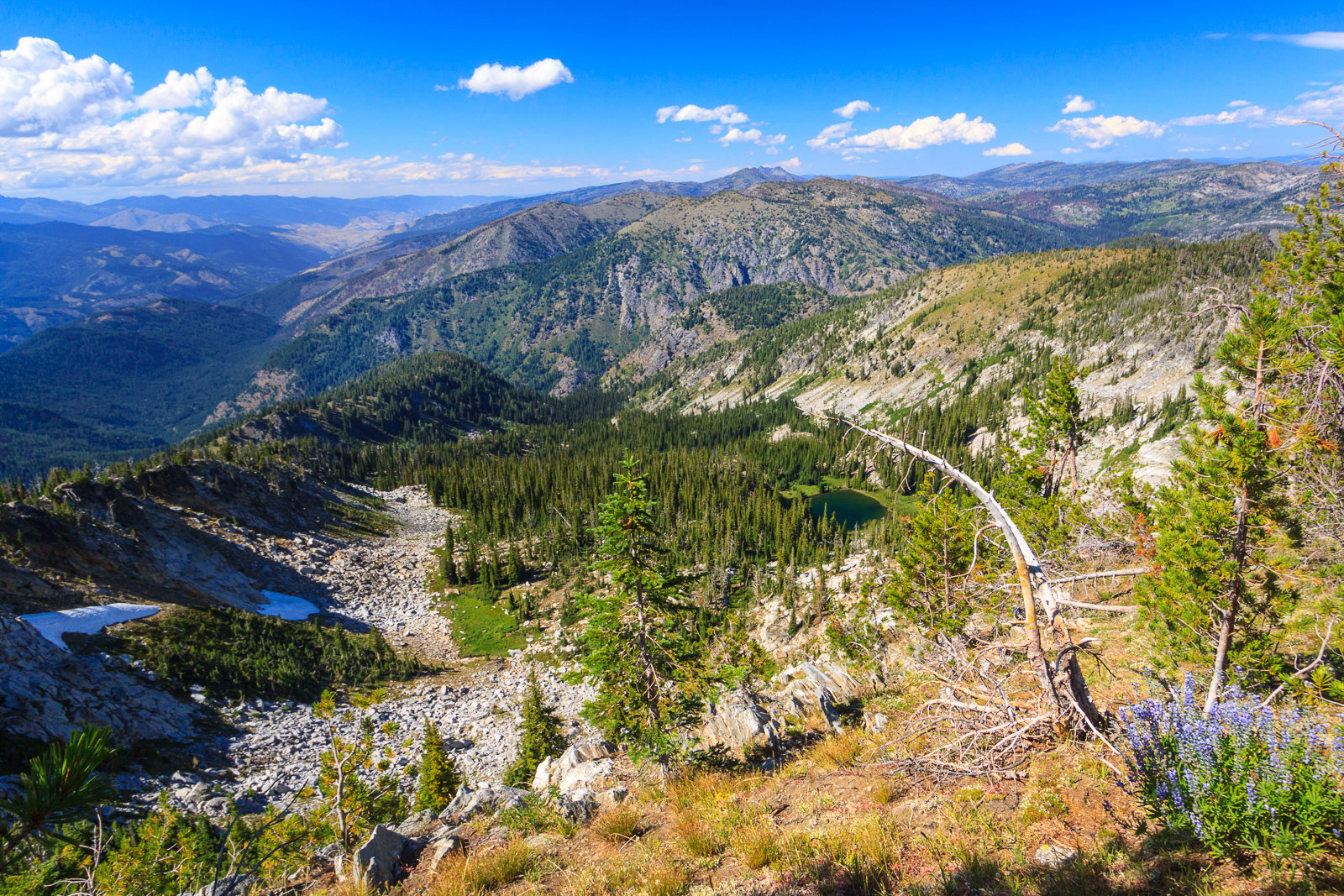
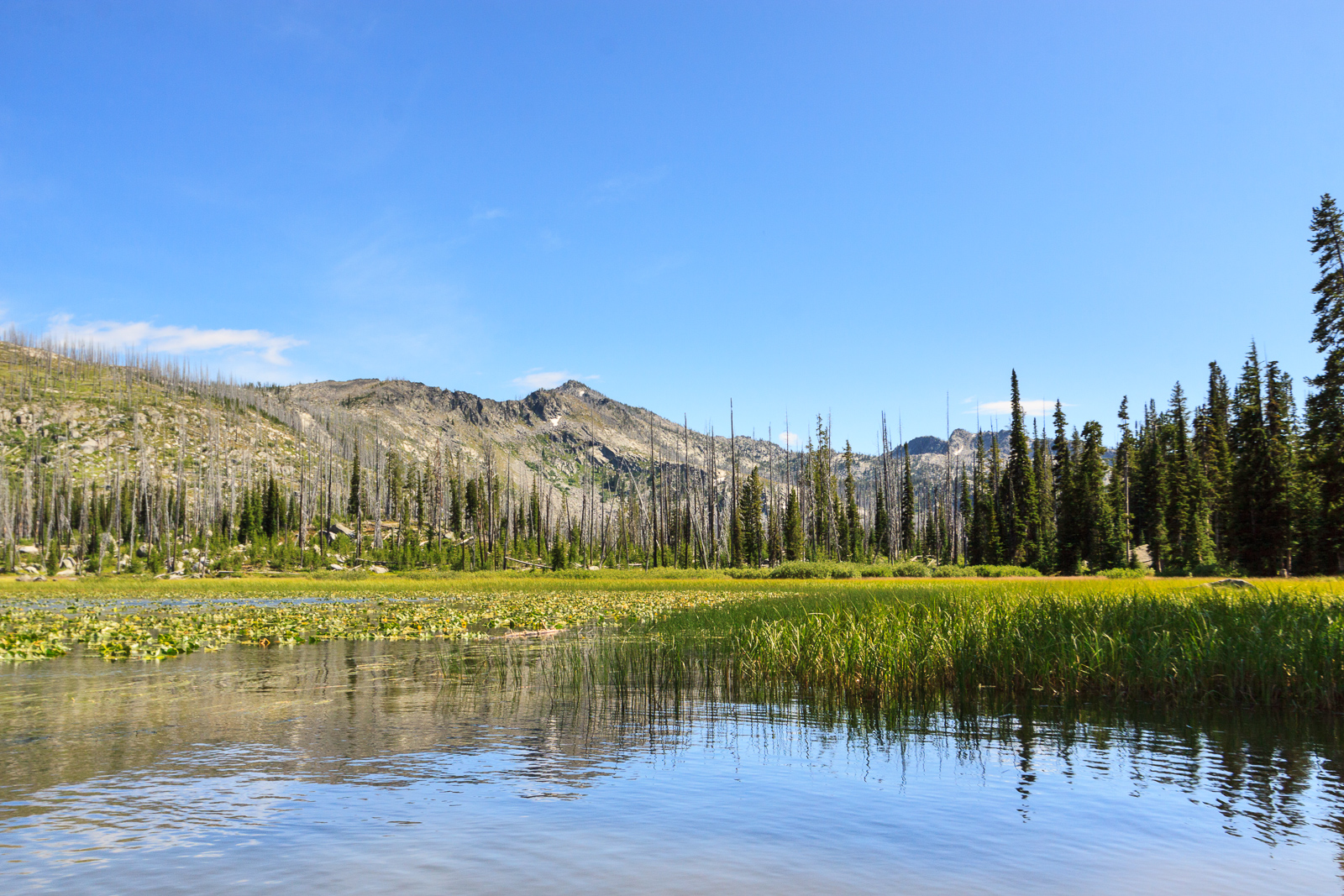
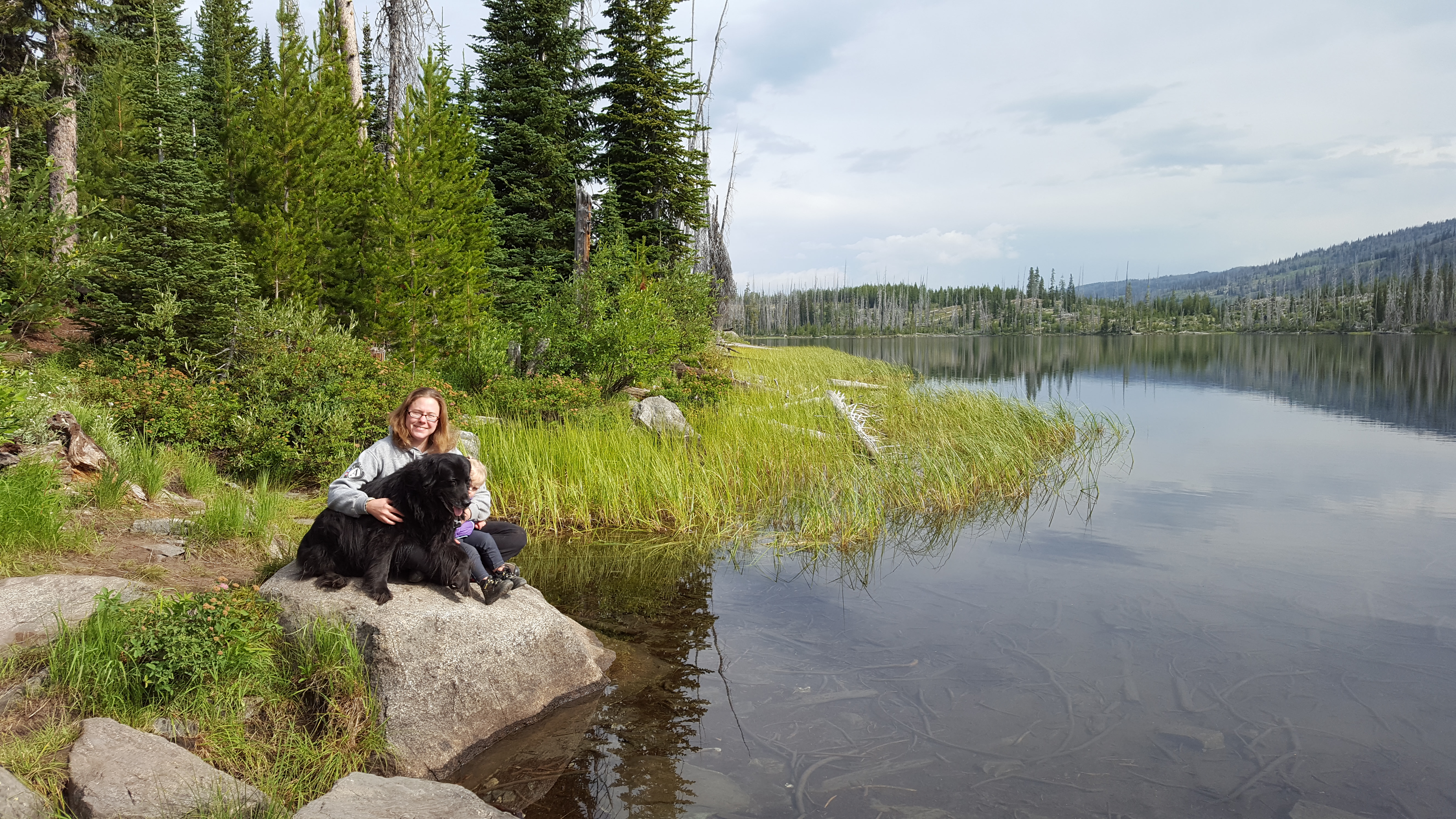
The campground is on the edge of Hazard Lake, which seems bigger than it appears on maps. Some people brought kayaks with them to paddle around the lake, and it does seem like it would be good for some exploration by boat. Big Hazard Lake is just down the road, and as the name suggests, is a larger lake. A trail leaves the campground for Upper Hazard Lake just 2 miles away. Upper Hazard sits at the base of Bruin Mountain and resembles a more traditional alpine tarn. The hike is easy which means we could it with Clara in just a few hours.

The trail to Upper Hazard Lake.
Upper Hazard Lake
Upper Hazard Lake
Erin, Clara, and Shadow by Hazard Lake.

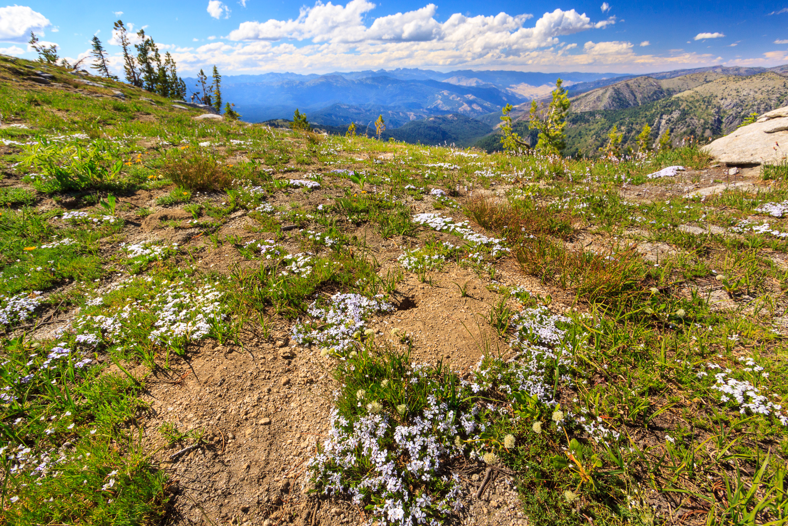
We arrived at the campground Saturday afternoon, set up camp and made dinner. We explored the campground, but otherwise just hung out at camp for the evening. On Sunday, we had lazy morning. We heard some thunder off in the distance and decided to wait and see what was going to happen. When the sun came out and it seemed that the storm had passed around us, we head on the trail for Upper Hazard Lake. Half way there, we heard thunder again and almost turned back, but waited to see where it was headed. At first, the storm looked to be heading right for us, but again it passed us by and we continued on to the lake. We had a nice hike and saw more wildflowers than I was expecting for this time of year. We got back and had a late lunch that turned into an early dinner, and then decided to drive back down to New Meadows for a soak at Zim’s hot springs. We stopped at a waterfall and some scenic views along the road and found some geocaches. By the time we got into cell service, we discovered that we’d only have about an hour at most to soak in the springs, so we decided to turn back.

[map style=”width: auto; height:400px; margin:20px 0px 20px 0px; border: 1px solid black;” gpx=”http://www.mineral2.com/wp-content/uploads/Upper Hazard Lake.GPX”]
A waterfall along the side of the road.
A view of Lloyd's Lake in the foreground and Patrick Butte in the distance.
A view of Lloyd’s Lake in the foreground and Patrick Butte in the distance.
An awesome view on Brundage Reservoir Road.
Overlook and view of Goose Creek gorge and Granite Mountain

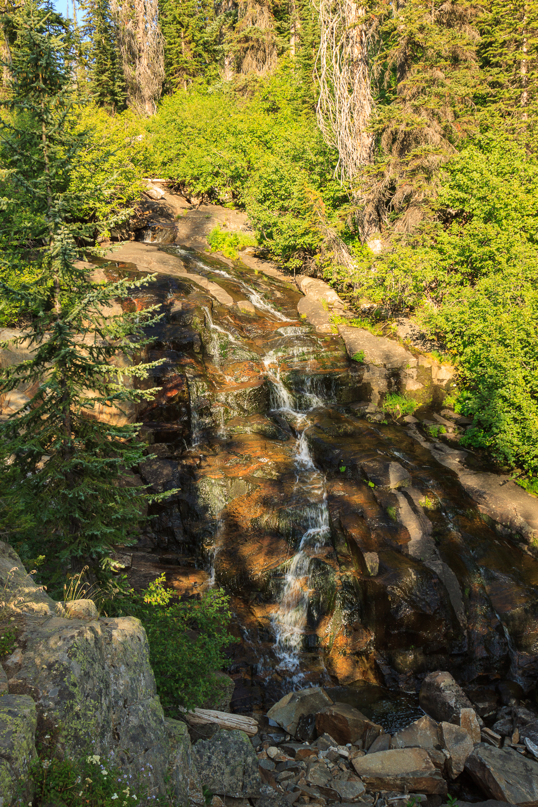
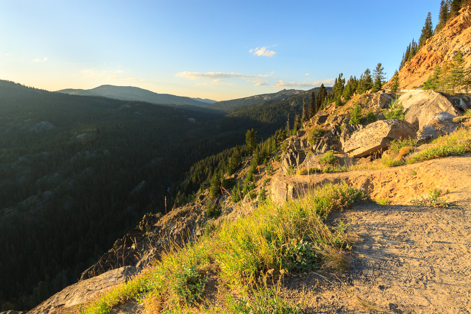
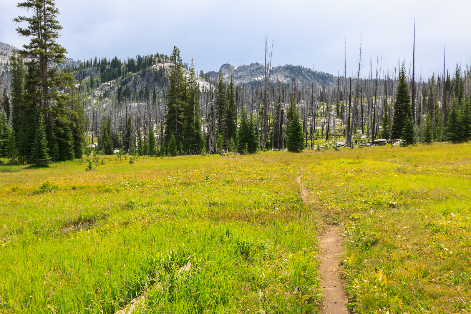
On Monday, we packed up camp and headed for Granite Mountain. Erin took the dogs on the shorter hike to Twin Lakes since Greta can’t hike much with her injured paw. I hiked with Clara on my back to the summit of Granite Mountain with my mom. Granite Mountain rises 8500 feet above sea level for a fantastic 360 degree view. At that height, the summit sits over 4000 feet above New Meadows. But for us, it was only an 1800 foot climb over 2.8 miles. Did I mention the views at the top? Cascade Lake and the Payette Valley to the south, New Meadows, the Wallowas to the west, the Seven Devils and the Salmon River canyon to the north., the Payette Mountains to the east. I look at Granite Mountain every time I’m skiing at Brundage and every time I’m up at the Seven Devils, so it was nice to finally stand on this peak. It’s a tough hike, especially with Clara on my back, but it’s well worth the effort.

Northern View on Granite Mountain
Phlox on top of Granite Mountain.
Lupine in flower with the Payette Mountains in the distance.
[map style=”width: auto; height:400px; margin:20px 0px 20px 0px; border: 1px solid black;” gpx=”http://www.mineral2.com/wp-content/uploads/Granite Mountain.GPX”]

Similar Posts

  • Elk Creek Falls

    I think I’ve mentioned Elk Creek Falls in passing, but haven’t actually written a featured post about it. Elk River is a small outdoor recreation town (read: hunting & fishing mostly) a little over an hour east of Moscow. This small community represents the “end of the road.” The paved road ends here and forest service roads pick up to take you into some remote places. While most people come back here to hunt, ride ATVs and snowmobile in the winter, there are some family-friendly hikes and other attractions that make Elk River worth a visit. There’s the giant cedar,…

  • It’s going to be a busy semester

    Somehow,  I had arranged the semester to be fairly light allowing me to work on my research. I was only signed up for one class, the work of which parallelled the work I have to do for my degree, namely write up a dissertation project proposal. On top of that, I was slated to teach one lab section, so overall my class and teaching load would be light. Funny how things actually work out. I am taking 3 classes, though one not for credit, and teaching two sections of lab. 314 lab isn’t really that bad, it’s all computer-based, but…

  • Fall Foliage

    I’ve been spending a lot of time finishing up my dissertation proposal, which is due in a little over a week, and that has kept me from taking time to enjoy the outdoors. We got some considerable rain over the past weekend which lead to some dramatic skies and really clear views on Monday and Tuesday, but I just wasn’t able to take advantage of the nice conditions. I did get out for a little bit yesterday afternoon to check out the fall foliage in the arboretum on campus. In Idaho, we don’t see very much fall color. There are…

  • Geocaching

    In case you weren’t aware, Geocaching is one of my hobbies turned obsession that fills my life with joy. Geocaching is a game in which people hide containers and post the coordinates on the web for others to enter into a GPS and go out and find. The game began in May of 2000. On May 2, the US Government declassified signals from the GPS satellites making them available to the public. This increased the accuracy of commercial GPS receivers from around 100m down to 10m. The next day, Dave Ulmer hid a stash in the woods outside of Portland,…

  • Illinois

    On Mount Moosilauke Originally uploaded by mineral2. I’m in Illinois now and will be here for a good majority of the year. While I’m living 40 miles in the Chicago suburbs, I’ve already taken a trip to the Mississippi River to see the Bald Eagles and am planning a weekend to Nebraska to watch the mass of Sandhill Cranes as they stopover on their migration north. As the spring approaches, I hope to go south to some terrain that is reminiscent of Alabma. I also plan to go northward to view the waterfowl and the flowers of the North Woods….

  • The Garden of 2013

    Because I was laid up and out of commission for much of the spring, I wasn’t able to work on expanding our garden much this year. Last year, I built a third 4×8 foot box and a 2×4 foot box which were meant to be tiered for planting small annual herbs in large quantities. I never got that box filled with dirt, so that will have to wait until next year. In the mean time, we’ve planted our usual array of crops in the two 4×8 foot boxes with limited success. Erin had bought some tomato plants in April, and…