Lookout Mountain

View North

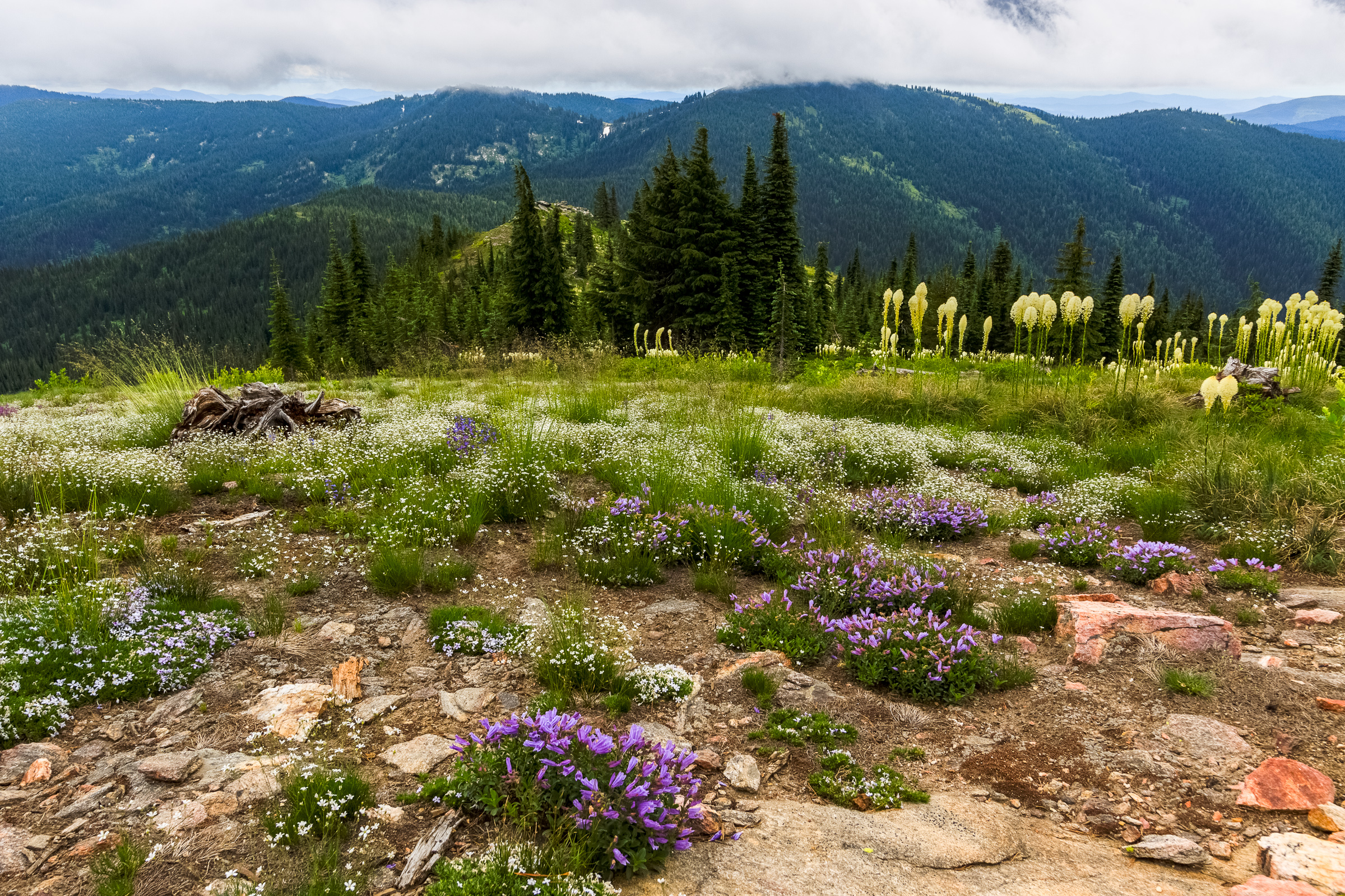
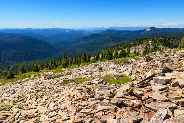
Everytime I’m up on Grandmother Mountain, I look to the east and see the bald dome of Lookout Mountain rising over the Marble Creek drainage and I long to stand on top and look down from the other side. Finally, with my parents and sister visiting, I decided this would be the perfect opportunity to try out this trail.

There are several mountains in northern Idaho named Lookout. This is not the ski area on the Idaho-Montana border off of I-90. This is not the peak in the Selkirks north of Sandpoint of the same name. This is in the St. Joe National Forest, accessed from FS-301, the same road that leads to Freezeout Saddle and the Grandmother Mountain trail outside of Clarkia.

Lookout Mountain is unique for this area because its summit is completely bald, offering spectacular views in 360 degrees. The summit stands at 6789 feet above sea level and overlooks Lost Lake, the nearest glacial tarn of considerable size to the Moscow Area. This trail is absolutely beautiful and probably seldom used compared to the neighboring Grandmother Mountain trail. The trailhead is only 7 miles farther down the road, but due to the rough road conditions, it took an extra hour of driving to get there. Despite its apparent remoteness, the trail and trailhead are in great condition. The trailhead features several developed campsites with picnic tables and fire rings along with a well-maintained privy. There are also two other small campgrounds nearby. Next time I hike this trail, I may have to spend the night.

From the trailhead at Orphan Saddle, it’s a 4-mile walk to the summit of Lookout Mountain. The trip isn’t very difficult, though you’ll begin your journey with a 600 foot ascent in just under a mile. By the time you start getting tired, you reach the ridge at 6500 feet and the journey becomes a relaxing meander through a mixture of hemlock forest and grassy field. The next two miles are gentle, holding elevation until the Widow Peak trial splits off, and then gently descending into the saddle above Lost Lake. The last mile is a 700 foot ascent to the summit, and though it may seem steep, you’re on the spine of the ridge with views that get better with every step you take. Take as much time as you need and eventually, you’ll find you can’t go any higher.

The return journey isn’t too bad. The descent on the way out was gradual and not very noticeable, but you may notice the uphill on the return. However, it’s still gentle compared to the two ascents (now descents) on the way out. In short, this may have become my new favorite local hike. Unfortunately, it is such a pain in the butt to get to that I’ll probably still stick to Grandmother Mountain as my go-to escape to higher elevations.
Map and elevation statistics

More Photos

Similar Posts

  • Upper Basin Trail

    View Upper Basin Trail in a larger map The Upper Basin Trail is a 5 mile loop in the upper basin of Elk Creek just north of Elk River The trail is near the giant western red cedar, thought to be the largest tree in the U.S. east of the Sierra-Cascade crest. The loop is also near the Morris Cedar Grove, another grove of large old-growth red cedar. unfortunately, the road to the Morris Grove was closed and blocked off on Saturday. If you’re looking for a difficult challenge, the Upper Basin loop is not for you. The trail was…

  • |

    A President’s Weekend in McCall

    I can’t believe February is almost over an I haven’t made any posts yet. I’ve been plugging along with classes and research and laying fairly low for financial reasons. I’m not skiing this year, which helps out in keeping my costs down. I have been snowshoeing more this winter than in the past, and that’s helping to keep me in shape, but it’s not quite as often as I’d like. In part, it’s due to time constraints, and in part it’s due to the weird weather we’ve been having this winter. We’ve had less snow than in winters past, and…

  • Annual Wallowas Weekend 2014

    [map style=”width: auto; height:400px; margin:20px 0px 20px 0px; border: 1px solid black;” gpx=”http://www.mineral2.com/wp-content/uploads/Selected Data from wallowas 2014.GPX”] The annual Wallowas Weekend tradition kinda took a hiatus for a couple of years. In 2012, Tyler had to pull out of the trip, and several other people followed. That left me with one other person who still wanted to hike, but also wanted to fish. So we turned it into a Seven Devils trip. Last year, I was still recovering from my ski accident and was in no shape to go backpacking. But this year, I was determined to get back in…

  • Grandmother and Grandfather Mountains

    Since my daughter was born a month ago, I haven’t been able to get out and stretch my legs on the trail. So when an opportunity came along to go hiking, I jumped at it. The past few weeks had been miserably hot, even to the point where escaping into the high elevations wouldn’t provide refuge from the heat. However, since nights were cool, the early morning hours were a pleasant time to be outside. So one morning, CJ and I hit up Spud Hill in Deary and made it down just in time for the heat to make life uncomfortable….

  • Hells Canyon

    Panoramic View from our vantage point, originally uploaded by Matthew Singer. This story begins with Luke and I itching to get out into the backcountry. Although it’s the middle of June, the combination of an unusually cold and wet Spring with the very productive winter has left many of the high country destinations (above 5000 ft.) still buried under 100+ inches of snow in places. And even some of the lower areas are still blocked with impassible snow drifts on the road. This makes our options quite limited. The one place we’re sure to have access is Hells Canyon. With…

  • |

    Old Rag

    Spring!, originally uploaded by Matthew Singer. In April, I briefly lost my camera due to a bent pin in the card slot. I sent it to Canon for repair and got the camera back in a week’s time. Unfortunately, during that time, I had scheduled a hike up Old Rag with Jon, my supervisor at the time. So, after a trip to Fed Ex, I stopped at the camera store and bought a couple rolls of film. I’ve finally had the chance to get the old scanner out of the box and get this set of slides scanned and uploaded….