Blue Mountains: Panjab Loop
We open the 2015 hiking season with a fairly big hike in the Blue Mountains. The Panjab loop takes us up the Panjab Creek trail and back down via the Rattlesnake Trail in the Wenaha Tucannon Wilderness. This hike is full of wildflowers, wildlife, and canyon views.
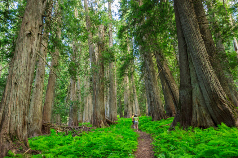
Panjab is becoming one of my favorite trails to hike in the Blue Mountains. It begins with a pack bridge over the creek, and then you’re immediately in the wilderness area. The first three and a half miles parallel Panjab Creek through lush riparian forest along the canyon floor. One of the highlights of this forest is the Pacific Yew. Yews are common along the Cascades and coastal forests of the northwest. But there’s an inland population that covers northern Idaho including the Blue Mountains of southeastern Washington and northeastern Oregon. Here, the Pacific Yew is less common, inhabiting wet forests that are remnants of the inland rainforests. The Blue Mountains, in particular, are quite dry, so finding a population of Yews along the river is quite exciting. The Pacific Yew can be distinguished from other conifers by its smooth, peeling bark and branching structure that resembles a deciduous hardwood.
It’s even more amazing that these trees managed to escape and survive a huge fire in 2005. Evidence of the fire is quite noticeable on the drive in. The canyon walls on both sides are devoid of live trees, and it’s not until you get close to Panjab Creek that a live forest becomes prominant again. Still, portions of the canyon walls along Panjab fell victim to the fire and are still recovering. But the riparian forest at the bottom appears to have been spared most of the damage.

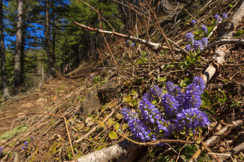
At three and a half miles, the trail turns away from the creek and climbs up the side of the canyon. During the ascent, we leave the forest and find ourselves in open fields. Don’t expect any sweeping vistas, though. The trees still block the view. But these fields are prime habitat for wildflowers. On this hike, we found an abundant supply of Glacier lilies, Yellow bells, Bluebells, Mountain kittentail, and a few paintbrush that had begun to emerge. These are the early season flowers. Later in the spring, expect to see lupins and penstemons, and asters should become abundant in the summer.
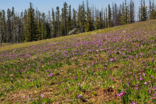
At one point, the main trail switchbacks to the right, but there’s another trail that seems to continue straight ahead. This secondary trail is likely an old trail that is no longer maintained. It doesn’t appear on any maps, but it’s used enough to be easily followed. Taking this trail will reduce the distance of this hike by about a mile and a half. Otherwise, follow the main trail to the right until it meets up with the Rattlesnake and Mt. Misery Trials on top of the ridge. We chose to take the shortcut this round just to see what it was like. The trail emerges from the forest into a high meadow at about 5600 feet. The meadow was covered in Grass widow which turned it pink. Again, don’t expect any views at the top, at least not yet. The forest abruptly transitions into meadow, leading us to wonder whether these meadows are natural or remnants of grazing and other activity before the area was designated as wilderness.
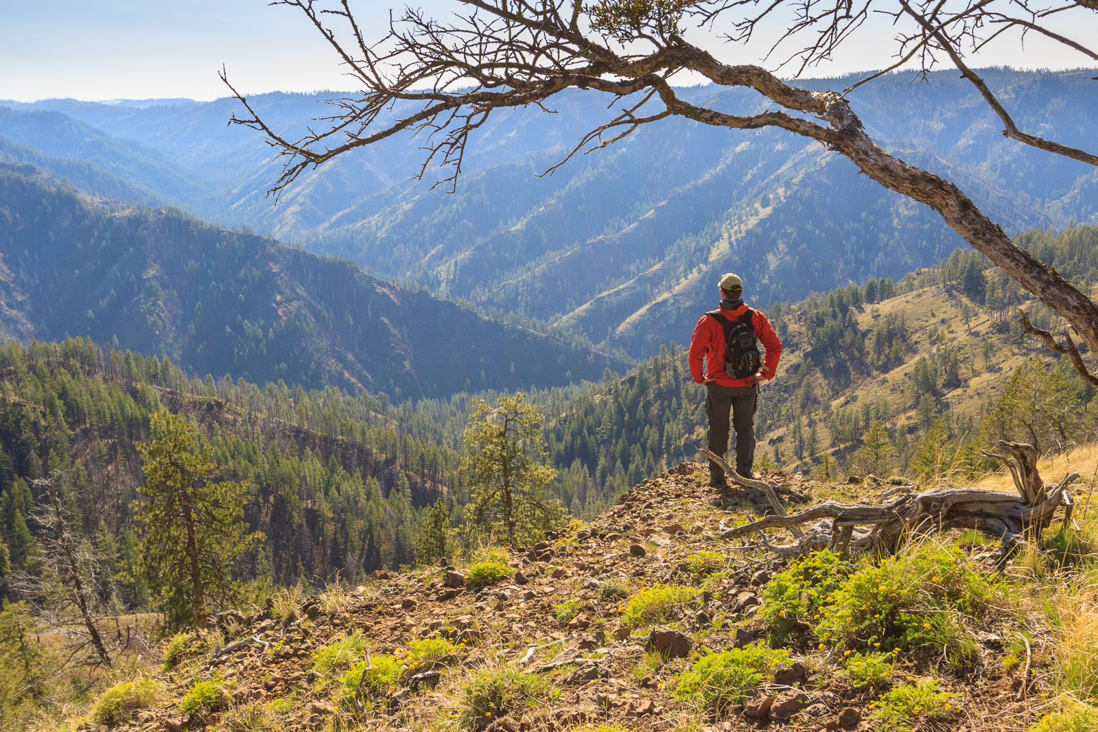
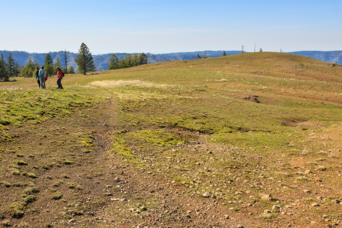
Regardless of the cause, the meadows are a nice change. The warm sun counters the cool wind, and the open ridge is easy walking compared with the steep canyon walls. There are several springs on the ridge which are great for collecting water. That also means this hike could be turned into an overnight trip. Eventually, the forests give way to views over the Tucannon River canyon. Here we found a nice lone tree to stop and snack under.

The Rattlesnake Trail is not very well maintained. At one point, it leaves the main meadow and traverses a stand of burned forest to get to another meadow. This section of trail is covered with downed trees where the Panjab Creek Trail had been recently cleared and maintained by trail crews. There are even sections of the Rattlesnake Trail where grass and vegetation have taken over. In the dark, it would be easy to lose the trail. If you’re interested in following this route, be prepared for these challenging conditions. However, don’t let that stop you. With the right attitude and sense of adventure, the poor condition of the trail will only act as a minor inconvenience.
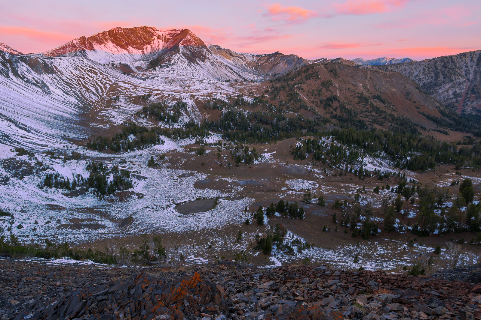
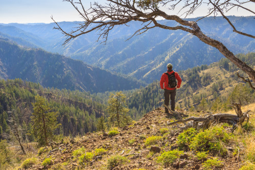
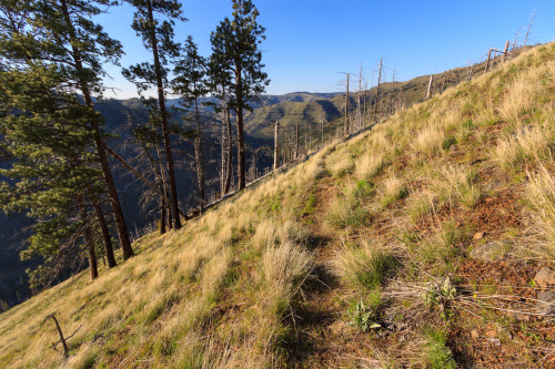
I do suggest hiking in the direction that we did. That is, start at Panjab Creek and end on the Rattlesnake Trail at the Panjab Campground. The ascent is gentler on the Panjab Creek trail. On the other hand, the descent at the end of the Rattlesnake Trail can be quite brutal, dropping about 2000 feet in 2 miles. But there’s another reason to travel in the direction that we did. The views only get better as you progress. As the trail begins to drop back down into the canyon, we find ourselves on a narrow ridge, one side completely treeless, the other a stand of burned forest. It’s not until you reach this ridge that you truly get an appreciation for just how steep the canyon walls are, and just how high up you are. You’ll be at 5000 feet staring down at the river 2000 feet below. It’s a magnificent sight, and the photographs don’t begin to do it justice.
The trail quickly descends back to the bottom of the canyon. There is a stream crossing at the campground, and during the spring melt, expect to get your feet wet. If you come with two cars, you can park one here and end the hike. Otherwise, the Panjab trailhead is about two miles up the road. Our trip was about 9.5 miles, according to the GPS track. Had we not taken the shortcut, the hike would be around 11 miles. The full loop including the road is about 13 miles. Total elevation gain is around 2500 feet. This is a great early season hike while waiting for the higher elevations to melt from winter. On a normal year, this loop should be snow-free mid to late May. But this year’s below average snowfall let the trail open up much sooner.
[map style=”width: 600px; height:600px; margin:20px 0px 20px 0px; border: 1px solid black;” gpx=”http://www.mineral2.com/wp-content/uploads/Panjab Loop 001.GPX”]