East Peak
There are many peaks in the Wallowas that top 9000 feet, so East Peak might go unnoticed if it weren’t so easily accessible. It turns out that I’m not the only one who thought to use the Wallowa Lake Tramway to cover the first 3700 feet of elevation, reducing the climb to the peak to 1300 feet. This hike is featured in the book, and while I was’t expecting a crowd, we did pass three other hikers along the way, two of which are local to the area and hike to the peak regularly.
The Wallowa Lake Tramway brings you to the summit of Mt. Howard. At 8200 feet, the views are incredible, but they also leave something to be desired. For one, you can only look across the Wallowa River valley, and not back into the huge, glacially carved terrain. And as you climb higher, every view always becomes more impressive. Finally, the crowds of tourists stick to the nature trails at the top of the tram, leaving you with an alpine experience that the masses don’t get.
The trail begins on the backside of the nature trails on Mt. Howard where a faint trail takes off down the east side of the mountain. It can be easy to miss if you’re not looking for it. Despite there not being an official trail, the path is well worn and easy to follow all the way to the summit. At one time, this must have been a popular destination because the forest service had a set of privies in the first saddle below the summit of Mt. Howard. The privies are no longer maintained. Neither have seats on the toilet and one is missing a door. After the saddle, there is a short, but steep climb that quickly levels off for a nice walk to the next saddle. You’re now in fairly treeless terrain so the trail is marked by a series of cairns that switchback up the slope and route you around the next false summit toward the next saddle. Here, the trail branches. To the right, you’ll ascend to the ridge where you make your way to the summit of East Peak. To the left, you can skirt around the summit to a spring and continue to the back side where you can summit East Peak or the next peak, Hidden Peak. Or you can continue to Aneroid Mountain, but that might be getting far for a day hike. Remember, the first tram is at 10:00, and if you’re lucky to be the first one, you’ll hit Mt. Howard at 10:15. The last tram down is at 4:45 pm, so timing is important.
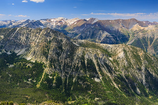 The book describes the hike up East Peak as having a scramble. It’s true that there are some rocks along the ridge to the summit, but nothing that really requires any climbing skills. The ridge top is neat, though. There are points where it is only a couple feet wide with steep dropoffs on both sides. The rock scramble does end and the ridge widens a bit for the final approach to the summit.
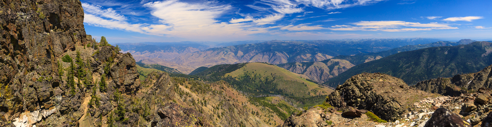
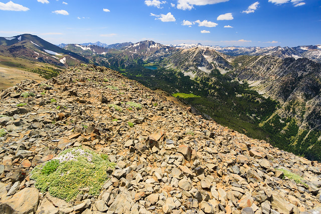
From the summit, you can look up the U-shaped valley to see Aneroid Lake and the mountains surrounding it. Some of the prominent peaks you can see include Aneroid Mountain, Sentinal Peak, Red Mountain, Eagle Cap, Sacajawea, Matterhorn, and Chief Joseph. To the east, you can look over the Imnaha canyon and Hells Canyon and see the Seven Devils rising into the sky. To the north, you can see Wallowa Lake, Joseph, and Enterprise over a mile below while looking out over the Wallowa valley to the Blue Mountains in the distance. It’s such an amazing place to be.