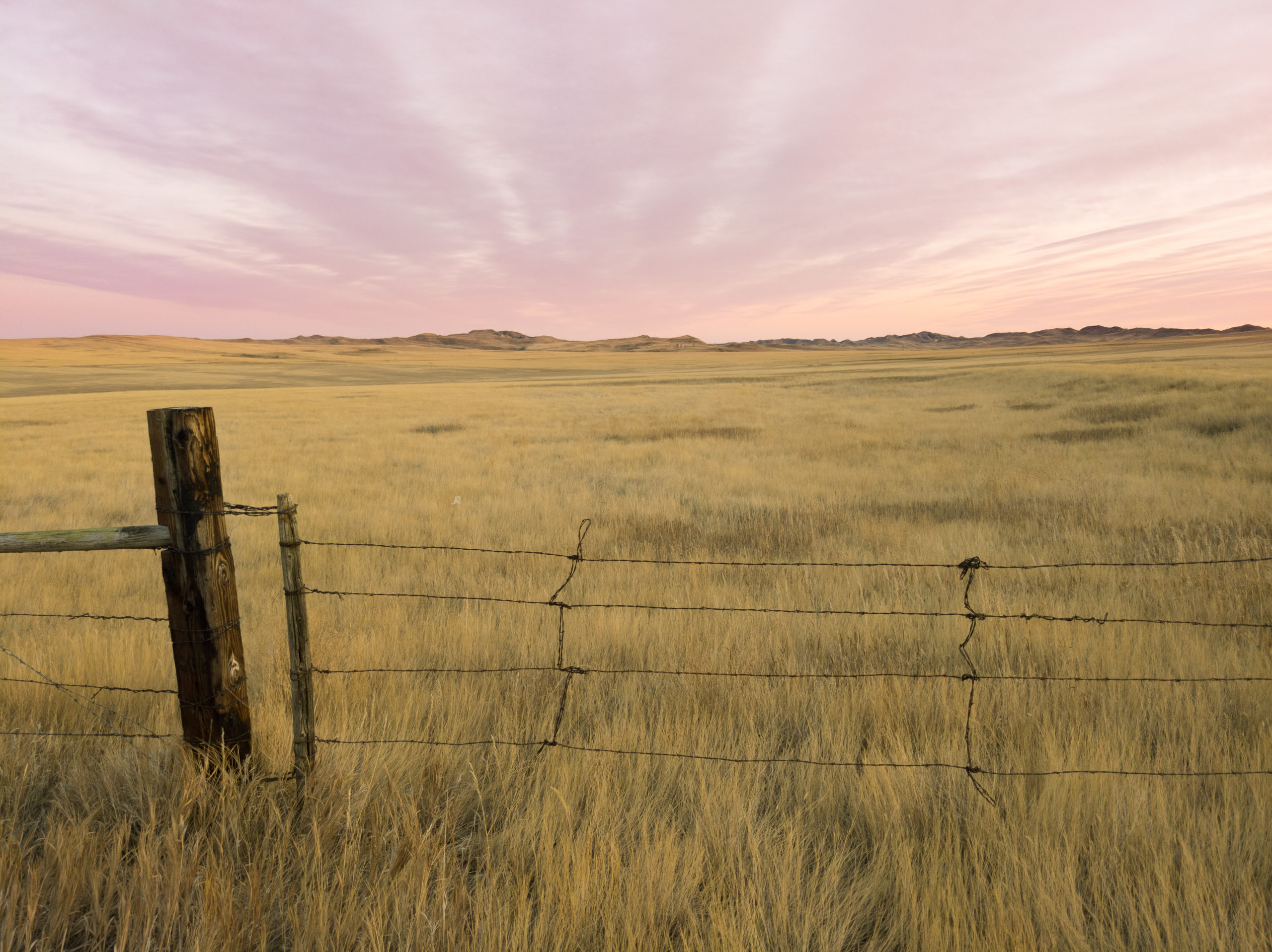
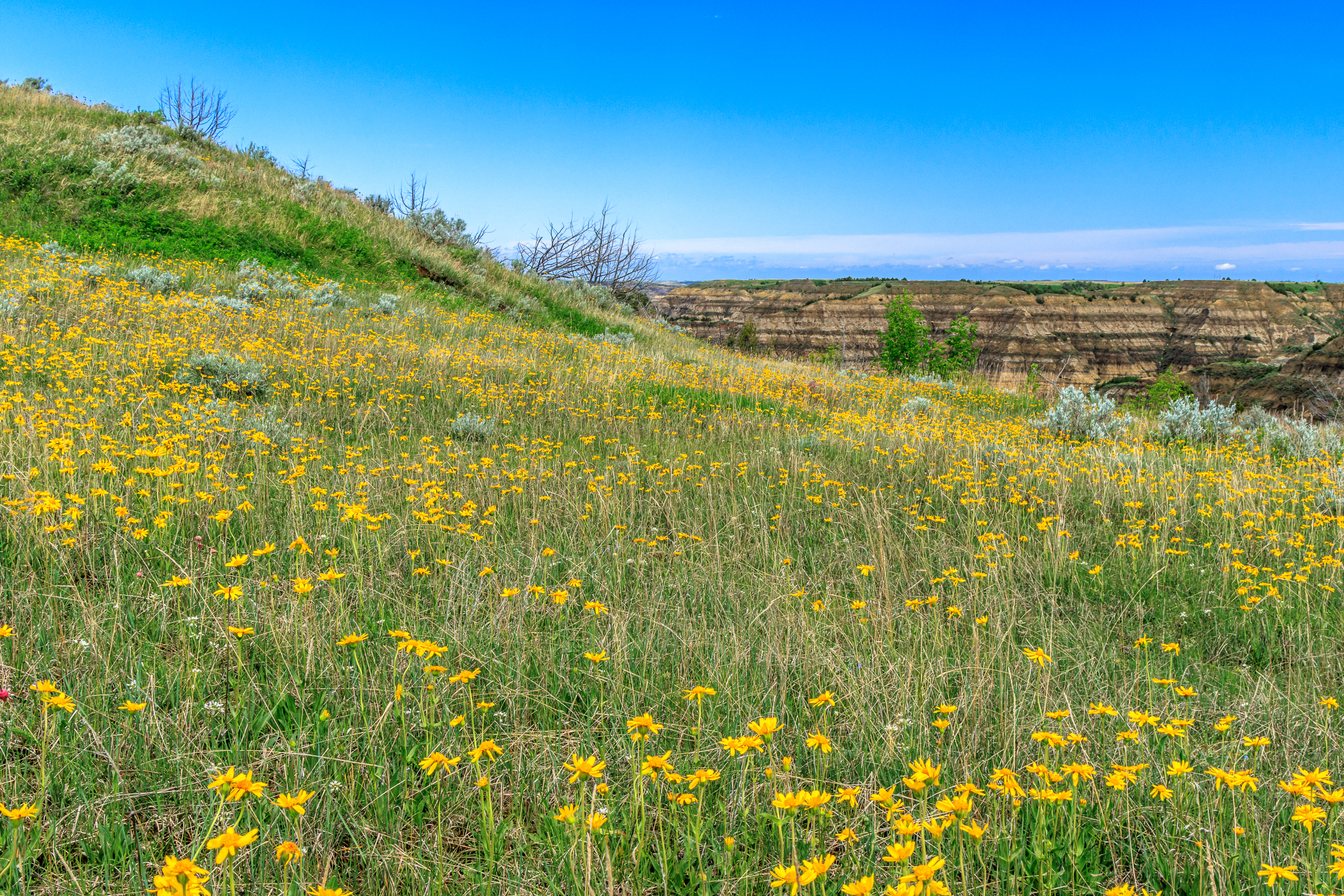
With the school year over and nice weather upon us, I’ve had some free time to get out and explore the landscape beyond Williston. I’ve been out on the prairie twice to discover the array of early wildflowers in the grasslands. This is the time of year when I feel like I could actually enjoy this place. Unfortunately, it doesn’t last very long.
It’s said that there are only two seasons on the northern plains – a very long winter, and a short summer. Spring and Fall exist, but only for a week. All year round, the wind can blow strong, though there are calm days too. Winter here is tough. We get enough snow to block access to many recreation trails, but not enough snow to take out skis and snowshoes. To be fair, it’s a bit snowier east of here. Summers become very hot and dry. With no forests to take shade in, hiking in the summer heat can be miserable. And then there are the transition seasons. Fall might be more tolerable for hiking. It’s still dry, and the temperatures are more tolerable, but it can be quite windy. Strong winds are just as bad as a strong sun for turning a nice adventure into unpleasantness. Spring is wet. Wet from the snowmelt, and wet from rain. Spring is typically mud season anywhere you go, but here in the Dakota Badlands, the mud is an especially sticky and slick clay that is not only a nuisance to hike through but can be downright dangerous on those badlands slopes. Spring also comes with ticks, though that’s a hazard I can deal with and is not unique to this area.
The prairie greens up in early to mid-May, right around when my semester ends, and with the green comes the first wave of wildflowers. One of the earlier wildflowers is the Pasqueflower, or prairie crocus (Pulsatilla nuttalliana or Pulsatilla patens). This large purple flower dots the brown grasslands as early as March and is certainly a sign that winter is on its way out.
Last weekend, I made a trip down to the national grassland to find a geocache atop a butte. But as part of that hike, I found some flowers in bloom. One of those finds includes Fritillaria atropurpurea, a somewhat uncommon find for this area that blends in so well I almost lost it after getting the camera out to photograph it.
I didn’t take many photos on this adventure, instead opting for a video:
Enamored with my finds on that trip, I decided I had to get back on the prairie before the flowers disappeared to photograph and identify as many species as I could find. I opted for the Summit Trail which stays mostly on top in the prairie while still offering views of the badlands canyons of the Little Missouri River. I was not disappointed. Below is a gallery of my finds, plus a few scenic shots of the badlands. All of the images are also on my Flickr site with species tags. There are twelve distinct species photographed here, though I did see some repeats from last week, and I’m sure there are others I saw and passed up, and even more that I failed to notice.
My trip to the Redwoods had a profound effect on me. I can’t really explain what it was or why. I’ve been to many amazing and beautiful places never come back as humbled and rejuvenated as I had on this last trip. But everything about it just put me at ease and at awe. It was a combination of spending time with the kids while experiencing a mature old-growth forest among some of the oldest and tallest trees on the planet. I came back to Williston ready to take on the world and maybe inspired to leave in search of better country.
And then, not even a week after my return:
The largest geomagnetic storm I have ever witnessed occurred on the evening of March 23. Auroras are usually visible in the northern sky, but this one washed overhead and into the southern sky. I apparently missed the largest peak, but as soon as I learned this was happening, I grabbed my camera and drove west into Montana where the oil rigs are fewer and the sky is darker. I turned up a dirt road where I was hoping to perch myself on a high ridge, but I saw a faint glow rising to the west, a strange sight for an aurora. I wasn’t sure if it was light pollution or fog, so I stopped to grab a picture. I noticed some light beams shining up behind a small butte, so I made that the subject of my image. I was expecting it to light from an oil rig behind it. Instead…
It was the unmistakable green glow of the northern lights. Instead of shining ahead to the north, it was coming out of the west, directly overhead, and continuing to the east.
The fact that it was overhead was novelty enough for me. But it was bright. I ran back and forth taking photos in both directions. The ribbon got wider and split apart, becoming more defined.
Eventually, I got cold and had to get in the car to warm up. I kept watching out the window, but it seemed like the aurora was waning. So I got out to collect my camera and maybe pack it in for the night. But as my eyes adjusted to the darkness, I noticed it wasn’t waning, it was getting brighter… and it was changing color. I thought I saw a red patch with the naked eye. I set up the camera again and confirmed it.
At this point, the ribbon began to take a definitive shape with some bright columns and curves and red spots. And then it started pulsing. And the pulsing continued for the remainder of my time out there. The aurora spread, mostly north, but a little south until it was covering at least 60% of the sky. I’ve seen big and bright auroras before, but never anything like this. It was literally dancing in the sky before my very eyes. I hate that the camera can’t convey the animation that was happening. At one point, the lights took on a web-like structure, still pulsing. The remaining images show the progression as the storm intensified and the red light took over.
This was without a doubt one of the most profound experiences I have ever had. It brought me to tears being out there to witness this spectacle of nature. I came home rejuvenated. The next day, I went to work in a trance, and it wasn’t just due to the lack of sleep. It was maybe a once-in-a-lifetime opportunity and I was part of it.
It has been quite some time since I last made a post here, so I’d say I’m a bit overdue for an update. For the past two and a half years, I have been living in northwestern North Dakota. Saying this is an adjustment is an understatement. North Dakota is considerably flatter than any place I’ve lived, and there are almost no trees here. Winters are extremely harsh and long. We can have weeks where the daytime high does not exceed 0º F, and the wind will send a chill to your core. Our corner of the state doesn’t get much snow compared to northern Idaho or eastern North Dakota, but when we do get snow, the wind blows it into drifts which can shut down the highways. And winter can persist until May without any sign of spring. Summer has the opposite problem. The wind still blows, but without much shade, the days are hot and dry, except when gnarly thunderstorms roll through dropping large hail and threatening tornadoes. Ok, that last part sounds scary and it is when it happens, but we aren’t technically in Tornado alley, so those events are relatively rare.
There is some fascinating geology on this side of the state. We have the Dakota Badlands carved by the Little Missouri River. But the Badlands terrain is comprised of a sticky and slick clay that, when wet, is quite treacherous. And thus the only time to really get out there and hike it is in the winter, when everything is frozen, or in the summer when everything is dry. Did I mention that the prairie is only green for about a month? I seem to miss it every year. Nevertheless, I do get out once in a while to explore.
Sunset on the Prairie
Theodore Roosevelt National Park lies about an hour to the south of here. There are trails to hike in the badlands. The Little Missouri National Grassland is just beyond the park’s borders. I’ve had some fun exploring this area. There are lots of deer in the area. But we also have pronghorn and prairie dogs, which are a fun treat for me to see in the wild. The national park also has a bison herd as well as some bighorn sheep.
I’ve gotten back into rock collecting while I’ve been here as well. The Yellowstone River is a great source of Montana Moss agates and petrified wood. I even discovered a petrified forest of giant and ancient redwood stumps.
Montana Moss AgaatePetrified Wood
Most of my fun has been on extended breaks. In the winter, I’ve been trekking across Montana back to Idaho to spend time with the kids. For spring breaks, I meet Erin in the middle and bring the kids home with me (except this year). And in the summer, I go pick up the kids and we have a camping adventure back to my place. Then we’ve been making epic road trips to North Carolina where my parents and sister live. Our first trip took us across Minnesota to Michigan’s Upper Peninsula. Last year’s trip took us down to the Black Hills and then across Nebraska, Missouri, a stop to explore the giant things in Casey, Illinois, and a night of camping in southwestern Kentucky. Then we all went to the beach for a few days where the kids got to experience the ocean for the first time. This year’s summer trip is still in planning, but we will all be traveling back to the Upper Peninsula to explore some more.
This year’s spring break was…. well, it was epic, and it will get a post of its own.
It’s been an adjustment living here, and I can’t say that this will be my forever home. It’s been easier now that I’ve found a group of people to play board games with. But I’ve been missing easy access to mountains, forests, and good hiking as well as being closer to the kids.
For many years, I have spent my Fourth of July basking in the part of America that I enjoy the most: its wild and natural beauty. It started in 2011 when I explored the Hobo Cedar Grove for the first time. Then again in 2013 when I hiked Grandmother Mountain. In 2015, I spent the fourth in the Seven Devils with friends. This year, I returned to Grandmother Mountain for what may be my last visit to one of my favorite peaks in the vicinity of Moscow.
America owes its wild places to a conservation movement that began as early as the 19th century, but really took off in the early 20th century. And while we should celebrate that we have set aside land for conservation and recreation, we should also recognize the cost of doing so. Native Americans were displaced from their homelands only to see sacred landmarks turned into tourist spectacles. In the appalachians, many families were forcefully removed from their land without just compensation to create Shenandoah National Park and the Blue Ridge Parkway. The history of conservation and preservation of land isn’t always kind and people have been marginalized as a result. In the case of the Appalachian peoples, there is a deep distrust of the federal government that resides generations later.
I don’t recommend giving the land back and undoing the protections created by national parks and wilderness areas. But we can maybe do better at including the historical land owners and occupants when it comes to decisions about how to maintain and manage the land moving forward. In the West, native american tribes should absolutely have a say as to how their current and ancient sacred places get utilized, whether for tourism and recreation or for commercial resource extraction. And with the the people of appalachia, perhaps we can work to ensure that their historic homesteads aren’t completely forgotten by the ravages of nature.
As I sit on Grandmother Mountain looking over the Marble Creek drainage, I can’t help but wonder who lived on and utilized this land before it was logged clear, and how that impacts the landscape today.
View on Grandmother Mountain
Wildflowers on Grandmother Mountain
In two weeks I will be moving to North Dakota to start teaching biology at Williston State College. While I am excited to begin this next chapter and to have a new home to explore, I will miss many of the attributes of the northwest, including trees and mountains. North Dakota has neither, at least not in abundance. Instead, I will have the unique formations of the Badlands and the biology of the prairie at my doorstep. There will be new plants and animals to learn, as well as new culture and history. I will have Theodore Roosevelt National Park and the Little Yellowstone National Grassland as my local playgound. Canada will be only an hour away. And I will have summers free to explore locally and beyond.
There is much I will miss. Lush forests, flower-laden alpine meadows, mountains, clear creeks and rivers, and hot springs. For now, I will spend my remaining time here relishing the grand landscapes that I have been immersed in for the past 10 years, and know that this is not goodbye, but more of a “see you later.”
Immediately after I published my last post, I wasn’t content with the manner in which I conveyed the SIR model. Simply posting graphs from scenarios that I ran isn’t exciting. It’s passive, and it doesn’t actively demonstrate for the reader how social distancing does work to reduce infection rates. I wanted something interactive. Something that you, my readers, can play with. So I built the model in Shiny.
Shiny is a tool for R that makes data visualization interactive. I had never used Shiny. But with a few hours of reading the introductory tutorial, I had my own custom application built with a basic SIR model. And I’m ready to share it with you.
As a reminder, here is our basic model, graphically and mathematically with a description of the parameters:
The parameters are , a composite that includes the probability any one person interacts with another and the probability that successful transfer occurs with an interaction; , a composite that includes the probability an infected individual recovers or dies (from the disease or naturally); S, I, and R, the number of susceptible, infected, and removed individuals; and N, the total population size which should be equal to S + I + R.
Here’s how you can play with my interactive model. If you are an R user, grab the code here: https://github.com/matthew-singer/ShinyToys. The file you want is called sirapp.r. You will need to install the shiny package, but it’s worth having.
If you are not an R user, you can play with the app which is hosted here: http://mineral2.shinyapps.io/SIRModel. If you are an R user, please download my script from the first link and run it locally because I only get 25 hours of active app time with my shinyapps.io account, and I’d like it to be available for educational purposes to non-science people.
Remember that social distancing acts to reduce the value of . As you play with different scenarios, note that as increases or decreases, what happens to the Infectious curve (Red)? Note the approximate time that infections peak, as well as the quantity of infections at peak. How long does it take for the disease to disappear from the population? How does population size affect the response?
Remember that this isn’t an accurate model of COVId-19. It is a basic and generic model of infectious disease spread. However it is still useful in understanding how our collective and individual behaviors can affect the way diseases spread through the population.
In case you weren’t aware, Geocaching is one of my hobbies turned obsession that fills my life with joy. Geocaching is a game in which people hide containers and post the coordinates on the web for others to enter into a GPS and go out and find. The game began in May of 2000. On May 2, the US Government declassified signals from the GPS satellites making them available to the public. This increased the accuracy of commercial GPS receivers from around 100m down to 10m. The next day, Dave Ulmer hid a stash in the woods outside of Portland, OR and posted the coordinates to a listserv. A few days later, it was found, and it didn’t take long for this idea to catch on. Within that first year, several hundred geocaches had been hidden world-wide with their coordinates posted for others to find. The largest repository of geocaches is hosted at geocaching.com. It’s free to play, and today, the game doesn’t even require that you have a GPS receiver since smartphones are able to communicate with the GPS satellites.
I was formally introduced to the game in 2007 when I created a lesson on GPS orienteering for a summer camp at the Max McGraw Wildlife Foundation. The activities culminated with me hiding containers around the property and having the kids wander around with some GPS receivers to find them. But it wasn’t until 2011, when I was able to buy my own GPS receiver, that I really started geocaching. Since then, I’ve accumulated 1663 finds, mostly around the inland northwest. It’s the perfect hobby, as it pairs well with my love of hiking, travelling. I’ve explored so many unique places that I would have overlooked if geocaching hadn’t brought me there.
A map of my geocache finds in the northwest.
Geocaching is a spatial game that accumulates a lot of data. Geocaching.com aggregates personal statistics for each user – you can see mine here. However, as fun as it is to analyze my own caching behavior, I’m also interested in larger questions about the game. For example, what places are more active in the game than others? While the game isn’t about the numbers, the numbers can tell us a lot about the game. Defining how a place is geocaching-friendly isn’t easy, and there are a lot of variables to consider. Unfortunately, I don’t have access (at least not easily) to the full data hosted at geocaching.com. So I have chosen the number of geocaches as a proxy for how active an area might be. And my definition of area is going to be at the level of state, because I can easily grab the total number of active geocache hides in each state from state regional searches on the website.
What states or regions of the country are most active in geocaching? Here is my data. The number of caches was collected manually using regional searches on the evening of June 12. The state area and population size were gathered from Wikipedia, and population is a 2018 estimate. Perhaps we’ll do this again when the 2020 census numbers get released.
State
sq mi
Geocaches
Cache Density
Population*
Population Density
Alabama
52420.07
14826
0.28
4887871
93.24
Alaska
665384.04
7591
0.01
737438
1.11
Arizona
113990.30
39083
0.34
7171646
62.91
Arkansas
53178.55
12014
0.23
3013825
56.67
California
163696.32
132475
0.81
39557045
241.65
Colorado
104093.67
26075
0.25
5695564
54.72
Connecticut
5543.41
8008
1.44
3572665
644.49
Delaware
2488.72
2890
1.16
967171
388.62
District Of Columbia
68.34
248
3.63
702455
10278.83
Florida
65757.70
41034
0.62
21299325
323.91
Georgia
59425.15
14254
0.24
10519475
177.02
Hawaii
10931.72
2442
0.22
1420491
129.94
Idaho
83568.95
18557
0.22
1754208
20.99
Illinois
57913.55
30905
0.53
12741080
220.00
Indiana
36419.55
21611
0.59
6691878
183.74
Iowa
56272.81
21753
0.39
3156145
56.09
Kansas
82278.36
11676
0.14
2911505
35.39
Kentucky
40407.80
16920
0.42
4468402
110.58
Louisiana
52378.13
5663
0.11
4659978
88.97
Maine
35379.74
9388
0.27
1338404
37.83
Maryland
12405.93
12116
0.98
6042718
487.08
Massachusetts
10554.39
16871
1.60
6902149
653.96
Michigan
96713.51
34800
0.36
9995915
103.36
Minnesota
86935.83
29094
0.33
5611179
64.54
Mississippi
48431.78
7136
0.15
2986530
61.66
Missouri
69706.99
13898
0.20
6126452
87.89
Montana
147039.71
8059
0.05
1062305
7.22
Nebraska
77347.81
9602
0.12
1929268
24.94
Nevada
110571.82
22599
0.20
3034392
27.44
New Hampshire
9349.16
11436
1.22
1356458
145.09
New Jersey
8722.58
14081
1.61
8908520
1021.32
New Mexico
121590.30
17722
0.15
2095428
17.23
New York
54554.98
32343
0.59
19542209
358.21
North Carolina
53819.16
22174
0.41
10383620
192.94
North Dakota
70698.32
3020
0.04
760077
10.75
Ohio
44825.58
28631
0.64
11689442
260.78
Oklahoma
69898.87
14428
0.21
3943079
56.41
Oregon
98378.54
31066
0.32
4190713
42.60
Pennsylvania
46054.35
39347
0.85
12807060
278.09
Rhode Island
1544.89
3613
2.34
1057315
684.40
South Carolina
32020.49
5701
0.18
5084127
158.78
South Dakota
77115.68
9354
0.12
882235
11.44
Tennessee
42144.25
18136
0.43
6770010
160.64
Texas
268596.46
67902
0.25
28701845
106.86
Utah
84896.88
29369
0.35
3161105
37.23
Vermont
9616.36
4988
0.52
626299
65.13
Virginia
42774.93
15162
0.35
8517685
199.13
Washington
71297.95
29634
0.42
7535591
105.69
West Virginia
24230.04
5708
0.24
1805832
74.53
Wisconsin
65496.38
29874
0.46
5813568
88.76
Wyoming
97813.01
5772
0.06
577737
5.91
There is tremendous variation in the number of geocaches hidden in each state. Excluding the District of Columbia, with only 248 active hides, the state with the fewest geocaches is Hawaii at 2442, and on the mainland, it’s Delaware at only 2890. Meanwhile, California leads the way with the most geocaches hidden at 138,475. That’s quite a spread, though the median number of hides per state is 14,826.
The first question that comes to mind is whether the number of hides is limited by the size of the state. After all, California is a huge state. Delaware and Hawaii are pretty small. And given that people who run Geocaching.com have set a rule that geocaches must not be placed within 0.1 mile of another geocache, there is a limit to the number of caches that can be hidden in a finite area.
The number of geocaches in each state as a function of the size of the state. Both axes are log transformed.
There is certainly a trend here. Larger states, on average, have more geocaches. Though the larger the area, the larger the variation in hide count. Without that D.C. outlier, we still have a positive slope, though it’s less steep. To gage just how much area influences the number of caches, we should look at the density, or the number of caches placed per square mile. We are looking for no effect of area on density of hides.
Cache Density as a function of state size. Axes are log transformed.
What we see is a negative association between the density of caches placed and the area of the state. So even though smaller states have fewer caches, overall, they are more densely packed with geocaches. In some ways, this makes sense. The large states of the western half of the country have a lot of open land, public and private. Some of this land, including national parks and designated wilderness areas, is off limits to physical geocaches. Some of this area is just difficult to get to. And some of it is private property – big ranches and farms where the public doesn’t have permission to trespass. When you look at states like Colorado, Montana, California, you’ll notice that geocaches are densely packed into cities with fewer caches in rural areas. Though still, in popular hiking areas, there are still a lot of geocaches hidden along the trails.
But small states have rural places, too. So wouldn’t this affect the density of geocaches? Well, yes. But maybe these small states have less rural land than the larger states. The rural land is broken up into smaller parcels with more public right of ways with which to put a geocache. Or maybe it’s not about the land at all, but about the people living there. Perhaps more people just means more geocachers, which means more geocaches being hidden in a given area.
Cache Density as a function of Population Density by state. Both axes are log transformed.
Here we see our tightest trend. The geocache density appears to be explained rather well by population density. This would also explain why urban areas see so many more caches than rural areas, even within a state. There are still differences among urban centers as to the density of caches, and that may also be explained by population size. Or maybe geocaching is more popular in cities with a higher aptitude for an outdoor lifestyle. Denver, Salt Lake City and Seattle are all some of the densest cities when it comes to geocaches. Perhaps I will find a way to aggregate such data for analysis. But at the state level, the number of people per square mile nicely explains the number caches hidden per square mile.
Let’s look at some maps.
Number of Caches hidden in each state.Density of caches in each state.Population density of each state.
If you’re an avid geocacher, and you want an active geocaching community, where should you live? Well, if we define active geocaching community solely by the number of geocaches placed, it appears that the northeast coast is the place to be. While these states are small and each have a small number of geocaches hidden, collectively, it is the densest area for geocache placement. And this seems to be driven by population density.
Of course, there are more variables to consider. The number of geocaches doesn’t always represent the quality of geocaches. Many people hide film canisters in lamp post skirts in a parking lot. The first time I saw one of these, it was neat. But after a hundred of them, it gets old. Many are placed for the sake of being placed, rather than bringing people to a unique and special area. Judging the quality of hides from numbers is itself a difficult task. Geocaching.com does have a system by which premium members can award favorite points to deserving caches, and this might be one method by which we can estimate the quality of a hide. The number of unique geocachers that are actively hiding and searching in an area will also determine how active a community is with the game. Lewiston and Clarkston once had over 400 hides in a four mile radius. Over half of them were owned by 3 prolific geocachers who have since archived their hides and left the area. Gathering and aggregating data on users is out of my ability at the moment.
And power trails can skew the numbers. These are caches placed 0.1 mile apart along a road or trail for the sole purpose of enhancing find counts. They are typically not quality hides, though a few trails on rural roads do take you into some scenic locations. The famous ET Highway in Nevada boasts over 2000 geocaches. And one prolific hider made power trails all over northern Nevada with over 20,000 hides. They have since been archived, and the state’s hide count dropped considerably.
On the other side of the distribution, South Dakota might be the worst state for a geocacher. With only 3020 caches to find, you’ll quickly be driving long distances if you want to stay active in the game. Montana and Wyoming aren’t much better. Alaska has the lowest density, and rightly so. Of the 7591 caches spread amongst this large state, most are concentrated around Anchorage and the Kenai Peninsula. If you live in this area, there are enough caches to keep you busy for some time. If you live in the small, isolated villages further north, you may quickly find yourself out of a hobby, and even your own hides may only get occasional finds through the years.
This analysis isn’t perfect, but it does give us some insight into where geocaches are hidden in the United States, and what states might be better to live if geocaching is a major part of your life. But don’t read too much into it. Despite Montana’s low ranking on cache density, Missoula, Helena, and Great Falls are all great cities for geocachers, as are Boise, Spokane, and Coeur d’Alene. I wonder, at the city level, how they compare with other comparable cities in other regions, and how they stack up against their larger cousins. That’s a project for another day.
When life prevents you from going out and adventuring, you make your own adventures at home. My latest adventure is making sourdough. Now, I could go out and obtain or buy a starter from a local bakery, but what’s the fun of that? It’s so easy to start my own from scratch, and now I have one that I can truly call my own. My guide for making the starter and baking my first batch of bread comes from King Arthur Flour’s Sourdough Baking Guide.
This all started about 3 weeks ago. I had some whole wheat flour sitting around and wasn’t sure how well it would start, given its age. But I mixed up the 1 cup of flour and half-cup of water and let it sit overnight and sure enough, there wasn’t much activity. But that’s normal. I fed it, and on day two, there were bubbles. Success. So I kept feeding it. Third day, more bubbles, and a ripe odor. Fourth day, still going strong. It was time for two feedings a day. But my starter was growing big. Ooops, I misread the instructions and threw out half a cup each day instead of saving half a cup. So I switched to that motif, keeping half a cup and feeding it, discarding the rest. Activity stopped. It no longer tasted tangy, nor smelled of fermentation. I kept feeding it anyway, hoping it would recover. It didn’t. It wouldn’t rise. Was it too cold? Did I screw something up by not properly feeding it originally? Probably not, but I also wanted to ensure success. So I dumped it and began again.
Adventures in Sourdough, take 2.
When baking, it’s important to get your flour to water ratios right or the dough won’t have the right consistency. I had been measuring my flour and water and starter by volume, which is not really an accurate gauge of how much material I was working with. So I ordered myself a kitchen scale. It arrived and this time I was determined to be more precise. Now I doubt that measuring by volume caused my previous attempt to flop – yeast and bacteria are both hardy creatures, and altering the moisture content can favor one over the other to control the flavor and intensity of your starter. But I was determined to be a bit more precise and deliberate in my measurements.
I weighed out 113g of whole wheat flour, and 113g of water, mixed it together and let it sit overnight. Again, no activity, but with a feeding of 113g of starter, 113g of flour, and 113g of water and another 24 hours of rest, the starter was on track just as before. I also decided to incubate the starter in the oven with the light on for a few hours, just in case room temperature on top of the fridge wasn’t in the ideal range. By day 4, it was starting to rise, and by day 6, it was consistently doubling in volume. In fact, it liked that environment so much that one day it overflowed the jar. I guess it’s a little too warm in the oven.
Friday night, I came home from game night and fed the starter, but instead of keeping the 113g, I expanded each ingredient to 200g so I’d have a total of 600g of starter in the morning – 113 I’d take out to continue culturing, and the rest I’d use to make bread. I followed the Naturally Leavened Sourdough recipe.
To me, breadmaking is zen. There’s a certain satisfaction that comes with mixing the flour and water, kneading, watching it rise, shaping the dough, and tasting the fruits of your labor. I love making pizza for the same reasons. But pizza is cakewalk compared with bread. It doesn’t require as much kneading, only rises once, and you’re stretching it out to put in the oven with the intent of it cooking flat. With bread, you want a rise, and I was pleasantly surprised when my dough rose during each of the resting periods. My natural yeast culture was alive and well and doing its job.
But there is still much to improve. I shaped the bread in bowls because I don’t own a proper bread shaping basket. I mean, a proper basket isn’t really necessary. But in the past, I would shape my loaves and let them rest on the counter, and without the support of the bowl, they would eventually spread out as the gluten relaxed, and when it was time to put them in the oven, they wouldn’t rise upward nearly as much as I wanted them to.
When shaping a loaf in a bowl, the bowl is often lined with a floured cloth. I grabbed the least-textured cloth towels we had, floured them and lined the bowls before dropping the dough in. At the end of the rise, I dumped the dough out, but it stuck to the towels. I mean, really stuck. I’m still trying to get dough out of them. Grr. The loaves deflated and I was pissed. Bummed. I wasn’t sure what to do. So I tried just greasing the bowls and dropping the dough in after reshaping them. I gave them another 2-hour rise and they came out just fine. Unfortunately, they deflated a bit upon scoring and the loaves didn’t puff up so much as out during baking.
My first sourdough loaves.
Now, let me just say that the bread came out of the oven smelling like heaven. After cooling, I couldn’t resist a taste. By all accounts, I think I had success. I had bread, and it tasted great. So it didn’t balloon up all big. So it’s not quite shaped right for any kind of sandwiches. Toast it up with some butter and it goes well with soup, or just on its own. In fact, even though these loaves weren’t ideal for sandwiches, I still stuffed cheese between two slices and grilled them up for the best damn toasted cheese sandwich I have ever made. God, it was heavenly. I made that for breakfast yesterday with two eggs on the side. I had another one this morning for an early lunch.
Making a grilled cheese with my sourdough.
My starter is now living in the fridge where I only have to feed it once a week. I don’t think I’ll be making bread on the regular, maybe every 2 weeks or so, though there are some recipes I’d like to try that use the discard from each feeding. For my next loaf, I may go with a no-knead recipe in which the entire gluten formation process occurs slowly through a process called autolyzation. I also need to work on getting that bread to hold its shape and rise properly in the oven. Some sources suggest the problem stems from letting the dough over-proof during the shaping stage. It rose too much and thus deflated when removing it from the bowl and scoring it. I might also shape it, or just bake it in a sandwich loaf pan just so I have bread that I can make sandwiches with. For now, I have made my first steps into the world of sourdough baking, and I’m eagerly looking forward to mastering the art of breadmaking.
It’s occurred to me that I haven’t been good at writing posts recently. My last update was from May, and that was subsequently my last big hiking trip. Since then, I have been incredibly busy, and that means I haven’t had as much time for fun. I did get out a few times this summer with the family. But there’s a lot to talk about. So here’s what happened in 2017.
I successfully defended my Ph.D. dissertation.
On December 14, I defended my dissertation in front of my committee. This is why I haven’t been very active this year. I had a lot of work to do and little time to do it. But in the end, I got it done. My dissertation and all of the accompanying paperwork has been submitted to the graduate school and I’m on track to receive my diploma in May. So where does that leave me now? Unemployed. I’m currently spending my time feverishly applying for jobs, hoping to get an interview and an offer. These things take time, so for the moment, my adventure hiatus will have to continue until I can afford to go back out and have some fun.
We welcomed the birth of my son.
On January 6, 2018, Adam Isaac Singer made his first appearance into this world. Clara is stoked to have a baby brother, and I’m excited to add another member to my adventure team. Our adventures this summer have been small to accommodate time constraints, a toddler and my pregnant wife. I imagine that in the coming future, most of my adventures will continue to be family-based with only a handful of bigger trips for myself. Of course, it all depends where I end up. I’m hoping there will be mountains and wild places nearby.
It was the summer of car camping and hot springs.
I know I’ve been doing something right when I’ve instilled an adventurous spirit and a love of camping in my daughter. Clara loves camping. This spring we bought a new sleeping bag for her, but it remained wet and cold into June. We finally had our first chance to test it out during a trip to Boise. We were headed down for Erin to see a specialist and decided to make a long weekend out of the ordeal. So we stopped at Pine Flats campground along the South Fork of the Payette River in the Boise National Forest and spent two nights beneath the towering ponderosa pines. Pine Flats happens to have a hot spring a short hike from the campground, and that was quite a treat. In fact, there are a series of hot springs scattered along the banks of the river, and we also spent some time at Kirkham hot springs down the road. We then headed into Boise where we took Clara to the zoo. This adventure was documented in the video below:
In July, we headed up to the Blue Mountains of southeastern Washington. I had been up there several times in the past few years, but Erin had never been up there. We stayed two nights at a remote campground and ended up being the only ones there the entire weekend. See the adventure below:
August came, and the first solar eclipse to cross the United States in my lifetime was forecasted to cross southern Idaho. We couldn’t resist this opportunity. Erin’s friend Alex came to visit as part of a broader tour of the west. She was headed to Yellowstone after the Eclipse. We tried to plan our own epic adventure to Denver, and then back via Yellowstone, but unfortunately we had to cancel that part of the trip. But we did make it back to southern Idaho to experience the eclipse and soak in some hot springs.
I first learned of this plan when we were in Boise in June. I soon found that all of the camping locations along the path of totality had already been booked up. Apparently this was a much bigger deal than I was expecting. I had gone back and forth on whether it was even worth trying to make this trip happen without advanced reservations. But I had a trick up my sleeve. The campgrounds do reserve some spaces as walk-in only, meaning they are available on a first-come first-served basis. The eclipse was on Monday, but the reserved spaces were booked up starting Saturday night. However there were still several spaces at several campgrounds that were available on Friday night. With that knowledge, I figured that there might be some walk-in sites unoccupied Friday night. Alex was arriving Friday evening, and we didn’t want to drive down immediately, so instead we got up early and left at 3:30 am hoping to get down to the campgrounds before the crowds would arrive. We turned down the South Fork of the Payette River and pulled into the first campground, which happened to be Pine Flats. There was one space open, and we took it for three nights.
We visited family too.
My parents flew us east in November to celebrate Thanksgiving and a late 90th birthday for my grandmother. She now lives in Charlotte, and my sister lives an hour north. My aunt and uncle and cousins and their families came in and we had a mini family reunion. It was a nice break. Clara got to meet her cousin for the first time and they just adored each other. We took them to the North Carolina Zoo because the Boise Zoo didn’t have elephants.
Looking ahead for 2018.
As I mentioned at the beginning of this post, I haven’t been good at making regular updates. A lot of that was because my time was spent writing my dissertation. I plan to post more often, even if they aren’t all hiking and adventure stories. For now, I’m spending about as much effort writing job applications. But hopefully I’ll get some time and funds to keep up with some local adventures and not neglect my photography hobby or this website. And maybe I’ll get to write about the next chapter of my life.
We’ve gotten a lot of snow this winter. And then it got cold. Like, really cold. Night time lows below zero, and daytime highs hovering around 20. Â So the only thing to do with this kind of weather is go swimming.
Last year, we took Clara to a developed hot spring near McCall and she loved it. This year we decided to give the undeveloped hot spring a try. Spoiler: She had a blast. Our biggest concern was keeping her warm during the one-mile hike to and from the springs. She did fine in her little blue down suit, but then, it helps that the hike was so short. I’ve written about these hot springs before, and since then, I’ve been back only twice (including this trip). I meant to make it an annual tradition, but after Clara was born, we just couldn’t seem to make it work. Now that we know that hot springs are a hit, I’m hoping we can visit more of them before we end up leaving the northwest.
When I started this site, I never expected to make daily posts. Weekly? Maybe. Monthly? Less desireable. I’m kind of ashamed that it’s been three months with no updates, but there hasn’t been much of excitement to talk about. There haven’t been any big adventures this fall. I’m just plugging away at the Ph.D. thing, which has also made me uninspired to write here. So, here’s my update for now.
It’s snowing. We had our first snowfall that actually stuck, and though it’s only a few inches, it’s enough to put on our boots and snow gear and go out and play. This year Clara is old enough to really appreciate the snow and all the fun that can be had, and that makes me happy. I can’t wait to take her out snowshoeing. I’ve thought about introducing her to skiing this year, but I think I’ll wait on that one for a number of reasons. Until then, she’s happy to make snow angels, build snowmen, throw snowballs, and sled down hills.
In May we bought a new tent to accommodate our growing family on camping trips. I guess the two-person backpacking tent just won’t do it anymore for thee people and two large dogs. So after we bought it, we took it out for its maiden test at a nearby campground. This summer was dubbed the summer of no fun. I was busy writing and Erin was working an internship. To make the summer a bit more bearable, we thought we’d go camping for a night or two once a month just to get out of the house and have some adventure with Clara. June came and I had planned a trip to the Blue Mountains of southeastern Washington. Then Clara got sick and we didn’t go. July came and I had planned a trip down to McCall. Then Clara got sick. And Erin got sick. And we didn’t go. So when Erin finished her internship the first week of August, I put my foot down and said we were going camping.
I’ve always wanted to explore the mountains behind Brundage. In the summer, the road continues past the Brundage Reservoir, Goose Lake with trailhead access to Granite Mountain, and onto Hazard Lake in the alpine valley at 7000 feet. At that elevation, we could escape the heat and dry vegetation on the Palouse. The Hazard Lake campground is remarkably nice for being 20 miles out of civilization on a gravel forest service road. The tent pads are filled with sand which keeps them flat and soft. Every site has a picnic table and a fire pit. The toilets were some of the cleanest I’ve seen at a forest service campground. And there’s potable water available at a central pump. Though the forest service claims the campground doesn’t get heavy use, we were lucky to find an open campsite when we arrived Saturday evening.
Bruin Mountain and Hazard Lake
The campground is on the edge of Hazard Lake, which seems bigger than it appears on maps. Some people brought kayaks with them to paddle around the lake, and it does seem like it would be good for some exploration by boat. Big Hazard Lake is just down the road, and as the name suggests, is a larger lake. A trail leaves the campground for Upper Hazard Lake just 2 miles away. Upper Hazard sits at the base of Bruin Mountain and resembles a more traditional alpine tarn. The hike is easy which means we could it with Clara in just a few hours.
The trail to Upper Hazard Lake.Upper Hazard LakeErin, Clara, and Shadow by Hazard Lake.
We arrived at the campground Saturday afternoon, set up camp and made dinner. We explored the campground, but otherwise just hung out at camp for the evening. On Sunday, we had lazy morning. We heard some thunder off in the distance and decided to wait and see what was going to happen. When the sun came out and it seemed that the storm had passed around us, we head on the trail for Upper Hazard Lake. Half way there, we heard thunder again and almost turned back, but waited to see where it was headed. At first, the storm looked to be heading right for us, but again it passed us by and we continued on to the lake. We had a nice hike and saw more wildflowers than I was expecting for this time of year. We got back and had a late lunch that turned into an early dinner, and then decided to drive back down to New Meadows for a soak at Zim’s hot springs. We stopped at a waterfall and some scenic views along the road and found some geocaches. By the time we got into cell service, we discovered that we’d only have about an hour at most to soak in the springs, so we decided to turn back.
[map style=”width: auto; height:400px; margin:20px 0px 20px 0px; border: 1px solid black;” gpx=”http://www.mineral2.com/wp-content/uploads/Upper Hazard Lake.GPX”]
A waterfall along the side of the road.A view of Lloyd’s Lake in the foreground and Patrick Butte in the distance.An awesome view on Brundage Reservoir Road.Overlook and view of Goose Creek gorge and Granite Mountain
On Monday, we packed up camp and headed for Granite Mountain. Erin took the dogs on the shorter hike to Twin Lakes since Greta can’t hike much with her injured paw. I hiked with Clara on my back to the summit of Granite Mountain with my mom. Granite Mountain rises 8500 feet above sea level for a fantastic 360 degree view. At that height, the summit sits over 4000 feet above New Meadows. But for us, it was only an 1800 foot climb over 2.8 miles. Did I mention the views at the top? Cascade Lake and the Payette Valley to the south, New Meadows, the Wallowas to the west, the Seven Devils and the Salmon River canyon to the north., the Payette Mountains to the east. I look at Granite Mountain every time I’m skiing at Brundage and every time I’m up at the Seven Devils, so it was nice to finally stand on this peak. It’s a tough hike, especially with Clara on my back, but it’s well worth the effort.
Northern View on Granite MountainPhlox on top of Granite Mountain.Lupine in flower with the Payette Mountains in the distance.
[map style=”width: auto; height:400px; margin:20px 0px 20px 0px; border: 1px solid black;” gpx=”http://www.mineral2.com/wp-content/uploads/Granite Mountain.GPX”]
I had a good Christmas this year. It began with a week of continuous snow fall. We’d have 3-6 inches here and there with warm days compacting the wet and heavy accumulation. But all of that still adds up so that by the time Christmas rolled around, the snow was over a foot deep in parts of our yard. Meanwhile the mountains have been getting hammered. Moscow Mountain has over 40 inches in the upper elevations, Brundage has over 90 inches at the summit, and I’m not sure of the current depths at Freezeout and Lolo Pass as the snotels have stopped reporting for the moment. As it stands, we’ve already had more snow on the ground than the entirety of last winter.
Yesterday, we went out for a snowshoe hike on Moscow Mountain. We only hiked a mile up Tamarack Road before Clara got cold, but the conditions were perfect for walking on the mountain. Lower temperatures meant a drier, fluffier snow pack and previous skiers had already packed a surface so that we weren’t breaking a new trail. I’m not sure how deep the snow was where we were, but it was at least 2 feet as my poles could sink that far into the powder. The surface was just a few inches below the gate.
Greta on the trail.
Clara enjoyed the hike from her backpack seat.
Christmas itself was quite enjoyable. Last year, Clara was too young to really appreciate presents. This year, she really enjoyed ripping off the wrapping and playing with her new toys. She got some crayons and markers, some books, a shopping cart, a baby doll (which she loves), a play kitchen, and a tea set. Here are some photos of Clara opening and enjoying her gifts.
It snowed in Moscow for the first time this season on Thursday. And although the accumulation didn’t amount to much in town, the mountains were turned white the next day. But two days of sunshine, and evidence of the snow is all but gone. The mountains around Moscow are back to their baren self. But at 5000 feet, winter has begun. Today I drove up to the Bald Mountain lookout tower on Palouse Divide, mostly to find a geocache, but also to enjoy the view, hike in the forest, and see just how much snow may have fallen at higher elevations. It turns out the answer is a lot, but not really that much.
The road up to Bald Mountain.
As I neared the summit, the road suddenly became blanketed in a couple inches of snow. It’s nothing I couldn’t handle, and someone had been up there before me leaving tracks for me to follow, but it was enough to cause some concern without snow tires on the car. I did make it up and back just fine and in time to enjoy some late afternoon views before the sun set and the clouds covered the sky. The last mile to the summit was surreal. There was even snow on the trees giving the impression that winter had freshly settled upon the mountain top. In the distance, higher peaks were covered in snow as well. And though it was a blistering warm 50-degree day in town, temperatures at the tower were only a few degrees above freezing. This is Fall in the northwest. Instead of bright colors on the trees, we slowly watch winter descend down the mountains to engulf the whole area. Maybe this year we’ll actually get a proper snowfall.
I think I’ve mentioned Elk Creek Falls in passing, but haven’t actually written a featured post about it. Elk River is a small outdoor recreation town (read: hunting & fishing mostly) a little over an hour east of Moscow. This small community represents the “end of the road.” The paved road ends here and forest service roads pick up to take you into some remote places. While most people come back here to hunt, ride ATVs and snowmobile in the winter, there are some family-friendly hikes and other attractions that make Elk River worth a visit. There’s the giant cedar, the largest tree east of the cascades, as well as a second old-growth cedar grove. There is Elk Butte, which is less of an official hike and more of a walk along gated roads to a high lookout tower 3000 feet above the town. There’s the general store in town, which serves its own huckleberry ice cream, a treat of itself. And then there are the falls.
Despite there being an abundance of mountains in Idaho, the state is relatively sparse in waterfalls compared with its western neighbors of Oregon and Washington. Elk Creek Falls is therefore something of a rarity for north Idaho. With the three cascades combined, it’s the tallest waterfall in the northern part of the state. To view all three falls, you hike a 3-mile loop of moderate difficulty. The upper falls is the smallest of the three, dropping about 20 feet into a deep pool accessible by the trail. This becomes a popular swimming hole on the hottest days of the summer. The middle falls are the tallest drop at about 70 feet, but this is viewed at a distance. While the lower falls is shorter, about 50 feet, it’s possibly the grandest of them all. The water plunges over some basalt columns into a steep-walled gorge before heading out toward the Dworshak Reservoir.
The hike takes you through some protected patches of forest where you can find a variety of plant and animal life. It’s a great place to find wildflowers in the spring and watch birds all summer long. The trailhead has a picnic area with 4 tables and a privy. The observation areas at each falls has a bench to sit on while enjoying the view. Expect to spend at least two hours here if you take the full hike. Fortunately, there are connector trails which allow you to pick and choose which falls to see if you don’t want to visit all of them.
Here’s a video tour of our most recent hike to the falls with Clara.
[map style=”width: auto; height:400px; margin:20px 0px 20px 0px; border: 1px solid black;” gpx=”http://www.mineral2.com/wp-content/uploads/Elk creek falls Hike.GPX”]
Clara loves animals. At home, she loves to pet the dogs and the cats. She tries to pet the chickens and gets all excited when we catch one and bring it over to her. She loves saying hi to the goats and touching the horses. So we brought her to the Latah County Fair where she could look at and touch a whole host of other animals that we don’t have on our property. But rather than write about this, I thought I’d change things up and record this account on video.
It’s been a long time since I’ve posted anything here. The purpose of this post is the reassure you that I’m still alive and kicking. There haven’t been many adventures and photo outings this winter for a number of reasons, the least of which is that it’s been a pretty lackluster winter in terms of snow fall. But I’ve also been busy with school and work and raising a child, and those add up. But as the snow melts and spring takes over the Palouse, I hope to get out more and stay active. So stand by and keep watching for updates to resume.
I just realized that August has come and gone and I have yet to write about anything that happened during this month. It’s not as though I haven’t done anything. In fact, I was quite busy every weekend. So, let’s see, what happened in August?
It got really hot. In fact, it got so hot, that doing things became unpleasant. Nevertheless, we took Clara out to Elk River to beat the heat. At first, she didn’t like sitting in the cool water, but by the end, I got her to tolerate it.
Moscow Mountain from Kamiak Butte.
We also took Clara up to Kamiak Butte. I’ve always been up on Kamiak Butte in the spring when the Palouse is still green and the wildflowers are at their best. It’s quite different to see the land in late summer. This was also Erin’s first time on Kamiak Butte as well.
I finally brought some graduate students up to Grandmother Mountain. It rained on us a little bit, but not as much as when I was up in July with my mother. Rain at Freezeout seems to be a theme this year. We had a great hike and everyone was amazed at the views up there. That’s also when I discovered that the huckleberries were ripe and it was a good year for the berries.
So the next week, this past weekend, Erin and I brought some friends up to Freezeout to collect huckleberries. On Saturday, we brought home 1 liter of berries between the two of us. Again, we ran into a bit of rain. We had such a great time that we actually went back up again on Monday with some more friends and brought back two more liters. Since we still have berries left from last year’s harvest, we’re pretty well stocked for a while. But don’t worry, we’ll get more next year.
The view from the summit of Grandmother Mountain.
While we’ve been pretty busy, I haven’t given the camera much action. But that should change. I’ve got some exciting trips lined up for September, starting with a hike to Oregon Butte in Washington’s Blue Mountains coming up this weekend, and the return of the annual Wallowas Weekend backpacking trip next weekend. I’ve got to get my hiking in. It’s been a pretty inactive summer, and the season soon coming to a close. I am looking forward to snowshoeing this winter.
On Thursday, June 19, my 32nd birthday, Erin woke up having contractions that were 10 minutes apart, give or take a minute. This persisted through the morning. By the afternoon, the contractions had gotten closer together. We left home around 2:30 and an hour later, we were at the birth center in Moscow.
Clara would have been born at the birth center with the midwife attending, but upon the final moments, we discovered she was breech. So, Erin was transferred over to the hospital where Clara came into this world ass-first at 10:47 pm.
Since we’ve arrived home, life has certainly changed. We now have much less free time and live on a sleep-deprived schedule. Greta immediately adored Clara, and she doesn’t seem to mind the dog either.
If I don’t seem as active over the next few months, this is why. I still hope to sneak in the occasional hiking trip, but they will be limited. It’s a worthy sacrifice.
I’m a bit late getting some updates out, so I’m going to condense about 3 posts in to one in the hopes that I can get caught up. So let’s start with my trip to Mexico.
If it wasn’t obvious from my last post, I went down to the Mayan Riviera with Erin and the rest of my family to celebrate the marriage of my sister and now brother-in-law. We all stayed at an all inclusive resort on the beach in Playa del Carmen, which sounds like a great idea, but in practice, I don’t think I’ll ever do it again. Don’t get me wrong, it’s nice being able to walk up to a bar and drink as much as I want, or to grab food from any of the numerous restaurants and snack bars at any time. But the food was mediocre at best. Part of the excitement of visiting another country is to sample the local cuisine, and I feel a little cheated out of that experience.
In addition to the wedding, this was a pseudo honeymoon for Erin and I, since we never really got to take one after our wedding. We were celebrating our 4th anniversary while we were down there, and this would be our last vacation with just the two of us. So, a relaxing vacation on the beach didn’t seem so bad. We got in on Wednesday, May 28 and on Saturday, it rained. It continued to rain fairly hard and steadily until we left the following Wednesday. So, in the end, we got two good days at the beach. But I got no reef time in either. It doesn’t help that after the wedding, I wasn’t feeling too good. I think it was something I ate.
My sister’s wedding was at a place farther inland in the middle of the jungle. The rain did help cool things down, but the humidity was still a pain to deal with, especially inside. So, I had to step outside often to get some fresh air. The rain does have a positive effect of bringing out frogs. In fact, I managed to find three species of tree frog, and heard several more. These guys are so cool.
I also managed to get in some birding and herping for lizards. One night, Erin and I walked along the edge of the jungle and beach at night and found an anole, though I don’t know what kind. The most frustrating part of the whole trip was finding all these new and awesome species of animals and not having any resources with which to identify them. This is the last time I travel without at least a bird guide.
A day after we returned, we got notice of a red alert for an aurora. We were still exhausted from travel, and I was going to blow it off, but just before bed, I stepped outside and saw one of the brightest light shows that we’ve had to the naked eye. I grabbed my camera and captured a few images. It was worth losing some sleep over.
Erin got word that there were Mountain Lady’s Slippers in bloom at Idler’s Rest. So, one day, we headed into town with the dogs and went for a short walk through the park. We found the orchids that I have been searching after for the past four years.
Last Thursday, I celebrated my 32nd birthday. Erin gave me the best present I ever have and will receive for a birthday. But I’ll save that for another post.
If you don’t already know me, I have a thing for maps and geography. It’s an absolute delight to see the landscape from the air. I’ve been bringing my GPS with me when I fly, mostly to keep track of flight progress and to identify what I’m seeing out the window. But it’s also interesting to see how the FAA routes flights. Spoiler Alert: it’s not a direct path between cities.
The two tracks above show the flight path between Phoenix and Cancun in both directions. The straight line between the two airports would cross into Mexico from New Mexico and remain over Mexican airspace except for a few points at the lower spurs of Texas. In fact, I was sure that this is what we were doing, but hadn’t paid close attention to the borders on the map. Of course, later it hit me that we were being routed to stay in American airspace as long as possible, which seemed odd for a flight headed to Mexico in the first place.
I wasn’t able to get tracks of the flights between Spokane and Phoenix. Apparently, the Airbus A319 is better at blocking GPS signal than a Boeing 757. But for the most part, I can identify landmark features by sight along that route. Overall, the flights were nice. We flew over Hells Canyon and I saw the expansive Frank Church wilderness (on the way down) and the Wallowa Mountains (on the way up). The Wallowas still have way more snow on them than their eastern neighbors. We flew past the Ruby Mountains in northern Nevada, the same mountains I was amazed to see from the ground when we drove down there two years ago. We flew past Cedar Breaks and Zion National Park, and we flew over the Grand Canyon, the first time I had actually been able to see it from the air. On the flight home, we flew right over Lewiston and Pullman before landing in Spokane. had I been on the other side of the aircraft, I would have been able to see my house from above.
On the flights between Phoenix and Cancun, I saw White Sands, the Guadalupe Mountains, and then the flat lands of Texas. Over the Gulf, I noticed spots of brown, probably oil stains from all of the drilling. Once we hit the Yucatan, I noticed a decidedly different terrain. Everything was green and fairly unbroken. It’s mostly undisturbed jungle with a few roads and dwellings. But for the most part, a sea of green. Quite a contrast to the American west, which is brown and arid, but also carved up with roads and farm fields. Of course, the geology of the Yucatan likely makes it a poor place for large scale farming, and the jungle is now largely protected for its ecological value.
I find it fascinating to look at the world from above. It provides a sense of scale and context to the places that we use and enjoy, and really cements how connected everything really is.