Mother’s Day

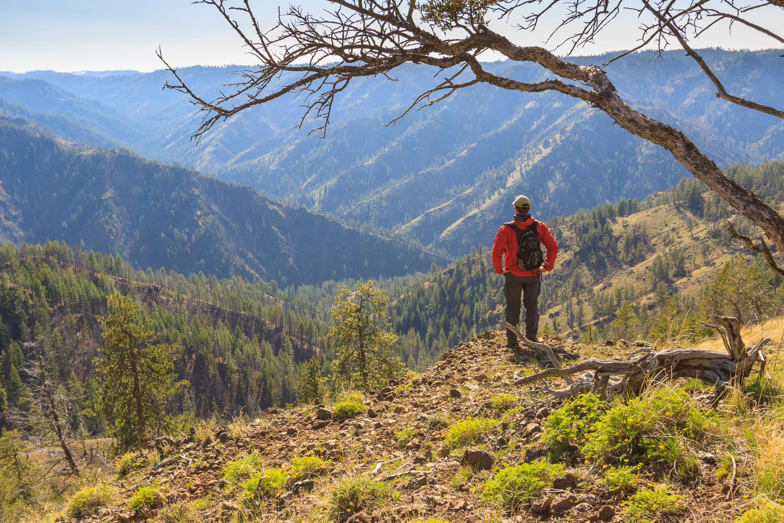
Hazeltop, originally uploaded by Matthew Singer.

This past weekend, my mom came to Luray to visit me. We spent Saturday in town at the annual Festival of Spring. Main Street is shut down to traffic and the stores and other vendors set up shop on the street. We spent a good deal of time at the wine tasting area, where there ten or so local wineries set up with their products to taste. I tried everything. There were your traditional wines, Chardonet, Merlot, Shiraz, etc. And there were some new ones, wines made from fruits other than grapes, one made with hot peppers, and even a wine made with chocolate.

The other highlight of the day was the dog frisbee competition. Sandy entered Bizzy, who just couldn’t compete with the seasoned veterans. They did win 2nd in the free-style event. I didn’t even bother to enter Shadow. She was uninterested in the discs, but she was happy to watch all the other dogs.

Sunday, we went for a hike in the national park. I chose a nice 7-mile loop over Hazeltop, then down to Rapidan Camp and back to Skyline Drive. It was a bit cold out, but the weather was perfect. Spring had just hit the upper elevations, and many trees still had yet to produce their leaves. There were lots of Large-flowered Trillium and Wood Anemone along the Appalachian Trail. On the Laurel Prong Trail, we ran into a patch of Pink Lady’s Slippers, and later we found the elusive Showy Orchid.

Rapidan Camp was Herbert Hoover’s version of Camp David, a Presidential retreat to get away from the hustle and bustle of Washington, D.C. The camp is located at the confluence of the Laurel Prong and Mill Prong where they form the Rapidan River. All that remains are the Brown House (president’s house), the Prime Minister’s Cabin for distinguished guests, and the Creel Cabin, currently used to occupy park service staff. There are exhibits set up in the other two buildings, but neither were open at the time. We did sit on the back porch of the Brown House to eat lunch and enjoy the relaxing atmosphere of the camp. We returned back to Skyline Drive by way of the Mill Prong Trail, stopping at Big Rock Falls for a photography break.

Similar Posts

  • Attempting to Snowshoe

    This past weekend, we had a nice day on my day off for once. So I took advantage of the sunshine and warm weather to get out and hike. Or so I thought. I’ve been waiting to take my snowshoes out for a real winter trek, and the timing has been bad. I set my sights on the Gold Center trail, which leaves at the base of the mountains behind Clarkia and climbs its way up to the ridge just below Grandmother Mountain. I’ve always wanted to hike this trail, and winter seems like the best time to do this…

  • Stevens Lakes

        The hike to Stevens Lakes itsn’t particularly hard, but it’s no walk in the park either. It’s about 2.5 miles and 1700 feet of vertical gain to the upper lake on a well-used and well-mantained trail. It starts off relatively steep and continues to climb steadily for the next mile before levelling out briefly as the trail emerges from a beautiful forest into an open basin surrounded by walls several hundred feet high. Just atop the headwall, 350 feet up, is the first lake, and Willow Creek drains from Lower Stevens Lake to drop over this ledge with…

  • |

    View from Mount Rogers

    View from Mount Rogers Originally uploaded by mineral2. Oops! I promised a detailed account of my Mount Rogers extravagansa, but forgot to post about it here. So here it is, almost two months late. Of course, you can visit the photo galleries for photos as they are now up there. But here’s my adventure: Sunday: I left Alabama on Sunday. I said my good byes to everyone, including my 5-foot wild gray ratsnake rescue friend (hehehe), and my partings from Jen. We’re still together for now, but time shall tell if the distance thing works out. So anyway, I headed…

  • |

    Potlatch River

    Potlatch River, originally uploaded by Matthew Singer. There is a Forest Service hiking trail about 3 miles due north of our house, though it’s about 7 miles to drive there. Still, it’s close for those after-work getaways. The trail is a ~5mi. loop along the Potlatch River that takes you along the river and then up to the “rim” of the canyon. The first half mile or so is paved, but it then becomes a regular old trail through the woods. There are interpretive markers along the entire length. I have been down on the trail several times, but yesterday…

  • Grandmother Mountain

    Looking West on Grandmother Mountain, originally uploaded by Matthew Singer. This weekend, Erin and I set out for our first hike together in Idaho and we made our first summit together on Grandmother Mountain. The hike to Grandmother Mountain begins high up in the St. Joe National Forest 12 miles out of Clarkia. The entire hike is above 5500 feet, which was a neat considering all of our hiking in the East (so far) was under 5500 feet.* Grandmother Mountain is an easy two-mile one-way along a high sub-alpine ridge with forest mixed with meadow. The summit stands at 6369…