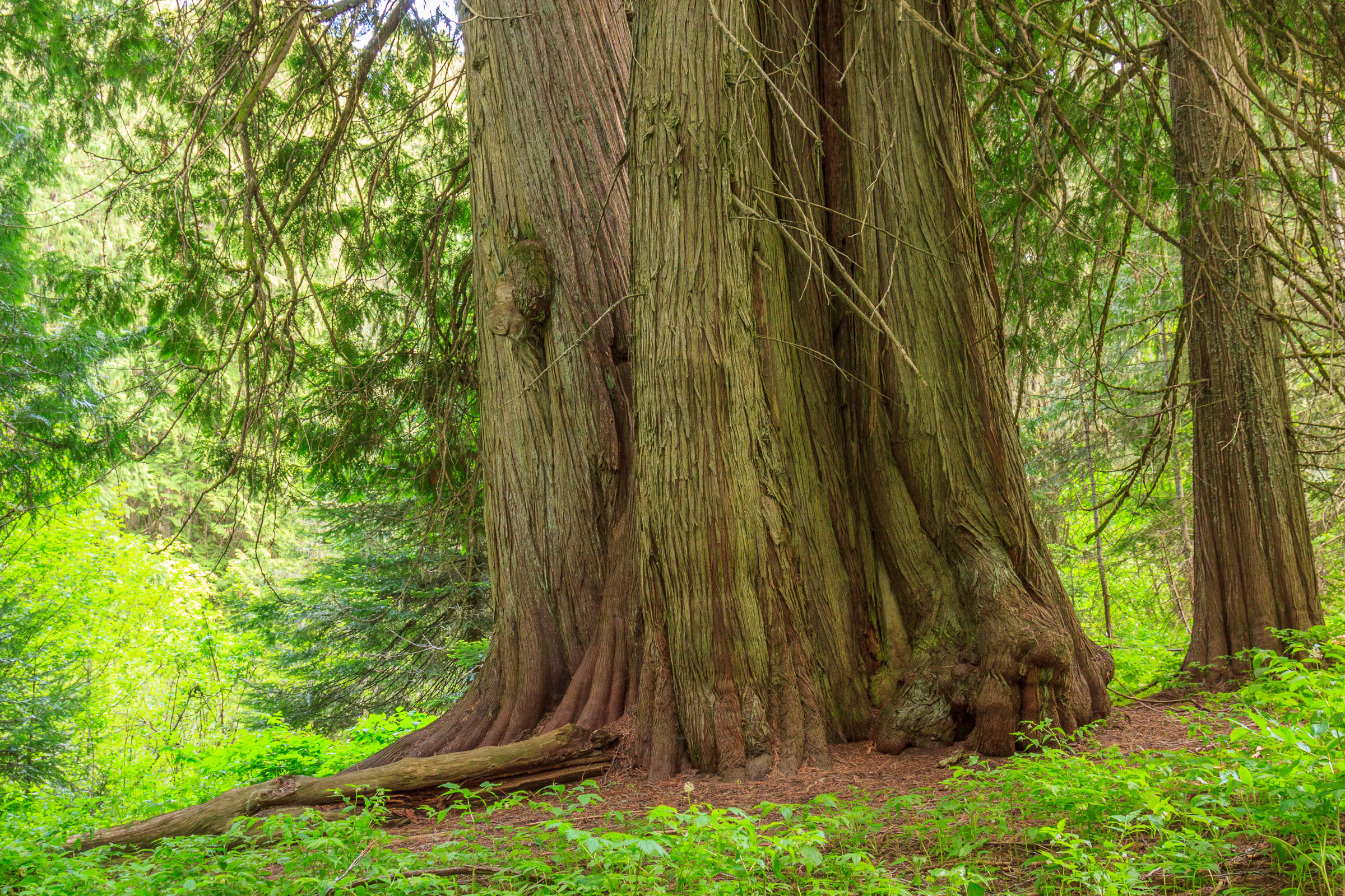
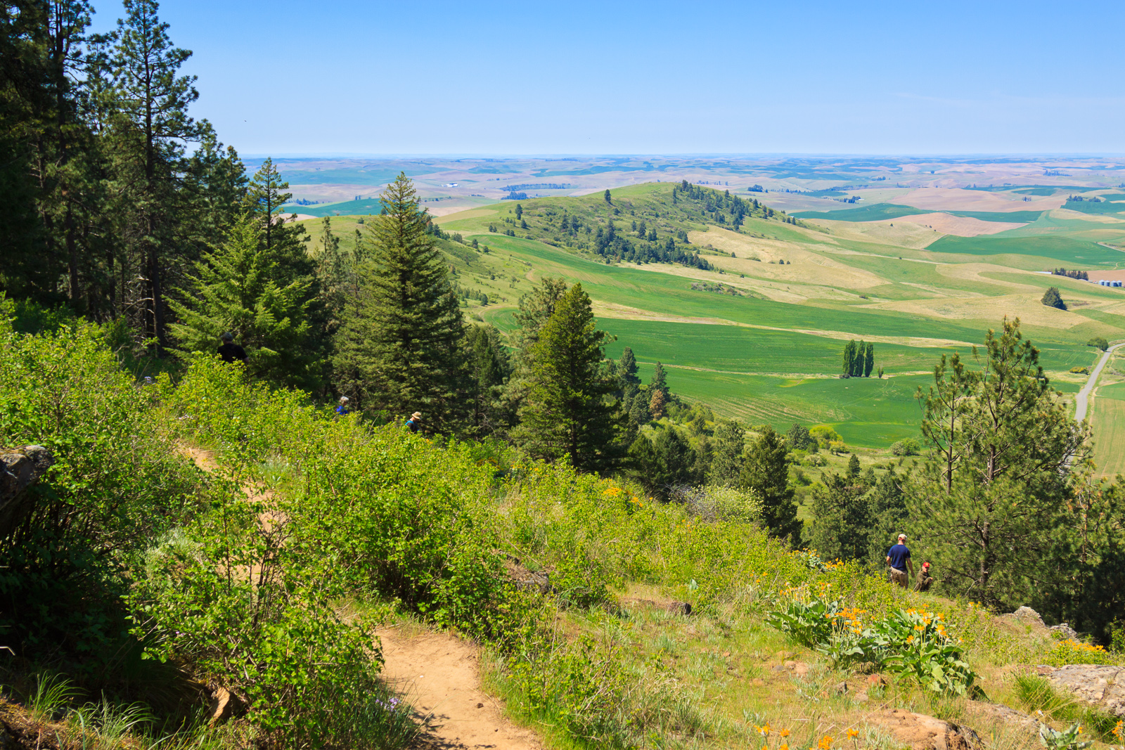
For many years, I have spent my Fourth of July basking in the part of America that I enjoy the most: its wild and natural beauty. It started in 2011 when I explored the Hobo Cedar Grove for the first time. Then again in 2013 when I hiked Grandmother Mountain. In 2015, I spent the fourth in the Seven Devils with friends. This year, I returned to Grandmother Mountain for what may be my last visit to one of my favorite peaks in the vicinity of Moscow.
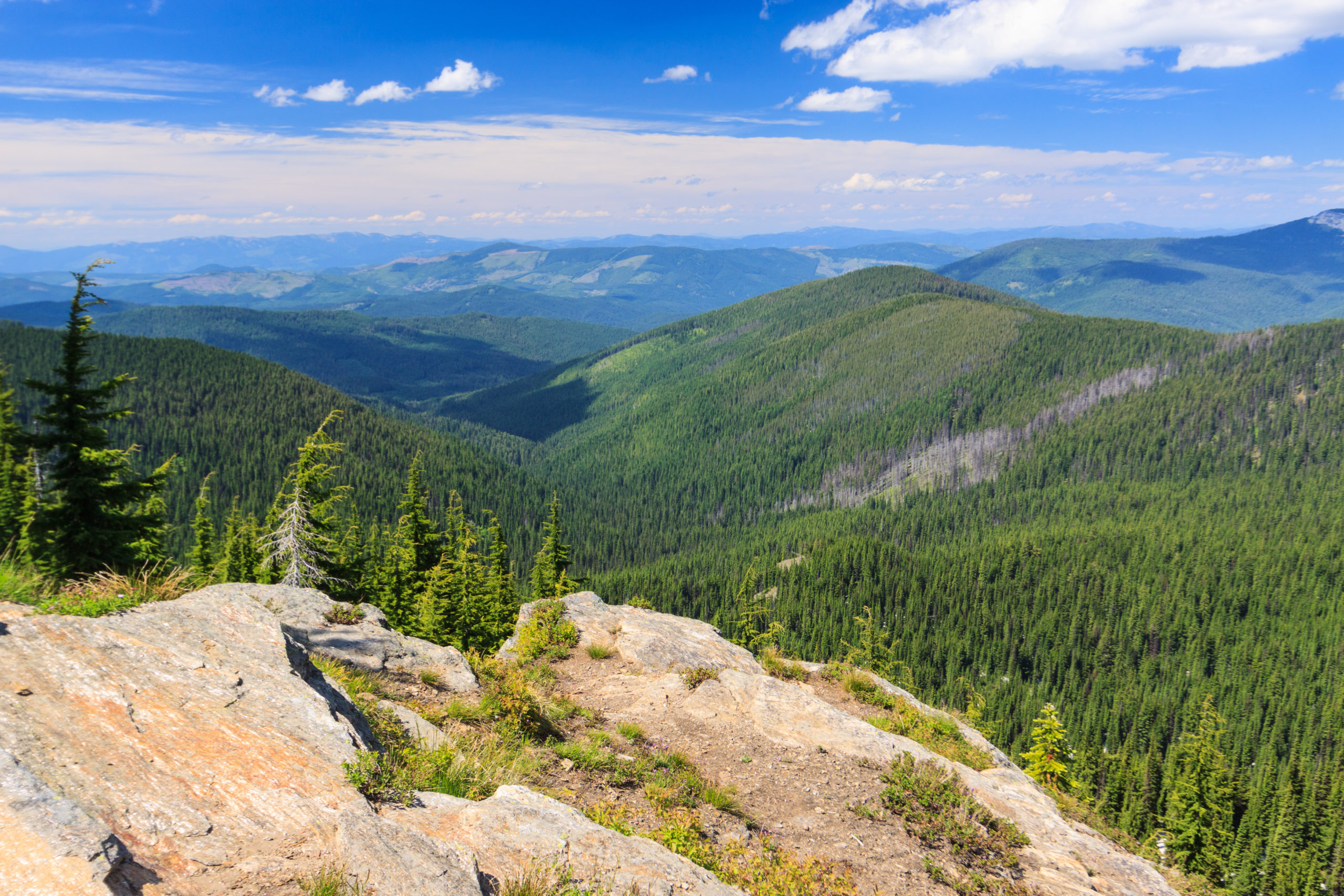
America owes its wild places to a conservation movement that began as early as the 19th century, but really took off in the early 20th century. And while we should celebrate that we have set aside land for conservation and recreation, we should also recognize the cost of doing so. Native Americans were displaced from their homelands only to see sacred landmarks turned into tourist spectacles. In the appalachians, many families were forcefully removed from their land without just compensation to create Shenandoah National Park and the Blue Ridge Parkway. The history of conservation and preservation of land isn’t always kind and people have been marginalized as a result. In the case of the Appalachian peoples, there is a deep distrust of the federal government that resides generations later.
I don’t recommend giving the land back and undoing the protections created by national parks and wilderness areas. But we can maybe do better at including the historical land owners and occupants when it comes to decisions about how to maintain and manage the land moving forward. In the West, native american tribes should absolutely have a say as to how their current and ancient sacred places get utilized, whether for tourism and recreation or for commercial resource extraction. And with the the people of appalachia, perhaps we can work to ensure that their historic homesteads aren’t completely forgotten by the ravages of nature.
As I sit on Grandmother Mountain looking over the Marble Creek drainage, I can’t help but wonder who lived on and utilized this land before it was logged clear, and how that impacts the landscape today.
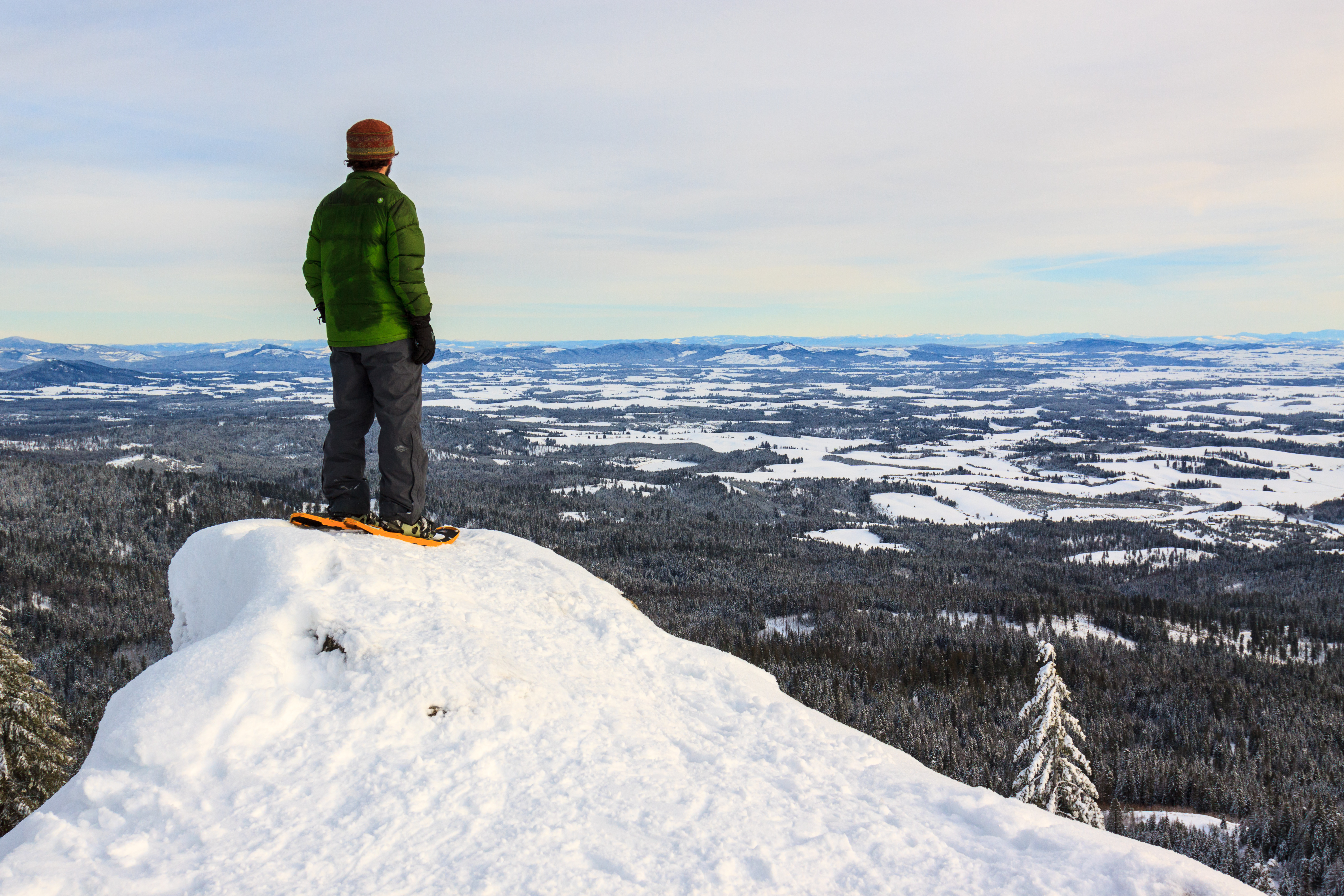
View on Grandmother Mountain
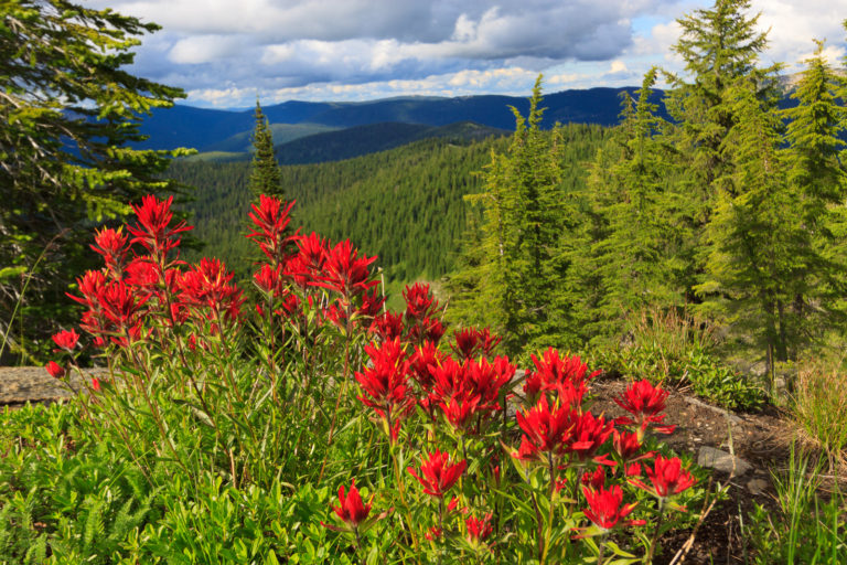
Wildflowers on Grandmother Mountain
In two weeks I will be moving to North Dakota to start teaching biology at Williston State College. While I am excited to begin this next chapter and to have a new home to explore, I will miss many of the attributes of the northwest, including trees and mountains. North Dakota has neither, at least not in abundance. Instead, I will have the unique formations of the Badlands and the biology of the prairie at my doorstep. There will be new plants and animals to learn, as well as new culture and history. I will have Theodore Roosevelt National Park and the Little Yellowstone National Grassland as my local playgound. Canada will be only an hour away. And I will have summers free to explore locally and beyond.
There is much I will miss. Lush forests, flower-laden alpine meadows, mountains, clear creeks and rivers, and hot springs. For now, I will spend my remaining time here relishing the grand landscapes that I have been immersed in for the past 10 years, and know that this is not goodbye, but more of a “see you later.”
I don’t get out hiking or geocaching often these days. With geocaching, it makes sense. I’ve found nearly all of the geocaches in a close distance to home and town, forcing me to travel farther distances just to make a find. But when it comes to hiking, I have less of an excuse. I don’t live in Moscow. I live near Deary, 25 miles east, which puts me 25 miles closer to the mountains. It puts me at the edge of the mountains, the foothills if you prefer. There are hiking trails all around. The closest is spud hill, from which there is an amazing view from the top. Then there’s the Potlatch River loop with great opportunities for flora and fauna sightings. There are more trails yet back in the Vassar Meadows area and up near Palouse Divide. I don’t have to go very far to get a nature fix. And yet, what keeps me from going out is more of a psychological barrier than a physical or economic one.
Barrier 1: I’ve hiked the trails before. The excuse is rubbish. But deep down, I desire to explore something new. And so I end up passing an opportunity just to get out because I’m hiking the same trails I’ve hiked in the past.
Barrier 2: The trails aren’t that good, or are shared with motorsports. Again, not a good excuse. Yes, many of the trails in the national forest are designed with single track or ATV use in mind. But that doesn’t mean they are terrible for hiking. The White Pine trail is fantastic, even though many people ride it rather than walk it. And yes, many trails don’t lead to a scenic destination – there are no mountain views, no lakes, no waterfalls. But I also enjoy a walk in the woods for its own merit. Yet sometimes these destinations are what bring me to a trail and I forget to just amble for the sake of ambling.
But once in a while, I’ll discover one of these trails through geocaching, and I’ll be quite impressed. Such is the case with the Sand Mountain trail. This trail traverses the ridge of Sand and Mica Mountains, and recently, someone put a geocache along the Sypah Creek. I knew the this trail existed, but ignored it this whole time because it had never shown up on the list of great hikes in the area. But someone recently placed a geocache along this trail, and so I had to find it.
I only hiked a small portion of the trail as it meanders along Sypah Creek for about two and a quarter miles. This section traverses through a lush cedar forest with a carpet of ferns and mosses near the creek. It’s very reminiscent of an inland rainforest, or at least a wet forest. The trail was in good condition, and the climb was gradual – it was 1000 feet up to where I stopped, but I didn’t think we had climbed that high until I looked at the GPS. The trail crosses the creek on a bridge, where we stopped, and then continues up to the ridge and toward the summit of Sand Mountain. I’m not sure if there’s much of a view up there, and I’ll have to return to explore it. But the section I hiked was a beautiful walk in the woods, with a first to find on a geocache as icing on the cake. Watch the video of my hike:
It’s not often that I get out to hike these days. But we’ve had a fantastic winter so far, and after a week of insanely cold temperatures and clear weather, I just had to get out and take advantage before the warm weather and rains took over. I’ve always wanted to hike to the lookout on East Moscow Mountain in the winter, but on every attempt, I was thwarted with people who just couldn’t make it all the way up. So on Saturday, I had a nice sunny day and some time to go for a snowshoe hike on my own. Since the temperatures hadn’t really risen above 25º in the past week, the snow was still fresh looking on the trees. I was hoping for a similar experience to my 2013 summit of Spud Hill, but going solo on a trail that is well used and already packed down.
I left rather late, starting the hike after 1:00 pm. That’s ok as I was hoping to catch the soft afternoon light over the Palouse from the summit, but leave enough time to return to the car before it got dark and really cold. I parked the car and put on my snowshoes only to discover a large group of New St. Andrews students also starting their hike. We nodded hello and started up the mountain together, but they took off up another trail while I continued up the road. The first thing that I noticed was that the road was plowed past the parking area. And the gate just beyond was open. This was unprecedented. In the six years I’ve lived here, Tamarack Road has never been plowed beyond the parking area, and the gate has never been opened past October. But then, for the past two summers, the gate hasn’t been open for through traffic either. I’m not sure how far the road was cleared, but it was only limited to Tamarack Road which continues down the back side of the mountain. Moscow Mountain road remained full of snow, and technically I could have driven up and parked by the intersection, but the extra mile each way was good for me.
Tamarack Road is plowed and open this year.
The hike up isn’t bad regardless of the road conditions. It’s about 2.25 miles to the top with a vertical rise of 1000 feet. About a mile up, the trail turns onto Moscow Mountain Road, which traverses the mountain ridge east to west. Since the back side of the mountain is logged, there are many views to the north that open up along this section of the hike.
Views open up to the north on Moscow Mountain Road. In the distance we can see Bald Mountain and Palouse Divide.
Finally, the East Moscow Mountain spur road takes off to the left. This last half mile is up on the ridge and is fairly flat. We start to get a glimpse of the true summit of Moscow Mountain and the Palouse off in the distance, but for the most part, the road is flanked by dense forest on both sides. The road ends with a little turn-a-bout, and suddenly the view opens over the Palouse, about 2500 feet below.
The forest on top of Moscow Mountain.
This day was so clear, that I could see the Wallowas and the Seven Devils poking up above the horizon 100 miles away. The sun had been obscured by some clouds, which made the light a bit flat and challenging to work with, but the relative clarity of the atmosphere provided stunning views all around. I feel as though I made the right choice going up when I did. Though the sky was clearer the next day, there was more haze and the mountains in the distance would have been much less defined.
The Seven Devils are peaking up over the rim of Hells Canyon.
The Wallowas can be seen behind the clouded Lewiston-Clarkston valley and the Blue Mountains.
Moscow Mountain looks over the entire Idaho Palouse, and the southern portion of Washington’s Palouse. Both Moscow and Pullman are visible, though on this day, Pullman is partially hidden by a layer of fog spilling over from the Clearwater and Snake canyons (Lewiston and Clarkston valley). The sun came out just before I headed back to the car giving some definition to the rolling hills on the Palouse. Unfortunately, Kamiak Butte and everything north is obscured by the main summit of Moscow Mountain.
The town of Moscow, home to the University of Idaho.
View of Pullman and the Washington Palouse
The Palouse through the trees.
Looking east toward the Clearwater Mountains. Grandmother Mountain and Freezeout Ridge are visible in this image.
The overlook on East Moscow Mountain
My car, 1000 feet below.
In total, the view from the rocks is around 180º from Freezeout to Pullman, including the ability to see the Mallard Larkins, Selway Crags, Gospel Hump, Seven Devils, Wallowas, Selway/Payette Mountains, the Blue Mountains, a bit of Hells Canyon, and all of the hills of the southern Palouse.
A full panorama of the view on East Moscow Mountain stitched from 28 individual frames.
While it was a pleasant 18 degrees out, my water did freeze while I had my pack off on the summit. As I headed back to the car trying to beat the sunset, the light actually got better and better. A part of me wanted to stay up there just a bit longer to reshoot the views with that last evening light. But the cold had gotten to my batteries, and I wasn’t really prepared to stay up there much longer. Within less than an hour, the temperatures would drop about fifteen degrees. And that’s the problem with having a real winter. It gets so cold so fast that even while keeping my batteries warm in my coat pocket, they get cold in the camera very fast and quit on me. On the way out, I was able to capture the last light of the day glowing off the mountain from below.
This past year, I found myself in a bit of a photographic slump. It’s not that I didn’t create any great images – some of my favorites were made on Steptoe Butte. But I didn’t get out much, and when I did, I didn’t always bring or use the camera. I’m hoping I can crawl out of that slump this year to capture more of this stunning place before leaving it.
The last light of the evening glowing off of the mountain.
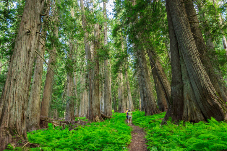
The Hobo Cedar Grove is a nice easy 1-mile hike through a grove of giant old-growth trees. It is the perfect hike for toddlers to explore nature, which is why we brought Clara up there on Sunday. She enjoyed the large trees, but wasn’t into walking the trail much. Eventually Erin had to carry her for most of the hike. In hindsight, she may not have completely gotten over her illness from Friday and Saturday.
I finally got some time to get up to Freezeout to hike Grandmother Mountain. The flowers are out and it’s quite pretty, though it’s not the best year for flowers that I’ve seen. It could be that I got up there a little late. Everything seems to be coming out a little earlier this year than normal. But then, all of the flowers that are out still seem to be in peak bloom. I was especially hoping for a great beargrass year like I got to see three years ago. But even with the lower abundance of flowers, the ones that were there were quite spectacular. I came across a patch of paintbrush on the summit that must have been the best I’ve ever seen, perfect and unblemished and bright and vivid.
Paintbrush on Grandmother Mountain
It’s been a strange summer. Our heat wave came early and has since left for cooler temperatures and rain. Typically by July, we’ve entered the dry spell. But this past weekend it rained pretty hard, letting up just long enough for a hike on Saturday. Since I’ve been to Grandmother Mountain so many times, I don’t have many new photos to share. So instead, I thought I’d try my hand at a video tour of the hike. So enjoy this hybrid blog-vlog post.
Last week, Clara and I had a day to ourselves, so we had a little adventure on a nearby trail. The white pine loop is a 3-mile hike from the White Pine campground off of Idaho Rt. 6. A one-mile (one-way) out and back spur takes us to the site of a WWII bomber crash site with some pieces of the wreckage still littered throughout the woods. But rather than write a lengthy post with a few photos, I’ve decided to try a video series that I’m calling Adventures with Clara to highlight just how adventurous she is.
[map style=”width: auto; height:400px; margin:20px 0px 20px 0px; border: 1px solid black;” gpx=”http://www.mineral2.com/wp-content/uploads/White pine loop hike.GPX”]
After a long summer with not much exploring, the pace has changed and I’ve had a fairly busy two weeks. The series begins with the return of the Annual Wallowas Weekend. In the six Septembers that I have lived here, I’ve led a backpacking trip to the Eagle Cap Wilderness four of those years, with this year being the fourth. Each time I bring someone new, and each time we explore new trails. This is the first year that we didn’t spend a night at Mirror Lake and the first year that Tyler didn’t join us. Instead, Wesley returns for a second year to help me lead six newcomers to these mountains. Amanda, John, Ian, and Mason are new graduate students to the Biology Department. Josef is a post-doc and his girlfriend Laura also joined us on this hike. Thibault has been to the Wallowas before, but not on one of my Wallowas Weekends. So there we were, a fellowship of nine misfits charged with the task of ensuring that the ring of pow…
Oh right. Sometimes when I’m hiking in the Wallowas, it’s hard not to imagine that we’re crossing the Misty Mountains, and the weather this year just added to that effect.
This year we hiked 11 miles over two days. If that doesn’t sound impressive, it’s because it’s not. I wanted a relatively easy and painless hike to make up for the past few backpacking trips that turned out to be way more strenuous than anticipated. And the weather kinda cut our trip down from three days of hiking to two. In fact, we almost didn’t go to the Wallowas at all. After our hike in the Seven Devils, fire season hit hard and heavy. It was one of the worst seasons on record, which is mostly why the summer has been devoid of travel and exploration. For over a month, the visibility and air quality in Moscow was abysmal, and those conditions extended beyond our region. Much of the smoke had come from some large fires along the northern California coast. But depending on which way the wind was blowing, the smoke could have also come from fires in north-central Washington, or a large fire very nearby to the east in Kamiah. In addition to the smoke, small fires dotted the forest up and down the state, leaving very few places safe for hiking. Once place that was spared the wrath of fires, near and far, was the Sawtooths. So a week before our planned outing, we met and decided that the Sawtooths would be a better alternative for this year’s adventure.
Then the weather changed. Cold fronts blew in and dampened the area. Winds blew the smoke out, temperatures dropped, and the air cleared. For the whole week, the smoke did not return, but we still had our hearts set on the Sawtooths. Despite the longer drive, we picked out a nice 3-day loop to explore some mountains that none of us had been to before. While the smoke conditions had improved, the overall weather had not. Instead of hot and dry conditions, we had cold rain in the forecast. In fact, it was to rain from Friday evening through Saturday night, and in the mountains, that rain was to fall as snow. I’ve camped in the cold and hiked in the rain, but we had no interest in camping and hiking in the cold and the wet. With Saturday’s high predicted to remain under 50º, we decided to cut our hiking down to Sunday and Monday of the holiday weekend. Both days were to be cooler than average, but at least the sun would be out. And since we didn’t feel it was worth driving seven hours to hike two days, we moved the hike back to the Wallowas where we would enjoy an evening of beer and food at Terminal Gravity the night before and camp on their lawn. And so we arrived in Enterprise on Saturday night just in time to see what the passing storm had done to the mountains.
A storm had dropped the first snow on the Wallowas the day before our backpacking trip.
Josef and Laura were to meet us in Enterprise Sunday morning. While we waited, we decided on a trail – a decision between hiking Two Pan to Mirror Lake as I did my first year, or hike into Dollar Lake at the base of Aneroid Mountain from the Tenderfoot trailhead. We eventually settled upon the second choice under the guise that none of us had been on that trail before and therefore we were all experiencing something new together. Josef and Laura were running late, so we agreed to meet them at our campsite at Dollar Lake instead.
The Tenderfoot trailhead lies at the end of a short rough road along the eastern side of the mountains. At 6500 feet, it’s one of the higher access points to the wilderness area. It’s a 5.5 mile hike to Dollar Lake with a continuous, but gentle climb of 2000 feet. This even grade makes for a nice easy hike. From the beginning, the terrain is gorgeous, but very different from the central valleys that we are used to. For one, the valley is not as deep as the Wallowa, Hurricane, or Lostine valleys, and the mountains are concocted of layers of basalt and shale rather than granite. This difference in underlying terrain meant the floral community was different as well. We passed by some sagebrush communities and aspen groves in the first section of the hike.
Hiking in on the Tenderfoot Wagon Road
We began on the Tenderfoot Wagon Road for about two miles before turning off onto the Bonny Lakes Trail which passes by the Bonny Lakes and ascends the pass to Dollar Lake. We had a leisurely hike in the sun, stopping frequently to rest and enjoy the view. We ate lunch at one of the Bonny Lakes and then trudged onward, our destination less than a mile ahead. As we neared the top, it became clear that not much snow had fallen, and that it just looked worse from below. Much of the snow had melted through the course of the day. When we made it to Dollar Lake, the sun was still shining down upon us, and we took some time to set up camp and rest a bit.
With such a short hike, we had planned to drop our packs and head for the summit of Aneroid Mountain another thousand feet up. Aneroid is not a hard mountain to climb. It’s practically a walk up the slope to the summit with a short rock scramble at the top. Of course, with all mountains, the route looks easier from below than when you’re actually on it. The slope was steep – not as steep as the scree fields at the Seven Devils – but it was still a workout to ascend. When we started our ascent, the sun was still shining. There were clouds amassing over the peaks to the south, but otherwise still looked like a clear day.
Climbing Aneroid Mountain
During the first half of the climb, we had an open forest of short trees for support. When we rose above the treeline, we were already above 9000 feet. But by that time, I had noticed the mountains to the west disappearing one by one into a storm. I called out to those ahead of me to reconsider our plan. Finally, when all but the adjacent ridge had disappeared, they decided to turn back. With no way of gauging just how bad this storm could be, I was not going to take any chances with bad weather on a mountain summit. We descended with snowflakes falling upon us.
Approaching Storm
Getting closer…
and closer…
Descending Aneroid
Back at camp, we waited out the storm. Josef and Laura had arrived and were exploring while waiting for our return. It turned out that the storm was small and passed over us rather quickly. But some other hikers coming off the mountain reported some strong gusts that reaffirmed our decision to turn back. Unable to build a fire, we huddled in a small clump of trees for warmth and snacked on cheese and wine before breaking out the stoves for a dinner of mac and cheese. The winds kicked back up and the snow returned as we performed the bare minimum of clean-up and retreated to the shelter of our tents for the evening. The wind gusts blew strong through the night, but our tents held firm. We had the fly tied down to rocks because the ground was too hard to put stakes in. A few times I found myself pulling out the vestibule only to have it blow back into the tent. Luckily the storm was mostly wind and little precipitation. Still, it was cold and I was the most uncomfortable I’ve ever been on a backpacking trip. I think I need a new sleeping bag as mine doesn’t seem to stay as warm as it used to. Also, I might want a new sleeping pad for better cushion.
Exploring Dollar Lake
When I backpack, I tend to bring extra weight. I carry a big DSLR with two lenses and a tripod. This allows me to capture the spectacular images that accompany these posts. The tripod is specifically for sunset and sunrise at the lakes. Without it, I’d get get blurry images due to the long exposures needed at such low light. With the storm Sunday night, I was afraid I had lugged the tripod up for nothing. I awoke Monday morning to calmness. I fixed the vestibule and then unzipped the tent to gauge the conditions: clear blue sky. With that, I got out and prepared to shoot the coming sunrise. Not only that, but others were awake too, and when I summoned them, they came. It was the first time I had company for a sunrise.
Pre-dawn at Dollar Lake.
Sunrise and the Wallowa River Valley
Alpenglow on Pete’s Point
Our camp with the ridge behind it.
The morning was cold, but worth the effort. Most everyone decided to climb the ridge behind camp to watch the sun rise. I stayed down below mostly because I didn’t feel like exerting the energy to get up there. The light quickly descended and warmed us up as we made breakfast and coffee and packed up our gear. We left at 9:30 and headed back the way we came. Monday was sunnier and warmer than Sunday. The remaining snow was quickly melting away as we hiked down into the valley. I stopped for a couple of reflection shots on the glassy mirror-like surface of Bonny Lake. Otherwise, we made good time, getting back to the car shortly after noon. We finished the weekend with our traditional beer and burger at Terminal Gravity.
Pete’s Point rises high behind Dollar Lake
Hiking back across the alpine meadow beneath Aneroid Mountain.
What do you do when temperatures rise above 100º F?
Seek relief at very high elevations.
This June was one of the hottest on record for the northwest with several days above 100 degrees in Moscow. So when my friends proposed a backpacking trip for the Fourth of July weekend, i was a bit skeptical, especially given the location’s tendency to get hot and dry in the summer months. It’s also a very popular destination for holiday weekends, though it’s not usually accessible for the Fourth of July. So it could have been really crowded, or completely empty. They wanted to hike the 26-mile loop around the Seven Devils (30 with the Dry Diggins add-on), and since that would be a new trail for me, I was in. And so were a lot of other people. In fact, we ended up with 13 students and postdocs that wanted to get away, though not everyone was up for 30 miles or couldn’t take the extra day off of work. We ended up splitting into two groups. Five of us would hike the loop spending three nights on the trail, and the rest would meet us at Bernard Lakes for a one-night trip.
So there we were, 8:00 pm local time at the Windy Saddle Trailhead on Thursday July 2. We were one of three cars at the trailhead, so we knew we’d pretty much have the place to ourselves. We had decided to hike the first four miles to Lower Cannon Lake in order to make hiking the rest of the loop less strenuous. Of course, that was before we got the news that there were a lot of downed trees on the trail. We began making alternate plans in case we didn’t want to dodge trees for 30 miles, and that included hiking over the ridge from Cannon Lakes to Sheep Lake. Spoiler alert: We chose this option. But we’ll get to that later.
We left Windy Saddle as the sun was setting below the horizon. With clear skies and a nearly full moon, I challenged the group to night hike the four miles to our camp. So, that’s what we did. We made it to Lower Cannon Lakes without using our headlamps. It was quite an awesome experience and I wholly recommend it if you’ve never done it before. By the time we chose a campsite and set up, it was after midnight. The moon was bright, but we slept “under the stars” (mesh tent to keep the mosquitos away, but no rainfly). I was still up to catch the sunrise alpenglow on the mountains.
The basin around Lower Cannon Lake illuminated by moonlight.
Morning Alpenglow across Lower Cannon Lake
On Friday, we were headed over to Sheep Lake. The trip begins by climbing 1000 feet up the valley to Upper Cannon Lake on an unofficial trail marked by a faint worn path and a few cairns. We began by bushwhacking up the hill from our campsite to the ridge to find the trail. But the trail is easily lost, so much of the first part of the day was spent hopping from downed tree to downed tree and trying to avoid the patches of dense bushes. It wasn’t tough though. In fact, it was quite beautiful running into wildflowers.
Bushwhacking up from camp.
We found the trail on the little ridge.
Fields of lupine in bloom color the alpine meadow.
The ridge turns into a little gorge with a series of waterfalls and cascades. The first brings us into a nice short-grass meadow lined with trees. It’s a small area with a headwall behind it. The creek drops off the wall with a nice display. We stopped to admire the waterfall, but had to climb up above it, at which point there is a second headwall to climb over before arriving at the lake. Lower Cannon Lake is at 7000 feet. The vegetation is brushy and somewhat tall. Upper Cannon Lake is at 8000 feet and most decidedly in the alpine zone. Lower Cannon is lined with shrubs and trees and is somewhat eutrophic as the summer progresses. Upper Cannon is cold, rock-lined, and clear all year. It’s a wonderful little lake, and might have been worth the extra effort to get to if we hadn’t been night hiking to our first camp. But it made for a good rest break for lunch. We had ascended approximately half of our ascent in 2.5 hours, but the next thousand feet were going to be more difficult – straight up the side of the mountain with no real trail to follow.
Ascending the “trail” to Upper Cannon Lake.
Alpine Heather in bloom on the way to Upper Cannon Lake.
Upper Cannon Lake
Lunch Break at Upper Cannon Lake.
From Upper Cannon Lake, we were essentially following a scree field to the ridge of the Seven Devils. It’s easy to pick out the route from the lake. Once we were on it, though, it became less clear which turns to make. In the worst case scenario, we’d make it most of the way only to turn around and try another direction. But we managed to choose the right route on the first try and were welcomed with cairns placed sporadically to validate our decisions. The ascent was tough, but ended up being easier than I expected. There were few sections of loose rock. It was mostly about keeping good footing. We reached the ridge at 9000 feet, a distance of just over half a mile in two hours. There, we had second lunch and contemplated a packless summit of the Tower of Babel and She Devil. Jessica and I tried for the Tower, but were thwarted when we discovered that the route required a descent along a screen field to skirt one of the monoliths. She devil, on the other hand, was supposed to be a straightforward scramble to the top. We could see the path from the ridge, but again, once we were on it, we kinda lost our way. Exhausted and dreading the descent down the other side, we turned back and decided it wasn’t worth the risk to make the summit at this time. The view on the ridge was good enough anyway.
Climbing up the Scree field above Cannon Lakes.
The Ogre
The Salmon River Canyon from the Seven Devils ridge.
View of the mountains toward McCall
Sheep Lake
The ascent puts is in the saddle between the Tower of Babel and Mt. Baal, a small tower of rock that breaks the ridge between She Devil and the Tower. To get to Sheep Lake, we had to skirt around Mt. Baal to the saddle with She Devil. That turned out to be tougher than anticipated. When we reached the second saddle, I had run out of water. That didn’t seem like a big deal at the time. We just needed to descend a steep scree field to Sheep Lake, over one thousand feet below. That descent took two hours. Unlike the ascent, this scree field was extremely loose and we sent some large boulders tumbling down the mountain on more than one occasion. I do not recommend ever doing this with full packs. The ascent was tough, but the views at the top were an awesome reward. The descent to Sheep Lake was simply demoralizing. By the end of the day, we were sore, exhausted, dehydrated, and we hated and regretted our choice to come this way. But we were at Sheep Lake, one of the nicest lakes around, and we were greeted with a nice surprise at the bottom. There was a pack of mountain goats hanging around the shores of the side pond, and they had babies with them.
Mountain goats at Sheep Lake.
I hadn’t had a drop of water to drink in hours, and spent the past two inhaling dust kicked up during the descent. My first priority was to refill at the lake’s edge, but instead, I dropped my pack, swapped lenses on the camera and sat and watched the wildlife for a while. That’s what photographers will do for a shot.
Thankfully, Sheep Lake wasn’t too crowded this time. I’ve had trouble finding good camp sites in the past, but we found a nice one above the lake with a good view and prime access to the water. The first thing we did was dive into the lake to cool off and rinse off the sweat and grime from the day. The water was cold and refreshing, and it was the best feeling ever. I then pumped some fresh water to drink and after we changed into our camp clothes, we celebrated our perseverance with a well deserved dinner.
Side note: on small trips like these, having a cooking meal is much more satisfying than eating the dehydrated backpacker meals.
Morning sun on He Devil across from Sheep Lake.Columbine and paintbrush along the Sheep Lake Trail.
Saturday’s route took us from Sheep Lake to Upper Bernard Lake below the Dry Diggins Lookout. It was a day of hiking on established trails with relatively little elevation gain. I had hiked this trail in 2012 when everything was brown and dry, so I was excited to see the landscape while it was still green and the flowers were in bloom. I was not disappointed. The trail begins with a 500 foot climb out Sheep Lake Basin and into the next valley where we pass three lakes in succession while descending to the shelf that extends out to Dry Diggins and then drops into Hells Canyon. The third lake, Basin Lake, is most accessible from the trail and made for a great spot to stop and eat lunch. From there, it was a mile to the intersection with the Seven Devils loop, which we’d take to the Dry Diggins trail.
Intersection with the Seven Devils Loop in September 2012.
Intersection with the Seven Devils Loop in July 2015.
The trail traversed through some burned meadows that are now carpeted with wildflowers in the early spring. It then gently climbed to almost 8000 feet for a view over Dry Diggins and Hells Canyon. We then dropped steeply into a saddle where we intersect with the Bernard Lakes trail. Here, we dropped our packs and headed for the lookout before descending to the lake to make camp. Our total mileage for the day was 8 miles with lots of stops and breaks.
A carpet of lupins and other wildflowers surround the trail.
View of the Dry Diggins Lookout (ahead) and Hells Canyon behind it.
View of the Snake River from Dry Diggins Lookout. The drop to the river is over 6000 feet.
The Seven Devils from Dry Diggins Lookout.
Fires destroyed the forest, but regrowth begins with a stunning display of flowers.
Sego Lilies are a true gem of the Seven Devils.
We arrived at our campsite on Upper Bernard Lake around 3:30. That gave us plenty of time to set up and relax while we waited for the other group of hikers to arrive. They were coming from Moscow that morning and hiking in almost 8 miles over some rough elevation changes with some first-time backpackers in the group (see day 4 in reverse). So we expected that they’d be on the trail between 6 and 8 hours, and that they’d be starting later than we did. Our Saturday hike was relatively easy in comparison, but we were still tired and sore from the previous day’s shenanigans. The first of the group made their appearance around 6:30 and the rest staggered in behind. We had ourselves a nice tent city behind the lake. We cooked dinner, swam in the lake, and sat upon the rocks watching the magnificent sunset turn the Seven Devils a deep shade of pink.
Sunset at Bernard Lake.
I initially had plans to hike up to the fire tower and capture the sunset. When we were on the tower earlier in the day, it looked as though we might have an overcast evening, but as we were making dinner, the skies cleared and the sun returned. By that time, I was tired, and so was everyone else. Still unsure whether the sunset would produce, we decided not to return to the tower that evening. And then the sunset did not disappoint. While I would have liked to have been at the tower, the lake was an excellent second choice for viewing. Instead, I suggested we get up early and hike up to the tower to catch the morning light. So that’s what we did.
The five of us, plus two from the other group, packed the stove, pots, water, and personal dishes and headed up to the tower to make breakfast. With fresh legs and light packs, the 1-mile hike to the tower was quick and easy, and the morning view did not disappoint. The sun was shining, the sky was blue, and the haze was a bit thinner than the previous afternoon. We spent an hour eating and admiring the view before heading back to pack up camp and prepare for the long trek back to the cars.
Hells Canyon
Breakfast with a view at the Dry Diggins lookout.
Dry Diggins fire tower.
The hike back would not be easy. The total elevation gain was about 2000 feet with a steep 500 foot section and a long and arduous 2 miles of continuous uphill for 1300 feet. Much of the trail is exposed to the sun and even though the high for the day was around 75 up there, it felt much hotter. Though I had recovered a bit from Friday’s controlled fall down the scree field, I was still tired, which made the hike out all the more difficult. Technically, it’s not all that hard of a hike. But by the end of a 4-day trip, it’s mentally exhausting. But this hike doesn’t come without its merits.
The hike began by descending into a dry basin and climbing up the other side. In two miles, we had lost and gained nearly 500 feet to meet up with the Seven Devils loop trail. Here, the trail descends rather quickly to 6500 feet into the Sheep Creek basin, pictured below. The only reprieve is that the bottom of this valley is covered in a lush forest, and the creek falls down a series of cascades to the trail. This waterfall made an excellent lunch stop and, more importantly, a place to refill with cold fresh water. This was the halfway point, but the difficulty lies ahead. After the creek, the trail climbed 1300 feet over the next two miles with each switchback deceivingly appearing as if it would be the last. At least the trail topped out with a view of Hell’s Canyon before plunging back downward into one more ravine before ascending to the finish line.
Wildflowers grow on the talus slopes as the trail descends into the Sheep Creek basin.
We made our goal of arriving at the cars by 4:00. The 8-mile hike out took only 5.5 hours. I couldn’t be happier to see the car at that point. The Seven Devils is a beautiful area with a rich diversity of flora. However, it is one of the toughest places I have hiked. Our total stats for the trip are as follows:
I had heard about the big trees on Moscow Mountain, but I had yet to experience them for myself. I first drove the road along the ridge back in 2010, the year I moved to Idaho. Back then, I passed some fairly large trees along the side of the road, and I assumed those were the trees everyone was talking about. But as I did some more research, I found that there really was a stand of old grown timber remaining on the north side of the mountain. The only problem is that it’s not well documented on the mountain itself. The trees are part of the old East Moscow Mountain park, which may or may not still be owned by the county. It’s clear that the picnic area near the Tamarack lookout is no longer maintained, but trails all along the mountain are maintained by the local mountain biking club. I suspect that they also maintain the picnic table at the cedar grove.
When I first drove Moscow Mountain, I was able to drive all the way through, descending on Tamarack Road and riding all the way out to Troy. Last summer, the gate at the bottom of Tamarack Road remained closed through the season. So instead of parking on the ridge to walk to the lookout, people had to park at the bottom where the winter lot is generally plowed. That’s not really a big deal, it adds about a mile to the hike each way, and the ascending road is well shaded most of the way. But it does mean that a trip to the cedars and the lookout is going to require a good half-day’s commitment at least.
Both the lookout and the cedars are about 2 miles (give or take) from the lower parking area. When you hit the turn off to go to the lookout, instead continue straight on the road for another half mile until you reach what looks like a pull-off on your right. There you’ll see a trail enter the woods marked by two metal poles. Follow this trail about .2 miles into the heart of the old-growth cedars. There, you’ll find a picnic table surrounded by many impressively sized trees. You won’t find as many large trees as you would at Elk River or the Hobo Cedar Grove, but you’ll find some solitude and awe among some giants that rival the ones at the other groves.
If you combine this with the lookout, as I did on Sunday, the entire trip will reach about 5.6 miles. That’s not bad, considering you get to experience both old-growth forest and a stunning view of the Palouse, all within 15 miles of Moscow.
Sunday began sunny and hot. Temperatures had exceeded 80 degrees when I parked my car at the Tamarack trailhead. I huffed and puffed and sweated my way to the top where I noticed that the temperature and humidity hadn’t really gotten any better, but at least I was in the shade and on relatively flat ground. We’ve had an unusual weather year in north Idaho. It began with a less than stellar winter. That’s not to say it was a dry winter, but it was quite warm, so on the few occasions that we did get snow it melted away pretty quickly. For the most part, it rained in January and February, leaving the burnt of the snowpack to the high elevations. By late April and early May, temperatures had risen into the 80’s at times. This past week, it even got up to 90, which is average for the middle of summer, but not Spring. On top of that, we’ve been experiencing daily thunderstorms each evening for over a week. Spring rains aren’t uncommon here, but thunderstorms are. We get a few each summer, but that’s about it. This year, we’ve gotten more in one week than I remember in some years.
I chose Sunday for my hike because the weather forecast predicted a clear, rain-free day. But the storms were to resume by evening. I started my hike late in the afternoon and enjoyed my walk up to the cedars. There, I took a break and cooled off before setting out for the lookout. I knew my sunshine was limited when I noticed the soft cloudy light in the cedar grove. I didn’t mind, though. Those are the best conditions for photographing the forest. When I finally packed up and headed back, I noticed that the air was heavy. It was humid, like hiking in the east. Of course, the funny thing is that the humidity on a “humid” day is still less than a “dry” day in the southern Appalachians, but when most days are below 20%, a day above 30% feels balmy. As I reached the lookout, I saw storm clouds and rain across the Palouse heading my way. The rain looked to be over Lewiston and Clarkston, but it was moving slowly. I had enough time to enjoy a snack with my view before I raced back down to the car. I did manage to beat the storm, but I think it was also moving in a more easterly direction than north, so it may not have hit the mountain for quite some time.
A storm approaches Moscow Mountain from the southwest.
Now that I know where the cedars are, and how far the hike is, I look forward to returning in the winter on snowshoes.
The end of the semester is a busy time, and that often means foregoing larger adventures for some smaller ones closer to home. In the last week, I’ve been trying to keep active and take advantage of the local trails. One of these trails is the Headwaters trail on the western end of Moscow Mountain. In my five years here, I’ve never hiked this trail despite its close proximity and popularity among hikers, runners, and mountain bikers. Yet when all of my friends say they were on Moscow Mountain, they almost always mean the Headwaters trail.
Headwaters is a 5 mile lollipop loop around the drainage that creates the headwaters for Paradise Creek, Moscow’s main water feature. There are no major attractions along this trail such as stunning views for waterfalls, but it does offer a nice walk in the woods with some great opportunities for wildlife sightings and enjoying the spring wildflowers. Â Since I hiked this after work on Friday with limited daylight, I did not bring my camera and thus have no photos to share.
I’ve hiked Kamiak Butte many times. But each time, I’ve stuck to the main loop and ignored the relatively new primitive trail that takes you around the west end of the feature. Saturday, I did just that, hiking with a group of geocachers from Spokane and finding the last cache in the park. The primitive trail is a bit more difficult than the main trail. It’s narrower, rockier, and steeper, but it’s not by any means a strenuous hike. Instead, it takes you away from most of the crowds into some nice wooded terrain. During the descent, there is a spot that opens up with some spectacular views of the northwestern Palouse. The wildflowers this time of year are also pretty spectacular. Arrowleaf balsamroot are past their peak, but still dotting the hillside with splashes of yellow. Meanwhile, the larkspur and wild hyacinth have become abundant, and the phlox carpets the ground with little pink clusters. In the woods, the western meadowrue and fairy bells have begun blooming. Calypso orchids have been out for a few weeks, but are still going strong.
I have always liked Kamiak Butte, and with this extended loop, I like it even more. The full loop is about 4 miles long. Unfortunately, dogs are not permitted on the primitive trail, so plan on leaving your four-legged companions at home or just sticking to the main loop.
[map style=”width: auto; height:400px; margin:20px 0px 20px 0px; border: 1px solid black;” gpx=”http://www.mineral2.com/wp-content/uploads/Kamiak Butte with primitive trail.GPX”]
We open the 2015 hiking season with a fairly big hike in the Blue Mountains. The Panjab loop takes us up the Panjab Creek trail and back down via the Rattlesnake Trail in the Wenaha Tucannon Wilderness. This hike is full of wildflowers, wildlife, and canyon views. (more…)
[map style=”width: auto; height:400px; margin:20px 0px 20px 0px; border: 1px solid black;” gpx=”http://www.mineral2.com/wp-content/uploads/Selected Data from wallowas 2014.GPX”]
The annual Wallowas Weekend tradition kinda took a hiatus for a couple of years. In 2012, Tyler had to pull out of the trip, and several other people followed. That left me with one other person who still wanted to hike, but also wanted to fish. So we turned it into a Seven Devils trip. Last year, I was still recovering from my ski accident and was in no shape to go backpacking. But this year, I was determined to get back in the game, and I didn’t disappoint. I chose a 24-mile loop to accomplish over three days. We’d climb a total of more than 6000 feet and finally summit the iconic Eagle Cap while exploring a total of four river valleys and a new lake. Tyler and I brought with us four newcomers to the Eagle Cap Wilderness, two of which were new to backpacking. It was a difficult trip, but we had a great time.
Day 0: Getting to Enterprise
The timing of this trip was planned around Tyler’s brother in law. Christian was visiting to drop off his car before heading to Germany for two years. He requested we take him backpacking in the mountains, and thus the annual Wallowas Weekend was reborn. We originally wanted to spend three nights in the backcountry, but none of our schedules meshed to allow that. So the best plan we could come up with would be to drive out there Thursday evening after work and car camp near the trailhead and then hike for three full days. There aren’t very many trail options to satisfy these demands. There are plenty of one-night hikes, and plenty of three-night hikes, but a two-night loop is in short supply, especially when we had to plan a true loop, unsure whether we’d have two cars to shuttle between trailheads. We did end up taking two cars for six people, but stuck to the loop motif anyway.
That’s because Tyler and I had a second mission. Every previous trip, we had stayed at Mirror Lake below the summit of Eagle Cap, and every year we look up at the summit and think that we’ll do it. This time, we wanted to make sure we made the 2000 foot climb. I figured we’d do the classic Mirror-Minam Lakes loop, but modify it to hike over Horton Pass rather than Carper Pass. This way, we’d hit the summit of Eagle Cap and get to experience some more scenery than if we had taken the shorter and more popular route.
And so came Thursday, September 11. We all left work a tad bit early to pack up the cars and get to Enterprise before dark. For convenience, we planned to eat dinner in town and ended up at the Terminal Gravity brewpub for a pre-hike beer and meal. But that meant we were setting up camp in the dark. We camped at a very nice campground about 1/4 mile before the Two Pan trailhead. The parking lot was pretty crowded, but the campground was relatively empty. We set up our tents, I set up my hammock, and we had a fairly cold night next to the river. At least nobody forgot his sleeping bag this trip, and we were able to pack up and get an “early” start on the trail.
Day 1: Lostine River to Mirror Lake (7.2 mi., approx. 2000 ft. up)
On our way to the lakes via the West Fork Lostine River trail.
We left the trailhead promptly at 10:00 am. This was the same trail that Tyler, Matt Pennell, and I hiked on our first trip in 2010, so Tyler and I at least knew what to expect from this day. Despite not having hiked with a heavy pack in over a year, I handled the climb much better than I did the first time. We stopped for our first lunch break at the waterfall about 2.5 miles in. We had already climbed about 1300 feet at this point and were making great time. It wasn’t long before we hit the great meadow and the majestic view of Eagle Cap looming in the distance. Here, the trail mellows out, staying relatively flat for the next 3miles. Near the back of the valley, the trail crosses a bridge over the Lostine River. We planned to use this as a great rest stop and photo opportunity, but there had been a group of horse packers hanging out near the bridge, so we ended up stopping for an extended lunch break shortly up the trail.
The weather was perfect – blue skies and moderate temperatures that made a rest in the grass all the more pleasant. Since we were making great time, we could afford to rest in the valley and enjoy the tranquility of the landscape. Some day, we’ll plan a trip where we camp in that meadow. But for now, we had to show everyone the experience of a night at Mirror Lake.
We started moving again after we noticed several groups of hikers heading in our direction. Mirror Lake is typically the most crowded spot in the Eagle Cap Wilderness, and we wanted to be sure we found a good campsite before it was taken. We arrived at the lake at 4:00. Had we not stopped, it would have only taken us four hours. But the breaks were worth it and well earned. Surprisingly, we found a campsite overlooking the lake with no problems. In fact, the ranger came by and said she had only counted about 25 people staying that night. I suppose that’s the result of hiking on a weekday on a non-holiday weekend.
We set up camp and explored the lake a bit before making dinner. Urs made us some of his alpine pasta, a combination of noodles, potatoes, caramelized onions, and cheese. It hit the spot and warmed the belly as the temperatures dropped. That night was the warmest night that I slept. There’s something about the fall inversion that really brings that cold air down to the river valleys, but leaves the high lakes fairly warm. We finished the day by laying out and looking at the stars. For some, this was the darkest sky they had ever experienced. It really is a marvelous sight.
Day 2: Eagle Cap, Frazier Pass and Minam River (9 mi., 3000 ft. total climb)
Sunrise on Eagle Cap
When I’m backpacking, somehow I manage to wake up just before the sun rises. That means I get to make images like the one to the right. It’s that very reason that I’m willing to load up my pack with extra weight and carry a tripod. That first light is the best time of day. It’s cold, but you know that very shortly, the light will bath the campsite and immediately start to warm everything up.
Our second day was to be our hardest and longest day of the trip. We originally planned to hike 11 miles and camp at Minam Lake after climbing to the summit of Eagle Cap. We didn’t quite make it that far, but it turned out to be a blessing that we didn’t.
We began our hike on the East Eagle Trail which climbs from the lakes basin up to Horton Pass. This was new terrain for all of us, and so it was quite exciting to photograph some new scenery. After passing Upper Lake, the trail quickly climbs up a series of switchbacks while opening up views of the Lostine River valley that we hiked up the previous day. Then the towering Matterhorn appears over the Hurricane Creek valley. At this point, the trees become dwarf and sparse. At Horton Pass, there are barely any trees at all. Ironically, the other side of the ridge is full of them. In fact, there’s even a sparse forest of dwarf trees at the summit which might provide enough wind shelter to set up a tent up there.
The trail to the summit leaves the East Eagle Trail before Horton Pass. It climbs up a series of switchbacks before reaching the ridge. At this point, we get our first glimpse of the southern half of the Wallowas. It’s quite a sight. It’s a steep drop straight down into the East Eagle River basin. One wrong move and you might slide all the way down to the bottom. But the trail is well maintained and well travelled, and since there are trees surrounding you, there’s no imminent risk.
From the meeting with the ridge, it’s a fairly steep 900 foot climb over the course of a mile. Most of us dropped our packs or the majority of the contents of our packs for the last part of the climb, which helped speed up the ascent. After all, at over 9000 feet, the air starts to get thin and any bit to reduce exertion will save us later on.
View of the lakes district from the summit of Eagle Cap. Mirror Lake is front and center.
The summit of Eagle Cap is at 9573 feet above sea level, making it the 8th highest peak in the Wallowas. It sits right in the middle of the mountain formation, and as a result, stares at more glacial valleys than any other peak in the range. The views are some of the best around. We could see a fire burning in front of the Seven Devils. Hells Canyon is barely visible beyond the Wallowa River Valley. On a completely clear day, we were told that some of the high volcanoes from the Cascades are visible from the summit. It wasn’t the clearest of days, but it was clear enough to be impressive. It certainly could have been much worse, and after experiencing thick smoke haze in Moscow this week, I’m thankful for the conditions that we did have on the mountain.
We spent well over an hour on the summit eating lunch, enjoying the views, and resting in the high altitude. It was certainly the high point of our trip. But all good things must come to an end, and eventually we did pack up and head back down the mountain. After all, we had 8 more difficult miles planned and only the afternoon to complete them.
Everyone always dreads hiking uphill, but always underestimates the downhill. The uphill might be more energetically expensive, but downhill is more taxing on your body. Uphill, you’re pushing against gravity. Downhill, you’re fighting gravity for control. That fight wears on your knees and feet. Thus, going down can sometimes hurt more than going up.
We ascended 2000 feet from Mirror Lake to the summit of Eagle Cap. We descended 3000 feet from the summit to the intersection with the Frazier Pass trail. That initial descent from Horton Pass was steep and rocky. By the time we reached the Frazier Pass trail, we were already exhausted. The campsite by the river looked inviting. But we couldn’t stop there or we’d have a major 10-mile hike out the next day. So, over Frazier Pass it was.
But before I get to Frazier Pass, let’s talk about the East Eagle River valley. In short: It’s beautiful. But it’s also very different from the Lostine River valley. As we descended Horton Pass, we could see a nice meadow down below. We would end up hiking through it before crossing the river and ascending up the other side of the valley, but the first thing I noticed was that the plant community was very different from the northern valleys. There seem to be fewer flat shelves with meandering streams and more of a deliberate slope to the whole valley floor. It’s not that it’s any better than the north. It’s just different. In fact, each valley seems to have its own unique character, distinct even from the next basin over. No two valleys are alike, which makes the prospect of returning to explore more of the area an enticing possibility.
Last light as I descend into the Minam River Valley.
Frazier Pass is a difficult trail, especially after having hiked seven miles with a major elevation gain and loss. We had two more miles to hike before reaching the Minam River where we could have the option to cut the second day short and still have a manageable last day to hike out. This required a steep climb of 1000 feet in one mile, and then a descent of 800 feet for the second mile. My feet were done, so this last stretch was slow and excruciating for me. Yet I pressed on. I made it to the river as the light was fading. Everyone else had already arrived and had chosen a suitable campsite for the night.
The advantage of sleeping in the valley is that we could make a fire. And that’s one of the first things we did. We had a nice fire going to keep ourselves warm while we set up camp and got dinner going. I don’t think we were so grateful to have a fire to relax by than we were this night. It was a chilly night, but nothing we couldn’t deal with. It still wasn’t as cold as our first night car camping by the trailhead.
Day 3
Sunrise from our Minam River campsite.
Again, the reason I bring my tripod is to get shots like this.
Throughout the night, I had been hearing the sounds of elk in the valley. So when I was awoken by elk bugles, I looked across the field from my hammock and thought I saw some grazing. That prompted me to preemptively wake everyone up for an elk sighting. I should have fished out my glasses first, because it turns out the dark blobs I thought were moving around were really just trees. Oops!
Well, it’s a good thing I woke everyone up or we would have slept in later than we wanted. We only had an 8-mile hike out to the car which, with short breaks, we estimated would take us 5 hours to complete. We left camp around 9:00 and headed up the trail toward Minam Lake. It was a gentle 700-foot climb over two miles through a combination of beautiful forests and open meadows. It was a much needed reprieve from the strenuous terrain of the day before. We reached the lake and stopped for a quick view, but decided not to take an extended break. We stopped once more near the northern end of the lake for a second view and then headed down into the valley.
The West Lostine Valley is similar to the East Lostine valley on the other side of the ridge where we hiked in, yet it’s quite different. The grasses are short and the meadows are fla just as its eastern sister. But this fork has more water in it. The meadow isn’t nearly as long, so there’s more time spent in the forest, especially after descending and meeting up with the Copper Creek trail.
Despite the more constant descent on the trail’s elevation profile, there were some steep sections along the trail which made me glad we didn’t go up this one. But overall, it was an easy and scenic 8 miles. As we descended the last switchbacks near the confluence of the east and west forks, we celebrated the end of our hike. As predicted, it took us five hours to reach the trailhead, just in time to pack up and head back to Enterprise for a post-hike beer and burger at Terminal Gravity.
This was my first backpacking trip since injuring my leg skiing last year. Even with an overweight pack and some strenuous terrain, my hip and knee performed like a champ. Yes, I came out sore, but not from my injuries. The worst part was getting out of the car in Enterprise after sitting for an hour. At that point, my calves did not want to support me. I was still hurting a bit Monday morning, but by the end of the day, I was feeling back to normal. It helps to be walking around.
This year’s Wallowa Weekend was a success. I’m already excited to plan next year’s adventure. I’m determined to keep the tradition alive until I leave the area.
In a world where there are so many playgrounds at arm’s reach, the Blue Mountains of southeastern Washington are so often overlooked. They’re not as tall as the surrounding mountain ranges – the highest point is just shy of 6400 feet. There are no natural lakes, and the valleys are actually canyons carved into an uplifted basalt lava flow. But while they may not have the grandeur of the nearby glaciated Wallowas, the Blue Mountains are quite beautiful and offer some great hiking experiences. A large portion of the Blue Mountains is protected under the Wenaha-Tucannon Wilderness Area, and a network of trails takes hikers from the scenic ridge tops to the raging rivers for a plethora of panoramic viewpoints and wildlife viewing opportunities.
At 6387 feet, Oregon Butte is the highest point in Washington’s Blue Mountains. That puts it on par with other local peaks such as Grandmother Mountain. Temperatures are often 20-30 degrees cooler than the surrounding cities which makes this hike a great place to escape the summer heat. The Blue Mountains are drier than some of the other mountains of comparable height, and that can be reflected in the vegetation. However, there are plenty of reliable springs with great tasting water. While the official government warning states to treat all water in the backcountry, these springs feature pipes coming directly out of the ground and are generally safe for direct consumption.
The summit of Oregon Butte with the fire lookout.
The hike to Oregon Butte is an easy 3-miles from the Teepee trailhead (see map below). You’ll gain about 900 feet in elevation while walking through lush ridge-top forests and mountain meadows. In late spring-early summer, this area is carpeted in wildflowers. In late summer, it’s nice to see that there is still green left on the hills when everything else has turned brown. There are still wildflowers blooming. The fields contain an abundance of western aster, paintbrush, goldenrods, and other late-summer flowers. The huckleberries are also ripe, though not nearly as abundant as they are at Freezeout.
The view on Oregon Butte is nothing short of amazing. On Saturday, I could see 90 miles to the Seven devils. The Wallowas were quite visible as were the Elkhorn Mountains and Moscow Mountain. According to some, that constitutes a clear day. However on a really good day, the view extends to over 200 miles. Spokane Mountain becomes visible to the north, and during the twilight hours, the shadows of Mt. Rainier, Mt. Adams, and Mt. Hood are all visible to the west. That’s not bad for a small mountain range. Of course, in the middle of the summer fire season, visibility might also be limited to just a few miles, so plan your trip accordingly.
I just realized that August has come and gone and I have yet to write about anything that happened during this month. It’s not as though I haven’t done anything. In fact, I was quite busy every weekend. So, let’s see, what happened in August?
It got really hot. In fact, it got so hot, that doing things became unpleasant. Nevertheless, we took Clara out to Elk River to beat the heat. At first, she didn’t like sitting in the cool water, but by the end, I got her to tolerate it.
Moscow Mountain from Kamiak Butte.
We also took Clara up to Kamiak Butte. I’ve always been up on Kamiak Butte in the spring when the Palouse is still green and the wildflowers are at their best. It’s quite different to see the land in late summer. This was also Erin’s first time on Kamiak Butte as well.
I finally brought some graduate students up to Grandmother Mountain. It rained on us a little bit, but not as much as when I was up in July with my mother. Rain at Freezeout seems to be a theme this year. We had a great hike and everyone was amazed at the views up there. That’s also when I discovered that the huckleberries were ripe and it was a good year for the berries.
So the next week, this past weekend, Erin and I brought some friends up to Freezeout to collect huckleberries. On Saturday, we brought home 1 liter of berries between the two of us. Again, we ran into a bit of rain. We had such a great time that we actually went back up again on Monday with some more friends and brought back two more liters. Since we still have berries left from last year’s harvest, we’re pretty well stocked for a while. But don’t worry, we’ll get more next year.
The view from the summit of Grandmother Mountain.
While we’ve been pretty busy, I haven’t given the camera much action. But that should change. I’ve got some exciting trips lined up for September, starting with a hike to Oregon Butte in Washington’s Blue Mountains coming up this weekend, and the return of the annual Wallowas Weekend backpacking trip next weekend. I’ve got to get my hiking in. It’s been a pretty inactive summer, and the season soon coming to a close. I am looking forward to snowshoeing this winter.
Upper Roman Nose Lake with Roman Nose peak rising behind it.
Last year, I tried to take my family up to Harrison Lake to enjoy a true alpine zone. When we got close, we saw that the lake had been closed due to problematic bear activity. I would have still been ok hiking up there, but my parents were wary, so we came up with an alternative: Roman Nose. There used to be a road connecting the Pack River to Roman Nose lakes on the other side of the ridge. That road is no longer passable except by ATV or mountain bike. We found that out the hard way. On the bright side, we ended up discovering a great patch of huckleberries and came home with almost a full gallon of them.
This year, I wanted to make up for last year’s shortcomings and head straight for the Roman Nose Lakes. Besides, Erin is not yet ready for the level of difficulty of the Harrison Lake hike. But Roman Nose is an easy hike at just under 3-miles round trip to one lake and not much elevation gain. The plan was to leave early and get to the trailhead before noon. We’d hike out to the upper lake where Erin and Clara and my parents would hang out for a while, and I would continue up to the summit of Roman Nose for some sweet panoramic vistas. Then we’d stop and pick more huckleberries on the way down and end the day with a nice dinner in Sandpoint.
Of course, nothing ever goes according to plan. Here’s what really happened. We left the house after 9:00, which would have put us at the lakes around noon. But along the way, Clara needed to be fed. Actually, Clara was sleeping just fine in her carseat, but Erin needed to feed her to feel comfortable. So we stopped at the Coeur d’Alene Casino for about an hour while she nursed. We got back on the road and made it smoothly into Sandpoint and continued north to the road accessing the lakes.
Now, if you look at Google Maps as well as the maps on a Garmin GPS, there appears to be three roads that lead up to the lakes. One of these is the correct route. My GPS chose one of the alternates, which if maintained would be the shortest and fastest choice. However, about 3 miles before the routes converged near the destination, that road becomes washed out to the point where I’d be wary of even bringing a heavy duty SUV. So, we got close, but had to turn around and backtrack, during which we had to stop again to nurse and change a diaper. Luckily there was a geocache hidden by a stream crossing, so we stopped there for a while. I pulled out the hiking guide book and sought out the recommended directions up to the lake. Of course, I didn’t quite read them correctly and thought that the road we wanted was just at the base of the road we were currently on. As we started up that road, I found the correct road on the GPS, so we turned around again and headed for the right road.
Of the three routes up the mountain, the correct one is the longest and furthest away. But otherwise, it’s a well-maintained and relatively smooth road, at least compared to the unmaintained roads. But then, Roman Nose Lakes is a highly used area, so I was expecting the access to be easy. We finally made it up to the parking area by 4:00 pm. At this point in the day, I wasn’t going to be making any runs for the summit, and I had to make a convincing point to even hike out to the upper lake. But we did, and it was awesome. Erin made it with no problems and Clara enjoyed her first hike. With all of the stops for feedings and diaper changes, we made it back to the car by 7:30 and made it back into Sandpoint too late to dine at our preferred restaurant. And, we didn’t get to collect any huckleberries.
Despite our misadventures, the Idaho Selkirks are awesome mountains, and I do regret not having spent more time up there in the past four years. I look at these last two trips as learning experiences. I now know how to get to my destinations, and traveling that long of a distance with an infant will require an overnight stay if we are to get anything accomplished. In the mean time, I really want to go back and stand on top of Roman Nose and hike to Harrison Lake and perhaps also stand atop Harrison Peak. I want to backpack in to some of the other lakes where the hikes are too long for just a day. And perhaps maybe I can get back up there without Erin and the baby and accomplish one of those goals before winter hits this year.
FYI: The correct direction to Roman Nose Lakes is to take Snow Creek Road. Even Google Maps wants to route up Ruby Creek Road, but this is impassible without an ATV.
[map style=”width: auto; height:400px; margin:20px 0px 20px 0px; border: 1px solid black;” gpx=”http://www.mineral2.com/wp-content/uploads/Roman Nose Lakes Hike.GPX”]
Since my daughter was born a month ago, I haven’t been able to get out and stretch my legs on the trail. So when an opportunity came along to go hiking, I jumped at it. The past few weeks had been miserably hot, even to the point where escaping into the high elevations wouldn’t provide refuge from the heat. However, since nights were cool, the early morning hours were a pleasant time to be outside. So one morning, CJ and I hit up Spud Hill in Deary and made it down just in time for the heat to make life uncomfortable. Despite the haze in the air, we could see all the way out to the Wallowas over 100 miles away.
Spud Hill (elevation 4009) overlooks Deary and the eastern edge of the Palouse.
On Wednesday of last week, temperatures actually broke 100 degrees fahrenheit, making it the hottest day of summer so far. We had to go to Spokane to pick up my mother from the airport, but because it was so hot, we didn’t even take any walks in the city. On Friday, we got a blast of cold air from Canada, but with it came smoke from a massive series of fires burning in the Northwest Territories. The smoke was so bad that even I was having trouble walking around town. Luckily, it moved out of the area over the weekend and yesterday, the air was pretty clear and still cool. There were clouds in the sky, but so far everything seemed dry, so I suggested we take advantage of the “good” conditions and hike up to Grandmother and Grandfather mountain.
The clouds were thicker over the mountains. On the drive up, I notice that the summits of each of the peaks were cloaked in the cloud, and the dark skies had the possibility of rain. But the clouds were moving quickly, and there was sunshine to the west that had me hopeful that we’d end up with a nice day on the mountain. During the hike, the summit of Grandmother Mountain came in and out of the clouds. We must have timed it just right because when we hit the summit, the low clouds had lifted and moved further out. Since it seemed nice, we decided to continue on to Grandfather Mountain.
For most of the hike, the mountains were cloaked in the clouds.
At Grandfather mountain, we noticed that there was some rain to the northeast. The clouds still looked like they were moving from the northwest, but it didn’t take long to feel the raindrops upon us. We ate a quick lunch and I found a geocache on the summit that hadn’t been found since 2005.
We found a geocache at the summit of Grandfather Mountain. This cache hadn’t been found since 2005.
Though the rain never amounted to more than a light sprinkle, we got fairly damp having to hike back in it for four miles. Despite the weather, it was a great hike. The wildflowers were in the peak of their blooms and provided a colorful carpet as we passed by. There were more beargrass flowers than I had ever seen up there before. I have not hiked 8 miles at once in a while, but my leg has healed such that I was pleasantly tired at the end, but not overly sore. In fact, my good leg was aching more than the injured one. I think I might be ready for a good hiking season, that is, if I can get the time to get out.
Wildflowers blooming in the meadow on Grandmother Mountain.
My mom taking photos of the wildflower blooms.
The full trip to Grandfather Mountain is a little over 8 miles with almost 2000 feet of total elevation gain. If you don’t wish to make the full trip to Grandfather, the shorter hike to Grandmother Mountain is just as good since the best views and scenery are found on this section of the hike. Grandmother Mountain is my favorite local hike. I’ve been up here several times each year since I’ve moved out here. It’s even a popular destination for people living farther away. On this hike, we met some hikers who came down from Spokane. That’s impressive considering there are plenty of great places to hike with a shorter driving time from the city.
I’m two weeks on this post, but forgive me because the last two weeks of the semester have been insane. The bi-annual northwest evolution conference, Evo-WIBO, occurred the last weekend of April. If you don’t remember, I attended the last meeting two years ago and presented a talk on the results of our selection experiment. This year, I presented a poster (my first) on the use of function-value trait analysis to analyze video tracking data. In short, we can use functions to describe behaviors over time and use more details in the data than if we were to simply distill it all down to a single mean number.
In many ways, this conference was more useful to me than the last one. This is the first conference in which I presented on work that is truly my own. Even at Evolution last summer, I had been presenting on data using the the selection lines, and though I spent so much time working on that project, it came out of a previous student’s dissertation, and I won’t be able to use it in my own. I still had tons of fun socializing and talking science with other students and faculty from neighboring states. As a 4th year graduate student, I felt more confident in my knowledge of evolutionary biology, and therefore could have more meaningful conversations. In the upcoming years, the purpose of conferences will shift to finding a post-doc, though I’ve already got some potential labs on my radar.
I don’t want to focus on the conference. Instead, I’d like to shift focus to my time after the conference: exploring the Olympic Peninsula. Two years ago, I felt it was a shame to drive all the way to Port Townsend for two nights only to return without seeing the sights. So, this year I vowed to take advantage of the location and spend a couple of days in Olympic National Park. I convinced three others to stay and explore with me. Here’s our adventure.
Friday, April 25
Petrified logs in Washington’s Columbia River Valley.
Two years ago, as I crossed the Columbia River for the first time, I found out that Washington has a petrified forest. At the time, I had to pass it by. This year, I deliberately made it a place to stop and stretch my legs. The Ginko Petrified Forest is neat, but unfortunately, we were before the summer season and the visitors center wasn’t open on a weekday. There are numerous logs on display outside with an overlook on the Columbia River. A set of petroglyphs had been relocated here when the nearby Wanapum Dam was built. There are a few hiking trails in the park, but they did not take off from the visitors center, and we didn’t really have time to walk them. It was a nice stop, and some day I’ll make it back out there with more time to explore.
Monday, April 28
The conference ended at noon on Sunday. We walked around Fort Worden while waiting for our 4th member to arrive from Seattle. After a delicious seafood dinner in Port Townsend, we drove to the Dungeness National Wildlife Refuge to camp. In the morning, I walked around the little county park to do some birding and geocaching while the others got moving. We then headed into the wildlife refuge to check out the Dungeness Spit, a 5.5 mile sandbar that juts out from the mainland. The sand deposition has created a harbor for wildlife. We saw many species of waterfowl including loons, grebes, surf scoter and more. We even had a seal follow us for a while. We were hoping to see a whale, but had no luck in that department.
There is a lighthouse at the end of the spit. From the parking lot, it’s a 5.5 mile one-way walk. Since we got a late start relative to the tide, we didn’t make the lighthouse a priority. At low tide, it’s a nice gentle walk along the beach. At high tide, you’re confined to the upper stretches of the beach, which limits you to climbing over giant pieces of driftwood. The lighthouse is staffed and provides bathrooms and drinking water to those who venture out that far. After our hike on the spit, we headed into Port Angeles and then on to the Sol Duc valley where we made camp for the night and soaked in the hot springs at the resort.
Tuesday, April 29
The Sol Duc campground is incredibly beautiful. It’s situated on the banks of the Sol Duc River in the midst of an old-growth forest. The best part about visiting Olympic National Park in April is the relative solitude and lack of crowds. Although only one loop of the campground was open, we had no trouble finding a campsite.
It hadn’t rained overnight or the previous evening, but everything was wet and damp in the morning. The sky was overcast, and that had me excited for appropriate light conditions for photographing waterfalls. Our destination for the day was the Hoh Rainforest, but since Sol Duc Falls was less than a mile’s hike in, I convinced everyone that we should make the hike before heading out.
The forest at Sol Duc is absolutely gorgeous. The trees are all 150-200 feet tall, and many are enormous in girth. Every log and rock is covered in a layer of moss. Small creeks tumble down from the side. And then you get to the waterfall. Sol Duc Falls drops 48 feet into a narrow gorge. The interesting part is that these falls enter the gorge from the side, rather than head-on. Sol Duc is perhaps the most picturesque waterfall in the park. From these images, it’s not hard to see why.
After a nice morning at Sol Duc, we drove out to Forks where we stopped for lunch and a re-stock on food for camping. By the time we made it into the Hoh Rainforest, the sun had come out in full force. The rainforest is quite a stark contrast with the forests of northern Idaho. For one, the humidity in the air is above 80%, on par with life in the southeast. On this April day, temperatures rose into the high 70’s or low 80’s. On all accounts, it was beautiful weather, except for photographers. In the forest, full sunlight creates high contrast conditions that are incredibly difficult to deal with. Either you keep details in the shadows and get highlights that are blown out where the sun is shining, or you get good exposure for the sunlit spots, but everything else is nearly black. I spent some time taking multiple exposures to blend together in Photoshop using the built-in HDR tools. I think this compromise worked well, though I still would have liked overcast and even rainy conditions.
The Hoh Rainforest is unlike any forest I’ve been in. In addition to the huge old-growth spruce, fir, and cedar, the forest is full of maples. These trees are covered from top to bottom in epiphytes. A blanket of moss covers every open surface, and that creates a substrate for ferns to grow. Seeds from the larger trees might not even make it to the ground, instead settling among the epiphyte communities and sprouting mid-way up the trunk of an existing tree. Those that die and fall over are quickly overrun with new plants. These nurse logs serve as nutrients for a new generation of forest dwellers. It’s not uncommon to see a row of large trees with a hole in their base where the nurse log once nourished them.
After spending some time at the Hoh Rainforest, we headed out for Quinault lake where we planned to spend the night. On the way, we stopped for a brief leg-stretch at Ruby Beach. Like the Dungeness Spit, the coastal beaches on the Pacific are full of giant driftwood logs. The beach is a rock beach below a cliff. Sea stacks rise like pillars from the waves. On a longer trip, we would have spent a whole day on the coast, but we were in a rush to set up our campsite before dark.
The only campground open was Willaby, but I think it was the nicest campground that we stayed at the entire trip. Willaby sits on the shore of Quinault Lake among a patch of old-growth forest. The campsites are spread farther apart than those in the national park, and they’re also smaller. Most of the sites would accommodate only one tent, but we managed to find one that fit two, and it was on the lake shore.
View from out campsite on Quinault Lake.
Wednesday, April 30
Quinault is a great place to spend some time. There is a system of trails in the national forest across the road from the campground. These trails traverse a beautiful rainforest and visit some waterfalls and some incredibly large trees. There’s even a waterfall just outside the campground. But on the other side of the lake, there’s another maple forest in the national park. We hiked the loop in the Quinault Rainforest, which passes through an old farmstead. After having been in the Hoh Rainforest, I think I like the Quinault better. There are fewer downed trees and fewer people. The forest habitat itself is similar, but the solitude and the historic homestead add to the beauty.
After our jaunt through the Quinault Rainforest, we headed home. It took us 8 hours to drive 430 miles, stopping only a handful of times for bathroom breaks and once to refuel. Olympic National Park is huge. I’m glad I suggested two full days to enjoy the area, but in reality, two wasn’t enough, even in April when access to the high country is restricted to skis and snowshoes. The low-land attractions seem like they’d be short, but they are spread out such that driving from valley to valley takes at least an hour, sometimes more. Spring is a great time to visit the coast and the rainforest. Summer is great for trekking into the alpine portions of the park. I’m glad to have gotten a taste of what the park has to offer, but it remains high on my list of places to return. We never made it up to Hurricane Ridge, and I’d like to backpack into the wilderness. Olympic National Park is pretty awesome.
It’s funny that only two weeks ago, I was clearing snow from my driveway, and now there’s hardly any sign of winter left on the Palouse. Instead of snow, it rained for nearly a week straight. So when we caught a break in the weather on Saturday, I was quite happy to take advantage and begin my spring hiking season. I chose to go to Asotin Creek.
The town of Asotin is located five miles south of Clarkston, Washington. It is here that Asotin Creek empties its water into the Snake River. But the hiking begins about 20 miles upstream deep in a 1500 foot canyon. Summers are hot and dry. In the spring, the hill sides are green. In the fall, the deciduous vegetation adds a splash of color to the dry landscape. In winter, the area is closed off to motorized vehicles to protect the wintering herds of elk and other large game. It takes just over an hour to reach the trailhead from Moscow, making it a great destination for a day trip.
Asotin Creek is a special place for me. It was the fist hike I ever did in this area, and that was before I even moved out here. I come to Asotin Creek to hike a few times a year, but really I should come more often. On this trip, I hiked in about 5 miles, farther than I have made it in previous trips. As you get farther back into the canyon, the forests begin to take over the bottom. By the time you reach the Blue Mountains, there are trees up both sides of the canyon. But I’m afraid I can’t quite make it that far in one day, at least not without a shuttle waiting for me at the other end. But I am tempted to bring my backpack and spend a night or two along the creek. I always forget that it’s a place to get away without having to travel too far from home.
I’ve always heard stories of the bighorn sheep that reside in the canyon. One of my Flickr contacts sees them every time. I never had such luck until this last trip. I had been looking for them on the entire hike in, and finally, on the way out, I spotted about 6 of them on the opposite wall of the canyon. The photo above is as good of a shot as I could make with a 105mm lens.
I can’t believe February is almost over an I haven’t made any posts yet. I’ve been plugging along with classes and research and laying fairly low for financial reasons. I’m not skiing this year, which helps out in keeping my costs down. I have been snowshoeing more this winter than in the past, and that’s helping to keep me in shape, but it’s not quite as often as I’d like. In part, it’s due to time constraints, and in part it’s due to the weird weather we’ve been having this winter. We’ve had less snow than in winters past, and when we do get a big snowstorm, temperatures warm up and we lose the accumulation pretty quickly. At least, that’s the case down here in the lower elevations of the Palouse. It’s a slightly different scenario higher up.
While the grass was out in Moscow, McCall was still buried under a few feet of snow, though warm weather threatened that as well. Last year, about 20 post-docs and graduate students got together and rented a house for a ski weekend in McCall. Apparently I didn’t post about this little adventure. We went down during the first weekend of McCall’s winter carnival, which also coincides with Brundage’s Beer and Gear weekend in which the ski shops set up gear demo stations and the local breweries brings some brews to try out. But since none of us actually demoed the gear, and the beer portion of the festival wasn’t anything special (no beer garden, no discounted pints), we decided to return during a 3-day weekend to have more time to play. Again, we had about 20 of us on this trip, and we found a really nice house to accommodate us. I also had a few people not skiing who could join me for some alternative fun. This is the story of our weekend.
Day 1: Snowshoeing to Molly’s Hot Springs
I had two goals on my agenda for the weekend: To do lots of snowshoeing, and to soak in a hot spring. Luckily, I could satisfy both in one trip. Molly’s Hot Springs is located about 90 minutes south of McCall (really only 50 miles of driving) near the Warm Lake recreation area. It would generally be accessible by car with a short walk to the springs, but in winter, only the main road to Warm Lake is plowed. This leaves us with a 2-mile hike in the snow along the unplowed forest service road along the South Fork of the Salmon River. At least, that’s what it was supposed to be. The nearest available parking was about half a mile down the road at a second unplowed FS road. The two run fairly parallel with a small mountain between them. According to my map, there was a connecting road on the opposite side of this mountain which would extend the hike to the springs to 3 miles, but allow us to make a full loop instead of an out-and-back hike. So, we chose this option.
For the first two miles, the hike was great. The road had been packed down by snowmobiles which makes snowshoeing quite easy. Even the cross-country skier in our group was having a great time. We made it to the connecting trail in about one hour. That’s when the easy part ended. The connecting road turned out to be an old logging road no longer maintained. As a result, there were no snowmobile tracks to walk on. But no problem, right? The snow pack was three, maybe four feet deep, though this wasn’t your dry, fluffy powder. The warm weather did extend to McCall and Warm Lake and even though we were above 5000 feet, temperatures had been above freezing. This was three or four feet of wet, heavy snow. But even with three of us, we should have been able to make a nice little trail. When I took my first steps, I sank down to my knees. It was way more unstable than I had expected, and that was with snowshoes. But what choice did we have? Our goal was to reach the hot springs, and this was the only way to possibly reach them with enough time to soak.
The main problem is that even when the first person sinks, the next person to step in that footprint may sink even lower. It dawned on me that we had been hiking on a road previously, a solid surface. We were now walking on top of small trees that were growing back and reclaiming what had once been a road many years ago. The vegetation under us was small enough to be completely covered by the snow, but it was enough to create tree wells, pockets of air under the snow that collapsed as soon as we stepped on them. Not every step sank so deep, so it became a game of how long would it take before you were plunged waste deep. If there was a way to break your leg snowshoeing, this would be it. Meanwhile, our cross-country skier was able to continue along just fine. This might be one of the advantages to taking skis into the backcountry.
It took us over an hour to travel 0.8 miles. When we finally reached the other road, we were ecstatic to be on snowmobile tracks again. But the hot spring was another 0.2 miles on a side road. We were still falling through the snow, but it wasn’t quite as bad. A bridge crosses the river and the hot springs are located up the hill from the opposite bank. We got to the bride around 3:00 pm, too late to take time to soak without having to hike out in the dark. But I wanted to check out the pool anyway.
Molly’s Hot Spring is the last in a series of springs along the South Fork of the Salmon River, heading upstream from Warm Lake Road. The other springs are closer to the river, and in late summer and fall, are easily accessible. In the winter, you don’t want to cross the cold river, and in the spring, the soaking pools are submerged by the snowmelt and runoff. Molly’s Hot Spring is high enough up the hill and near a bridge to avoid any of these problems, so it’s technically a year-round soaker. The hot water runs down the hill and is piped into a pool that’s not very deep and large enough for maybe four people to fully submerge, though you could probably squeeze six in and still be comfortable. Had we known the connecting trail was going to be so treacherous with snowshoes, we would have just come the other way and saved some time and energy.
The total loop was about six miles, and we made it in 4 hours and 45 minutes. The snowmobile tracks ended about halfway back to Warm Lake Road, adding a little extra difficulty to the last bit of the hike. As we approached the road, we met a group of 12 or so students from Boise State who were snowshoeing in with large packs to spend the night near the hot springs. We sure could have used the path they make our exit easier. Once we hit Warm Lake Road, we were able to take off our snowshoes and walk the remaining half-mile on pavement.
The warm Lake area seems quite beautiful. Unfortunately, it was snowing pretty heavily on the way in, and the clouds remained low for much of the hike. We had scattered snow showers  that turned into scattered rain showers later in the day, but nothing so wet that we were miserable. I was able to see the mountains a bit as we hiked out. On our way back, we stopped at Trail Creek Hot Springs, which are just off the road near Warm Lake. Although this one is road-side, the approach includes a steep decline down the bank to the creek. You’re actually quite hidden from the road, so you don’t notice your proximity. The soaking pools are first class. Two rock and mortar pools were made along the creek and pipes from the source bring hot water to each. The water is so hot that it must be mixed with the cold creek water to be comfortable.
Day 2: Ponderosa State Park
After the epic snowshoe adventure of Saturday, I decided we should keep things light and simple and close to home. But since Anahi had no trouble navigating the deep snow on cross country skis, the rest of us thought we’d also give it a try. Spoiler alter: cross country skiing is not easy.
When I was little, and by little, I mean less than 10 years of age, my parents tried to get my sister and I into cross country skiing. I hated it. It was hard work and not much fun. When I worked at the Weis Ecology Center after college, I had to teach very beginner cross-country ski lessons over the winter which would end with a trip to High Point State Park. Â That winter, we didn’t get enough snow or registrants to make the trip to the park, but I did give a lesson or two, as well as get trained on the basics myself. Since then, I thought it might be good to give it another try. I finally got that chance, and while I don’t regret it at all, it sure reminded me why I wasn’t downhill skiing this year.
Ponderosa State Park is a peninsula in the middle of Payette Lake in McCall. The majority of the park becomes a snow park for cross country skiing and snowshoeing. The groomed trails should be good for beginners. I should mention that this was Tim and Daniel’s (from Brazil) first time on nordic skis. They did well. We started on a trail called Through the Woods. In hindsight, it probably wasn’t the best trail to start on, but then, we were having trouble finding the beginner trails, and thought this was one of them. It wasn’t bad, and led us to one of the beginner trails, but we wanted the one that went up the peninsula. We mistakenly turned onto an intermediate trail and was immediately confronted with a hill. First lesson: going uphill. It was tough, but doable. We got up the small hill to go down on the other side. Fortunately, the downhill wasn’t as steep as the uphill, and we all made it fairly unscathed. Then there was a second hill, and again the downhill wasn’t so bad. Then a third hill, and then a fourth. As we stood on top of the fourth hill, it became apparent that this trail would not be suitable for us beginners to continue. That also presented us with a dilemma. All of the hills we had previously conquered were steep on the ascent, but gentler on the descent. In the return direction, we’d have a steeper descent. We ended up walking down those.
We returned to the parking area via the beginner trail and stopped for a lunch break. Afterward, we found the beginner trails and took a small loop, which proved to be much better for our skill level. In fact, we got through the loop much faster than I had anticipated and we continued up one of the other easy trails until we decided it would be good to turn around and quit for the day. In all, we skied about five miles. Not bad for a first time.
Cross country skiing proved to be a bit harder on me than I expected. I was using a different set of muscles than I did snowshoeing, and I had to rely more on my knees to bear my weight and aid in balance. I knew my right knee wasn’t strong enough to handle downhill skiing this year, and cross-country skiing reinforced that notion. But nordic skiing isn’t completely out of the picture. I wonder if I continue to ski through the rest of the winter (dependent on snow) if that would help me strengthen my knee so that next year, I could hit the slopes again, assuming I can afford it next year. I hear little ones are expensive.
Day 3: Brundage
On monday, we had to pack up and check out of the house. Surprisingly, a large chunk of our group decided to leave on Sunday. The remaining folks decided that the snow was good enough to ski a third day. Originally, I had planned to stop at Pittsburg Saddle and snowshoe up to the Grave Point lookout tower if the weather cooperated for a high point view. But several of my passengers had bailed, my remaining passenger wanted to ski, and the weather report called for inclement weather. I thought maybe a snowshoe along Goose Lake Road at Brundage would be a perfect compromise. Luckily, we awoke to blue skies and sunshine and that remained through much of the afternoon, with some clouds in the sky.
In the summer, Goose Lake Road takes you back into the mountains to the Brundage Reservoir and then to Goose Lake. In the winter, it becomes a snowmobile trail. I had anticipated that the road would be packed down, and it was. I was also afraid we’d have to share it with the snowmobilers, which we did. Nevertheless, it’s still a nice road to walk on with snowshoes. The road traverses the steep side of Brundage Mountain. At around 1.5 miles from the Brundage parking lot, the trees on the downhill slope disappear, opening up a spectacular view of the Goose Creek valley, the mountains up the valley, New Meadows down the valley, and more mountains in the distance. This overlook was my goal for the day. Perhaps in the future, I’ll return and hike farther, though I’d really like to return in the summer and explore the terrain behind Brundage a bit more. There’s a campground at Goose Lake, and from there, a trail takes off for the summit of Granite Peak where there is also a lookout/fire tower.
In total, I logged about 14 miles this weekend, bringing me up to 25 miles for the year. My goal for 2014 is to hike (or snowshoe or cross country ski) a total of 100 miles. When I was working at the Mountain Campus, I would probably have reached that goal in a few months. But since moving out here, I haven’t been covering as much ground. I’m hoping that 100 miles in the year will keep me active enough to be satisfied, though with 25 miles logged in 1.5 months, maybe I can reach that goal before the baby arrives in July.
Last week, winter returned to the Palouse. We got about six inches of snow in Deary, most of which was still around over the weekend. On Sunday, I joined a group of students and post-docs for a snowshoeing trip to Moose Creek. Although it was a foggy and overcast day, we had a great time.
I’m always amazed at how much more snow Moose Creek gets, despite its close proximity to home. I estimate the snow was about a foot deep, which is plenty for snowshoeing. We ended up hiking just under 2 miles in before turning around and heading back. I’ve forgotten how much energy is required to walk in snow, and after four miles, I was thoroughly whooped. I also brought the dogs along, including two that we are watching for other people. The four dogs had a blast and came home exhausted.
I can’t wait for more snow to fall. Since I won’t be skiing this year, I’ll be doing more snowshoeing and maybe some cross-country skiing. Erin got a pair for Christmas, so she’ll be coming along, too. And I’ve got more friends excited for some winter exploration when they return from break. It’s going to be a good winter.